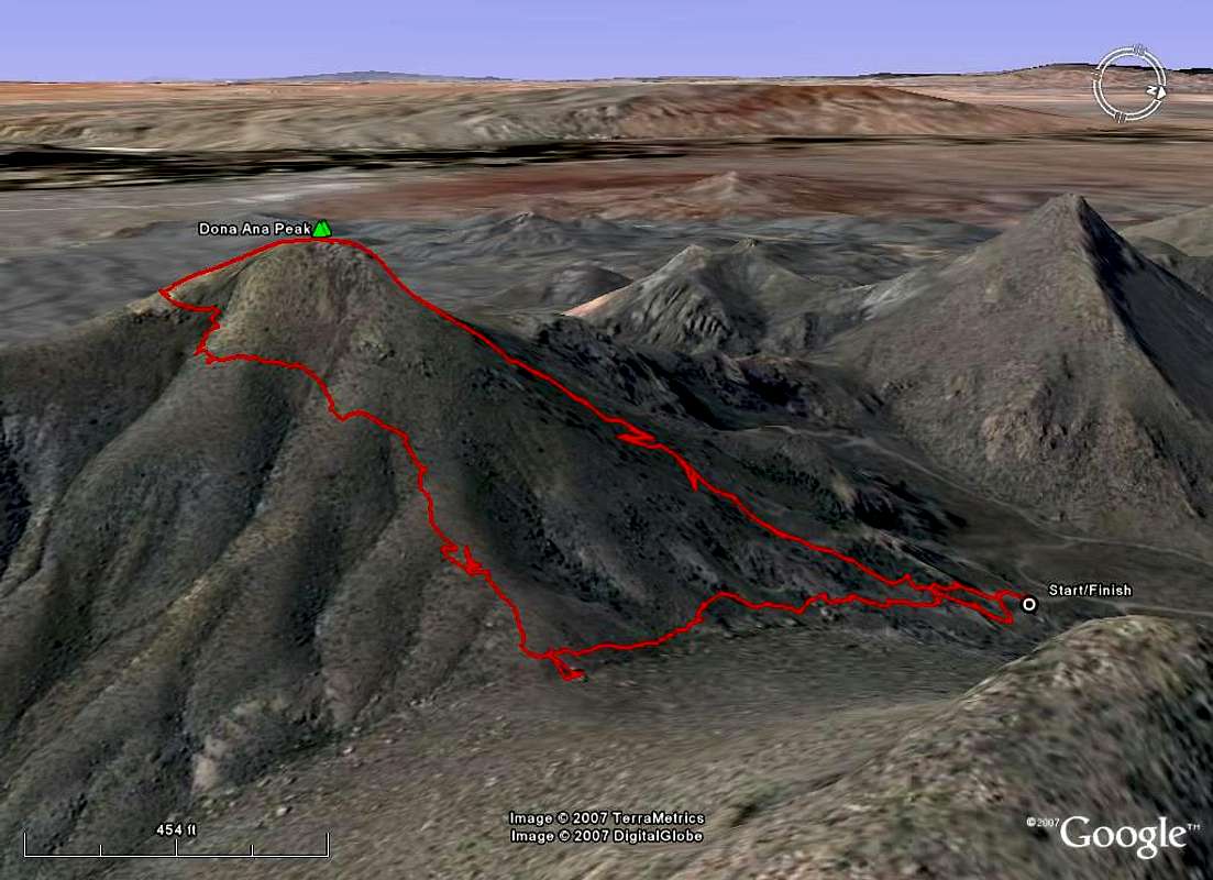
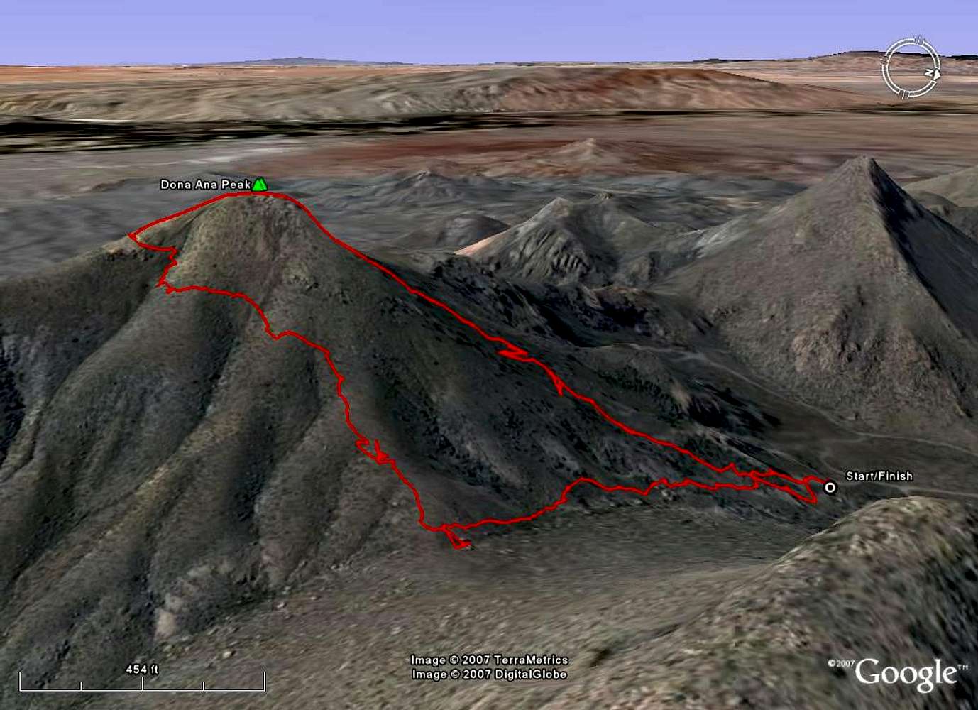
*** For reference only ***
GPS track from
Doña Ana Peak (elev. 5,835 ft.) in the
Doña Ana Range near Las Cruces, New Mexico. The upper section of the track was the ascent; no trail and steep with a lot of loose rock, especially near the summit, but a lot of fun; 0.50 miles to the summit. The lower section of the track was the descent and actually has an intermittent trail for most of the second half of the descent; 0.85 miles in length.


