
-
 10283 Hits
-
 82.48% Score
-
 15 Votes
|
|
List |
|---|---|
|
|
Aosta Northern, Piedmont Western and Switzerland Southern Valleys |
|
|
ROSA Mountain Chain OVERVIEW > to 90° ~
MONT BLANC/JORASSES/VERTE and 33 MOUNTAIN CHAINS of the AOSTA VALLEY & SURROUNDINGS
AOSTA VALLEY 360° from West to East and from East to West in TOPOGRAPHIC clockwise system and order from Seigne Pass towards Seigne Pass (PARTS A+B+C+D+E+F+G).
FIFTH PART (E):
PART E)- AOSTA VALLEY PARTIAL HALFCIRCULAR (90°~) NORTHERN and EASTSOUTHEATERN PERIMETERS OUTSIDE AREA.
AOSTA VALLEY 360° from West to East and from East to West in TOPOGRAPHIC clockwise system and order from Seigne Pass towards Seigne Pass (PARTS A+B+C+D+E+F+G).
FIFTH PART (E):
PART E)- AOSTA VALLEY PARTIAL HALFCIRCULAR (90°~) NORTHERN and EASTSOUTHEATERN PERIMETERS OUTSIDE AREA.
This final part of the tour around the Aosta Valley at 360° exhibits, in addition to the individual mountain ranges, a detailed exposition of all the hills between it and Switzerland in the Northern Sector and in the Eastern Piedmont, also have been added to some internal protocols that allow a connection with others, sometimes poached closely "linked" with regard to the route to be followed. The historical part, more decisive in other areas, this is aimed almost exclusively at the border with Switzerland and beyond to the Western part of the Sesia Valley above Macugnaga Resort, as regards the border with Piedmont is practically almost nothing, because formed by passes and hills of the transit of which is lost in the mists of time. He has wanted to go beyond these boundaries by performing an analysis of what surrounds even the highest Top of Monte Rosa, or the Dufour (4634/5m), it is concluded that the work by taking a look also to the high hills that rise from the same towards the Nordend and the Grand Fillar in the Upper of River Sesia Valley.
As already pointed out in "AOSTA North Or.-Hydr VALLEYS &VALLONS (Ayas/Gressoney) - Second Part/C ", in this area, the numbering of the paths assumes a graphic description, as shown by the Maps consulted, slightly different, for example, can be reversed letters and numbers (1A > a1, 1a etc.) and use lowercase letters. Or simply numbers unaccompanied by any letter (Ex. 1). Do not be surprised then anyone who encounters this differentiation, apparently due to an error.
Questa parte conclusiva del tour intorno alla Valle di Aosta a 360° espone, oltre alle singole catene montuose, una dettagliata esposizione di tutti i colli tra la medesima e la Svizzera nel Settore Settentrionale e con il Piemonte in quello Orientale; inoltre sono stati aggiunti alcuni colli interni che permettono una connessione con gli altri, poché a volte strettamente "legati" per quanto concerne l'itinerario da seguire. La parte Storica, più decisiva in altri settori, in questo si rivolge quasi esclusivamente al confine con la Svizzera ed oltre verso la parte più Occidentale della Valsesia sopra Macugnaga; per quanto riguarda il confine con il Piemonte risulta praticamente quasi nulla, anche perché formata da passi e colli il transito dei quali si perde nella notte dei tempi. Si é voluto oltre passare questi confini effettuando anche una analisi di quanto circonda la Cima più elevata del Monte Rosa, ovvero la Dufour (4634/5 m); si é concluso così il lavoro dando uno sguardo anche agli alti colli che dalla medesima si innalzano verso la Nordend ed il Gran Fillar nell'Alta Valle del Fiume Sesia.
Come già evidenziato in "AOSTA North Or.-Hydr VALLEYS & VALLONS (Ayas/Gressoney) - Second Part/C", in questo settore la numerazione dei sentieri assume una descrizione grafica, come risulta dalle Carte consultate, leggermente diversa; ad esempio posson essere invertiti lettere e numeri (1A > a1, 1a ecc.) ed utilizzate lettere in minuscolo. Oppure semplicemente dei numeri non accompagnati da alcuna lettera (Es. 1). Non si sorprenda quindi chi incontri questa differenziazione, apparentemente imputabile ad errore
***
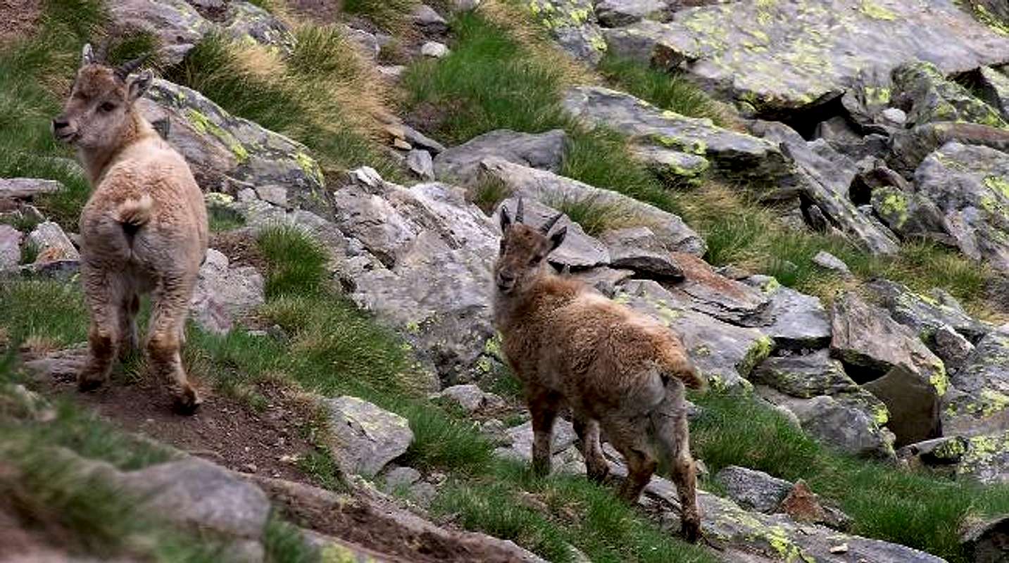
I represent the LIFE that circulates in whole the ALPS, not only in the Gran Paradiso National Park,
by Antonio
![]()
^^^^^^^
LEGENDA
In red: paths, routes, cable railway, chair lift & main roads;
in green: Summits, Spurs, Buttress, Spires;
in blue: Glaciers, Lochs, Ponds, Streams, Torrents, Brooks & Fountains;
in purple: Passes, Saddles, Hills, Brèches, Carvings & Collars;
in brown: Historical Remarks, Sanctuaries, Hermitages, Oratories, Castles, Churchs, Chapels, Crosses, Cairns, Tumulus, Mines, Historic Bridges or Roads, Campings, meaning of place names & various informations.
As already pointed out in "AOSTA North Or.-Hydr VALLEYS &VALLONS (Ayas/Gressoney) - Second Part/C ", in this area, the numbering of the paths assumes a graphic description, as shown by the Maps consulted, slightly different, for example, can be reversed letters and numbers (1A > a1, 1a etc.) and use lowercase letters. Or simply numbers unaccompanied by any letter (Ex. 1). Do not be surprised then anyone who encounters this differentiation, apparently due to an error.
Questa parte conclusiva del tour intorno alla Valle di Aosta a 360° espone, oltre alle singole catene montuose, una dettagliata esposizione di tutti i colli tra la medesima e la Svizzera nel Settore Settentrionale e con il Piemonte in quello Orientale; inoltre sono stati aggiunti alcuni colli interni che permettono una connessione con gli altri, poché a volte strettamente "legati" per quanto concerne l'itinerario da seguire. La parte Storica, più decisiva in altri settori, in questo si rivolge quasi esclusivamente al confine con la Svizzera ed oltre verso la parte più Occidentale della Valsesia sopra Macugnaga; per quanto riguarda il confine con il Piemonte risulta praticamente quasi nulla, anche perché formata da passi e colli il transito dei quali si perde nella notte dei tempi. Si é voluto oltre passare questi confini effettuando anche una analisi di quanto circonda la Cima più elevata del Monte Rosa, ovvero la Dufour (4634/5 m); si é concluso così il lavoro dando uno sguardo anche agli alti colli che dalla medesima si innalzano verso la Nordend ed il Gran Fillar nell'Alta Valle del Fiume Sesia.
Come già evidenziato in "AOSTA North Or.-Hydr VALLEYS & VALLONS (Ayas/Gressoney) - Second Part/C", in questo settore la numerazione dei sentieri assume una descrizione grafica, come risulta dalle Carte consultate, leggermente diversa; ad esempio posson essere invertiti lettere e numeri (1A > a1, 1a ecc.) ed utilizzate lettere in minuscolo. Oppure semplicemente dei numeri non accompagnati da alcuna lettera (Es. 1). Non si sorprenda quindi chi incontri questa differenziazione, apparentemente imputabile ad errore
I represent the LIFE that circulates in whole the ALPS, not only in the Gran Paradiso National Park,
by Antonio
LEGENDA
In red: paths, routes, cable railway, chair lift & main roads;
in green: Summits, Spurs, Buttress, Spires;
in blue: Glaciers, Lochs, Ponds, Streams, Torrents, Brooks & Fountains;
in purple: Passes, Saddles, Hills, Brèches, Carvings & Collars;
in brown: Historical Remarks, Sanctuaries, Hermitages, Oratories, Castles, Churchs, Chapels, Crosses, Cairns, Tumulus, Mines, Historic Bridges or Roads, Campings, meaning of place names & various informations.
Getting There
By car:
By plane:
***
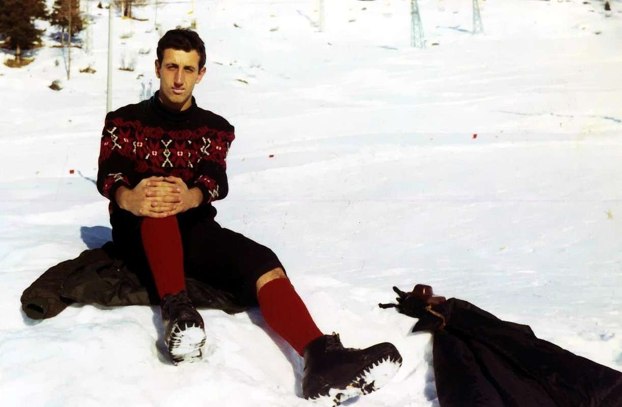
"Youthful Training White Week" in Champoluc Resort to MOUNT ROSA,
by
![]()
^^^^^^^
E1)- *** ALL EXTERNAL PASSES, saddles, brèches, "carvings" and ROUTES from AOSTA VALLEY to SWITZERLAND and PIEDMONT.
From West to East Between AOSTA VALLEY (ITALY) and VALLESE-Zermatt (SWITZERLAND) from:
D1)- To East from: Northern, Southern Adventine, Breithorn Pass, Breithornjoch, Porta Nera or Schswarztor, Verra also Zwillingsjoch, Felik, EntdeKonselse, Lys or Lysjoch, to Ippolito delle Piode Pass.
D1/1)- Breithorn Pass: from Guide del Cervino Refuge (3450m), nearby Testa Grigia (3469m) in East, generally with a track on Breithornplateau, to Breithorn Pass (3818/31m), between Gobba di Rollin (3882m)/Klein Matterhorn (3881m)/Western Breithorn (4165m); descent in North towards various glaciers (Plateau Rosa, Saint Théodule, Unterer and Oberer Theodulgletschers ) to Gandegghutte (3036m), Trockener Steg (2946m; by Cablecar), above Lake 2850 metres, Furgg Station (2432m) and, through dirt road, to Hotel (2589m). Also from hutte in North, path TMR, to Trockener Steg, Uf der Mur (2713m), Gartfad, Furgg, to Hotel. Also: a)- from North to Southeast starting from Piccolo Cervino Station; in opposite from b)- Gobba di Rollin, through short descent on glacier. Again from c)- Guide d'Ayas Refuge (3394m), traverse in West on Verra Glacier, below Rossi and Volante Bivouac (3750m) and Central Breithorn; or from d)- Mezzalama Refuge (3004m), Becco dell'Aquila, in North Great Verra Glacier and preceding route. First traverse by Sthephen Winkworth, two unknown companions with Chamonix Mountain Guides J.B. Croz and P. Perren, in September 21th, 1866. Also, there is a descent to e)- the North Gandegghutte through Breithornplateau, St. Theodule, Unterer and Oberer Theodulgletschers.
D1/2)- Breithornjoch o Finestra del Breithorn: small window (4034m) between Central (4160m)/Eastern (4141m) Breithorns; impassable because the North has a steep wall. Is reached by traverse from the two Breithorns, or by the Rossi-Volante Bivouac (crossing from Great Véraz Glacier to Breithornplateau) or the Breithorn Pass-Breithornplateau for its Southern Slope above the Great Glacier Verra (terminal crevasse in altitude about 3935 metres; moderate slope from 30°/33° to 38°/42°).
D1/3)- Porta Nera or Schswarztor: large glacial saddle (4025m) between Schwarzruken or Roccia Nera (4065m)/Pollux (4084m); from Mezzalama, Guide d'Ayas Refuge or from , more nearby, Rossi-Volante Bivouac through Great Véraz Glacier in North-northeast or in Northeast to pass. Descent in Switzerland through a)- Schwarzegletscher (descent inadvisable because of the numerous crevasses between 3000/3450 meters level), to Rotenboden Station (2815m) and from this to Zermatt-Gornergrat (cog railway); in North to b)- Klein Triftjisattel (3498m) and Triftjisattel (3230m), Gandegghutte (3029m), through a most complex and complicate route under Roccia Nera/Eastern Breithorn Walls. In North to c)- Monte Rosahutte, through the ice cap 3659 metres, saddle 3294 metres on great North Crest of Pollux, rocky band of Schalbetterfluh, Zwillingsgletscher. First traverse of pass by John Ball with Zermatt Mountain Guide Matthias Taugwalder, in August 18th, 1845.
D1/4)- Weisstor or Eastern Pass: ancient passage actually abandoned, sited more in East near the point 3887 metres below Pollux West Face. Again reached, through crossing, in ascent by Normal Route to Polluce; the shape of the glacier that time advised the passage to the East, even with a small climb higher.
D1/5)- Verra also Zwillingsjoch: large saddle (3844m) but in the sharp of glacial narrowing between Punta Polluce or Pollux/Castor (4221m); accessible from Southeast by 1)- Mezzalama, Guide Valle di Ayas Shelter towards Véraz Little Glacier or from 2)- Rossi-Volante Bivouac in West, through Great/Little Véraz Glaciers. Moreover, even farther to the West, ie from 3)- the Rifugio Guide del Cervino, at the Testa Grigia through the Breithornplateau, Breithornpass, Great Glacier de Véraz. Descent in North to 4)- Monte Rosahutte, through the Zwillingsgletscher (need to know to choose the via, cause very large crevasses and seracs presence).
First crossing from North to South by Stephen Winkworth, J.J. Bennen and Chamonix Mountain Guide Jean Baptiste Croz, July 31th, 1863.
***
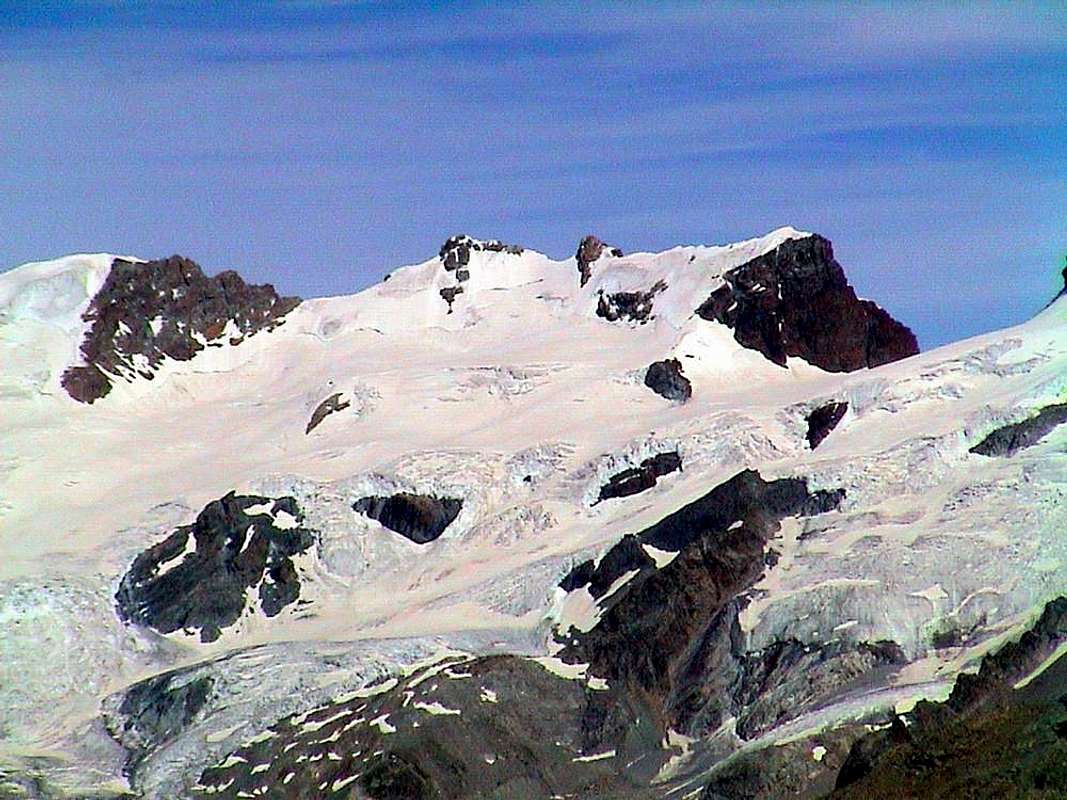
From Central Breithorn to Schswarztor & Weisstor,
by emilius
![]()
^^^^^^^
D1/6)- Felikjoch or Felik Pass: sited (4065m) between Felekspétz (4178m)/point 4089 metres on Southwestern Ridge of Westliche Lyskamm (4478m); connects the two Italian Castor/Felekgletschers with Swiss Zwillingsgletscher, Eastern branch. First traverse with even first absolute on Castor William Mathews, F.W. Jacomb with Chamonix Mountain Guides Jean Baptiste and Michel Croz, in August 23th, 1861. From Refuge Quintino Sella (3602m), through the second and crossing below Punta Perazzi and Hill, a)- easily reaching the little ice dome 4089 metres, nearby the pass; also through the first starting from b)- Mezzalama Refuge to Perazzi Hill (3862/80m) and same South Slope. Very long descent (around 7 Km.) in North to c)- Unt. Plattje, Monte Rosahutte through Zwillingsgletscher (large transverse crevasses and ice falls from Lyskamm in the final part). First ascent of this route F.F. Tuckett with Mountain Guides Christian Lauener and Ferdinand Imseng, July 06th, 1874.
D1/7)- Lyskamms Eastern and Western Saddles: most Oriental saddle (4414m) between the two Lyskamms; in existance another saddle more in West (4456m) not popular and frequented. On the first Route through South Slope to small Western Basin on Lysgletscher, nearby Perazzi Crest, by Julius Kugy, Luigi Bonetti and a unknown Mountain Carrier, in descent August 14th, 1891 (Not meant as a pass, but rather may be useful as a descent route after climbing the North Walls).
D1/8)- EntdeKonselse or Westerner Lysjoch: this depression (4155m) is the real hill but it is not used, because the big and numerous seracs present in its Northern Slope, is preferred over the hill near the East point of passage for all climbers who want to "enter the heart" of Monte Rosa. From 1)- Mantova (3455m) or Gnifetti (3610m) Refuges also from 2)- Giordano Bivouac (4184m), through Lysgletscher, in North-northwest to pass. From 3)- Grenzgletscher to South not advisable.
D1/9)- Lysjoch or Lys Pass: same departures, but more in North, to pass (4255m), between an altitude 4257 metres/Ludwigshohe (4342m); long descent (about 7 Km.) in Northeast on Grenzgletscher to small tableland around 3950 metres, great 3700 metres, point 3472 metres on great rocky spur, Obere Plattje, Monte Rosahutte (as mentioned, is long in the wild glacial environment and requires experience to research the passages, due to the numerous crevasses to get around or through).
D1/10)- Piode or Ippòlita Pass: large iced saddle between Ludwigshohe/Parrot Summit (4433m). Is "touched" in crossing to the Regina Margherita Hut (4554m, the highest in Europe) at the top of the Signalkuppe, its Southeast Slope is formed by a high wall nearly 600 metres above the homonym Western Glacier. This wall has been climbed by Luigi Gottardo Prina, Giuseppe and Pietror Gugliermina with Arcangelo Romelli, September 4th, 1875. The first dedicated the hill to his daughter, but that is the name the way, maybe not the most repeated, have fallen into disuse for the hazardous due to falling rocks. Completely different the ascent from the opposite side or West where a small detour along the road that leads from the Lys Hut to Signalkuppe leads to a small basin under the same. A short and easy climb reaches him.
INSIDE PASSES
** REMARK: We also give some information on some hills not placed on the border-crest but intimately, practical purpose, connected with the same.
***
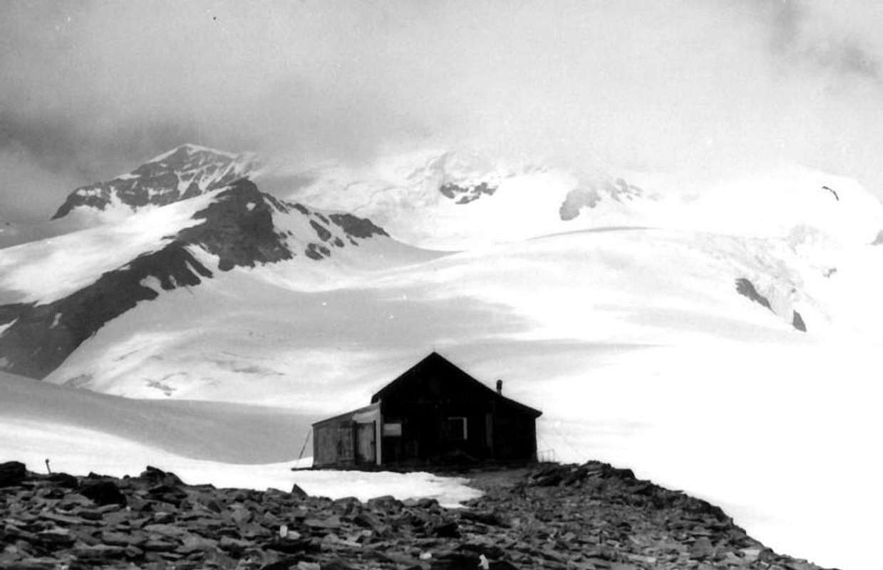
OLD Quintino Sella Hut 1969,
by Ilario Antonio Garzotto
![]()
^^^^^^^
D1/11)- Northern Adventine Pass: from Breuil-Cervinia (2006m) in East, through dirt road or path n° 16, to Chavanon (2335m), Goillet Lake (2516m), Gaspard Hutte (2847m) nearby pond 2856 metres; from this point in East-northeast through moraine and crossing Valtournanche Glacier to North Pass (3450m), near Refuge Guide del Cervino (3467m; * even Cableway from Cervinia-Plan Maison (2561m)-Station 2814 metres near Cimes Blanches Lacs-Testa Grigia (3469m). From pass in South to a)- Plateau Rosa, Glacier of Saint Théodule, Théoduljoch and Refuge (3316m); in East-southeast, through Breithornplateau, to b)- Breithorn Pass (3818m).
D1/12)- Southern Adventine Pass: from Aventine Comba starting from Saint-Jaques-Blanchard (1721m) in Northwest with path n° 8E/5A, along Cortot Torrent, to Lake de Rollin (2823m) and various Adventine Lochs (Grand Lake 2809m, Loch de la Pointe de Rollin 2910m), amongst Gran Sometta/Northern Hill of Cime Bianche/Plateau Rosa Pass/Pointe de Rollin. From Lake de Adventine in North, pathless and through moraines to Plateau Rosa Hill (3123m) and from this in Northeast, through Adventine Glacier, to South Pass (about 3690 metres), between Quota 3594 metres/Gobba of Rollin. Descent in East-northeast, through Breithornplateau, to Breithorn Pass.
D1/13)- Perazzi or Castore Pass: large glacial saddle (3882m) which combines the Glaciers of Castor (to the West) and Felik is located between the Felekspétz-FelikPass (4173m, 4165m, to the North-northeast) and the eponymous Summit (3901m). Both popular and very known to mountaineers as less described in the Alpine Guidebooks that is on the Maps, which is not even mentioned. Instead it is a very important step that allows D1/6/b)- the a)- connection between the Mezzalama Refuge (3009m) and Quintino Sella (3602m) and vice versa as ski touring, passing beneath the South Face of Castor. In addition to this last refuge is reached, as in the ascent to b)- the Felikjoch to continue toward the Castor or to Western Lyskamm. The name of Castor Pass can be confusing, because it is already used to the saddle (3987m), almost never crowded at the base of the ridge Southwest of Castor. This last can only be used as a "way out", while it should be remembered that the first presents difficulties for the seracs at the beginning of Castorgletscher. Furthermore, it is very useful, starting from Sella Shelter, approach to the South Face of Castor.
D1/14)- Fronte Pass o Colle della Fronte: small glacial saddle (4232m) located between the "Sella Ridge" on Lyskamm East and the ice cap of Nose (4271m), of little practical use, since its two East and West Slopes are quite steep, is reached by crossing to climb the ridge above. However, it is already crossed by the party of the three brothers Sella and P. Gugliermina with Valtournanche Mountain Guide J.J. Maquignaz, March 22th, 1885. Almost a winter traverse! A classic for the strong Sella ...
D1/15)- Naso del Lyskamm: very popular hill (about 4125/30 metres), just South of Lyskamm Nose (4271m), allows the crossing between the two Lysgletschers and between the Sella/Gnifetti-Mantova Refuges (from East to West). Crucial knot in the "Mezzalama Trophy" that marks the descent towards the latter via the Eastern branch of the glacier itself. From the saddle, crossed the Glaciers Felik, Perazzi and Western branch of the Lys, climb heading towards the rocky altitude 3864 meters at the edge of the latter, where the ice "broken" in two the Nasogroab; paying attention to crevices in the first part of slopes of moderate slope, go up the hill instead of progressively steeper slopes (even 40°). The descent is at first Eastward, over his Icefall, overcoming a narrowing semi rocky, and the subsequent plateau that leads to the Balmenhorn (4161m; "Christ of the Summits" and Bivouac Giordano) then definitely towards the South in the direction of the Refuges Gnifetti and Mantova.
***
From Lysjoch to Eastern Lyskamm, Fronte Pass & Lyskamm Nose,
by emilius
![]()
^^^^^^^
D2)- To North-northeast between VALLESE-Zermatt (SWITZERLAND) and VALSESIA-Macugnaga-Pecetto-Staffa -PIEDMONT (ITALY).
From: Sesia, Gnifetti, Zumstein or Grenzsattel, Silbersattel, Jagerjoch to Fillar Pass.
D2/1)- Sesia Pass: high and wide glacial saddle (4298m) between Punta Parrot/Signalkuppe. It has the same characteristics of the nearby Hill of Piode with an Eastern Slope, which here, however, is climbed by a long couloir of snow (about 500 metres) above Sesia Glacier, difficult route, while the opposite is almost identical to another hill. A brief digression to the East by the road leading to the Capanna Regina Margherita leads to a fast ascent via a hill of moderate slope. First ascent on East Face G.B. Gugliermina, Natale Schiavi and Nicola Motta in August 16/17th, 1898, from Vigna Alp, crossing Sesia Glacier and through Right Rib and the gully on center of rocky spur, with bivouac and following ascent on Signalkuppe. Repeated three more times in August 09th, 1908 by Stefano Carlo Johnson, Guglielmo Guglielmetti, Nicola Motta and Antonio Pernettaz; in October 04th, 1948 with rocky variant (by Francesco Ilorini and Adolfo Vecchietti) and directly in solo by a strong Mountain Guide Giorgio Bertone (unharmed fall from exit out to the base). Again completely through couloir by the same in the first winter with Gianni Galli, March 12th, 1961. Delicate and difficult ascent.
D2/2)- Gnifetti Pass: long glacial saddle (4454m) which combines the Signalkuppe to Zumstein (4564m), this last part of the ridge, or from Punta Parrot to Punta Dufour (4634/5m; the highest of the entire Mount Rosa), are now fully outside the territory of the Aosta Valley and instead mark the boundary between Switzerland/Sesia Valley in Piedmont. Again, this hill offers the features of the previous two: an easy glacial face and small slope on the Southwest Slope and a high and steep wall on the opposite side, falling, intersected by large frozen couloirs, over 2000 meters on the Belvedere Glacier in direction of Macugnaga Resort (1317m). Along this big wall climb of the historic routes not only for the history of Monte Rosa. From the Refuge Gnifetti salt with the top of the homonymous route crossing or passing by it immediately to the left, the same route, but much longe, by Monte Rosahutte that, via the same route Sesia Pass, reaches the slopes North of Grenzgletscher.
D2/3)- Zumstein Pass or Grenzsattel also Colle del Papa: narrow and dual snowy saddle between the Dufour and Zumstein Summits, generally is achieved in the crossing between syphilis summit, otherwise from the East to the tough routes of Marinelli Couloir (ascent in 1889) or through the "Crestone Zapparoli" (the Valtournanche Mountain Guides Amato and Alberto Bich, Baptist and Camillo Maquignaz and Joseph Pession, August 14th, 1925, in search of the body of Casimir Bich precipitate August 2th during the crossing of the ridge. Both the routes are dangerous and have a height of nearly 1500 meters from the Marinelli Hut (3036m); the course was even in first winter and first solo ascents in 1981, by G. Cattaneo and L. Ferioli 3/4/5th January, and in 1949, by Oliviero Elli. While the second handed down the name of Ettore Zapparoli gone on this big wall in 1951 (same in 1934 had made a first ascent Direct Via on Northeast Wall of the Pass Signalkuppe). From Monte Rosahutte with routes to D1/9)- Lys Pass, but in ascent; reached the large plateau at an altitude of 3720 metres, abandon the via to the hill and, with sinuous path between the crevasses and progressively toward the Northeast, small glacial basin to reach the highest summit of the Grenz Glacier lies between the South Wall of the Dufour Top and the Southwest Ridge of Zumstein Summit at an altitude of about 4250 meters. Overcoming the steep slide the frozen Western Slope (35° to 40° or more) to the pass at one of its two notches. The same itinerary can be made at the end coming from the Lys Pass, or down from the Signalkuppe, in these two cases, however, held higher up on the Grenz at an altitude of about 3875 metres, rounding to the left (West) the base of the Crest Southwest of Zumstein. In any case poorly itinerary below, as you prefer, coming from Italy, reach the summit of this hill traverse and, from Switzerland, downhill from Dufour Summit. How did you get there that is the first Luigi Grasselli, Achille Ratti, the future Pope, with the Mountain Guides Courmayeur Joseph Gadin and Alessio Proment; reached from the East Dufour July 31th, 1889, the day after they went down along the wall rocks of the South to seek a ax fall. Reached approximately the height of the hill crossed left (East) joining him. The same Ratti proposed the name of Colle Zumstein, so that the same is also known as the Pope's Hill. Reached and achieved (G.B. and G.F. Gugliermina with G. Lampugnani, July 7th, 1904) also from the South crossing the Signalkuppe Pass "cutting across" to the East Punta Zumstein; route is very exposed and often not in good snow conditions, for which reason it is surely preferable to climb the Zumstein Summit, even if, at times, the descent on his North Ridge has the "verglass".
***
Through "Marinelli Couloir" to Silbersattel,
by Rahel Maria Liu
![]()
^^^^^^^
D2/4)- Silbersattel Pass or Silver Seat: opens like ice saddle between Dufourspétze/Nordend (4609m) and the Eastern summit of Mount Rosagletscher (4515m), is' the highest hill in all of Europe, but of this hill "silver seat" has very little, as it rushes to the East with a glacial gully that is grafted onto the "Marinelli Couloir".
Via walked uphill from the Marinelli Hut by Karl Christian Blodige Ranggetiner August 7th, 1880; on the occasion they carried also the first crossing East/West. In the opposite direction, ie downhill, Massimo Magliola, Giuseppe Mosca, Cesare Pironi and Zaverio Zurbriggen September 2th, 1931, and the first winter ascent is by Emilio Amosso and Oliviero Elli on 9/10/11th, March 1953. It is also been made in the first solo from the very famous Hermann Buhl in Summer 1955; moreover downhill skiing by Sylvain Saudan June 10th, 1969; exploit repeated, after solo ascent into couloir, by Fabio Jacchini July 31th, 1985. On the West Slope, departing from Monte Rosahutte through a long route but definitely more "sweet", though with many large crevasses in the midst-upper part, the first ascent took place back in August 12th, 1847 by V. Puiseux, E. Ordinaire with Guides Zermatt J. Brantschen, J. M. Taugwalders Zumtaugwald and J. Moser. Despite the date, this track is not to be underestimated and requires good glaciers experience. From the hut follow the Standard Swiss Route for the Dufourspétze to a height of 4050/70 metres, leaving this to the right (South) continue in the direction of the rocky outcrop that comes from Nordend (4100 metres). With slopes steeper first to Southeast, including large crevasses, which progressively decreased to reach the saddle at the edge of the North Wall of the Dufour, below the Shoulder 4596 metres, near Grenzgipfel (4618m).
D2/5)- Jagerjoch or Jager Pass: Glacial saddle ( 3910m ) located between the Quota 4352 meters of Nordend (Crest of St. Catherine) and Jagerhorn (3970m; Bivouac City of Gallarate ), and between the great Gorner Glacier in Switzerland and the much more reduced Nordend, immediately Northeast of the same summit. Due to the precipitous Eastern Wall that "fuses" with the Wall Southeast of Jagerhorn no great importance as a crossing point, although the Italian has already been traveled downhill journey from Zermatt to Macugnaga by W.E. Davidson with the renowned Ferdinand Imseng in 1876, also reached on skis by F. Amann and R. Wild in May 1913 along the Gornergletscher in its most Southern branch. It is useful for the ascent of the "Ridge of the Santa Caterina" starting from Bivouac City of Gallarate (3960m), accessible from Northwest starting Refuge Eugenio Sella (3029m) through the way of the Old Weisstor, New Weisstor Pass (3498m) and bypassing great Fillar (3676m) and Little (3620m), and finally between the Wall Northeast Nordend/West of Jagerhorn you climb almost 280 meters in altitude with the final slopes with large crevasses.
D2/6)- Fillar Pass: Even this glacial saddle, placed between the Jagerhorn and Little Fillar, shows the typical features of previous packages: a precipitous part of 400 meters above the glacier on the Italian side of Fillar towards Macugnaga Resort in Valsesia (Piedmont) and a long slope that connects with the Western Gornergletscher. First ascent in July 3th, 1882, and probably coincides with the first ascent, he was joined by W.M. Conway with Zermatt Mountain Guide Ludwig Zurbriggen. The final part of the North Slope is formed by moderate snowfields, while access in the first part see the previous itinerary D2/5)-. On the opposite side is reached by Valentino Belloni Bivouac (2490m), which in turn reached from Macugnaga, Pecetto Village (1562m), C.A.I. Saronno Refuge (1827m), Alp (1974m) and Glacier Fillar. The North Slope is rather rocky and with a vertical drop of 1100 meters to the pass, formed by a rocky couloir terminal 400 meters quite difficult and somewhat exposed to falling rocks.
***
From South to Eastern Rosa,
by buxlex
![]()
^^^^^^^
D3)- To South-southeast between AOSTA VALLEY and NOVARA/BIELLA/TURIN Provinces in PIEDMONT from: Zurbriggen, Vincent, Pass 3511m or Indren, Pisse, Salati, Olen, Zube, Saddle 2938m or Straling Gòmbò, Coppa, Pioda, Saddles 2895 and 2848m, Uomo Storto, Nétschò Bocchetta, Rissuolo, Alpetto, Valdobbiola, Valdobbia or Spissiòcoll, Camino or Casara Nuova, Maccagno, Loo, Niel Bocchetta, Great Mologna, Little Mologna, Vecchia, Lupo, Gragliasca, Chardon, Carisey, Giassit-Lace, Ciarma Passes above Carema Commune to IVREA City in Canavese, TURIN Province (PIEDMONT).
D3/1)- Zurbriggen Saddle: this small icy saddle (4272m) has a unique historical importance, because in fact it is not easily passable on the side of Piedmont, where it happened the first ascent starting from Gugliermina Hut (3212m) by the brothers Gugliermina with Mattia Zurbriggen and Clemente Imseng, 10/11th September, 1898. Located between the Corno Nero (Black Horn) and the Ludwigshohe (4342m) is most easily reached from the Western Slope through a modest climb on the Lys Glacier starting from the Gnifetti Refuge (3610m). Ascension that very rarely frequented the East Slope has a vertical drop of 600 meters from the Eastern Piode Glacier.
D3/2)- Vincent Pass: Identical considerations for this pass (4088m) located between the Schwarzhorn and the Pyramid Vincent. Its easy with the Western Slope from Refuge Gnifetti or from the nearest Giordano Bivouac (4184m) at the Balmenhorn was reached for the first time probably by Adolf and Hermann Schlagintweit with Peter Beck September 15th, 1851. On the Eastern Slope much more demanding, always from the Capanna Gugliermina by the roped Zurbriggen-Lanti-Gugliermina in September 08th, 1896. Already well down the path in 1925 and 1930 shows some variations always difficult. Very dangerous route, difficult and ice fallings exposed.
D3/3)- Pisse Pass: from Refuge Squinobal (2621m); pathless, sinuously along the torrent to Indren Lake or Endroseena (2977m), below Endregletscher. From shelter in North-northeast, through a track, to 1)- Solemberg Mine (2902; abandoned), Upper Pisse Pass (3110m), between Punta Indren (3260m; Cableway from Pisse Bocchetta 2396m). Descent in East, pathless, to 2)- Case Miniere (2481m), Alp la Balma (2207m), Crespi-Calderini Refuge (1829m), in Pisse Walloon to Sesia Valley.
D3/4)- Salati Pass: from Lys Refuge (2339m; Cablecar from Staffal) in Northeast through dirt road-path n° 6/TMR to Ponte Refuge (2388m) and in Northeast to alternative on dirt Wisso (2540m); continue, same direction, pond 2721 metres, to 1)- large/debris saddle Salati Pass (2931m), between Stolemberg-Pissehòre/Corno del Camoscio. Descent to Sesia Valley through moraine in first part and path n° 5E 2)- Città di Vigevano, Città di Mortara Refuges (2864m, 1945m) in d'Olen Valley.
D3/5)- Olen Hill: from and nearby the pond 2721 metres in East-northeast, path n° 6/TMR, to hill (2880m), just in North of the true hill (2896m), between Corno del Camoscio/Corno Rosso; descent in East to Città di Vigevano and Gugliermina Refuges, above small Lakes Cimalegna (2799m), Otro Vallon, Alagna Resort in Valsesia.
D3/6)- Zube Pass: from State Road after Gressoney la Trinité (alternative 1801m between Obrò de Jòlò/Erp Villages; no transit signal) in Southeast through dirt road to Montery, Tschòcke (1926m), fork 1941 metres (in Northeast continuation to Recka (2131m), Shéttò, nearby Lys Refuge (2339m); to this point even by Cablecar from Staffal); continue from fork, always in dirt road-path n° 5A concomitant, before in Southeast to Bédemie (1910m), Punta Jolanda (2272m; connection in North-northeast with the shelter). After in Northeast to point 2212 metres (to this even with path n° 5 from Obre Eselbode/Revec, 1636m), Piere Gaveno Alp, Gabietsee or Gabiet Loch (2363m), nearby Gabiet Refuge (2370m; short connection with neighbor Lys Refuge). From Lake along the affluent in Northeast to 1)- Zube Pass through moraines and unnumbered path (from Lys Shelter) in final part. Descent in East, path n° 3, towards 2)- Zube (2515m), Pianmisura (1854m), Scarpia (1726m), Follu (1664m) Alps.
D3/7)- Saddle 2938 metres:in East-northeast into Straling Gòmbò to Saddle 2938 metres, same route to Zube Alp in Otro Walloon to Alagna Valsesia (1186m).
D3/8)- Coppa: Pass from saddle in South to Punta Straling, with signed route, easily on North Crest. From lake in East through moraines to Coppa Pass (2914m).
D3/9)- Pioda Pass: in East-southeast, same previous route, to 1)- Pioda Pass (2902m), below Corno Grosso or Groshòre (3039m). Descent, pathless, to 2)-Granus Alp (2338m), below Bivouac Ravelli (2503m), and with path to Cuttiri (2113m), Pianmisura (1854m), Follu (1664m) Alps in Otro Walloon and from this to Alagna Valsesia.
D3/10)- Saddle 2895 metres: from lake in South, path n° 3A, to source 2342 metres; in East, through moraine, to pond 2593 metres, small pass 2895 metres.
***
From West to Corno Bianco Group,
by emilius
![]()
^^^^^^^
D3/11)- Saddle 2848 metres: from pond continue Southeast to point 2727 metres on Schkéerpie moraine; after in East to 1)- carving. Descent to 2)- Ravelli Bivouac.
D3/12)- Uomo Storto Pass: from source in South, path n° 3A, to Schkéerpie Gaveno Alp (2393m); in East, pathless, 1)- to pond 2728 metres and Pass (2856m). Also 2)- variant: from Gastaldi Bivouac (2620m) in Northeast, Alta Via Tullio Vidoni, to pond 2692 metres, pass. Descent to 3)- Ravelli Bivouac, near pond 2481 metres.
D3/13)- Nétschò Bocchetta: from Schkéerpie Gaveno (2393m); from alp in South to 1)- cross 2436 metres, with the path n° 3 from Ondre Eselbode, Gastaldi Bivouac (2620m), below Nétschò Summit (3247/80m) and small glacier, Nétschò Bocchetta on North Crest. Descent, pathless, to 2)- Verde, Nero Lochs, Shelter Rissuolo.
D3/14)- Rissuolo Pass: from State alternative after Balmeto Village (1533m) in East through a short Municipal Road to Ondrò Village (1541m); from this in Northeast, path n° 8; 1)- to Lecko (1907m), Tsachampònò (2015m), Obrò (3137m; source 2159m), Pastures, Alp 2309 metres and, through traces in final, part to Rissuolo Pass (2930m), between Ciampono/Rissuolo (3102m) Summits. Descent in East, path n° 2B,to 2)- Lago Nero (2668m) and, path n° 2, Lake Bianco (2333m), near Shelter Alp Rissuolo (2264m), Pile (2201m), Spinale, le Piane/Cambiaveto (1511m), Sant'Antonio (1381m) Alps in Vogna Vallon to Riva Valdobbia (1112m) in Sesia Valley.
D3/15)- Alpetto Pass: from State near Onder Perletoa Hamlet (+; 1421m) through Municipal to Lòubonò (1476m); in East, path n° 9, to Gruebe, Ondrò Ebielò (1898m), Tené Gavene (2182m), Obrò Ebielò (2209m), Schenébiel (2316m) Pastures. In Northeast, path n° 9, to 1)- source 2376 metres, points 2512, 2593 metres, Alpetto Pass (2768m), below Rissuolo Crest. Descent in East, path n° 2. to 2)- Shelter-Alp Rissuolo (2264m), nearby Lake Bianco (2333m), Pile (2201m), S. Antonio (1381m) in Vogna Walloon to Riva Valdobbia (1112m). From lake in North, paths n° 2/2C, to 3)- Lochs Bianco and Verde (2849m), in small walloon below Corno Bianco.
D3/16)- Valdobbiola: with previous route in East-southeast, path n° 9A, to sources 2387, 2503 metres, pond under Valdobbiola Hill (2638m). Descent in Southeast.
D3/17)- Valdobbia or Spissiòcoll: from State nearby Ondrò Verdebiò (1391m) in Northeast, path n° 11, to fork 1570 metres; continue, same direction path n° 11/105, to 1)- Ondrò Tschalvrétzò (+; 1904m), Tschalvrétzò (1897m), Obrò Tschalvrétzò (2030m), Valdobbia Hill or Spissiòcoll (2489m), near Refuge-Hospice Sottile. Descent in East-northeast, paths n° 1/1C, to 2)- fork 2463 metres (path n° 1B from Valdobbiola), Pastore (2133m), Montata (1638m), Peccia (1475m), S. Antonio Alps.
D3/18/19)- Saddles 2642, 2708 metres: from Saint Jean-Valdobbia (1380m) in Northeast, path n° 11B, to Pòtzie (1877m; source); from this path n° 11/105, to Ondrò Schkéerpie (2146m), Ondrò Tschalvrétzò Lower (1904m) and Upper (2030m) Pastures. In Southeast, pathless and through moraines, to various ponds (2098m, 2442m, 2484m); from the last in East-northeast to 1)- Saddle 2642 metres, below Punta Plaida (2689m). Descent in Northeast, pathless, to 2)- fork with path n° 1C from Valdobbia, Balma Lake (2310m), Pastore Alp. From pond 2484 metres in Southeast, pathless, to 3)- Saddle 2708 metres, on North-northwest Crest of Corno Rosso (2979m); descent, same route, in East to 4)- Plaida (2458m), Balma Lochs, Larecchio (1900m), Spinale Alps and preceding routes in Vogna Vallon to Valdobbia.
***
From Valsesia to Rosa Group,
by Diveria
![]()
^^^^^^^
D3/20)- Camino or Casara Nuova also Viaréccio Pass: from Lommattò-Soagò (1311m) in East, path n° 12/GSW/High Route number 1, to Bérche, Loo (1860, 2084m) Alps, crossing the torrent, directly on grassy-debris slope to 1)- a rocky terminal couloir, pass (2472m); descent to 2)- Casera Nuova Lake (2306m), Maccagno (2188), Camino (2016m), Pioda di Sopra (1877m), Buzzo, Peccia (1475m), S. Antonio (1381m), Ca' di Janzo (1354m) Alps and Pastures to Riva Valdobbia (1112m).
D/3/21)- Maccagno Pass: : from State near Soagò/Steina (1311m) through short Municipal Road to Lommattò or Loamatten/Lysò Fractions (+; 1358m; source); from this in Southeast to Jatzie Pasture; crossing on Lòò Torrent to Berché Pasture. From fork in North, path n° 12c, after three Loo Alpages to 1)-Maccagno Pass (2495m), between il Cornaccio (2589m)/Monte Cossarello (2691m). Same preceding descent in Northeast, into Vogna Walloon, to 2)- Maccagno, S. Antonio, Riva Valdobbia.
D/3/22)- Loo Pass: from Berché Pasture (1535m) in Northeast, path n° 12 along torrent and in Nidelstei-Spettal Gover area, to 1)- Onde Lòò tiny Village (1860m), Ondrò/Obrò Bodma (1884m, 1910m; sources), Lòò Superior (+; 2084m), fork around 2230 metres under Mount Kick (2315m), Lòò Hill (2452m), between Monte Cossarello/Punta Lazoney (2579m); descent in Southeast, path n° 51, to 2)- Lake Lamaccia (1925m), Alp il Toso (1649m), Punto di Appoggio, Alp il Rosso (1395m), Parbella Bridge, Sponde Pasture (+; 1093m), Rassa Hamlet in Sorba Valley. From this with Municipal Road to Piode Hamlet on State Road n° 299 (1,5 Km. from Alagna).
D/3/23)- Niel Bocchetta: from Gaby Commune (1040m) in East through Municipal Road to Chanton (+; 1444m), Niel (1535m), Gruba (1550m) Villages; from in North-northheast, path n° 6, to Sctvòla (1757m), Giazet (1972m), Bodo (2215m) Pastures, 1)- Lazoney Hill (2395m); from Sctvòla in East-northeast, path n° 6b, to 2)- Piccolo Loozoney, Grétie (2207m) Alps, Crétier Pond (2221m), Niel Bocchetta (2430m). Descent in Northeast, path n° 69, to two Lakes Tre Vescovi (2370m, 2309m), fork with paths n° 51 (from Loo Hill/51c (to Artorto, Dosso, Massucco Alps) in North to 3)- Baitello in Gronda Valley; in Southeast to 4)- Lamaccia Lake in Sorba Vallon.
D/3/24)- Gran Mologna Pass: from Niel Bocchetta in Southeast, path VA/gta (Great Traverse of Alps), to and under Punta Tre Vescovi (2501m) with traverse to 1)- Mologna Grande Pass (2364m), near A. Rivelli (2150m), below Monte i Gemelli (2473m). Descent in Northeast, path n° 69, to 2)- Tre Vescovi Lake and previous fork.
***
Mologna Area,
by Corvus
![]()
^^^^^^^
D/3/25)- Piccola Mologna Pass: From Gruba in Southeast to 1)- Picchere, fork 1800 metres around, Mologna Piccola Hill (2205m), between Monte i Gemelli/Punta Serange (2334m). Descent in Southeast, path n° E65/gta, to 2)- Anval Alp (1539m) and from this, path n° 60/gta, to Buron, Monta Pastures, Piedicavallo (1037m), (Rosazza 882m), Campiglia Cervo (776m), Quittengo, Sagliano Micca (818m), Miagliano/Andorno Micca (544/613 m) Hamlets in Cervo Valley to Biella Town (399m).
D/3/26)- Grovera Pass: from fork in South, path n° 6d, to 1)- la Piana (1829m), Turia (1878m) Alps, Grovera Pass (2210m), between Punta Serange/Punta Chaparelle (2409m). From hills descent to 2)- la Bosa Alp (2019m), with traces and, path n° E51, to Ambruse (1694m), le Piane, Monta Pastures, Piedicavallo in Cervo Valley.
D/3/27)- Vecchia Pass: from Zendelabaz Village (1019m), on State Road before Gaby, in East, path n° 9/VA, to 1)- Lamponey (1341m), Beccaz (1525m), Nost (1706m), Fontane (1874m) Alps, Vecchia Hill (2187m), between Punta Chaparelle/Punta della Vecchia (2387m). From hill descent in East-southeast, path n° E50 along Cervo Torrent, to 2)- Vecchia Refuge (1872m), Vecchia Loch (1858m), Caneba (1492m), Casette (1410m) Pastures, Rosei (1179m), Piedicavallo (1037m) Hamlets.
D/3/28)- Lupo Pass: from the cross (+; about 850 metres) just before Issime (930m) in Southeast through Municipal Road to nearby Bioley Village (+; 1118m); from this in Northeast, path n° 3, to Lion, la Torretta (+; 1353m), Tourrison (1638m) Credemy (1768m), Piccolo Lago (1935m) Alpages, Pond 2098 metres; in Northeast, with traces, to 1)- Crest Alp (2253m), Lupo (Wolf) Pass (2340m), between Monte Cresto (2546m)/Monte Pietra Bianca (2490m). Descent to 2)- Giaspret Pond (2136m) in Cervo Valley. In South, path n° 3a, to 3)- Marmontana Pass (2407m), under Monte Pietra Bianca; in Southeast to 4)-Pietra Bianca Alp (2190m), Torretta Lake (2146m).
***
Issime or in walser dialect Eischeme,
by om
![]()
^^^^^^^
D/3/29)- Gragliasca Pass: from Fontainemore (760m) in East through Municipal Road to Espaz, Pervero (895m); in North, path n° 3a, to Racoulla Pian, Farettaz, Bonin/Asere and in East-northeast to 1)- Vernetta (1606m), Breuil (2122m), Touche (2068m), Pietra Bianca di Mezzo and Alta (2190m), Marmontana Hill. From Pervero in South to 2)- Chuchal (1212m), Clapasson, Pillaz, Cloz (1356m) Pastures; from this through dirt road-path n° 2 to 3)- fork 1435 metres, Tronc Alps. In Northeast, path n° 3a, to 4)- Cleva Bella, Sapel, Pietra Bianca Rion (2032m) and in North Torretta Lake, Pietra Bianca Alta, Marmontana Hill; from Cleva Bella in Southeast through dirt to 5)- hairpin band amongst Matta/Vargno/Vargnit Alpages, nearby Vargno Lake (1670m). From Matta in East, path n° 2a, to 6)- Grangeas/Met Ros (1895m), Rosaras Alps, Gragliasca Hill (2213m), between Punta Gragliasca/Punta Gran Gabe. Descent in East, path n° 30, to 7)- Gragliasca Alps (1826m), Besate (1101m), Rosazza.
D/3/30)- Barma or Oropa Hill: from Vargno/Vargnit in Southeast to 1)- Lei Long, Balma, near homonym four Lakes (2022m), Bar(l)ma also Oropa Hill (2261m), between Punta LeiLong (2236m)/Monte Rosso in Mount Mars Nature Reserve. Traverse in Northeast to 2)- Renata Hut (2360m), near Bocchetta di Finestra (2308m) and between Monte Camino/Monte Tovo; descent in East to 3)- Rosazza (1813m) and to nearby Savoia Shelters, above Oropa Sanctuary (+; 1100m; famous Madonna Procession from Gressoney Valley. Cablecar with alternatives from Oropa to three Refuges), on Pollone-Oropa Valley. From lakes in South, path n° 2c and traces, to 4)- Chardon Pass (2221m), between Monte Rosso (2374m)/Monte Mars (2615m). From Pillaz in East through Municipal to 5)- Granges (1395m), Goy, Pian Courmarial and with dirt road to Bosco, Vercosa (1600m), Crotal (1684m), Leretta (1784m), Goillas (1817m) Alpages, nearby Goillas two Ponds (1861m); in North, path-traces, to 6)- Bonnel (1796m), Long, Balma Lochs. From Fontainemore-Espaz in East, path n° 3, to 7)- Chucal, Thea (1212m), Sas, Bosco, Ramere, Rovinas, Serafredda (1797m), Montagnet Ponds, D. and A. Coda Refuge (2280m), between Punta della Sella (2315m)/Cerisey Hill. From Serafredda in South, same path n° 3, to 8)- Carisey di Sotto, Alp (1934m) and Hill (2132m); in West, path n° 1, to 9)- Portola Hill, below Mount Portola (1988m). From Carisey Hill descent to 10)- Bocchetta del Lago, Mucrone Loch (1902m) amongst Monte Mars/Monte Rosso/Monte Mucrone, Savoia and Rosazza Shelters. From Oropa, through Municipal Roads, to Pollone or to Miagliano, Biella City.
D/3/31)- Chardon Pass: from two lakes in South, path n° 2c and traces in moraine, to 1)- Chardon Pass (2221m), between Monte Rosso (2374m)/Monte Mars (2615m); descent in East-southeast, path n°D23, to 2)- Monte Rosso (2195m), Mucrone Lochs (1902m), Oropa Sport (arrival station of Cableway from Oropa).
D/3/32)- Carisey Pass: from Fontainemore-Espaz in East, path n° 3, l'Alas, Berce, Chucal to Thea (1212m), Sas, Bosco, Vercosa, Rovinas, Serafredda (1797m) Pastures; from this in South to 1)- Carisey Pass (2132m). Descent in Northeast, path n° C3/C4 to 2)- la Bella (1831m), la Tura (1720m), Mucrone Loch, Oropa Sport.
D/3/33-34)- Giassit/Lace Hills: a)- from the fork just before Lillianes (667m) in East, Municipal Road, to Chessun, Balmetta, Curtes, Costey (1056m), S. Margherita, Verman Villages; from S. Margherita in Southeast, path n° 2, to Pianas, l'Arpet (1623m), lo Stret (1724m), Giassit (1817m) Alps, Giassit Hill (2026m). b)- From this with short East traverse to Lace Hill (2121m). Descent in Northeast, path n° C2, to la Lace del Vitton (2097m), Pian Masere (1903m), Brangolone (1464m), Raja di Grangia (1138m), Sordevolo (632m) in Elvo Walloon. From this to Pollone, Occhieppo, Muzzano, Graglia Municipalities; in Southeast to Biella, in Southwest Ivrea Cities.
D/3/35)- Ciarma Hill: from State Road of Gressoney Valley, fork near Remondin Village (620m) in Southeast through Municipal Road to Mignot, Cavalle, Pian Mattet, Ververt (1282m), Pourci Pastures; from this, with path, to Tiombe (1859m), la Ciarma (1881m) Alps, la Ciarma Hill (1934m), between Bec di Nona (2085m)/Monte Parassone (1799m). From hill descent in South, path n° D3/gta, to Boses, Maschiero, Chiavanesso, Maletto Alps, Carema Commune (379m), immediately in Piedmont.
INSIDE PASSES
*** REMARK: We also give some information on some hills not placed on the border-crest but intimately, practical purpose, connected with the same.
D/4/1)- Salza Hill or Soalzecoll: from Bòrrethus-Staffal, in North, path n° 7, to Weng, Courttlys Pastures, fork 2244 metres; from this in East, path n° 7C, to 1)- Ustro Soalze (2323m), Salza Hill (2882m). Descent in Southeast, path n° 6A, to 2)- pond 2751 metres, Becksch Gaveno (2424m), Ponte, Lys Refuges near Gabietsee.
D/4/2)- Saddle 2767 metres or "Tullio Vidoni High Route": pass between Spilmannsberg (2772m)/West-southwest Crest of Tschampònòhòre or Ciampono (3235m). From Obrò (2137m) in East, path n° 8, to 1)- Rissuolo Hill (2930m); just before in altitude about 2840 metres in northwest, path "Alta Via Tullio Vidoni", to 2)- large saddle. From this in North, through traces below Leckenétsgletcher, to 3)- three mini ponds 2856 metres, Netscho Lake (2537m), Bivouac Gastaldi (2620m); from thisin Northeast, same route, connection with route to 4)- Uomo Storto Pass (2856m). Descent in East to 5)- Ravelli Bivouac (2503m) in Otro Walloon to Alagna.
D/4/3)- Rezza Carving: small, rocky, narrow pass (2774m) between Southwest Crest of Corno Carro or Charròhòre (3004m)/Mount Rezza (2843m). It does not have great importance as a crossing point and is more aimed at hunters who do not hikers. Reachable from the South with a digression on path n° 9 Alpetto Hill, just before the two Beckschlochs at an altitude of about 2500 meters; you climb through the moraine in a small walloon and turning left (West) in the last part. The West-northwest Slope is instead somewhat, though not excessively high, steep and falls on the route n° 8 at a ruin at an quota of 2309 m, above Obrò, along the via that leads to the Rissuolo Hill. In any case inadvisable, because unknown (near the Horn Carro has been climbed only in July 17th, 1988, by brothers Francesco and Pier Luigi Ferrero).
D/4/4)- Lago Hill: from Casera Nuova or Camino Pass in East, pathless to Casera Nuova Loch (2306m), also from Maccagno Hill in North, path n° 12c, to fork after Lake Nero (2322m); from this connection with path n° 5c to 1)- hill (2535m). Descent in Northeast, path n° 61, to 2)- il Laghetto (2366m), Seia Loch (2161m), Lake Alp; from this in East, path n° 61, to Piana d'Ovagol, Salei, Casere, Stralga, Goretto, Piana (+; 1193m) Pastures, Rassa in Gronda Vallon. Route completely in Piedmont.
D/4/5)- Lazoney Hill: from Loo Upper Alp in South, path n° 21a/VA in South of Loo Torrent, to 1)- Lazoney Hill (2395m), between Punta Pianeritz/Punta Tre Vescovi, above A. Rivelli Refuge, with descent to 2)- Gaby Commune; from fork about 2400 metres in East, path n° 12, to 3)- Loo Hill, with descent in Sorba Vallon, Piedmont.
D/4/6)- Marmontana Hill: in West of Monte Pietra Bianca, between Tourrison/Mount Mars small Valleys. From Lago Chiaro (2098m) in South, path n° 3, to hill (2407m). Descent in South, same path, to 1)-Upper Pietra Bianca Alp (2190m); in Southeast, path n° 3a, to 2)- Torretta Lake (2146m) and connection with Grugliasca Hill.
D/4/7)- Portola Hill: between Mount Portola (1988m)/Mount Bechit (2320m) and Fontainemore/Lillianes Communes. From Fontainemore-Espaz to Thea, Bosco, Vercosa, Serafredda Alpages (1797m) in South, path n° 3, to fork 2000 metres; after in West to 1)- hill (1988m). Connection with 2)- Carisey Hill in Northeast; descent to 3)- Pian di Bosc, Pian Sapei (1504m) Alps in Southwest to Municipal Road or path n° 1. Through these to Santa Margherita, Costey Villages (1056m), Lillianes.
***
From West to Uomo Storto/Nétschò/Ciampono in Corno Bianco Group,
by emilius
![]()
^^^^^^^
D4)- INSIDE RANGES:
Dora Baltea Stream Left Hydrographic Watershead from Northt to South-southeast:
Pont Saint Martin, Perloz little towns (East-southeast) in AOSTA VALLEY and Carema, Cesnole, Settimo Vittone, Montestrutto, Nomaglio, Andrate, Donato, Castellazzo, Netro, Graglia-Muzzano, Sordevolo in Elvo Valley, Pollone, Oropa little Towns between TURIN/BIELLA Provinces in PIEDMONT.
From: Cervinia-Breuil/Zermatt/Gressoney la Trinité/Gressoney Saint Jean/Gaby/Issime/Fontainemore/Lillianes/Pont Sain Martin in Aosta Valley.
From: Carema/Andrate/Oropa/C. Cervo/Piedicavallo/Riva Valdòbbia/Alagna Valsesia/Macugnaga (Turin, Biella, Novara Provinces) in Western Piedmont.
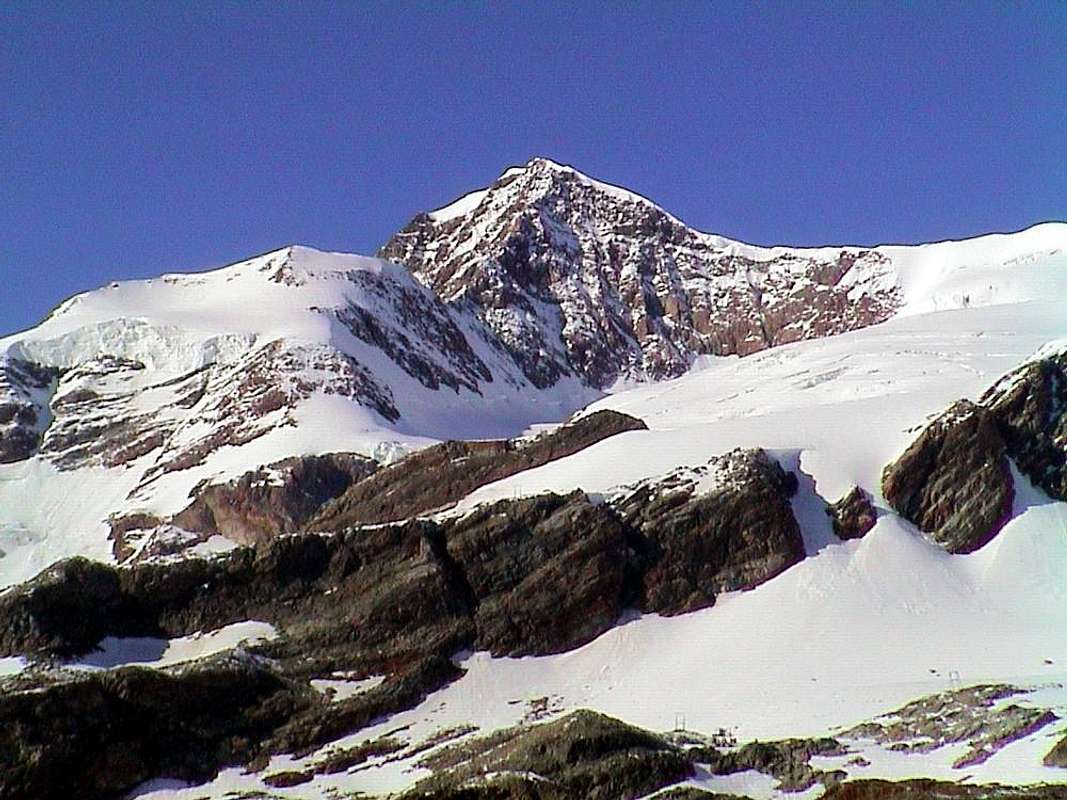
MATTERHORN from OLD YOUNG BREITHORN, in AUGUST 10th, 1980
35)- Testa Grigia/Rollin Gobba or Hump. Inside: Rollin Point/Quote various or Aventine Points; Quote various/Rocca di Verra.
Klein Matterhorn/BREITHORNS West, Central, East/Zwillinge/Roccia Nera or Schwarzhorn Area.
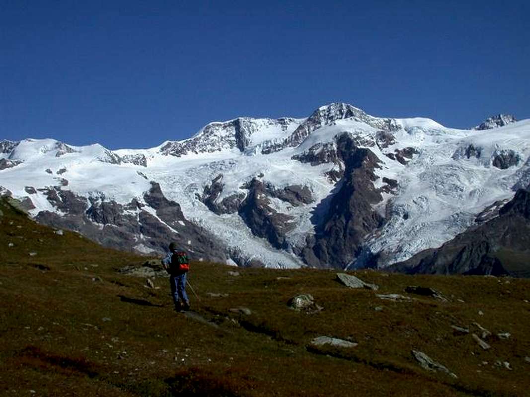
36)- Gemini: Pollux and Castor/Punta Felik/LYSKAMMS West, East and Nose Area; Testa Grigia/Monte Pinter/Corno Vitello/Punte di Palasina/Punta del Lago/Corno Bussola/Punta di Briguez/Mont Palon/Punta della Gua; Monte Chiappa or Quiappa; Punta di Valfredda/P. di Valnera/Bieteron; Mont Ciosé North, Central, South Mountain Chain.
SKY TRAVERSE JULY 27th, 1969.
- From TORINO, MILANO, etc: Motorway A5. Exit at IVREA or Quincinetto (PIEDMONT): (Mount Roux - Tre Vescovi - Mombarone Area and Bocchetta, Lace Pass);
Pont Saint Martin: (Gressoney Valley and Southern appendages to Mombarone Colma between AOSTA VALLEY and PIEDMONT and Mount Crabun - Perloz - Nantay and Valbona little Valleys and Finestra, Arche, Chiva, Dondeuil Passes);
Pont St. Martin to Hone/Bard - Arnad little Towns: (Crabun - Cima Pietre Bianche South Slopes; Vert, Civa, Arche, Finestra Pass and Machaby Corma; Rock Gym, among Champagnolaz, Sengla, Machaby, Albard di Bard Villages);
Verrès (Ayas Valley and Southern appendages to Becca Torché - Corno del Lago - M. dell'Aquila - Cima Graulà) and Vert, Civa, Dondeuil Pass;
Saint Vincent: (Zerbion - T. di Comagna - M. Ros Area, near Saint Pantaléon and Zuccore Passes);
Chatillon: (Valtournanche Valley and Southern appendages to Tantané - Zerbion Mounts, South Slope Area, near Joux Pass; to Becca d'Aver Area, near Saint Pantaléon Pass);
Nus: (Saint Barthélemy Valley and Faroma - Luseney Area and Southern appendages to Aver - Longhede Area, near Saint Pantaléon Pass);
AOSTA Est: (Viou - Tsaat à l'Etsena little chain from Becca Conge - Faroma Area, near Saint Barthélemy Pass; Valpelline, Ollomont, Great Saint Bernard Valleys and Merdeux Comba, near Malatrà Pass);
AOSTA West/Aymavilles to Saint Pierre - La Salle little towns: (Vertosan Valley to Citrin Pass; Vétan Tourist Village /Mount Fallère Area to Finestra Pass or Chiusella little Valley to Fallère Lake and Saddle 2674m, Chaligne and Met Passes);
Morgex: (Valdigne Valley or Courmayeur to Ferret Valley and Great Ferret Pass; Courmayeur - Villair - La Trappe in little Sapin Valley to Sapin Pass. Morge - Planaval/Great Rochère Area) to Liconi, Battaglione Aosta, Serena Passes.
- From SWITZERLAND: through the Saint Bernard Tunnel or the Great Saint Bernard Pass, closed since late Autumn until half Springtime, to Saint Rhémy en Bosses - Saint Oyen - Etroubles - Gignod - Aosta Towns.
- From FRANCE: through the Mont Blanc Tunnel to Entrèves-crossroads to Vény/Ferret Valleys - Mountain Guides of Courmayeur - La Saxe Rock Gym - Courmayeur. By Little Saint Bernard Pass, closed since November until half May to La Thuile Valley - Pré Saint Didier - Courmayeur.
It is not necessary to take Motorway A5: you can drive on State Road n° 26, in the direction of AOSTA - IVREA - TURIN.
By plane:
- Aeroporto Internazionale "Corrado Gex" Saint Christophe (Aosta)
E1)- *** ALL EXTERNAL PASS, saddles, brèches, collars, "carvings" & ROUTES amongst Aosta/Switzerland/Piedmont
"Youthful Training White Week" in Champoluc Resort to MOUNT ROSA,
by
E1)- *** ALL EXTERNAL PASSES, saddles, brèches, "carvings" and ROUTES from AOSTA VALLEY to SWITZERLAND and PIEDMONT.
From West to East Between AOSTA VALLEY (ITALY) and VALLESE-Zermatt (SWITZERLAND) from:
D1)- To East from: Northern, Southern Adventine, Breithorn Pass, Breithornjoch, Porta Nera or Schswarztor, Verra also Zwillingsjoch, Felik, EntdeKonselse, Lys or Lysjoch, to Ippolito delle Piode Pass.
D1/1)- Breithorn Pass: from Guide del Cervino Refuge (3450m), nearby Testa Grigia (3469m) in East, generally with a track on Breithornplateau, to Breithorn Pass (3818/31m), between Gobba di Rollin (3882m)/Klein Matterhorn (3881m)/Western Breithorn (4165m); descent in North towards various glaciers (Plateau Rosa, Saint Théodule, Unterer and Oberer Theodulgletschers ) to Gandegghutte (3036m), Trockener Steg (2946m; by Cablecar), above Lake 2850 metres, Furgg Station (2432m) and, through dirt road, to Hotel (2589m). Also from hutte in North, path TMR, to Trockener Steg, Uf der Mur (2713m), Gartfad, Furgg, to Hotel. Also: a)- from North to Southeast starting from Piccolo Cervino Station; in opposite from b)- Gobba di Rollin, through short descent on glacier. Again from c)- Guide d'Ayas Refuge (3394m), traverse in West on Verra Glacier, below Rossi and Volante Bivouac (3750m) and Central Breithorn; or from d)- Mezzalama Refuge (3004m), Becco dell'Aquila, in North Great Verra Glacier and preceding route. First traverse by Sthephen Winkworth, two unknown companions with Chamonix Mountain Guides J.B. Croz and P. Perren, in September 21th, 1866. Also, there is a descent to e)- the North Gandegghutte through Breithornplateau, St. Theodule, Unterer and Oberer Theodulgletschers.
D1/2)- Breithornjoch o Finestra del Breithorn: small window (4034m) between Central (4160m)/Eastern (4141m) Breithorns; impassable because the North has a steep wall. Is reached by traverse from the two Breithorns, or by the Rossi-Volante Bivouac (crossing from Great Véraz Glacier to Breithornplateau) or the Breithorn Pass-Breithornplateau for its Southern Slope above the Great Glacier Verra (terminal crevasse in altitude about 3935 metres; moderate slope from 30°/33° to 38°/42°).
D1/3)- Porta Nera or Schswarztor: large glacial saddle (4025m) between Schwarzruken or Roccia Nera (4065m)/Pollux (4084m); from Mezzalama, Guide d'Ayas Refuge or from , more nearby, Rossi-Volante Bivouac through Great Véraz Glacier in North-northeast or in Northeast to pass. Descent in Switzerland through a)- Schwarzegletscher (descent inadvisable because of the numerous crevasses between 3000/3450 meters level), to Rotenboden Station (2815m) and from this to Zermatt-Gornergrat (cog railway); in North to b)- Klein Triftjisattel (3498m) and Triftjisattel (3230m), Gandegghutte (3029m), through a most complex and complicate route under Roccia Nera/Eastern Breithorn Walls. In North to c)- Monte Rosahutte, through the ice cap 3659 metres, saddle 3294 metres on great North Crest of Pollux, rocky band of Schalbetterfluh, Zwillingsgletscher. First traverse of pass by John Ball with Zermatt Mountain Guide Matthias Taugwalder, in August 18th, 1845.
D1/4)- Weisstor or Eastern Pass: ancient passage actually abandoned, sited more in East near the point 3887 metres below Pollux West Face. Again reached, through crossing, in ascent by Normal Route to Polluce; the shape of the glacier that time advised the passage to the East, even with a small climb higher.
D1/5)- Verra also Zwillingsjoch: large saddle (3844m) but in the sharp of glacial narrowing between Punta Polluce or Pollux/Castor (4221m); accessible from Southeast by 1)- Mezzalama, Guide Valle di Ayas Shelter towards Véraz Little Glacier or from 2)- Rossi-Volante Bivouac in West, through Great/Little Véraz Glaciers. Moreover, even farther to the West, ie from 3)- the Rifugio Guide del Cervino, at the Testa Grigia through the Breithornplateau, Breithornpass, Great Glacier de Véraz. Descent in North to 4)- Monte Rosahutte, through the Zwillingsgletscher (need to know to choose the via, cause very large crevasses and seracs presence).
First crossing from North to South by Stephen Winkworth, J.J. Bennen and Chamonix Mountain Guide Jean Baptiste Croz, July 31th, 1863.
From Central Breithorn to Schswarztor & Weisstor,
by emilius
D1/6)- Felikjoch or Felik Pass: sited (4065m) between Felekspétz (4178m)/point 4089 metres on Southwestern Ridge of Westliche Lyskamm (4478m); connects the two Italian Castor/Felekgletschers with Swiss Zwillingsgletscher, Eastern branch. First traverse with even first absolute on Castor William Mathews, F.W. Jacomb with Chamonix Mountain Guides Jean Baptiste and Michel Croz, in August 23th, 1861. From Refuge Quintino Sella (3602m), through the second and crossing below Punta Perazzi and Hill, a)- easily reaching the little ice dome 4089 metres, nearby the pass; also through the first starting from b)- Mezzalama Refuge to Perazzi Hill (3862/80m) and same South Slope. Very long descent (around 7 Km.) in North to c)- Unt. Plattje, Monte Rosahutte through Zwillingsgletscher (large transverse crevasses and ice falls from Lyskamm in the final part). First ascent of this route F.F. Tuckett with Mountain Guides Christian Lauener and Ferdinand Imseng, July 06th, 1874.
D1/7)- Lyskamms Eastern and Western Saddles: most Oriental saddle (4414m) between the two Lyskamms; in existance another saddle more in West (4456m) not popular and frequented. On the first Route through South Slope to small Western Basin on Lysgletscher, nearby Perazzi Crest, by Julius Kugy, Luigi Bonetti and a unknown Mountain Carrier, in descent August 14th, 1891 (Not meant as a pass, but rather may be useful as a descent route after climbing the North Walls).
D1/8)- EntdeKonselse or Westerner Lysjoch: this depression (4155m) is the real hill but it is not used, because the big and numerous seracs present in its Northern Slope, is preferred over the hill near the East point of passage for all climbers who want to "enter the heart" of Monte Rosa. From 1)- Mantova (3455m) or Gnifetti (3610m) Refuges also from 2)- Giordano Bivouac (4184m), through Lysgletscher, in North-northwest to pass. From 3)- Grenzgletscher to South not advisable.
D1/9)- Lysjoch or Lys Pass: same departures, but more in North, to pass (4255m), between an altitude 4257 metres/Ludwigshohe (4342m); long descent (about 7 Km.) in Northeast on Grenzgletscher to small tableland around 3950 metres, great 3700 metres, point 3472 metres on great rocky spur, Obere Plattje, Monte Rosahutte (as mentioned, is long in the wild glacial environment and requires experience to research the passages, due to the numerous crevasses to get around or through).
D1/10)- Piode or Ippòlita Pass: large iced saddle between Ludwigshohe/Parrot Summit (4433m). Is "touched" in crossing to the Regina Margherita Hut (4554m, the highest in Europe) at the top of the Signalkuppe, its Southeast Slope is formed by a high wall nearly 600 metres above the homonym Western Glacier. This wall has been climbed by Luigi Gottardo Prina, Giuseppe and Pietror Gugliermina with Arcangelo Romelli, September 4th, 1875. The first dedicated the hill to his daughter, but that is the name the way, maybe not the most repeated, have fallen into disuse for the hazardous due to falling rocks. Completely different the ascent from the opposite side or West where a small detour along the road that leads from the Lys Hut to Signalkuppe leads to a small basin under the same. A short and easy climb reaches him.
INSIDE PASSES
** REMARK: We also give some information on some hills not placed on the border-crest but intimately, practical purpose, connected with the same.
OLD Quintino Sella Hut 1969,
by Ilario Antonio Garzotto
D1/11)- Northern Adventine Pass: from Breuil-Cervinia (2006m) in East, through dirt road or path n° 16, to Chavanon (2335m), Goillet Lake (2516m), Gaspard Hutte (2847m) nearby pond 2856 metres; from this point in East-northeast through moraine and crossing Valtournanche Glacier to North Pass (3450m), near Refuge Guide del Cervino (3467m; * even Cableway from Cervinia-Plan Maison (2561m)-Station 2814 metres near Cimes Blanches Lacs-Testa Grigia (3469m). From pass in South to a)- Plateau Rosa, Glacier of Saint Théodule, Théoduljoch and Refuge (3316m); in East-southeast, through Breithornplateau, to b)- Breithorn Pass (3818m).
D1/12)- Southern Adventine Pass: from Aventine Comba starting from Saint-Jaques-Blanchard (1721m) in Northwest with path n° 8E/5A, along Cortot Torrent, to Lake de Rollin (2823m) and various Adventine Lochs (Grand Lake 2809m, Loch de la Pointe de Rollin 2910m), amongst Gran Sometta/Northern Hill of Cime Bianche/Plateau Rosa Pass/Pointe de Rollin. From Lake de Adventine in North, pathless and through moraines to Plateau Rosa Hill (3123m) and from this in Northeast, through Adventine Glacier, to South Pass (about 3690 metres), between Quota 3594 metres/Gobba of Rollin. Descent in East-northeast, through Breithornplateau, to Breithorn Pass.
D1/13)- Perazzi or Castore Pass: large glacial saddle (3882m) which combines the Glaciers of Castor (to the West) and Felik is located between the Felekspétz-FelikPass (4173m, 4165m, to the North-northeast) and the eponymous Summit (3901m). Both popular and very known to mountaineers as less described in the Alpine Guidebooks that is on the Maps, which is not even mentioned. Instead it is a very important step that allows D1/6/b)- the a)- connection between the Mezzalama Refuge (3009m) and Quintino Sella (3602m) and vice versa as ski touring, passing beneath the South Face of Castor. In addition to this last refuge is reached, as in the ascent to b)- the Felikjoch to continue toward the Castor or to Western Lyskamm. The name of Castor Pass can be confusing, because it is already used to the saddle (3987m), almost never crowded at the base of the ridge Southwest of Castor. This last can only be used as a "way out", while it should be remembered that the first presents difficulties for the seracs at the beginning of Castorgletscher. Furthermore, it is very useful, starting from Sella Shelter, approach to the South Face of Castor.
D1/14)- Fronte Pass o Colle della Fronte: small glacial saddle (4232m) located between the "Sella Ridge" on Lyskamm East and the ice cap of Nose (4271m), of little practical use, since its two East and West Slopes are quite steep, is reached by crossing to climb the ridge above. However, it is already crossed by the party of the three brothers Sella and P. Gugliermina with Valtournanche Mountain Guide J.J. Maquignaz, March 22th, 1885. Almost a winter traverse! A classic for the strong Sella ...
D1/15)- Naso del Lyskamm: very popular hill (about 4125/30 metres), just South of Lyskamm Nose (4271m), allows the crossing between the two Lysgletschers and between the Sella/Gnifetti-Mantova Refuges (from East to West). Crucial knot in the "Mezzalama Trophy" that marks the descent towards the latter via the Eastern branch of the glacier itself. From the saddle, crossed the Glaciers Felik, Perazzi and Western branch of the Lys, climb heading towards the rocky altitude 3864 meters at the edge of the latter, where the ice "broken" in two the Nasogroab; paying attention to crevices in the first part of slopes of moderate slope, go up the hill instead of progressively steeper slopes (even 40°). The descent is at first Eastward, over his Icefall, overcoming a narrowing semi rocky, and the subsequent plateau that leads to the Balmenhorn (4161m; "Christ of the Summits" and Bivouac Giordano) then definitely towards the South in the direction of the Refuges Gnifetti and Mantova.
From Lysjoch to Eastern Lyskamm, Fronte Pass & Lyskamm Nose,
by emilius
D2)- To North-northeast between VALLESE-Zermatt (SWITZERLAND) and VALSESIA-Macugnaga-Pecetto-Staffa -PIEDMONT (ITALY).
From: Sesia, Gnifetti, Zumstein or Grenzsattel, Silbersattel, Jagerjoch to Fillar Pass.
D2/1)- Sesia Pass: high and wide glacial saddle (4298m) between Punta Parrot/Signalkuppe. It has the same characteristics of the nearby Hill of Piode with an Eastern Slope, which here, however, is climbed by a long couloir of snow (about 500 metres) above Sesia Glacier, difficult route, while the opposite is almost identical to another hill. A brief digression to the East by the road leading to the Capanna Regina Margherita leads to a fast ascent via a hill of moderate slope. First ascent on East Face G.B. Gugliermina, Natale Schiavi and Nicola Motta in August 16/17th, 1898, from Vigna Alp, crossing Sesia Glacier and through Right Rib and the gully on center of rocky spur, with bivouac and following ascent on Signalkuppe. Repeated three more times in August 09th, 1908 by Stefano Carlo Johnson, Guglielmo Guglielmetti, Nicola Motta and Antonio Pernettaz; in October 04th, 1948 with rocky variant (by Francesco Ilorini and Adolfo Vecchietti) and directly in solo by a strong Mountain Guide Giorgio Bertone (unharmed fall from exit out to the base). Again completely through couloir by the same in the first winter with Gianni Galli, March 12th, 1961. Delicate and difficult ascent.
D2/2)- Gnifetti Pass: long glacial saddle (4454m) which combines the Signalkuppe to Zumstein (4564m), this last part of the ridge, or from Punta Parrot to Punta Dufour (4634/5m; the highest of the entire Mount Rosa), are now fully outside the territory of the Aosta Valley and instead mark the boundary between Switzerland/Sesia Valley in Piedmont. Again, this hill offers the features of the previous two: an easy glacial face and small slope on the Southwest Slope and a high and steep wall on the opposite side, falling, intersected by large frozen couloirs, over 2000 meters on the Belvedere Glacier in direction of Macugnaga Resort (1317m). Along this big wall climb of the historic routes not only for the history of Monte Rosa. From the Refuge Gnifetti salt with the top of the homonymous route crossing or passing by it immediately to the left, the same route, but much longe, by Monte Rosahutte that, via the same route Sesia Pass, reaches the slopes North of Grenzgletscher.
D2/3)- Zumstein Pass or Grenzsattel also Colle del Papa: narrow and dual snowy saddle between the Dufour and Zumstein Summits, generally is achieved in the crossing between syphilis summit, otherwise from the East to the tough routes of Marinelli Couloir (ascent in 1889) or through the "Crestone Zapparoli" (the Valtournanche Mountain Guides Amato and Alberto Bich, Baptist and Camillo Maquignaz and Joseph Pession, August 14th, 1925, in search of the body of Casimir Bich precipitate August 2th during the crossing of the ridge. Both the routes are dangerous and have a height of nearly 1500 meters from the Marinelli Hut (3036m); the course was even in first winter and first solo ascents in 1981, by G. Cattaneo and L. Ferioli 3/4/5th January, and in 1949, by Oliviero Elli. While the second handed down the name of Ettore Zapparoli gone on this big wall in 1951 (same in 1934 had made a first ascent Direct Via on Northeast Wall of the Pass Signalkuppe). From Monte Rosahutte with routes to D1/9)- Lys Pass, but in ascent; reached the large plateau at an altitude of 3720 metres, abandon the via to the hill and, with sinuous path between the crevasses and progressively toward the Northeast, small glacial basin to reach the highest summit of the Grenz Glacier lies between the South Wall of the Dufour Top and the Southwest Ridge of Zumstein Summit at an altitude of about 4250 meters. Overcoming the steep slide the frozen Western Slope (35° to 40° or more) to the pass at one of its two notches. The same itinerary can be made at the end coming from the Lys Pass, or down from the Signalkuppe, in these two cases, however, held higher up on the Grenz at an altitude of about 3875 metres, rounding to the left (West) the base of the Crest Southwest of Zumstein. In any case poorly itinerary below, as you prefer, coming from Italy, reach the summit of this hill traverse and, from Switzerland, downhill from Dufour Summit. How did you get there that is the first Luigi Grasselli, Achille Ratti, the future Pope, with the Mountain Guides Courmayeur Joseph Gadin and Alessio Proment; reached from the East Dufour July 31th, 1889, the day after they went down along the wall rocks of the South to seek a ax fall. Reached approximately the height of the hill crossed left (East) joining him. The same Ratti proposed the name of Colle Zumstein, so that the same is also known as the Pope's Hill. Reached and achieved (G.B. and G.F. Gugliermina with G. Lampugnani, July 7th, 1904) also from the South crossing the Signalkuppe Pass "cutting across" to the East Punta Zumstein; route is very exposed and often not in good snow conditions, for which reason it is surely preferable to climb the Zumstein Summit, even if, at times, the descent on his North Ridge has the "verglass".
Through "Marinelli Couloir" to Silbersattel,
by Rahel Maria Liu

D2/4)- Silbersattel Pass or Silver Seat: opens like ice saddle between Dufourspétze/Nordend (4609m) and the Eastern summit of Mount Rosagletscher (4515m), is' the highest hill in all of Europe, but of this hill "silver seat" has very little, as it rushes to the East with a glacial gully that is grafted onto the "Marinelli Couloir".
Via walked uphill from the Marinelli Hut by Karl Christian Blodige Ranggetiner August 7th, 1880; on the occasion they carried also the first crossing East/West. In the opposite direction, ie downhill, Massimo Magliola, Giuseppe Mosca, Cesare Pironi and Zaverio Zurbriggen September 2th, 1931, and the first winter ascent is by Emilio Amosso and Oliviero Elli on 9/10/11th, March 1953. It is also been made in the first solo from the very famous Hermann Buhl in Summer 1955; moreover downhill skiing by Sylvain Saudan June 10th, 1969; exploit repeated, after solo ascent into couloir, by Fabio Jacchini July 31th, 1985. On the West Slope, departing from Monte Rosahutte through a long route but definitely more "sweet", though with many large crevasses in the midst-upper part, the first ascent took place back in August 12th, 1847 by V. Puiseux, E. Ordinaire with Guides Zermatt J. Brantschen, J. M. Taugwalders Zumtaugwald and J. Moser. Despite the date, this track is not to be underestimated and requires good glaciers experience. From the hut follow the Standard Swiss Route for the Dufourspétze to a height of 4050/70 metres, leaving this to the right (South) continue in the direction of the rocky outcrop that comes from Nordend (4100 metres). With slopes steeper first to Southeast, including large crevasses, which progressively decreased to reach the saddle at the edge of the North Wall of the Dufour, below the Shoulder 4596 metres, near Grenzgipfel (4618m).
D2/5)- Jagerjoch or Jager Pass: Glacial saddle ( 3910m ) located between the Quota 4352 meters of Nordend (Crest of St. Catherine) and Jagerhorn (3970m; Bivouac City of Gallarate ), and between the great Gorner Glacier in Switzerland and the much more reduced Nordend, immediately Northeast of the same summit. Due to the precipitous Eastern Wall that "fuses" with the Wall Southeast of Jagerhorn no great importance as a crossing point, although the Italian has already been traveled downhill journey from Zermatt to Macugnaga by W.E. Davidson with the renowned Ferdinand Imseng in 1876, also reached on skis by F. Amann and R. Wild in May 1913 along the Gornergletscher in its most Southern branch. It is useful for the ascent of the "Ridge of the Santa Caterina" starting from Bivouac City of Gallarate (3960m), accessible from Northwest starting Refuge Eugenio Sella (3029m) through the way of the Old Weisstor, New Weisstor Pass (3498m) and bypassing great Fillar (3676m) and Little (3620m), and finally between the Wall Northeast Nordend/West of Jagerhorn you climb almost 280 meters in altitude with the final slopes with large crevasses.
D2/6)- Fillar Pass: Even this glacial saddle, placed between the Jagerhorn and Little Fillar, shows the typical features of previous packages: a precipitous part of 400 meters above the glacier on the Italian side of Fillar towards Macugnaga Resort in Valsesia (Piedmont) and a long slope that connects with the Western Gornergletscher. First ascent in July 3th, 1882, and probably coincides with the first ascent, he was joined by W.M. Conway with Zermatt Mountain Guide Ludwig Zurbriggen. The final part of the North Slope is formed by moderate snowfields, while access in the first part see the previous itinerary D2/5)-. On the opposite side is reached by Valentino Belloni Bivouac (2490m), which in turn reached from Macugnaga, Pecetto Village (1562m), C.A.I. Saronno Refuge (1827m), Alp (1974m) and Glacier Fillar. The North Slope is rather rocky and with a vertical drop of 1100 meters to the pass, formed by a rocky couloir terminal 400 meters quite difficult and somewhat exposed to falling rocks.
From South to Eastern Rosa,
by buxlex
D3)- To South-southeast between AOSTA VALLEY and NOVARA/BIELLA/TURIN Provinces in PIEDMONT from: Zurbriggen, Vincent, Pass 3511m or Indren, Pisse, Salati, Olen, Zube, Saddle 2938m or Straling Gòmbò, Coppa, Pioda, Saddles 2895 and 2848m, Uomo Storto, Nétschò Bocchetta, Rissuolo, Alpetto, Valdobbiola, Valdobbia or Spissiòcoll, Camino or Casara Nuova, Maccagno, Loo, Niel Bocchetta, Great Mologna, Little Mologna, Vecchia, Lupo, Gragliasca, Chardon, Carisey, Giassit-Lace, Ciarma Passes above Carema Commune to IVREA City in Canavese, TURIN Province (PIEDMONT).
D3/1)- Zurbriggen Saddle: this small icy saddle (4272m) has a unique historical importance, because in fact it is not easily passable on the side of Piedmont, where it happened the first ascent starting from Gugliermina Hut (3212m) by the brothers Gugliermina with Mattia Zurbriggen and Clemente Imseng, 10/11th September, 1898. Located between the Corno Nero (Black Horn) and the Ludwigshohe (4342m) is most easily reached from the Western Slope through a modest climb on the Lys Glacier starting from the Gnifetti Refuge (3610m). Ascension that very rarely frequented the East Slope has a vertical drop of 600 meters from the Eastern Piode Glacier.
D3/2)- Vincent Pass: Identical considerations for this pass (4088m) located between the Schwarzhorn and the Pyramid Vincent. Its easy with the Western Slope from Refuge Gnifetti or from the nearest Giordano Bivouac (4184m) at the Balmenhorn was reached for the first time probably by Adolf and Hermann Schlagintweit with Peter Beck September 15th, 1851. On the Eastern Slope much more demanding, always from the Capanna Gugliermina by the roped Zurbriggen-Lanti-Gugliermina in September 08th, 1896. Already well down the path in 1925 and 1930 shows some variations always difficult. Very dangerous route, difficult and ice fallings exposed.
D3/3)- Pisse Pass: from Refuge Squinobal (2621m); pathless, sinuously along the torrent to Indren Lake or Endroseena (2977m), below Endregletscher. From shelter in North-northeast, through a track, to 1)- Solemberg Mine (2902; abandoned), Upper Pisse Pass (3110m), between Punta Indren (3260m; Cableway from Pisse Bocchetta 2396m). Descent in East, pathless, to 2)- Case Miniere (2481m), Alp la Balma (2207m), Crespi-Calderini Refuge (1829m), in Pisse Walloon to Sesia Valley.
D3/4)- Salati Pass: from Lys Refuge (2339m; Cablecar from Staffal) in Northeast through dirt road-path n° 6/TMR to Ponte Refuge (2388m) and in Northeast to alternative on dirt Wisso (2540m); continue, same direction, pond 2721 metres, to 1)- large/debris saddle Salati Pass (2931m), between Stolemberg-Pissehòre/Corno del Camoscio. Descent to Sesia Valley through moraine in first part and path n° 5E 2)- Città di Vigevano, Città di Mortara Refuges (2864m, 1945m) in d'Olen Valley.
D3/5)- Olen Hill: from and nearby the pond 2721 metres in East-northeast, path n° 6/TMR, to hill (2880m), just in North of the true hill (2896m), between Corno del Camoscio/Corno Rosso; descent in East to Città di Vigevano and Gugliermina Refuges, above small Lakes Cimalegna (2799m), Otro Vallon, Alagna Resort in Valsesia.
D3/6)- Zube Pass: from State Road after Gressoney la Trinité (alternative 1801m between Obrò de Jòlò/Erp Villages; no transit signal) in Southeast through dirt road to Montery, Tschòcke (1926m), fork 1941 metres (in Northeast continuation to Recka (2131m), Shéttò, nearby Lys Refuge (2339m); to this point even by Cablecar from Staffal); continue from fork, always in dirt road-path n° 5A concomitant, before in Southeast to Bédemie (1910m), Punta Jolanda (2272m; connection in North-northeast with the shelter). After in Northeast to point 2212 metres (to this even with path n° 5 from Obre Eselbode/Revec, 1636m), Piere Gaveno Alp, Gabietsee or Gabiet Loch (2363m), nearby Gabiet Refuge (2370m; short connection with neighbor Lys Refuge). From Lake along the affluent in Northeast to 1)- Zube Pass through moraines and unnumbered path (from Lys Shelter) in final part. Descent in East, path n° 3, towards 2)- Zube (2515m), Pianmisura (1854m), Scarpia (1726m), Follu (1664m) Alps.
D3/7)- Saddle 2938 metres:in East-northeast into Straling Gòmbò to Saddle 2938 metres, same route to Zube Alp in Otro Walloon to Alagna Valsesia (1186m).
D3/8)- Coppa: Pass from saddle in South to Punta Straling, with signed route, easily on North Crest. From lake in East through moraines to Coppa Pass (2914m).
D3/9)- Pioda Pass: in East-southeast, same previous route, to 1)- Pioda Pass (2902m), below Corno Grosso or Groshòre (3039m). Descent, pathless, to 2)-Granus Alp (2338m), below Bivouac Ravelli (2503m), and with path to Cuttiri (2113m), Pianmisura (1854m), Follu (1664m) Alps in Otro Walloon and from this to Alagna Valsesia.
D3/10)- Saddle 2895 metres: from lake in South, path n° 3A, to source 2342 metres; in East, through moraine, to pond 2593 metres, small pass 2895 metres.
From West to Corno Bianco Group,
by emilius
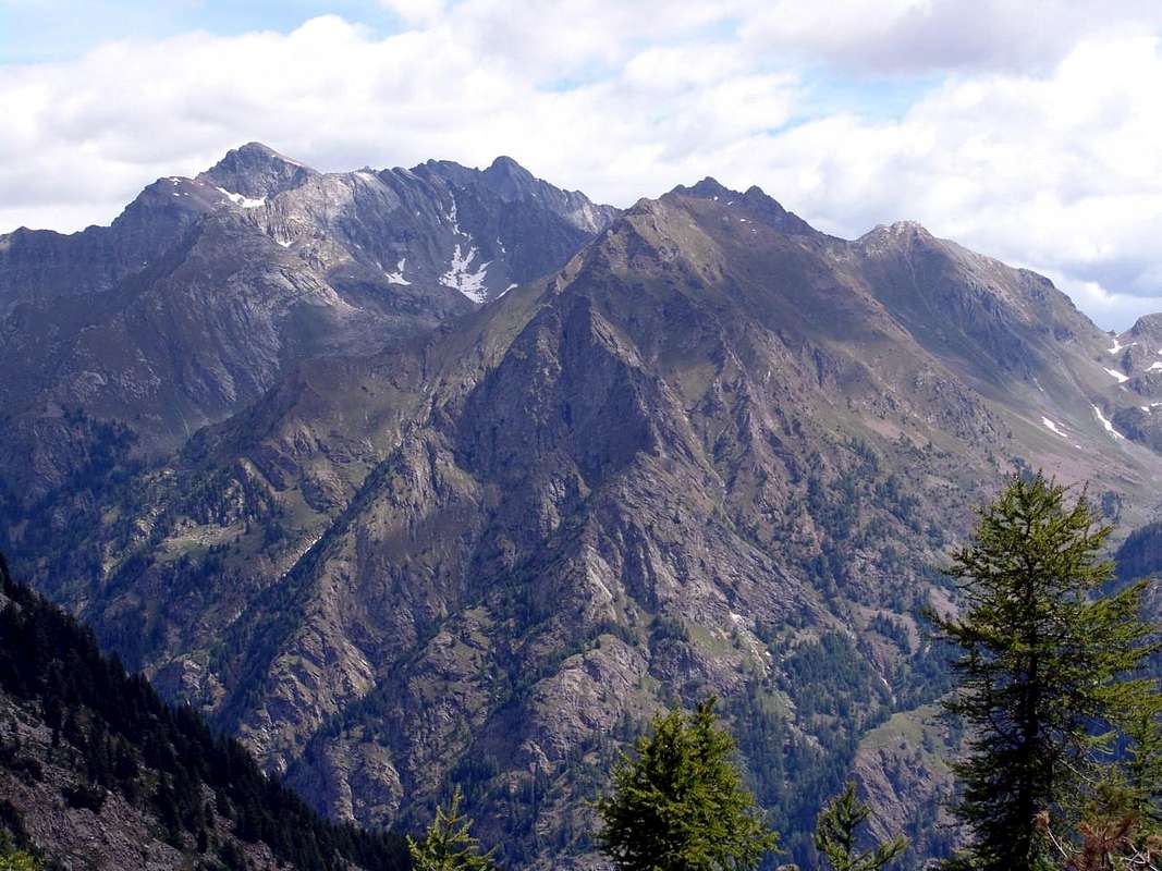
D3/11)- Saddle 2848 metres: from pond continue Southeast to point 2727 metres on Schkéerpie moraine; after in East to 1)- carving. Descent to 2)- Ravelli Bivouac.
D3/12)- Uomo Storto Pass: from source in South, path n° 3A, to Schkéerpie Gaveno Alp (2393m); in East, pathless, 1)- to pond 2728 metres and Pass (2856m). Also 2)- variant: from Gastaldi Bivouac (2620m) in Northeast, Alta Via Tullio Vidoni, to pond 2692 metres, pass. Descent to 3)- Ravelli Bivouac, near pond 2481 metres.
D3/13)- Nétschò Bocchetta: from Schkéerpie Gaveno (2393m); from alp in South to 1)- cross 2436 metres, with the path n° 3 from Ondre Eselbode, Gastaldi Bivouac (2620m), below Nétschò Summit (3247/80m) and small glacier, Nétschò Bocchetta on North Crest. Descent, pathless, to 2)- Verde, Nero Lochs, Shelter Rissuolo.
D3/14)- Rissuolo Pass: from State alternative after Balmeto Village (1533m) in East through a short Municipal Road to Ondrò Village (1541m); from this in Northeast, path n° 8; 1)- to Lecko (1907m), Tsachampònò (2015m), Obrò (3137m; source 2159m), Pastures, Alp 2309 metres and, through traces in final, part to Rissuolo Pass (2930m), between Ciampono/Rissuolo (3102m) Summits. Descent in East, path n° 2B,to 2)- Lago Nero (2668m) and, path n° 2, Lake Bianco (2333m), near Shelter Alp Rissuolo (2264m), Pile (2201m), Spinale, le Piane/Cambiaveto (1511m), Sant'Antonio (1381m) Alps in Vogna Vallon to Riva Valdobbia (1112m) in Sesia Valley.
D3/15)- Alpetto Pass: from State near Onder Perletoa Hamlet (+; 1421m) through Municipal to Lòubonò (1476m); in East, path n° 9, to Gruebe, Ondrò Ebielò (1898m), Tené Gavene (2182m), Obrò Ebielò (2209m), Schenébiel (2316m) Pastures. In Northeast, path n° 9, to 1)- source 2376 metres, points 2512, 2593 metres, Alpetto Pass (2768m), below Rissuolo Crest. Descent in East, path n° 2. to 2)- Shelter-Alp Rissuolo (2264m), nearby Lake Bianco (2333m), Pile (2201m), S. Antonio (1381m) in Vogna Walloon to Riva Valdobbia (1112m). From lake in North, paths n° 2/2C, to 3)- Lochs Bianco and Verde (2849m), in small walloon below Corno Bianco.
D3/16)- Valdobbiola: with previous route in East-southeast, path n° 9A, to sources 2387, 2503 metres, pond under Valdobbiola Hill (2638m). Descent in Southeast.
D3/17)- Valdobbia or Spissiòcoll: from State nearby Ondrò Verdebiò (1391m) in Northeast, path n° 11, to fork 1570 metres; continue, same direction path n° 11/105, to 1)- Ondrò Tschalvrétzò (+; 1904m), Tschalvrétzò (1897m), Obrò Tschalvrétzò (2030m), Valdobbia Hill or Spissiòcoll (2489m), near Refuge-Hospice Sottile. Descent in East-northeast, paths n° 1/1C, to 2)- fork 2463 metres (path n° 1B from Valdobbiola), Pastore (2133m), Montata (1638m), Peccia (1475m), S. Antonio Alps.
D3/18/19)- Saddles 2642, 2708 metres: from Saint Jean-Valdobbia (1380m) in Northeast, path n° 11B, to Pòtzie (1877m; source); from this path n° 11/105, to Ondrò Schkéerpie (2146m), Ondrò Tschalvrétzò Lower (1904m) and Upper (2030m) Pastures. In Southeast, pathless and through moraines, to various ponds (2098m, 2442m, 2484m); from the last in East-northeast to 1)- Saddle 2642 metres, below Punta Plaida (2689m). Descent in Northeast, pathless, to 2)- fork with path n° 1C from Valdobbia, Balma Lake (2310m), Pastore Alp. From pond 2484 metres in Southeast, pathless, to 3)- Saddle 2708 metres, on North-northwest Crest of Corno Rosso (2979m); descent, same route, in East to 4)- Plaida (2458m), Balma Lochs, Larecchio (1900m), Spinale Alps and preceding routes in Vogna Vallon to Valdobbia.
From Valsesia to Rosa Group,
by Diveria
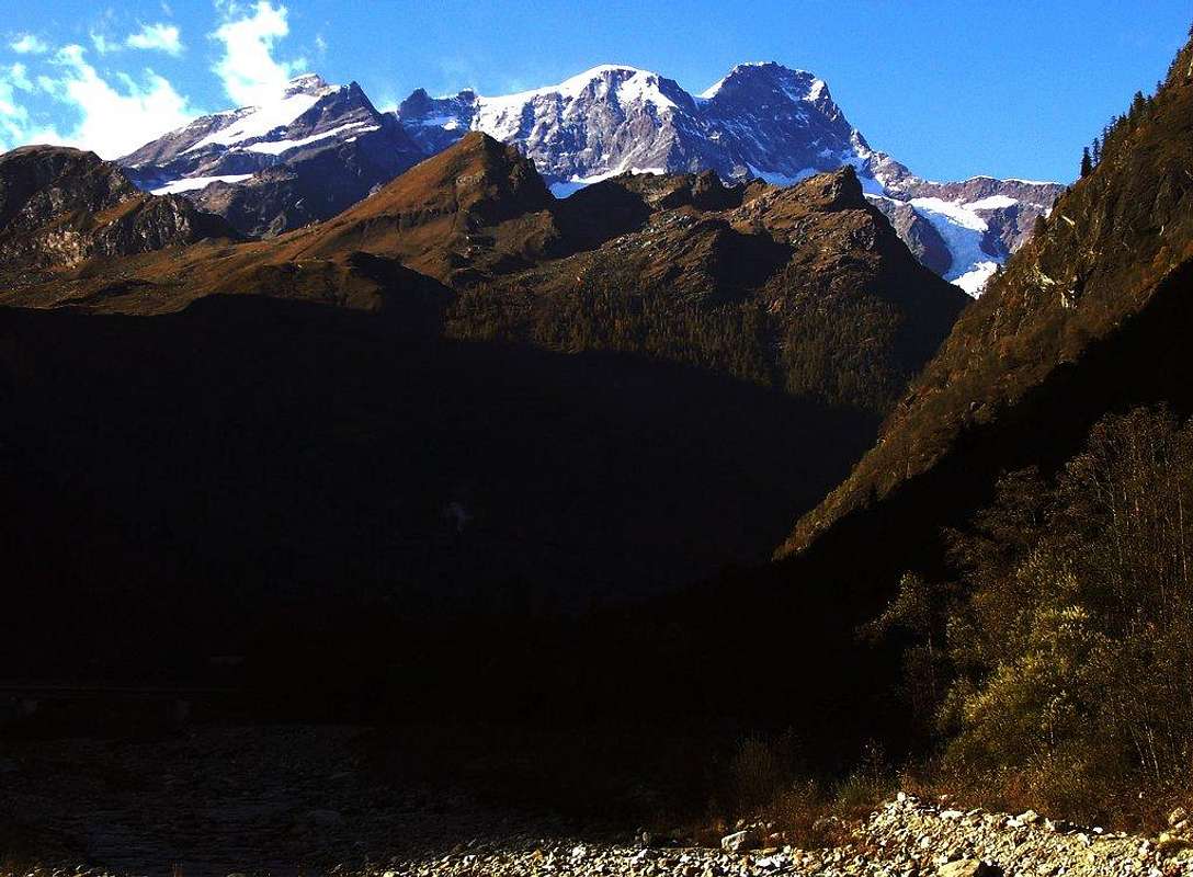
D3/20)- Camino or Casara Nuova also Viaréccio Pass: from Lommattò-Soagò (1311m) in East, path n° 12/GSW/High Route number 1, to Bérche, Loo (1860, 2084m) Alps, crossing the torrent, directly on grassy-debris slope to 1)- a rocky terminal couloir, pass (2472m); descent to 2)- Casera Nuova Lake (2306m), Maccagno (2188), Camino (2016m), Pioda di Sopra (1877m), Buzzo, Peccia (1475m), S. Antonio (1381m), Ca' di Janzo (1354m) Alps and Pastures to Riva Valdobbia (1112m).
D/3/21)- Maccagno Pass: : from State near Soagò/Steina (1311m) through short Municipal Road to Lommattò or Loamatten/Lysò Fractions (+; 1358m; source); from this in Southeast to Jatzie Pasture; crossing on Lòò Torrent to Berché Pasture. From fork in North, path n° 12c, after three Loo Alpages to 1)-Maccagno Pass (2495m), between il Cornaccio (2589m)/Monte Cossarello (2691m). Same preceding descent in Northeast, into Vogna Walloon, to 2)- Maccagno, S. Antonio, Riva Valdobbia.
D/3/22)- Loo Pass: from Berché Pasture (1535m) in Northeast, path n° 12 along torrent and in Nidelstei-Spettal Gover area, to 1)- Onde Lòò tiny Village (1860m), Ondrò/Obrò Bodma (1884m, 1910m; sources), Lòò Superior (+; 2084m), fork around 2230 metres under Mount Kick (2315m), Lòò Hill (2452m), between Monte Cossarello/Punta Lazoney (2579m); descent in Southeast, path n° 51, to 2)- Lake Lamaccia (1925m), Alp il Toso (1649m), Punto di Appoggio, Alp il Rosso (1395m), Parbella Bridge, Sponde Pasture (+; 1093m), Rassa Hamlet in Sorba Valley. From this with Municipal Road to Piode Hamlet on State Road n° 299 (1,5 Km. from Alagna).
D/3/23)- Niel Bocchetta: from Gaby Commune (1040m) in East through Municipal Road to Chanton (+; 1444m), Niel (1535m), Gruba (1550m) Villages; from in North-northheast, path n° 6, to Sctvòla (1757m), Giazet (1972m), Bodo (2215m) Pastures, 1)- Lazoney Hill (2395m); from Sctvòla in East-northeast, path n° 6b, to 2)- Piccolo Loozoney, Grétie (2207m) Alps, Crétier Pond (2221m), Niel Bocchetta (2430m). Descent in Northeast, path n° 69, to two Lakes Tre Vescovi (2370m, 2309m), fork with paths n° 51 (from Loo Hill/51c (to Artorto, Dosso, Massucco Alps) in North to 3)- Baitello in Gronda Valley; in Southeast to 4)- Lamaccia Lake in Sorba Vallon.
D/3/24)- Gran Mologna Pass: from Niel Bocchetta in Southeast, path VA/gta (Great Traverse of Alps), to and under Punta Tre Vescovi (2501m) with traverse to 1)- Mologna Grande Pass (2364m), near A. Rivelli (2150m), below Monte i Gemelli (2473m). Descent in Northeast, path n° 69, to 2)- Tre Vescovi Lake and previous fork.
Mologna Area,
by Corvus
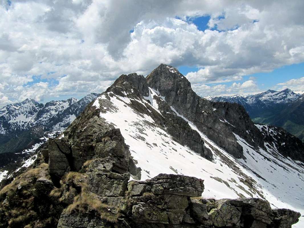
D/3/25)- Piccola Mologna Pass: From Gruba in Southeast to 1)- Picchere, fork 1800 metres around, Mologna Piccola Hill (2205m), between Monte i Gemelli/Punta Serange (2334m). Descent in Southeast, path n° E65/gta, to 2)- Anval Alp (1539m) and from this, path n° 60/gta, to Buron, Monta Pastures, Piedicavallo (1037m), (Rosazza 882m), Campiglia Cervo (776m), Quittengo, Sagliano Micca (818m), Miagliano/Andorno Micca (544/613 m) Hamlets in Cervo Valley to Biella Town (399m).
D/3/26)- Grovera Pass: from fork in South, path n° 6d, to 1)- la Piana (1829m), Turia (1878m) Alps, Grovera Pass (2210m), between Punta Serange/Punta Chaparelle (2409m). From hills descent to 2)- la Bosa Alp (2019m), with traces and, path n° E51, to Ambruse (1694m), le Piane, Monta Pastures, Piedicavallo in Cervo Valley.
D/3/27)- Vecchia Pass: from Zendelabaz Village (1019m), on State Road before Gaby, in East, path n° 9/VA, to 1)- Lamponey (1341m), Beccaz (1525m), Nost (1706m), Fontane (1874m) Alps, Vecchia Hill (2187m), between Punta Chaparelle/Punta della Vecchia (2387m). From hill descent in East-southeast, path n° E50 along Cervo Torrent, to 2)- Vecchia Refuge (1872m), Vecchia Loch (1858m), Caneba (1492m), Casette (1410m) Pastures, Rosei (1179m), Piedicavallo (1037m) Hamlets.
D/3/28)- Lupo Pass: from the cross (+; about 850 metres) just before Issime (930m) in Southeast through Municipal Road to nearby Bioley Village (+; 1118m); from this in Northeast, path n° 3, to Lion, la Torretta (+; 1353m), Tourrison (1638m) Credemy (1768m), Piccolo Lago (1935m) Alpages, Pond 2098 metres; in Northeast, with traces, to 1)- Crest Alp (2253m), Lupo (Wolf) Pass (2340m), between Monte Cresto (2546m)/Monte Pietra Bianca (2490m). Descent to 2)- Giaspret Pond (2136m) in Cervo Valley. In South, path n° 3a, to 3)- Marmontana Pass (2407m), under Monte Pietra Bianca; in Southeast to 4)-Pietra Bianca Alp (2190m), Torretta Lake (2146m).
Issime or in walser dialect Eischeme,
by om
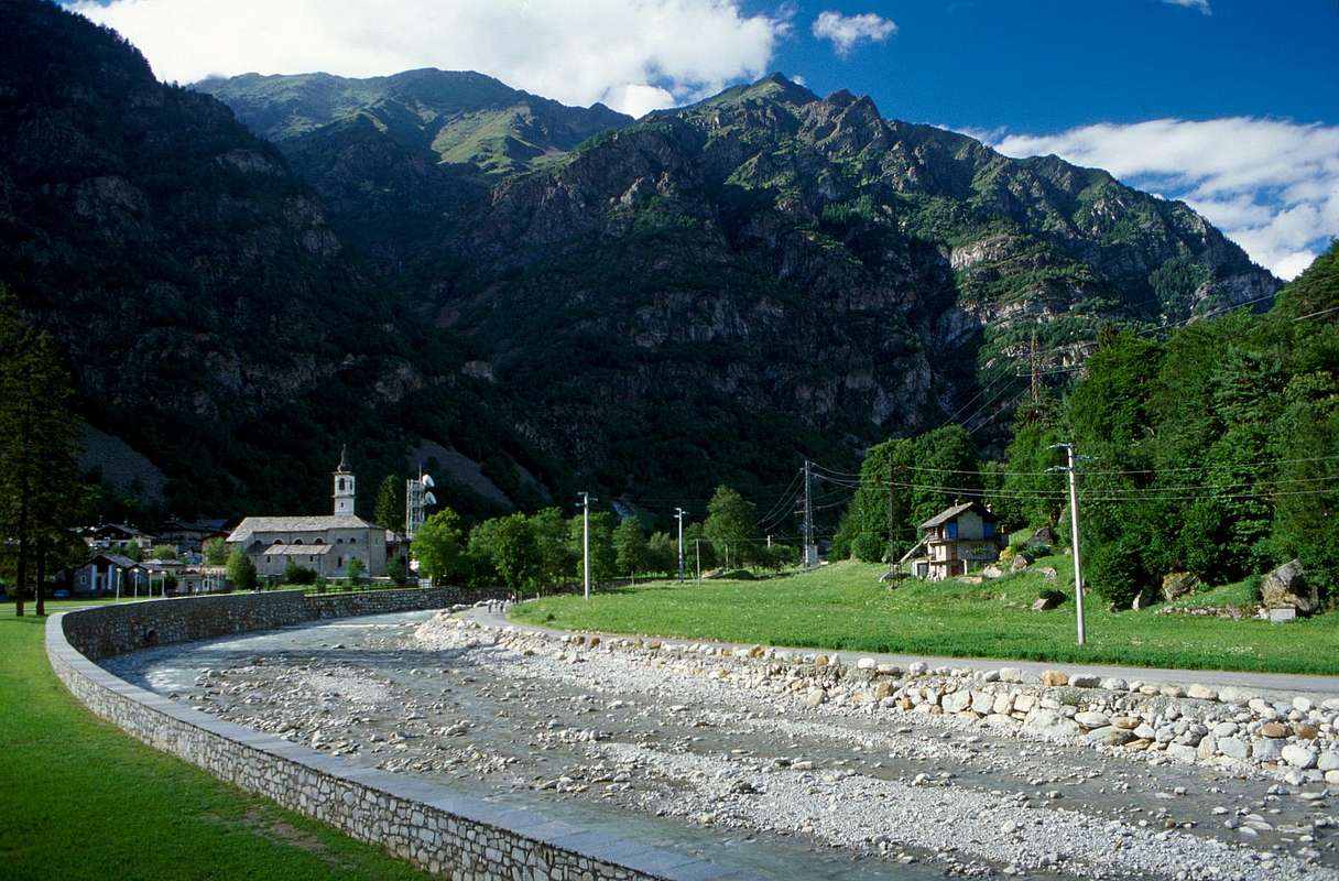
D/3/29)- Gragliasca Pass: from Fontainemore (760m) in East through Municipal Road to Espaz, Pervero (895m); in North, path n° 3a, to Racoulla Pian, Farettaz, Bonin/Asere and in East-northeast to 1)- Vernetta (1606m), Breuil (2122m), Touche (2068m), Pietra Bianca di Mezzo and Alta (2190m), Marmontana Hill. From Pervero in South to 2)- Chuchal (1212m), Clapasson, Pillaz, Cloz (1356m) Pastures; from this through dirt road-path n° 2 to 3)- fork 1435 metres, Tronc Alps. In Northeast, path n° 3a, to 4)- Cleva Bella, Sapel, Pietra Bianca Rion (2032m) and in North Torretta Lake, Pietra Bianca Alta, Marmontana Hill; from Cleva Bella in Southeast through dirt to 5)- hairpin band amongst Matta/Vargno/Vargnit Alpages, nearby Vargno Lake (1670m). From Matta in East, path n° 2a, to 6)- Grangeas/Met Ros (1895m), Rosaras Alps, Gragliasca Hill (2213m), between Punta Gragliasca/Punta Gran Gabe. Descent in East, path n° 30, to 7)- Gragliasca Alps (1826m), Besate (1101m), Rosazza.
D/3/30)- Barma or Oropa Hill: from Vargno/Vargnit in Southeast to 1)- Lei Long, Balma, near homonym four Lakes (2022m), Bar(l)ma also Oropa Hill (2261m), between Punta LeiLong (2236m)/Monte Rosso in Mount Mars Nature Reserve. Traverse in Northeast to 2)- Renata Hut (2360m), near Bocchetta di Finestra (2308m) and between Monte Camino/Monte Tovo; descent in East to 3)- Rosazza (1813m) and to nearby Savoia Shelters, above Oropa Sanctuary (+; 1100m; famous Madonna Procession from Gressoney Valley. Cablecar with alternatives from Oropa to three Refuges), on Pollone-Oropa Valley. From lakes in South, path n° 2c and traces, to 4)- Chardon Pass (2221m), between Monte Rosso (2374m)/Monte Mars (2615m). From Pillaz in East through Municipal to 5)- Granges (1395m), Goy, Pian Courmarial and with dirt road to Bosco, Vercosa (1600m), Crotal (1684m), Leretta (1784m), Goillas (1817m) Alpages, nearby Goillas two Ponds (1861m); in North, path-traces, to 6)- Bonnel (1796m), Long, Balma Lochs. From Fontainemore-Espaz in East, path n° 3, to 7)- Chucal, Thea (1212m), Sas, Bosco, Ramere, Rovinas, Serafredda (1797m), Montagnet Ponds, D. and A. Coda Refuge (2280m), between Punta della Sella (2315m)/Cerisey Hill. From Serafredda in South, same path n° 3, to 8)- Carisey di Sotto, Alp (1934m) and Hill (2132m); in West, path n° 1, to 9)- Portola Hill, below Mount Portola (1988m). From Carisey Hill descent to 10)- Bocchetta del Lago, Mucrone Loch (1902m) amongst Monte Mars/Monte Rosso/Monte Mucrone, Savoia and Rosazza Shelters. From Oropa, through Municipal Roads, to Pollone or to Miagliano, Biella City.
D/3/31)- Chardon Pass: from two lakes in South, path n° 2c and traces in moraine, to 1)- Chardon Pass (2221m), between Monte Rosso (2374m)/Monte Mars (2615m); descent in East-southeast, path n°D23, to 2)- Monte Rosso (2195m), Mucrone Lochs (1902m), Oropa Sport (arrival station of Cableway from Oropa).
D/3/32)- Carisey Pass: from Fontainemore-Espaz in East, path n° 3, l'Alas, Berce, Chucal to Thea (1212m), Sas, Bosco, Vercosa, Rovinas, Serafredda (1797m) Pastures; from this in South to 1)- Carisey Pass (2132m). Descent in Northeast, path n° C3/C4 to 2)- la Bella (1831m), la Tura (1720m), Mucrone Loch, Oropa Sport.
D/3/33-34)- Giassit/Lace Hills: a)- from the fork just before Lillianes (667m) in East, Municipal Road, to Chessun, Balmetta, Curtes, Costey (1056m), S. Margherita, Verman Villages; from S. Margherita in Southeast, path n° 2, to Pianas, l'Arpet (1623m), lo Stret (1724m), Giassit (1817m) Alps, Giassit Hill (2026m). b)- From this with short East traverse to Lace Hill (2121m). Descent in Northeast, path n° C2, to la Lace del Vitton (2097m), Pian Masere (1903m), Brangolone (1464m), Raja di Grangia (1138m), Sordevolo (632m) in Elvo Walloon. From this to Pollone, Occhieppo, Muzzano, Graglia Municipalities; in Southeast to Biella, in Southwest Ivrea Cities.
D/3/35)- Ciarma Hill: from State Road of Gressoney Valley, fork near Remondin Village (620m) in Southeast through Municipal Road to Mignot, Cavalle, Pian Mattet, Ververt (1282m), Pourci Pastures; from this, with path, to Tiombe (1859m), la Ciarma (1881m) Alps, la Ciarma Hill (1934m), between Bec di Nona (2085m)/Monte Parassone (1799m). From hill descent in South, path n° D3/gta, to Boses, Maschiero, Chiavanesso, Maletto Alps, Carema Commune (379m), immediately in Piedmont.
INSIDE PASSES
*** REMARK: We also give some information on some hills not placed on the border-crest but intimately, practical purpose, connected with the same.
D/4/1)- Salza Hill or Soalzecoll: from Bòrrethus-Staffal, in North, path n° 7, to Weng, Courttlys Pastures, fork 2244 metres; from this in East, path n° 7C, to 1)- Ustro Soalze (2323m), Salza Hill (2882m). Descent in Southeast, path n° 6A, to 2)- pond 2751 metres, Becksch Gaveno (2424m), Ponte, Lys Refuges near Gabietsee.
D/4/2)- Saddle 2767 metres or "Tullio Vidoni High Route": pass between Spilmannsberg (2772m)/West-southwest Crest of Tschampònòhòre or Ciampono (3235m). From Obrò (2137m) in East, path n° 8, to 1)- Rissuolo Hill (2930m); just before in altitude about 2840 metres in northwest, path "Alta Via Tullio Vidoni", to 2)- large saddle. From this in North, through traces below Leckenétsgletcher, to 3)- three mini ponds 2856 metres, Netscho Lake (2537m), Bivouac Gastaldi (2620m); from thisin Northeast, same route, connection with route to 4)- Uomo Storto Pass (2856m). Descent in East to 5)- Ravelli Bivouac (2503m) in Otro Walloon to Alagna.
D/4/3)- Rezza Carving: small, rocky, narrow pass (2774m) between Southwest Crest of Corno Carro or Charròhòre (3004m)/Mount Rezza (2843m). It does not have great importance as a crossing point and is more aimed at hunters who do not hikers. Reachable from the South with a digression on path n° 9 Alpetto Hill, just before the two Beckschlochs at an altitude of about 2500 meters; you climb through the moraine in a small walloon and turning left (West) in the last part. The West-northwest Slope is instead somewhat, though not excessively high, steep and falls on the route n° 8 at a ruin at an quota of 2309 m, above Obrò, along the via that leads to the Rissuolo Hill. In any case inadvisable, because unknown (near the Horn Carro has been climbed only in July 17th, 1988, by brothers Francesco and Pier Luigi Ferrero).
D/4/4)- Lago Hill: from Casera Nuova or Camino Pass in East, pathless to Casera Nuova Loch (2306m), also from Maccagno Hill in North, path n° 12c, to fork after Lake Nero (2322m); from this connection with path n° 5c to 1)- hill (2535m). Descent in Northeast, path n° 61, to 2)- il Laghetto (2366m), Seia Loch (2161m), Lake Alp; from this in East, path n° 61, to Piana d'Ovagol, Salei, Casere, Stralga, Goretto, Piana (+; 1193m) Pastures, Rassa in Gronda Vallon. Route completely in Piedmont.
D/4/5)- Lazoney Hill: from Loo Upper Alp in South, path n° 21a/VA in South of Loo Torrent, to 1)- Lazoney Hill (2395m), between Punta Pianeritz/Punta Tre Vescovi, above A. Rivelli Refuge, with descent to 2)- Gaby Commune; from fork about 2400 metres in East, path n° 12, to 3)- Loo Hill, with descent in Sorba Vallon, Piedmont.
D/4/6)- Marmontana Hill: in West of Monte Pietra Bianca, between Tourrison/Mount Mars small Valleys. From Lago Chiaro (2098m) in South, path n° 3, to hill (2407m). Descent in South, same path, to 1)-Upper Pietra Bianca Alp (2190m); in Southeast, path n° 3a, to 2)- Torretta Lake (2146m) and connection with Grugliasca Hill.
D/4/7)- Portola Hill: between Mount Portola (1988m)/Mount Bechit (2320m) and Fontainemore/Lillianes Communes. From Fontainemore-Espaz to Thea, Bosco, Vercosa, Serafredda Alpages (1797m) in South, path n° 3, to fork 2000 metres; after in West to 1)- hill (1988m). Connection with 2)- Carisey Hill in Northeast; descent to 3)- Pian di Bosc, Pian Sapei (1504m) Alps in Southwest to Municipal Road or path n° 1. Through these to Santa Margherita, Costey Villages (1056m), Lillianes.
From West to Uomo Storto/Nétschò/Ciampono in Corno Bianco Group,
by emilius
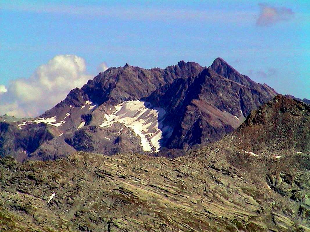
D4)- INSIDE RANGES:
Dora Baltea Stream Left Hydrographic Watershead from Northt to South-southeast:
Pont Saint Martin, Perloz little towns (East-southeast) in AOSTA VALLEY and Carema, Cesnole, Settimo Vittone, Montestrutto, Nomaglio, Andrate, Donato, Castellazzo, Netro, Graglia-Muzzano, Sordevolo in Elvo Valley, Pollone, Oropa little Towns between TURIN/BIELLA Provinces in PIEDMONT.
E2)- *** Amongst AOSTA VALLEY / SWITZERLAND / PIEDMONT ALL SUMMITS
E2)- *** Among AOSTA VALLEY/ SWITZERLAND/PIEDMONT ALL SUMMITS of Left Side.From: Cervinia-Breuil/Zermatt/Gressoney la Trinité/Gressoney Saint Jean/Gaby/Issime/Fontainemore/Lillianes/Pont Sain Martin in Aosta Valley.
From: Carema/Andrate/Oropa/C. Cervo/Piedicavallo/Riva Valdòbbia/Alagna Valsesia/Macugnaga (Turin, Biella, Novara Provinces) in Western Piedmont.
 |  |  |  |  |
35)- Testa Grigia/Rollin Gobba or Hump. Inside: Rollin Point/Quote various or Aventine Points; Quote various/Rocca di Verra.
Klein Matterhorn/BREITHORNS West, Central, East/Zwillinge/Roccia Nera or Schwarzhorn Area.
36)- Gemini: Pollux and Castor/Punta Felik/LYSKAMMS West, East and Nose Area; Testa Grigia/Monte Pinter/Corno Vitello/Punte di Palasina/Punta del Lago/Corno Bussola/Punta di Briguez/Mont Palon/Punta della Gua; Monte Chiappa or Quiappa; Punta di Valfredda/P. di Valnera/Bieteron; Mont Ciosé North, Central, South Mountain Chain.
 | 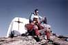 |  |  | 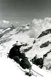 |
37)- Punta della Regina/Taf/Mont Nery also Becca di Frudiera/Becca di VLOU-Becca Torché/Punta del Dondeuil/Corno del Lago or Pic des Allemands/Mont Crabun/Cima Pietre Bianche Mountain Chain and Groups.
38)- Stolenberg/Punta Indren/Punta Giordani/Pyramid Vincent/Balmenhorn/Schwarzhorn or Corno Nero/Ludvigshohe/Punta Gnifetti also Signalkuppe/Punta Zumstein/DUFOURspitze MONTE ROSA MOUNTAIN CHAIN.
Traverse from ZUMSTEINSPETZ 4564m) to DUFOURSPETZ (4636m): SUMMIT of the Summits AUGUST 27th, 1967.
39)- Corno del Camoscio/Punta di Straling/Corno BIANCO/Corno Rosso/Corni del Pallone/Monte Cossarello, amongst Gressoney/Alagna Valsesia/Valgrande Valleys.
38)- Stolenberg/Punta Indren/Punta Giordani/Pyramid Vincent/Balmenhorn/Schwarzhorn or Corno Nero/Ludvigshohe/Punta Gnifetti also Signalkuppe/Punta Zumstein/DUFOURspitze MONTE ROSA MOUNTAIN CHAIN.
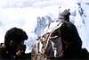 |  | 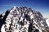 |
39)- Corno del Camoscio/Punta di Straling/Corno BIANCO/Corno Rosso/Corni del Pallone/Monte Cossarello, amongst Gressoney/Alagna Valsesia/Valgrande Valleys.
40)- Monte Mars and Reserve/Punta Tre vescovi-Colma di Mombarone, borderland between Aosta Valley (West) and Piedmont (East).
![]()
BREITHORNS AREA
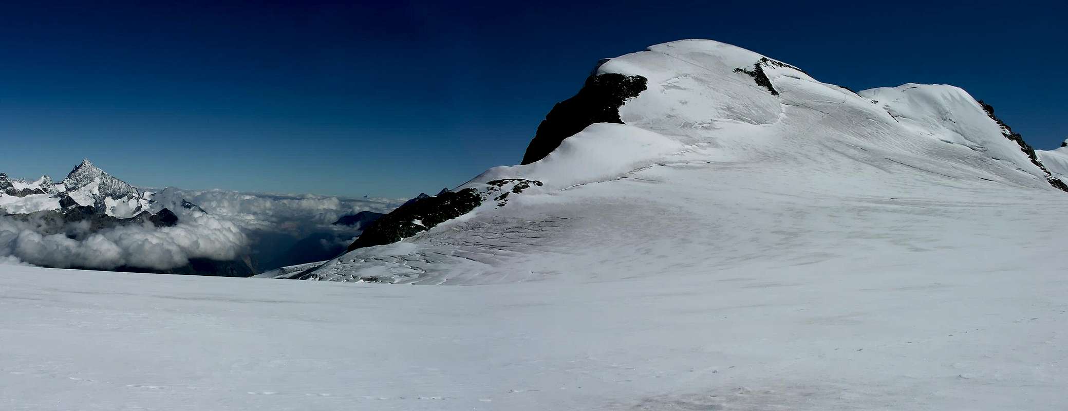
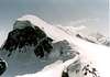 |  |  |  |  |
From Southern, Northern Aventine Pass, near Tete Grise Station or from interfarms routes between Goillet and Cimes Blanches Lakes to Plateau Rosa Pass Quote various (3287, 3303, 3277, 3062, 3094, 3015m) - Pointe de Rollin - Pointe Rollin, Adventine, Rollin Grand Lake, other little Lakes in Northwest. From Northern Adventine Pass, Breithorn Pass Gobba di Rollin or Dos de Rollin (Rollin Hump) - Quote various (3705, 3739, 3759, 3645, 3401, 3375, 3309, 3326, 3248, 3072m) - Rocca or Mont di Verra (Rocky Gym in East above Verra Tableland) and Bleu Lake in Southeast; Great Lake in West and Céré Lake in Southwest - Città di Mariano Bivouac to West. From Adventine Northern Pass or from Breithorn Pass Piccolo Cervino or Klein Matterhorn - BREITHORNS AREA: Breithorn Occidentale - Breithorn Centrale - Breithorn Orientale - Breithornzwillinge - Roccia Nera or Schwarzruken - Rossi and Volante Bivouac to Porta Nera or Schwarztor.
![]()
![]()
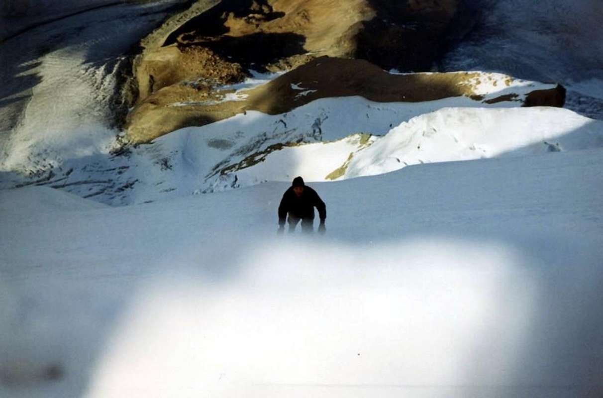
LYSKAMKMS / TESTA GRIGIA / CORNO VITELLO / CORNO BUSSOLA AREA

From Porta Nera or Schwarztor: Ayas Valley Guides Refuge to South - GEMINI: Pollux also Punta Polluce and Castor or Punta Castore - Mezzalama Refuge in Southwest - Punta Felik also Felekspétz Sella Refuge in South - LYSKAMMS AREA: Lyskamm Occidentale or Westliche Lyskamm - Lyskamm Orientale or Ostliche - Naso del Lyskamm also Nasogroad ( Lyskamm Nose) - to Entdekonselse, Lys Passes.
From Saddle 3862m great ramification to South: Punta Perazzi - Bettolina Crest (Quote 3512, 3599, 3602 (refuge), 3510, 3496, 3353, 3313, 3133m) to Bettolina Pass also Obre Betlinòfòrkò - ten little Lakes in East and Lake 2774 m in West. From Pass little ramification to Southwest: Red Mount Crest (Quote 3095, 3061, 2948, 2936m) - Monte Rosso - Palon de Résy - Resy Lakes various in East. From Lower Bettolina Pass or Betlinòfòrkò Punta Bettolina or Betlinòhòre to Battfòrkò or Bettaforca Pass - Mielegofer little lakes in East - Monte Bettaforca or Battbéerg - Continery Lake in East and Charchèrioz Lake in Southwest, nearby Little Mont Cavallo - Bloabhòre - Saler Damon Lake in West - Rothorn or Ròthòre; Blach Little Rothorn to East (+); Quota 3107m; Pass and Mount Sarezza to West. Testa Grigia also Groabhopt Area: Monte Pinter or Péntespétz - Lateltin Bivouac in Shoulder 3113m - Pinter or Pénte Lakes to Southwest. Ramification to Northwest: From Perrin Pass: Mont Chateau - Mont Pezzei - Mont de la Nonna. From Mascognaz Pass or Mascognacoll: Corno Vitello or Chalberhòre (+) Perrin Lake in Northwest. From Quota 2823m ramification to West: Pointes de Palasina - Couloir, Vert, Palasina, della Battaglia Lakes (Battle Lake) in South. Pointe du Lac Long - Long, Pocia Lakes in Southwest - Corno Bussola. Little ramification to North: Pointe de Mascognaz - Pointe Piure - Croix de Bequet (+). From Bussola Horn ramification to South: Pointes de Bri(e)nguez (Quote 2899, 2840, 2859, 2853, 2842, 2855, 2734, 2740m) Bringuez Lake in East - Pointe Palon - Pointe de la Gua (+). From Little Bringuez Pass to Southeast: Monte Quiappa or Chiappa. From Valfreyda Pass or Freidecoll continuation of the great ramification to South: Punta di Valfredda or Feidòhòre - three Freide Lakes in West - Punta di Valnera or Valdònièrhòre - Mont Ciosé or Stallerhòre North, Central, South Summits to Ranzola Pass.
![]()
![]()
DUFOURSPETZ: SUMMIT of the Summits AUGUST 27th, 1967.
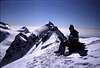 | 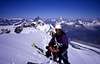 | 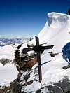 |  |  |
From Saddle 3862m great ramification to South: Punta Perazzi - Bettolina Crest (Quote 3512, 3599, 3602 (refuge), 3510, 3496, 3353, 3313, 3133m) to Bettolina Pass also Obre Betlinòfòrkò - ten little Lakes in East and Lake 2774 m in West. From Pass little ramification to Southwest: Red Mount Crest (Quote 3095, 3061, 2948, 2936m) - Monte Rosso - Palon de Résy - Resy Lakes various in East. From Lower Bettolina Pass or Betlinòfòrkò Punta Bettolina or Betlinòhòre to Battfòrkò or Bettaforca Pass - Mielegofer little lakes in East - Monte Bettaforca or Battbéerg - Continery Lake in East and Charchèrioz Lake in Southwest, nearby Little Mont Cavallo - Bloabhòre - Saler Damon Lake in West - Rothorn or Ròthòre; Blach Little Rothorn to East (+); Quota 3107m; Pass and Mount Sarezza to West. Testa Grigia also Groabhopt Area: Monte Pinter or Péntespétz - Lateltin Bivouac in Shoulder 3113m - Pinter or Pénte Lakes to Southwest. Ramification to Northwest: From Perrin Pass: Mont Chateau - Mont Pezzei - Mont de la Nonna. From Mascognaz Pass or Mascognacoll: Corno Vitello or Chalberhòre (+) Perrin Lake in Northwest. From Quota 2823m ramification to West: Pointes de Palasina - Couloir, Vert, Palasina, della Battaglia Lakes (Battle Lake) in South. Pointe du Lac Long - Long, Pocia Lakes in Southwest - Corno Bussola. Little ramification to North: Pointe de Mascognaz - Pointe Piure - Croix de Bequet (+). From Bussola Horn ramification to South: Pointes de Bri(e)nguez (Quote 2899, 2840, 2859, 2853, 2842, 2855, 2734, 2740m) Bringuez Lake in East - Pointe Palon - Pointe de la Gua (+). From Little Bringuez Pass to Southeast: Monte Quiappa or Chiappa. From Valfreyda Pass or Freidecoll continuation of the great ramification to South: Punta di Valfredda or Feidòhòre - three Freide Lakes in West - Punta di Valnera or Valdònièrhòre - Mont Ciosé or Stallerhòre North, Central, South Summits to Ranzola Pass.
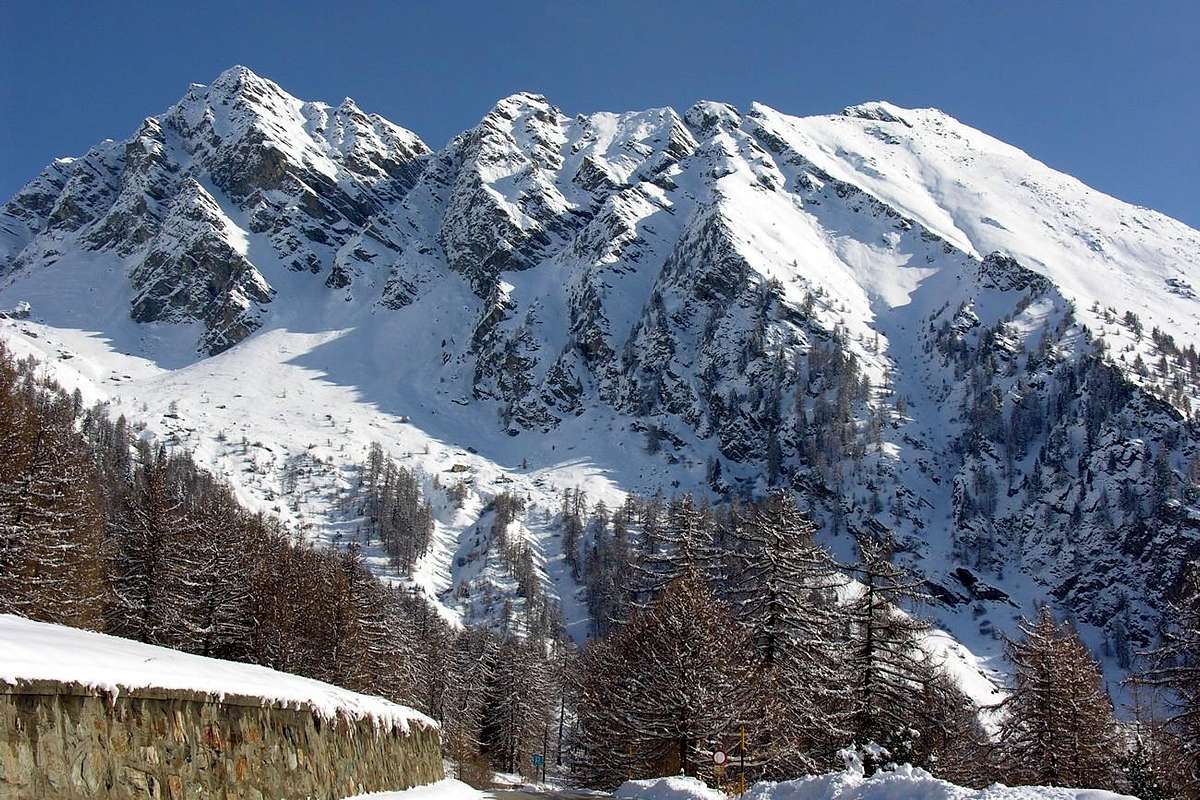
MONTE ROSA - DUFOURSPITZE AREA

 |  |  | 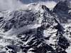 | 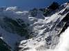 |
From Salati Pass: to North: Passehòre - Stolemberg (+; X Stolemberg mines to West) - Punta Indren - Indren Refuge - Indren Lakes or Endroseena in West - Punta Giordani - Pyramid Vincent (+). Little ramification to Southwest: Quota 3498 m (+) , near Mantova, Gnifetti Refuges - Alta Luce or Hochliecht (+: ex Passera Bivouac) - Squinobal Refuge in Southeast - Punta Telcio or Teltschospétz (+) - Bloabesee, Verde lake and other little Lakes to East-northeast. Balmenhorn (Summit CHRIST) - Giordano Bivouac to East - Schwarzhorn or Corno Nero - Ludwigshohe - Punta Parrot - Punta GNIFETTI also Signalkuppe - Regina Margherita Refuge, in Europe more taller - Punta Zumstein - Shoulder 4596 m - Grenzgipfel - Ostspitze - PUNTA DUFOUR or Dufourspitze AREA: (*; +) Punta Nordend - Jagerhorn to Fillar Pass.
![]()
![]()
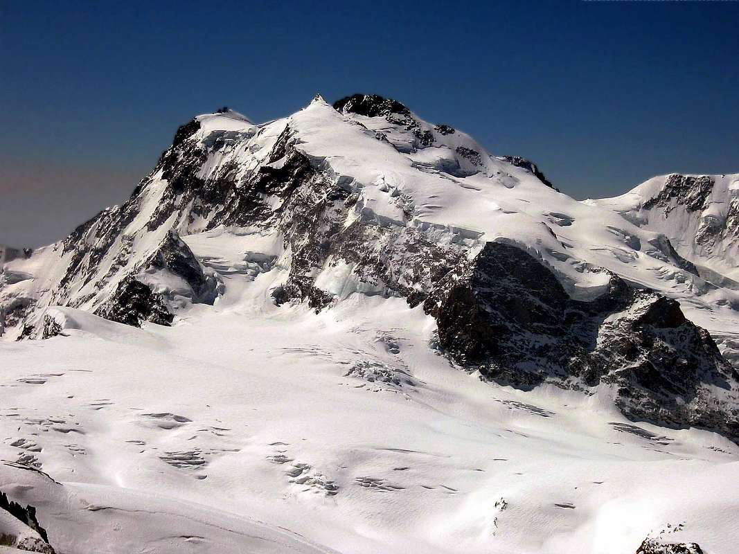
P. STRALING / CORNO BIANCO / MONTE MARS / MOMBARONE AREA
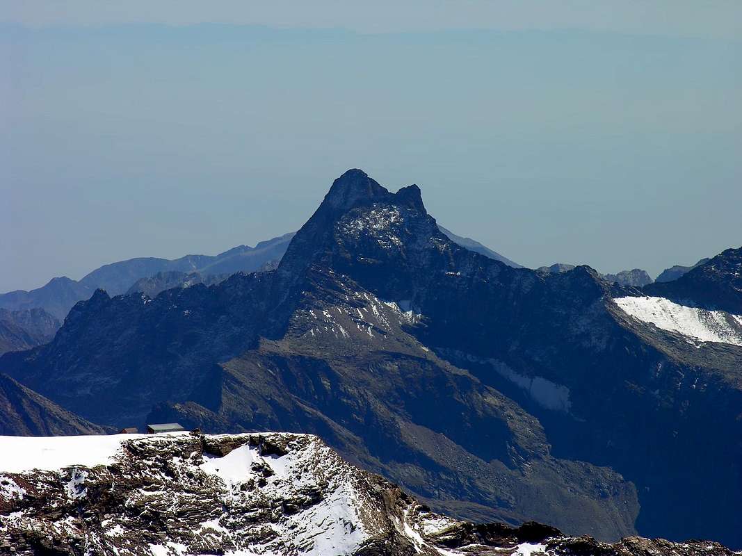
Great ramification to south between Gressoney and in Piedmont Varallo Sesia/Cervo/Biella Valleys: from Salati Pass to south Corno del Camoscio - Rothòre or Corno Rosso - Punta Straling Little Area: Gabietsee or Gabiet Lake - Groshòre also Corno Grosso - Punta dell'Uomo Storto - Punta di Nétscho - Corno Bianco Area: from Bocchetta (pass) Punta di Nétscho - Punta di Chiampono or Tschampono also Tschampònòhòre - Verde Lake in East and Gastaldi Bivouac in Northwest, Nétschò little Lakes and Seebiene Lake. Spilmannsberg: Punta di Rissuolo Nero Lake in Northeast; Corno Carro or Charròhòre - Monte Rezza - Rissuolo Crest - Rotegroad or Cresta Rossa; Corno Rosso in East and Bianco Lake in North; Corno Valdobbia Home Ospice-Refuge Sottile in South, near Valdobbia Pass or Spissiòcoll; Triscte della Bandiera, Schilten Points; Punta Plaida Balma Lake in Northeast and Plaida Lake in Southeast; P. Oro. Ròthòre or Corno Rosso also Punta Carestia. Small ramification to West: Hòre also Punta Rossa - little lakes to Northwest - Talléspétz or la Corna; P. Loo. Corni del Pallone; P. Pater. Il Cornaccio Casera Nuova Lake to Northwest. Cima Morticci - Monte Cossarello (Northwest and Southeast Summits) - Il Laghetto, Seia Lakes in North to Loo Pass. From pass small ramification to West: P. Lazoney - P. Pianeritz - Tàille. Inside and from Lazoney Pass: Mont Kick and Piane ponds. Punta Tre Vescovi - Zuckie, Three Vescovi, Cretie, Niel, Lamaccia Lakes - A. Rivetti Refuge - Monte i Gemelli - P. Serange - P. Chaparelle to della Vecchia Pass (Old Woman) - Vecchia Refuge to East and Vecchia Lake and from pass Punta della Vecchia; Cima Becchet in West; Cima Canaggio in East. Monte Cresto Chiaro, Giaspret Lakes, Nera Lupo Pass (Wolf Pass) - Monte Pietra Bianca - P. della Gragliasca - Torretta Lake - P. Gran Gabe - P. Lei Long - P. della Barma or della Barma di Oropa (famous Sanctuary) - Renata Hut, near Monte Camino; Monte Rosso Mucrone Lake to South - Mont Mars Area and Natural Wildlife Reserve of Mount Mars:
![]()
Balma, Long, Vargno, Bonnel, Goillas Lochs to North: P. Figlieu; P. Leretta. P. della Sella - D. and A. Coda Refuge to South. In West: M. Portola - M. Cimin. To Southwest: M. Bechit - M. Roux to Giassit Pass. Ramification to Westsouthwest: P. Cressa - Bec di Nona - la Ciarma - M. Parassone - M. dell'Orso above Pont Saint Martin and Carema little Towns. From Lace Pass Punta Tre Vescovi Lace ponds to North. M. Rasca in Southwest; Truc del Buscajon in East; Colma di Mombarone (+; Redeemer) Area: Mombarone Refuge and Mombarone little Lake in West. P.no dei Test always to West; Bric Paglie in Southeast; to South: Monte Cavalgrosso Pasci Lake to East: M. Cavalpiccolo - M.la Torretta (X quartzquarry) Point of Support, near Cavanna Alp above Donato, Andrate, Settimo Vittone little Towns.
![]()
Mountain Chains Colorphotos, colorpictures, B&W photographs, by Antonio GIANI & Osvaldo CARDELLINA.
Moreover, Action photographs and other, by Various AUTHORS & WRITERS:
"Old Young Breithorn" also "ROLLIN HUMP/BEITHORNS double traverse/KLEIN MATTERHORN o'-roses", by Camillo Roberto FERRONATO;
"Breithorn", by Camillo Roberto FERRONATO;
"Breithorns Double Traverse", by Camillo Roberto FERRONATO;
"From Central to Western Breithorn 1980", by Camillo Roberto FERRONATO;
"Sky Traverse "LYSKAMM EAST (4532m)", by Ilario Antonio GARZOTTO;
"Dufourspétz: SUMMIT of the Summits", by Antonio DOLANDO;
"From Zumsteinspétze to Grenzsattel", by Bruno PAGLIARIN;
"Pointe Dufour", by Osvaldo CARDELLINA;
"From LITTLE MATTERHORN toward WEST in ....... THE MORNING, by Gianni JUNOD;
"Old "Vecchio" Breithorn", by Gianni JUNOD;
"AOSTA's VALLEY in SUMMITS INDIAN File", by Ilario Antonio GARZOTTO;
"LYSKAMMS TRAVERSE, after "Perazzi" South Edge on 1969", by Ilario Antonio GARZOTTO;
"TRAVERSE from LYSKAMMS to CASTOR 1969", by Ilario Antonio GARZOTTO;
"Old Sella Hut, Castore & Lyskamms in 1969", by Ilario Antonio GARZOTTO;
"Youthful Champoluc to MOUNT ROSA 1969", by Unknown, Osvaldo CARDELLINA's Collection;
"Mont Mars", by Corvus;
"Mont Blanc chain and Gran Combin from Mombarone (60 miles away)", by luca;
"Breithorn ridge", by by as;
"Zumstein & Dufour East side", by Gabriele ROTH (gabriele);
"Punta Dufour and Nordend from...", by Corvus;
"Nordend and Dufour seen from Alphubel.", by andrea.it;
"Lyskamm south side", by om;
"Lyskamm traverse E-W", Lyskamm, Castor and Pollux, by andrea.it;
"West Lyskamm", by andrea.it;
"At the summit ridge of the...", by Stefan WEBER (kletterwebbi);
"A little iron cross on Eastern Lyskamm", by Silvia MAZZANI;
"Lyskamm seen from E. July...", by Romuald KOSINA;
"Monte Rosa", by Simnel;
"Pollux", "Monte Rosa", by Simnel;
"Roccia Nera", by Corvus;
"Piccolo Cervino 3883 m.", by Paolo OLIETTI (OliettiPaolo);
"A windy day on Corno Nero summit", by Silvia MAZZANI;
"P.Parrot (Parrotspitze)", by Gabriele ROTH (gabriele);
"The Punta Giordani as seen...", by Gabriele ROTH (gabriele);
"North Dufour & Nordend from Signalkuppe/Zumstein 1981", by Camillo Roberto FERRONATO;
"MOUNT ROSA From Corno Bussola to Breithorns 2001", by Emilio BERTONA alias emilius;
"MOUNT ROSA Group Eastern Lyskamm & Naso 2001", by Emilio BERTONA alias emilius;
"Below the Silbersattel - 4500 m", by Rahel Maria Liu;
"Eastern Rosa group", by buxlex;
"M. ROSA Corno Bianco/Ciampono Group from West 2001", by Emilio BERTONA alias emilius;
"ValSesia, the Lord.", by Diveria;
"Gemelli di Mologna", by Corvus;
"M. ROSA From Corno Vitello Corno Bianco Group 2001", by Emilio BERTONA alias emilius;
"MOUNT ROSA To Ranzola Hill & Three Mount Ciosé 2004", by Emilio BERTONA alias emilius;
"WEST BREITHORN (4165m) NORTH FACE Exit Out to SUMMIT", by Ilario Antonio GARZOTTO.
"Voyages dans les Alpes", by Horace Bénedict De Saussure, Tome I 1779, Tome IV 1796;
"Manuel du voyageur en SUISSE et à Chamonix" - Nouvel Ebel, by Adolphe Joanne, Second Edition 1859;
"La Vallée d'Aoste", by Edoard Aubert, 1860;
"A Handbook for Travellers in Switzerland, Savoye, and Piedmont", by John Murray, Twelfth Edition 1867;
"Studi sul Gruppo del Gran Paradiso", by Martino Baretti, 1867;
"Historique de la Vallée d'Aoste", by Jean Baptiste De Tillier, 1888;
"Climbers' Guide to the Central Pennine Alps", by William Martin Conway, 1890;
"The Mountains of Cogne", by George Yeld and W.A.B. Coolidge, 1893;
"Guida delle Alpi Occidentali Vol. II°, Parte 2°, by Giovanni Bobba and Luigi Vaccarone, 1896;
"Scrambles in the Eastern Graians 1878-1897", by George Yeld, 1900;
"Nel Regno del Cervino", by Edmondo De Amicis, 1905;
"Les Alpes Occidentales", by Federico Sacco, 1913;
"Guide du Valpelline", by Abbot Joseph Maria Henry, 1925;
"Le Alpi Pennine", by Silvio Saglio, 1951;
"La Luce delle vette", by Francesco Cavazzani, 1954;
"Guida della Regione Autonoma della Valle d'Aosta", by Mario Aldrovandi, 1964;
Monte Marzo e la cresta dal Colle dei Corni al Colle di Valbella", by Piero Falchetti, 1966;
"Dal Bec d'le Steje alla Cima Battaglia", by Piero Falchetti, 1968;
"Gran Paradiso - itinerari scelti", by Roberto Mantovani and Renato Misischi, 1974;
"80 itinerari di escursionismo alpinismo sci alpinismo in valle d'aosta", by Osvaldo Cardellina, 1977;
"Guida del Monte Emilius, by Osvaldo Cardellina, 1978.
C.A.I./T.C.I. Collana Guide dei Monti d'Italia-Italy Mounts Guides SERIES, Volumes:
"Monte Rosa", by Sivio Saglio and Felice Boffa, 1960;
"Gran Paradiso", by Emanuele Andreis, Renato Chabod and Mario Carlo Santi, 1939; Reprint 1963;
"Monte Bianco Volume I°", by Renato Chabod, Laurent Grivel and Silvio Saglio, 1963;
"Aggiornamenti alla Guida del Gran Paradiso (Seconda Edizione)", by Renato Chabod and Piero Falchetti, 1964;
"Monte Bianco Volume II°", by Renato Chabod, Laurent Grivel, Sivio Saglio and Gino Buscaini, 1968;
"Alpi Pennine Volume II°", by Gino Buscaini, 1970;
"Alpi Pennine Volume I°, by Gino Buscaini, 1971;
"Gran Paradiso", by Emanuele Andreis, Renato Chabod and Mario Carlo Santi, Third Edit. with revisions and collaborations by Renato Chabod, Ugo Manera and Corradino Rabbi, 1980;
"Alpi Graie Centrali", by Alessandro Giorgetta, 1985;
"Monte Rosa e Mischabel", by Gino Buscaini, 1991;
"Monte Bianco Volume I°", by Gino Buscaini, 1994;
"Emilius Rosa dei Banchi Parco del M. Avic", by Giulio Berutto and Lino Fornelli, 2005;
BASIC MAPS
• "Carta dei Sentieri comuni di Ayas - Brusson n° 1", Carta della Comunità Montana Evançon, Ediz. varie e successive 1:30.000.
• "Media Valle n° 2", Carta della Comunità Montana Evançon, Ediz. varie, 1:30.000.
• "Fondo Valle n° 3", Carta della Comunità Montana Evançon, Ediz. 1999 e successive 1:30.000.
• L'Escursionista Carta dei Sentieri n° 7 "Valtournenche Monte Cervino Val d'Ayas ovest" 1:25.000.
• L'Escursionista Carta dei Sentieri n° 8 "Val d'Ayas Val di Gressoney Monte Rosa" 1:25.000.
• Kompass "Breuil/Cervinia-Zermatt" Carta turistica 1:50.000.
• I.G.C. Istituto Geografico Centrale Torino "Cervino e Monte Rosa" 1:50.000.
• Studio F.M.B. "Cervino Monte Rosa" Bologna 1:50.000.
• I.G.C. Istituto Geografico Centrale Torino "Monte Rosa Alagna e Macugnaga" (n° 10), 1:50.000.
• "Carta Turistica della Valle d'Aosta", della Regione Autonoma della Valle d'Aosta Assessorato al Turismo, a cura di Alessio Nebbia; Istituto Geografico De Agostini Novara, 1957 1.100.000.
Balma, Long, Vargno, Bonnel, Goillas Lochs to North: P. Figlieu; P. Leretta. P. della Sella - D. and A. Coda Refuge to South. In West: M. Portola - M. Cimin. To Southwest: M. Bechit - M. Roux to Giassit Pass. Ramification to Westsouthwest: P. Cressa - Bec di Nona - la Ciarma - M. Parassone - M. dell'Orso above Pont Saint Martin and Carema little Towns. From Lace Pass Punta Tre Vescovi Lace ponds to North. M. Rasca in Southwest; Truc del Buscajon in East; Colma di Mombarone (+; Redeemer) Area: Mombarone Refuge and Mombarone little Lake in West. P.no dei Test always to West; Bric Paglie in Southeast; to South: Monte Cavalgrosso Pasci Lake to East: M. Cavalpiccolo - M.la Torretta (X quartzquarry) Point of Support, near Cavanna Alp above Donato, Andrate, Settimo Vittone little Towns.
COMPLETE WORKS & OPERAs SUMMARY - BOOKS & MAPS
Idealization, of the Omnia Work and texts, by Osvaldo CARDELLINA.Mountain Chains Colorphotos, colorpictures, B&W photographs, by Antonio GIANI & Osvaldo CARDELLINA.
Moreover, Action photographs and other, by Various AUTHORS & WRITERS:
"Old Young Breithorn" also "ROLLIN HUMP/BEITHORNS double traverse/KLEIN MATTERHORN o'-roses", by Camillo Roberto FERRONATO;
"Breithorn", by Camillo Roberto FERRONATO;
"Breithorns Double Traverse", by Camillo Roberto FERRONATO;
"From Central to Western Breithorn 1980", by Camillo Roberto FERRONATO;
"Sky Traverse "LYSKAMM EAST (4532m)", by Ilario Antonio GARZOTTO;
"Dufourspétz: SUMMIT of the Summits", by Antonio DOLANDO;
"From Zumsteinspétze to Grenzsattel", by Bruno PAGLIARIN;
"Pointe Dufour", by Osvaldo CARDELLINA;
"From LITTLE MATTERHORN toward WEST in ....... THE MORNING, by Gianni JUNOD;
"Old "Vecchio" Breithorn", by Gianni JUNOD;
"AOSTA's VALLEY in SUMMITS INDIAN File", by Ilario Antonio GARZOTTO;
"LYSKAMMS TRAVERSE, after "Perazzi" South Edge on 1969", by Ilario Antonio GARZOTTO;
"TRAVERSE from LYSKAMMS to CASTOR 1969", by Ilario Antonio GARZOTTO;
"Old Sella Hut, Castore & Lyskamms in 1969", by Ilario Antonio GARZOTTO;
"Youthful Champoluc to MOUNT ROSA 1969", by Unknown, Osvaldo CARDELLINA's Collection;
"Mont Mars", by Corvus;
"Mont Blanc chain and Gran Combin from Mombarone (60 miles away)", by luca;
"Breithorn ridge", by by as;
"Zumstein & Dufour East side", by Gabriele ROTH (gabriele);
"Punta Dufour and Nordend from...", by Corvus;
"Nordend and Dufour seen from Alphubel.", by andrea.it;
"Lyskamm south side", by om;
"Lyskamm traverse E-W", Lyskamm, Castor and Pollux, by andrea.it;
"West Lyskamm", by andrea.it;
"At the summit ridge of the...", by Stefan WEBER (kletterwebbi);
"A little iron cross on Eastern Lyskamm", by Silvia MAZZANI;
"Lyskamm seen from E. July...", by Romuald KOSINA;
"Monte Rosa", by Simnel;
"Pollux", "Monte Rosa", by Simnel;
"Roccia Nera", by Corvus;
"Piccolo Cervino 3883 m.", by Paolo OLIETTI (OliettiPaolo);
"A windy day on Corno Nero summit", by Silvia MAZZANI;
"P.Parrot (Parrotspitze)", by Gabriele ROTH (gabriele);
"The Punta Giordani as seen...", by Gabriele ROTH (gabriele);
"North Dufour & Nordend from Signalkuppe/Zumstein 1981", by Camillo Roberto FERRONATO;
"MOUNT ROSA From Corno Bussola to Breithorns 2001", by Emilio BERTONA alias emilius;
"MOUNT ROSA Group Eastern Lyskamm & Naso 2001", by Emilio BERTONA alias emilius;
"Below the Silbersattel - 4500 m", by Rahel Maria Liu;
"Eastern Rosa group", by buxlex;
"M. ROSA Corno Bianco/Ciampono Group from West 2001", by Emilio BERTONA alias emilius;
"ValSesia, the Lord.", by Diveria;
"Gemelli di Mologna", by Corvus;
"M. ROSA From Corno Vitello Corno Bianco Group 2001", by Emilio BERTONA alias emilius;
"MOUNT ROSA To Ranzola Hill & Three Mount Ciosé 2004", by Emilio BERTONA alias emilius;
"WEST BREITHORN (4165m) NORTH FACE Exit Out to SUMMIT", by Ilario Antonio GARZOTTO.
BASE BOOKS & MAPS
BASE BOOKS:"Voyages dans les Alpes", by Horace Bénedict De Saussure, Tome I 1779, Tome IV 1796;
"Manuel du voyageur en SUISSE et à Chamonix" - Nouvel Ebel, by Adolphe Joanne, Second Edition 1859;
"La Vallée d'Aoste", by Edoard Aubert, 1860;
"A Handbook for Travellers in Switzerland, Savoye, and Piedmont", by John Murray, Twelfth Edition 1867;
"Studi sul Gruppo del Gran Paradiso", by Martino Baretti, 1867;
"Historique de la Vallée d'Aoste", by Jean Baptiste De Tillier, 1888;
"Climbers' Guide to the Central Pennine Alps", by William Martin Conway, 1890;
"The Mountains of Cogne", by George Yeld and W.A.B. Coolidge, 1893;
"Guida delle Alpi Occidentali Vol. II°, Parte 2°, by Giovanni Bobba and Luigi Vaccarone, 1896;
"Scrambles in the Eastern Graians 1878-1897", by George Yeld, 1900;
"Nel Regno del Cervino", by Edmondo De Amicis, 1905;
"Les Alpes Occidentales", by Federico Sacco, 1913;
"Guide du Valpelline", by Abbot Joseph Maria Henry, 1925;
"Le Alpi Pennine", by Silvio Saglio, 1951;
"La Luce delle vette", by Francesco Cavazzani, 1954;
"Guida della Regione Autonoma della Valle d'Aosta", by Mario Aldrovandi, 1964;
Monte Marzo e la cresta dal Colle dei Corni al Colle di Valbella", by Piero Falchetti, 1966;
"Dal Bec d'le Steje alla Cima Battaglia", by Piero Falchetti, 1968;
"Gran Paradiso - itinerari scelti", by Roberto Mantovani and Renato Misischi, 1974;
"80 itinerari di escursionismo alpinismo sci alpinismo in valle d'aosta", by Osvaldo Cardellina, 1977;
"Guida del Monte Emilius, by Osvaldo Cardellina, 1978.
C.A.I./T.C.I. Collana Guide dei Monti d'Italia-Italy Mounts Guides SERIES, Volumes:
"Monte Rosa", by Sivio Saglio and Felice Boffa, 1960;
"Gran Paradiso", by Emanuele Andreis, Renato Chabod and Mario Carlo Santi, 1939; Reprint 1963;
"Monte Bianco Volume I°", by Renato Chabod, Laurent Grivel and Silvio Saglio, 1963;
"Aggiornamenti alla Guida del Gran Paradiso (Seconda Edizione)", by Renato Chabod and Piero Falchetti, 1964;
"Monte Bianco Volume II°", by Renato Chabod, Laurent Grivel, Sivio Saglio and Gino Buscaini, 1968;
"Alpi Pennine Volume II°", by Gino Buscaini, 1970;
"Alpi Pennine Volume I°, by Gino Buscaini, 1971;
"Gran Paradiso", by Emanuele Andreis, Renato Chabod and Mario Carlo Santi, Third Edit. with revisions and collaborations by Renato Chabod, Ugo Manera and Corradino Rabbi, 1980;
"Alpi Graie Centrali", by Alessandro Giorgetta, 1985;
"Monte Rosa e Mischabel", by Gino Buscaini, 1991;
"Monte Bianco Volume I°", by Gino Buscaini, 1994;
"Emilius Rosa dei Banchi Parco del M. Avic", by Giulio Berutto and Lino Fornelli, 2005;
BASIC MAPS
• "Carta dei Sentieri comuni di Ayas - Brusson n° 1", Carta della Comunità Montana Evançon, Ediz. varie e successive 1:30.000.
• "Media Valle n° 2", Carta della Comunità Montana Evançon, Ediz. varie, 1:30.000.
• "Fondo Valle n° 3", Carta della Comunità Montana Evançon, Ediz. 1999 e successive 1:30.000.
• L'Escursionista Carta dei Sentieri n° 7 "Valtournenche Monte Cervino Val d'Ayas ovest" 1:25.000.
• L'Escursionista Carta dei Sentieri n° 8 "Val d'Ayas Val di Gressoney Monte Rosa" 1:25.000.
• Kompass "Breuil/Cervinia-Zermatt" Carta turistica 1:50.000.
• I.G.C. Istituto Geografico Centrale Torino "Cervino e Monte Rosa" 1:50.000.
• Studio F.M.B. "Cervino Monte Rosa" Bologna 1:50.000.
• I.G.C. Istituto Geografico Centrale Torino "Monte Rosa Alagna e Macugnaga" (n° 10), 1:50.000.
• "Carta Turistica della Valle d'Aosta", della Regione Autonoma della Valle d'Aosta Assessorato al Turismo, a cura di Alessio Nebbia; Istituto Geografico De Agostini Novara, 1957 1.100.000.