PYRAMIDS of EARTH
Also the Valley of Aosta has its glacial erosion pyramids, among which I want to illustrate those relating to three specific locations:
1) - The erosion pyramids in the valley above the small Town of Saint Pierre;
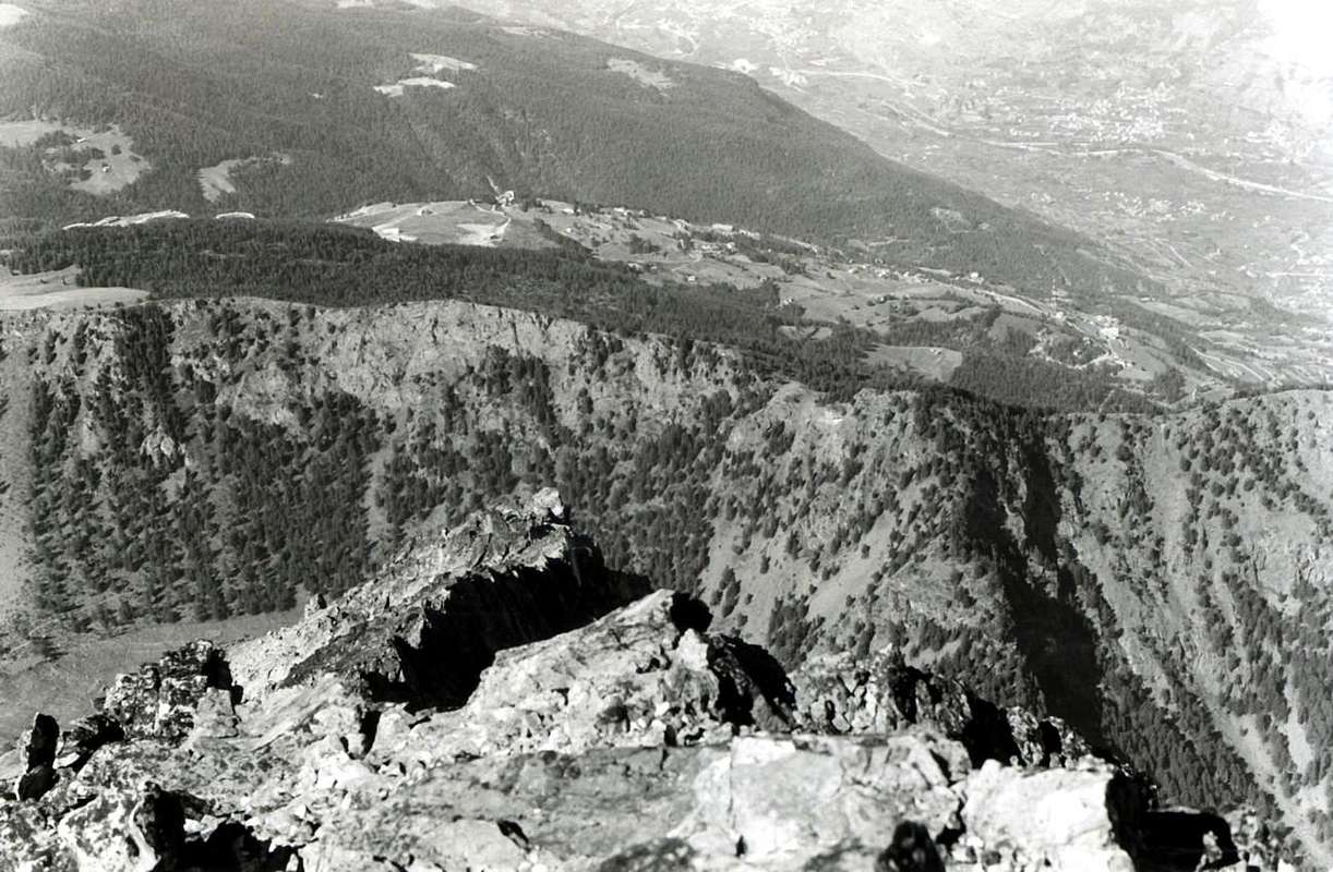
2) - The pyramids in the highest part of the Gorgia del Dard, which Abbot Joseph Maria Henry baptized in 1800 as the "Devil's Wall";
3) - The pyramids or rather the steep wall looming over the Regional Road in the stretch that connects the Municipalities of Nus (ad Nonum Praetoriae) and Quart (ad Quartum Praetoriae), both immediately at the eastern gates of the City of Aosta (the ancient Augusta Praetoria Salassorum of 25 BC), between the two towns of La Planta (or Plantaz) (540 meters) and the small village with Chétoz tower (621 meters);
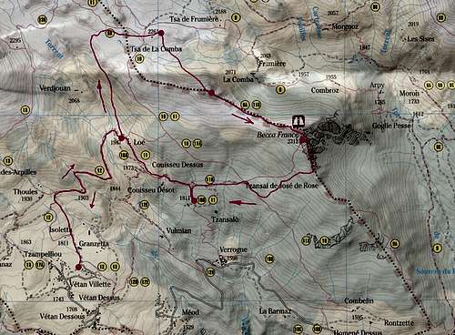
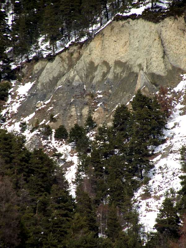
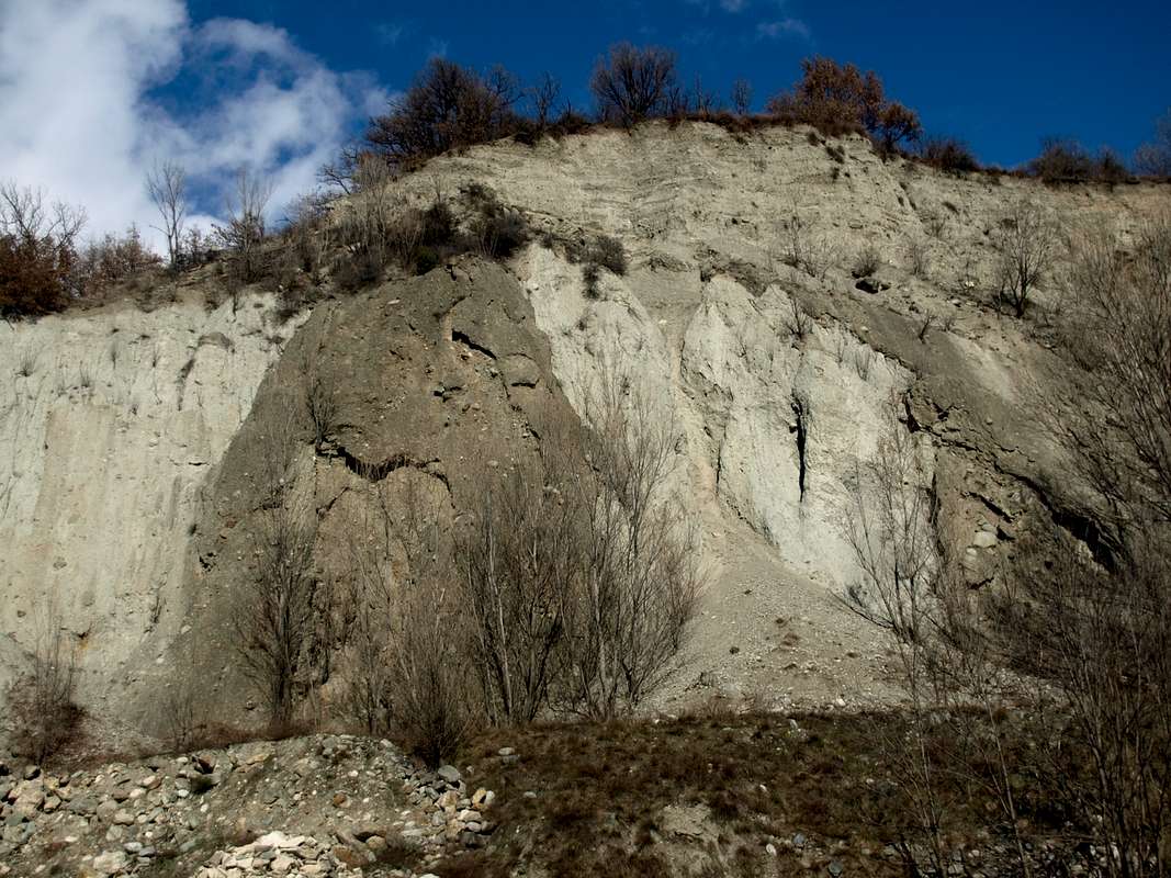
4) - In addition, returning to the area above Saint Nicolas Municipality and on the border with the adjacent one of Saint Pierre, there are other badlands with at the base half a dozen small erosion pyramids. The latter are located between the large Conca di Vetan (or Vetan 's Basin, sited to the West) and the small valley that from the Village of Verrogne (1595m; Church of San Teodulo) goes North-northwest to the foot of Mont Fallère (3090m); mountain, the latter, which constitutes the highest peak of this small subgroup placed between the Central Valley of Dora Baltea (in the South) and Gran San Bernardo Valley (North). 5)- This last area can be divided into two differentiated parts that concern: a) - the right sector (looking) or Eastern sector which concerns the Torrent de la Crete and therefore between the Villages of Rossan (West) and Orléans (+; 1142 meters) on the opposite side; b) - the area below the Hamlets of Rossan, Rumiod de la Chapelle, Rumiod de Lé, Rumiod Dessous and Chantel (1203m).
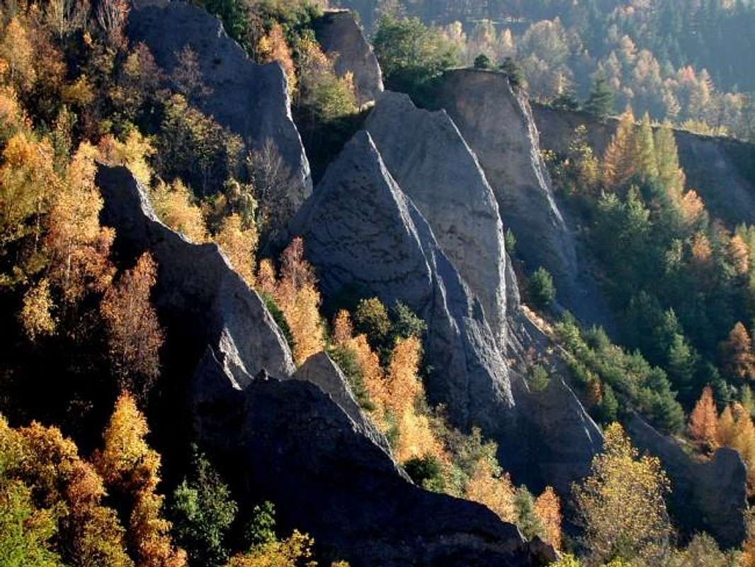
Pictures just abovethe "Bois de la Tour" near Saint Nicolas & Municipality, by livioz & osw
Anche la Valle d'Aosta possiede le sue piramidi di erosione glaciale, tra le quali voglio illustrarvi quelle concernenti tre specifihe località: 1)- Le piramidi di erosione nel vallone soprastante il Comune di Saint Pierre; 2)- Le piramidi nella parte più elevata della Gorgia del Dard, che l'Abate Joseph Maria Henry battezzò nel 1800 come il "Muro del Diavolo"; 3)- Le piramidi o meglio il ripido muraglione incombente sulla Strada Regionale nel tratto che unisce i Comuni di Nus (ad Nonum Praetoriae) e Quart (ad Quartum Praetoriae), entrambi subito alle porte orientali della Città di Aosta (l'antica Augusta Praetoria Salassorum del 25 avanti Cristo), tra le due località di La Planta (o Plantaz) (540 metri) ed il piccolo Villaggio con torre di Chétoz (621 metri); 4)- inoltre, ritornando alla zona soprastante il Comune di Saint Nicolas ed al confine con quello adiacente di Saint Pierre, sussistono altri calanchi con alla base una mezza dozzina di piccole piramidi di erosione. Queste ultime risultano collocate tra l'ampia Conca di Vetan (ad Ovest) ed il valloncello che dal Villaggio di Verrogne (1595 m; Chiesa di San Teodulo) risale verso Nord-nordovest fino ai piedi del Mont Fallère (3090 m); montagna, quest'ultima, che costituisce la cima maggiormente elevata di questo piccolo sottogruppo posto a cavallo tra la Valle Centrale della Dora Baltea (a Meridione) e la Valle del Gran San Bernardo (a Settentrione). 5)- Questa ultima zona può essere distinta in due parti differenziate che riguardano: a)- il settore di destra (guardando) ovvero Orientale che concerne il Torrent de la Crete e quindi compreso tra i Villaggi di Rossan (ad Ovest) ed orléans (+; 1142 metri) sull'opposto versante; b)- l'area sottostante le frazioni di Rossan, Rumiod de la Chapelle, Rumiod de Lé, Rumiod Dessous e Chantel (1203 m).
This short photographic survey, with a path from the West (Mont Fallère Group) to the East (Becca di Viou Group / Tsaat à l'Etseina), runs through the central area of the Valle d'Aosta along the left or Northern hydrographic course of the Dora Baltea and precisely between the Municipalities of Avise and Nus with the intermediates of Saint Nicolas, Saint Pierre, Sarre, Aosta and Quart. A "digression" towards the opposite or southern side leads us instead to a visit to what Abbé Joseph Maria Henry baptized as "The Pyramids of the Devil, located between the Becca di Nona and the Punta del Dard (Monte Emilius Group) where the valley that descends semicircularly from it changes its name again becoming from Vallone di Arbole or Arbolle to Vallone di Comboé or Combuì and then definitively Gorgia del Dard. Other similar areas exist in Valle d'Aosta for which we are committed since now for further exploration with related work.
Questa breve disamina fotografica, con percorso da Occidente (Gruppo del Mont Fallère) verso Oriente (Gruppo della Becca di Viou / Tsaat à l'Etseina) percorre la zona centrale della Valle d'Aosta lungo il corso idrografico sinistro o Settentrionale della Dora Baltea e precisamente tra i Comuni di Avise e Nus con gli intermedi di Saint Nicolas, Saint Pierre, Sarre, Aosta e Quart. Una "divagazione" verso il lato opposto o Meridionale ci porta invece ad una visita a quelle che l'Abbé Joseph Maria Henry battezzò come "Le Piramidi del Diavolo, collocate tra la Becca di Nona e la Punta del Dard (Gruppo del Monte Emilius) là dove il vallone che scende in modo semicircolare dal medesimo cambia ancora denominazione diventando da Vallone di Arbole od Arbolle a Vallone di Comboé o Combuì e poi definitivamente Gorgia del Dard. Altre zone similare sussistono in Valle d'Aosta per le quali ci impegnamo fino da ora per un ulteriore esplorazione con relativo lavoro.
Saint Nicolas near Fossaz's Hamlet
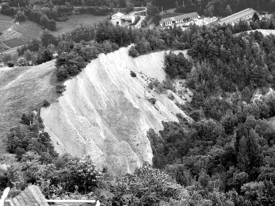
Signboard of the highest zone over Fossaz Dessus Hamlet of Saint Nicolas right on the border with Avise Municipalities, by osw Below Rumiod Village
Hapax Card of the lower area below Rumiod Dessus Hamlet of Saint Nicolas right on the border with Saint Pierre Municipalities, by emilius aka Emilio Bertona
Above & amongst Rossan - Torretta - Orléans localities
General Map of the higher area above Rossan - Rumiod Dessus Hamlets of Saint Pierre Municipality, by maria grazia s
Over Reverier Dessus & between Pousses - Ponteilles Alps
Highest & middle area above Les Pousses - Ponteilles - Reverier Dessus - du Milieu or Dessous - du Chat or Tzat Alps of Charvensod Municipality, by osw
Under Chétoz Tower & nearby La Plantaz Fraction between Quart - Nus Municipalities
Panel and partial photos of lower zone below Chétoz Hamlet with its tower & neighboring the Fraction La Plantaz at Quart - Villefranche Municipality, by osw
Comments
No comments posted yet.