Toggle navigation
Mountains
Routes
Images
Trip Reports
Forum
What's New
People
Areas & Ranges
Articles
Trailheads
Canyons
Huts & Campgrounds
Albums
Logistical Centers
Fact Sheets
Lists
Custom Objects
Gear
Plans & Partners
WELCOME TO SUMMITPOST
SIGN IN
REGISTER
East Ridge Direct
Additional Parents
Image
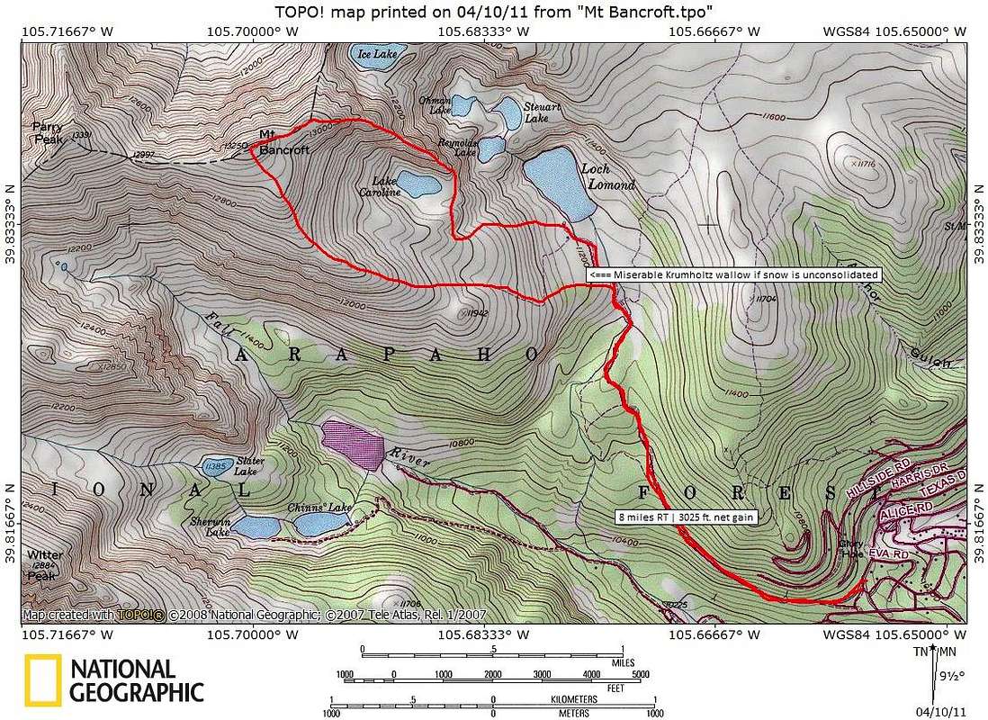
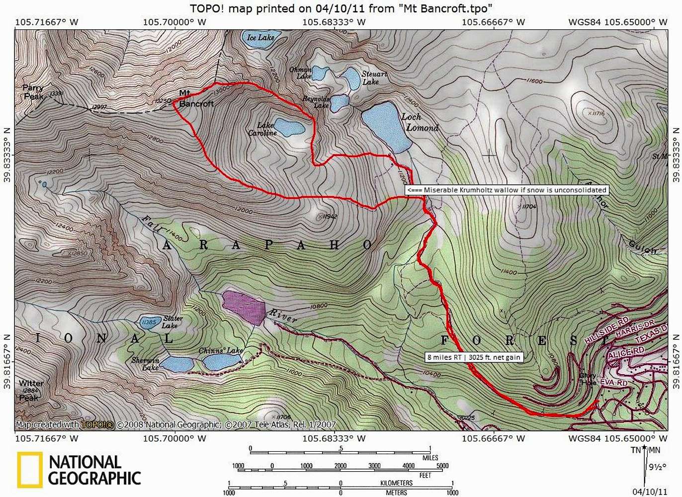
East Ridge Map
View High-Resolution Image
East Ridge Map
Route map for the East Ridge Direct route with Southeast Ridge descent.
Roundtrip Distance: 8 miles | Net Elevation Gain: 3025 feet
Map designed April 2011
« PREV
NEXT »
Sarah Simon
on
Apr 10, 2011 11:46 pm
Comments & voting
Other parents
Lat/Lon:
39.83760°N / 105.7002°W
Image Type(s):
Topo/Diagram
Image ID:
709372
3242 Hits
73.06
% Score
3
Votes
Log in to vote
Comments
No comments posted yet.
to post!
Don't have an account?
East Ridge Direct
(Route)
« PREV
Viewing
#13 of 17
GALLERY
NEXT »
Sarah Simon's Image Gallery
« PREV
Viewing
#2689 of 5480
GALLERY
NEXT »
Photo of the Hour
(Album)
Loading....
×
You need to login in order to vote!
User Name
Password
Remember me
Forgot your password?
Log me out when I close my browser.
Keep me logged in all the time.
sign in as a user
Don't have an account?
Register now for FREE
Rating available
Suggested routes for you
People who climb the same things as you
Comments Available
Create Albums
Register Here


