

Viewing: 1-4 of 4

cp0915 - Apr 5, 2007 3:53 pm - Voted 10/10
Informative10 of 10.

mgeo - Apr 5, 2007 8:40 pm - Hasn't voted
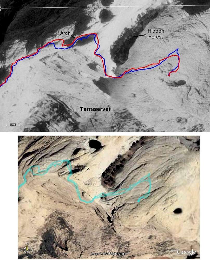
Datums and ProjectionsIf your map and your GPS unit are using different datums and projections, this is always going to be an issue.

MoapaPk - Apr 5, 2007 9:38 pm - Hasn't voted
Re: Datums and ProjectionsSupposedly, Google earth is WGS84. The tracks are WGS84. In other nearby areas, more citified, the choice of WGS84 gives very close registration.
The vast majority of programs will assume WGS84 for upload and download of tracks; other datums on the GPS are mainly for the GPS display. NMEA communications are an exception, and some programs (like Nat Geo) must have explicit instructions.

SusanM - Apr 11, 2007 8:56 am - Voted 10/10
Interestingto see the differences.
Viewing: 1-4 of 4


Comments
Post a Comment