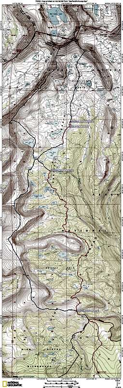


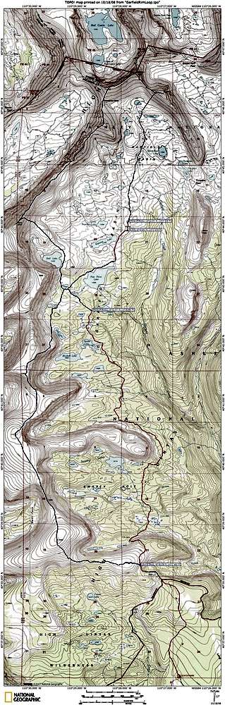
lcarreau - Oct 21, 2008 11:52 pm - Voted 10/10
Aha!I gave it 10/10, but when you click on "Large" view, it gets smaller. (You might want to check with Sp-member 'Dean' on this one.)
Dean is one mapping son-of-a-gun! I'm sure
Dmitry CAN correct the situation, also.
Other than that, it's a truly nice map !!!
Larry

ZeeJay - Oct 22, 2008 4:40 pm - Hasn't voted
Re: Aha!I think that might be just the way it is. If you click on it again, (two clicks total) then it blows way up and the resolution is back and it looks nice. One click always results in crummy resolution. I'll have to click on other people's maps to see if the same thing is happening to theirs.
lcarreau - Oct 22, 2008 11:09 pm - Voted 10/10
Re: Aha!You're right! I clicked again - that's an
outstanding map!
What I was lookin' for was "Stone Benchmark."
Yes, there it is above 11,352' Doll Lake.
Gracias. That's some remarkable scenery!!!
ZeeJay - Oct 23, 2008 12:23 am - Hasn't voted
Re: Aha!Thanks Larry. I clicked on some other maps and the larger the map, the worse it looks with one click, since it gets squished more to fit on one page.


Comments
Post a Comment