Toggle navigation
Mountains
Routes
Images
Trip Reports
Forum
What's New
People
Areas & Ranges
Articles
Trailheads
Canyons
Huts & Campgrounds
Albums
Logistical Centers
Fact Sheets
Lists
Custom Objects
Gear
Plans & Partners
WELCOME TO SUMMITPOST
SIGN IN
REGISTER
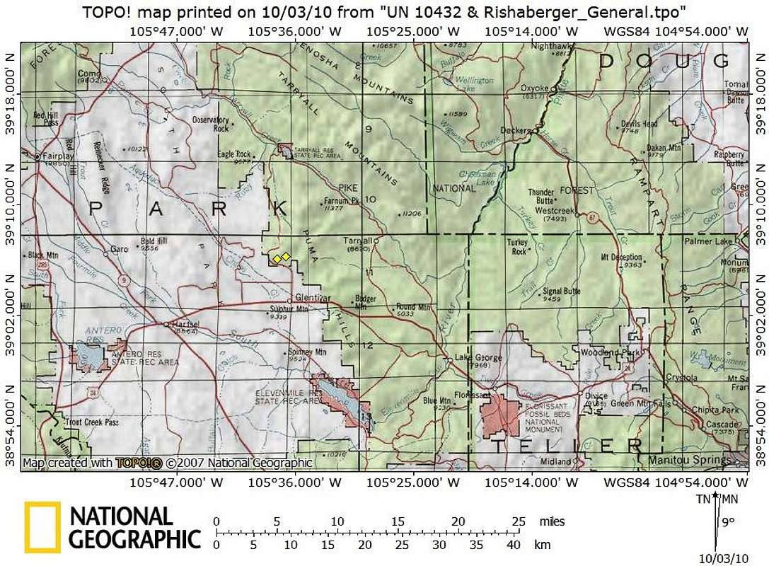
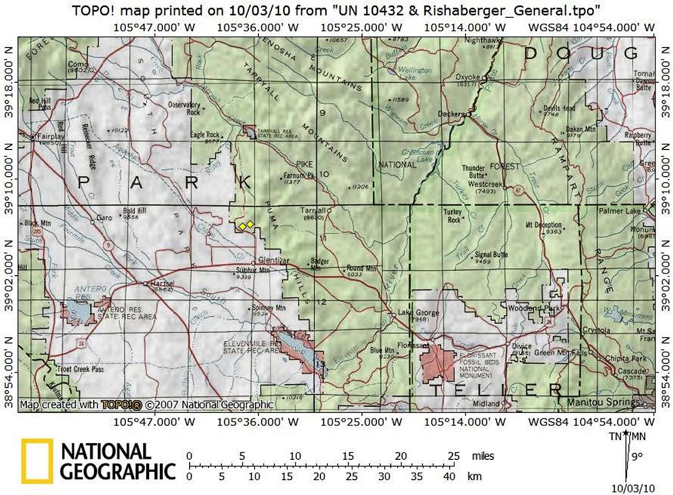
Getting There Map
View High-Resolution Image
Getting There Map
Guarded by private property to the west and the south and by more rolling Puma Hills neighbors to the north and the east, Rishaberger Mountain is most readily accessible via CO Rd 23 to the northwest.
Map created October 2010
« PREV
NEXT »
Sarah Simon
on
Oct 11, 2010 5:28 pm
Comments & voting
Other parents
Lat/Lon:
39.10320°N / 105.6136°W
Image Type(s):
Topo/Diagram
Image ID:
669820
1521 Hits
73.06
% Score
3
Votes
Log in to vote
Comments
No comments posted yet.
to post!
Don't have an account?
Rishaberger Mountain
(Mountain/Rock)
You are at
the First
Image
Viewing
#1 of 1
GALLERY
You are at
the Last
Image
Sarah Simon's Image Gallery
« PREV
Viewing
#2519 of 5480
GALLERY
NEXT »
Rishaberger Mountain
(Mountain/Rock)
Loading....
×
You need to login in order to vote!
User Name
Password
Remember me
Forgot your password?
Log me out when I close my browser.
Keep me logged in all the time.
sign in as a user
Don't have an account?
Register now for FREE
Rating available
Suggested routes for you
People who climb the same things as you
Comments Available
Create Albums
Register Here


