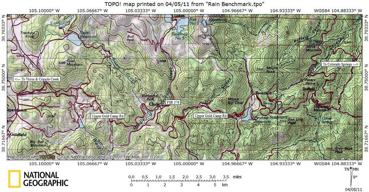
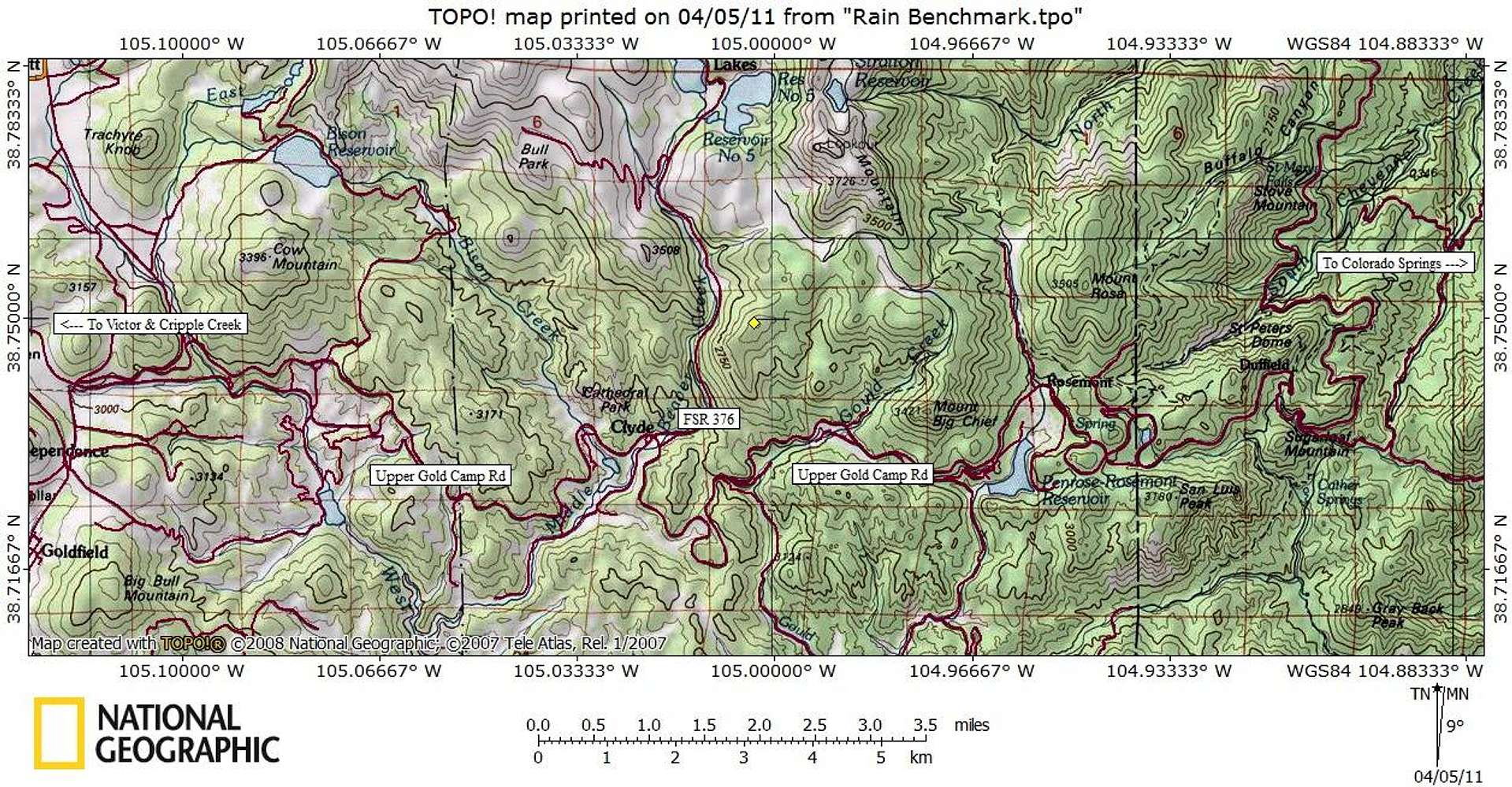
Rain Benchmark sits southwest of Colorado Springs in Teller County, not far from the convergence of El Paso, Teller and Fremont counties. The peak is snuggled between FS 376 to the west and Gould Creek Road (FS 370 C), and accessed via Gold Camp Road.
Map designed March 2011


