Toggle navigation
Mountains
Routes
Images
Trip Reports
Forum
What's New
People
Areas & Ranges
Articles
Trailheads
Canyons
Huts & Campgrounds
Albums
Logistical Centers
Fact Sheets
Lists
Custom Objects
Gear
Plans & Partners
WELCOME TO SUMMITPOST
SIGN IN
REGISTER
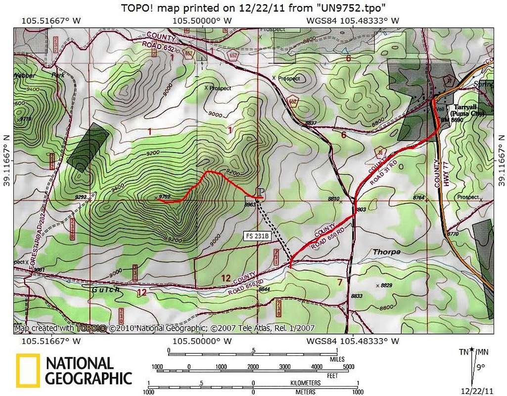
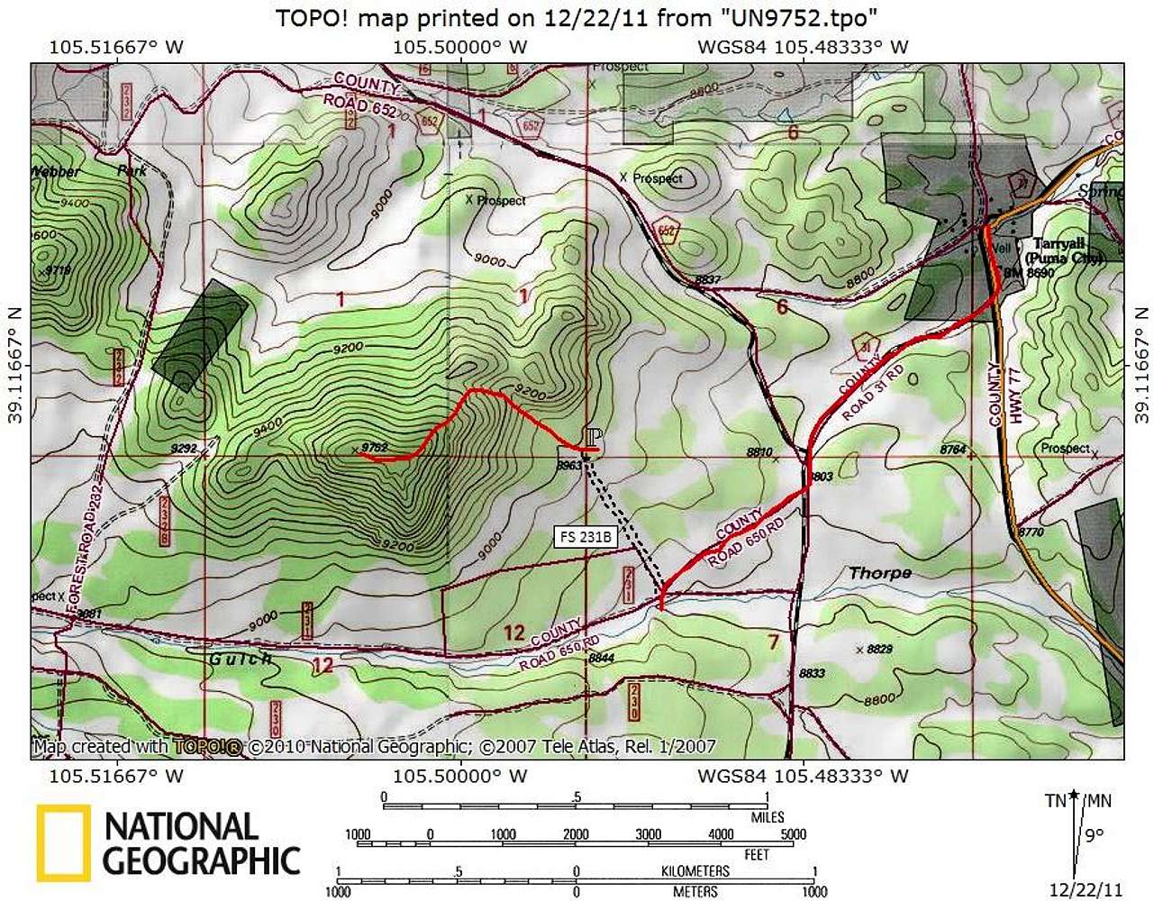
Getting There & Route Map
View High-Resolution Image
Getting There & Route Map
This peak sits 3.25 miles as the crow flies west-southwest of the small town of Tarryall, Colorado.
The northeast ridge route is only 1.5 miles round trip with 810 feet of elevation gain.
Map designed December 2011
« PREV
NEXT »
Sarah Simon
on
Dec 22, 2011 12:44 pm
Comments & voting
Other parents
Lat/Lon:
39.11360°N / 105.505°W
Image ID:
767050
1123 Hits
72.08
% Score
2
Votes
Log in to vote
Comments
No comments posted yet.
to post!
Don't have an account?
UN 9752
(Mountain/Rock)
You are at
the First
Image
Viewing
#1 of 1
GALLERY
You are at
the Last
Image
Sarah Simon's Image Gallery
« PREV
Viewing
#3701 of 5480
GALLERY
NEXT »
UN 9752
(Mountain/Rock)
Loading....
×
You need to login in order to vote!
User Name
Password
Remember me
Forgot your password?
Log me out when I close my browser.
Keep me logged in all the time.
sign in as a user
Don't have an account?
Register now for FREE
Rating available
Suggested routes for you
People who climb the same things as you
Comments Available
Create Albums
Register Here


