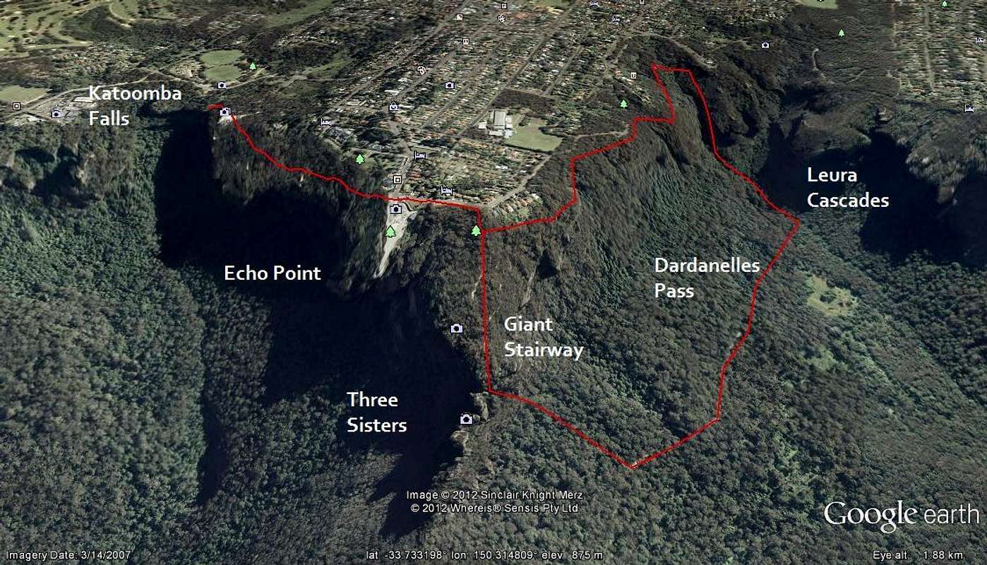
Approximate route figure for circuit done on 3rd day. Route is in red, hopefully none of you are red-green colour blind. Katoomba is the urban area at the top. Image from Google Earth. Think the Dardeanelles Pass may be marked too far from the cliff but you get the general idea.


