Toggle navigation
Mountains
Routes
Images
Trip Reports
Forum
What's New
People
Areas & Ranges
Articles
Trailheads
Canyons
Huts & Campgrounds
Albums
Logistical Centers
Fact Sheets
Lists
Custom Objects
Gear
Plans & Partners
WELCOME TO SUMMITPOST
SIGN IN
REGISTER
Kinabalu
Additional Parents
Image
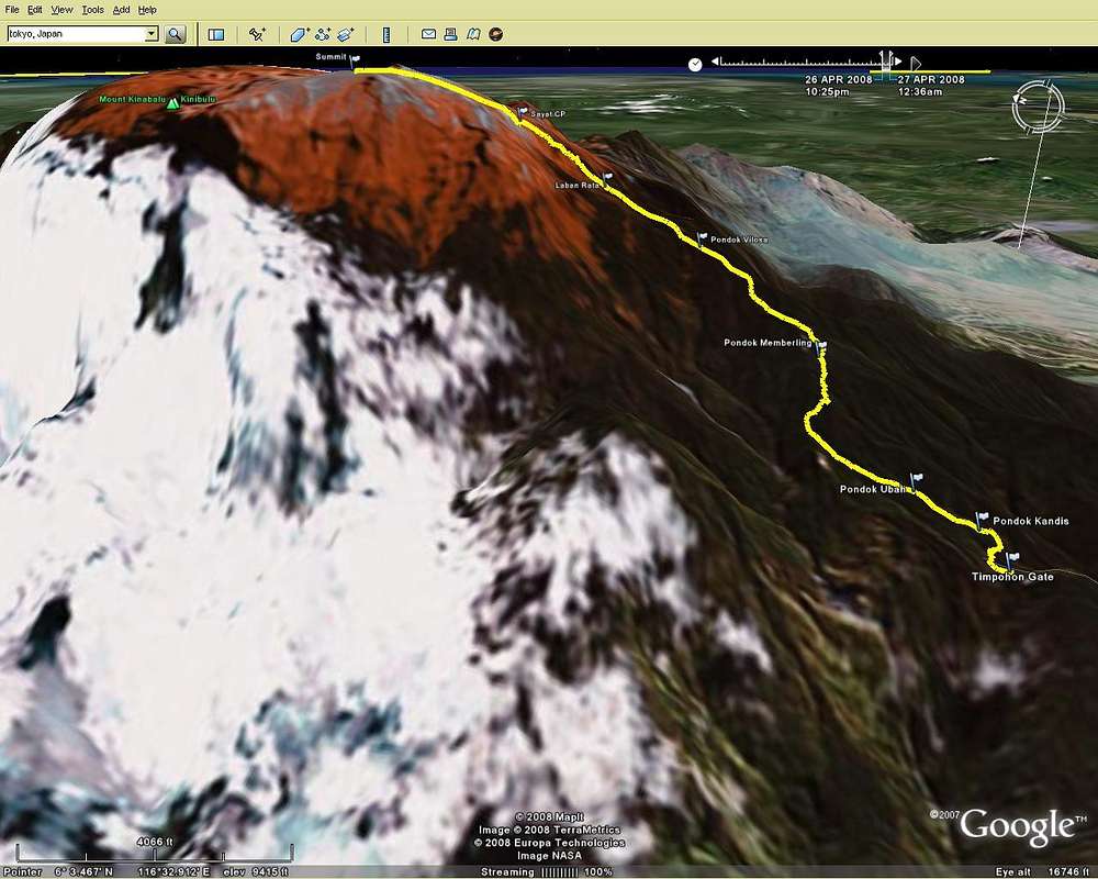
Google Earth Picture
View High-Resolution Image
Google Earth Picture
I captured a set of GPS waypoints and a track all the way to the summit and loaded the info into GoogleEarth so I could see the trail. This was what I saw! 7257ft in 4.94 miles. No wonder my legs hurt! ;-)
« PREV
NEXT »
derekp62
on
May 7, 2008 3:12 pm
Comments & voting
Other parents
Image Type(s):
Alpine Climbing
Image ID:
401969
2682 Hits
0
% Score
0
Votes
Log in to vote
Comments
No comments posted yet.
to post!
Don't have an account?
Kinabalu
(Mountain/Rock)
You are at
the First
Image
Viewing
#1 of 1
GALLERY
You are at
the Last
Image
derekp62's Image Gallery
« PREV
Viewing
#46 of 48
GALLERY
NEXT »
×
You need to login in order to vote!
User Name
Password
Remember me
Forgot your password?
Log me out when I close my browser.
Keep me logged in all the time.
sign in as a user
Don't have an account?
Register now for FREE
Rating available
Suggested routes for you
People who climb the same things as you
Comments Available
Create Albums
Register Here


