La montagna chiama i suoi figli, ed essi rispondono fedelmente al suo appello…
Osvaldo Cardellina, Diario alpinistico, 1964-65
Page texts: @ OsvaldoCardellina"Osva", passed away on May 2, 2022. Page owners: Christian Cardellina e Osvaldo Cardellina. Any updates from September 12, 2022: Antonio Giani, page administrator, friend and climbing companion.
Testi della pagina: @ OsvaldoCardellina "Osva", scomparso il 2 maggio 2022. Proprietari pagina:Christian Cardellina e Osvaldo Cardellina. Eventuali aggiornamenti dal 12 settembre 2022: Antonio Giani, amministratore della pagina, amico e compagno di salite.
Cross crossed Overview
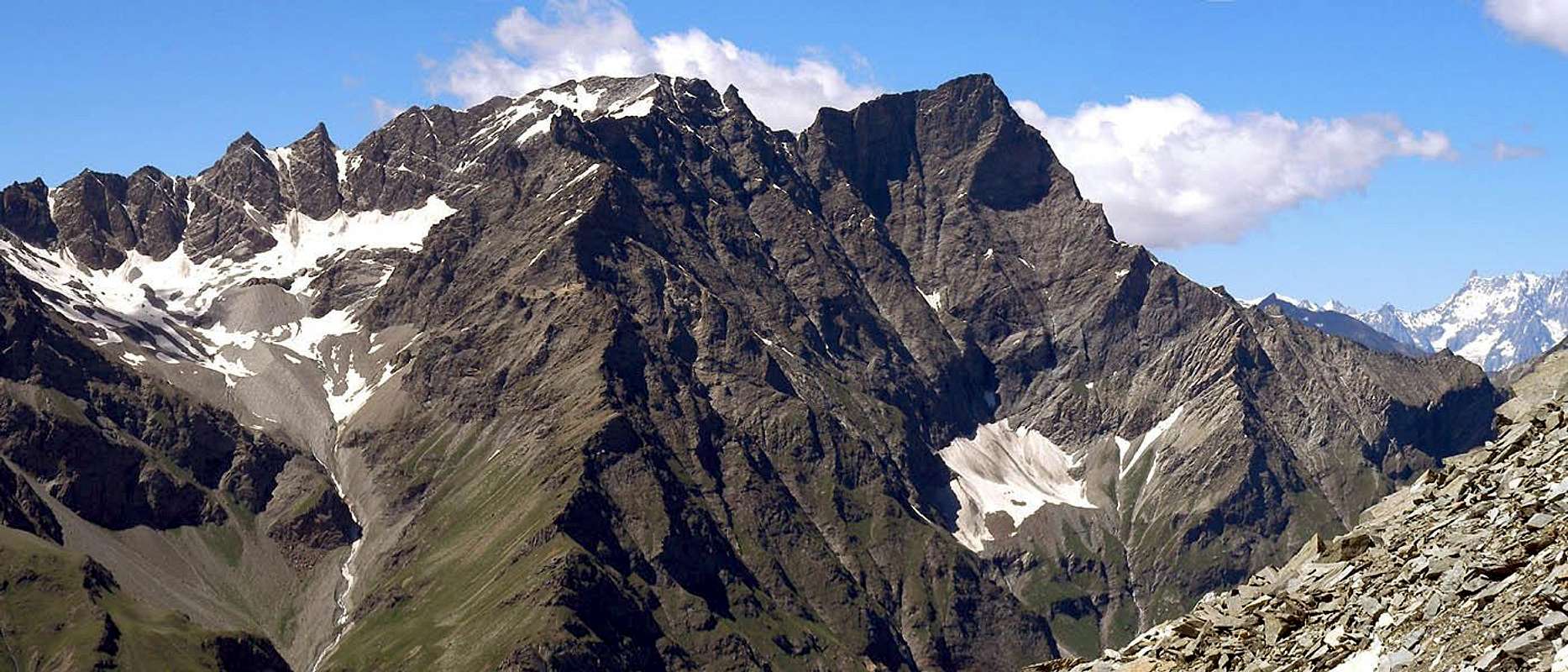
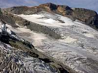
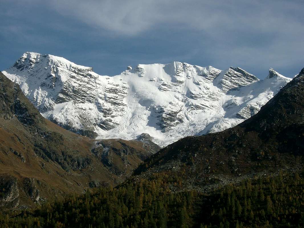
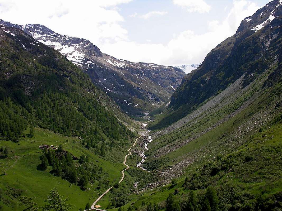
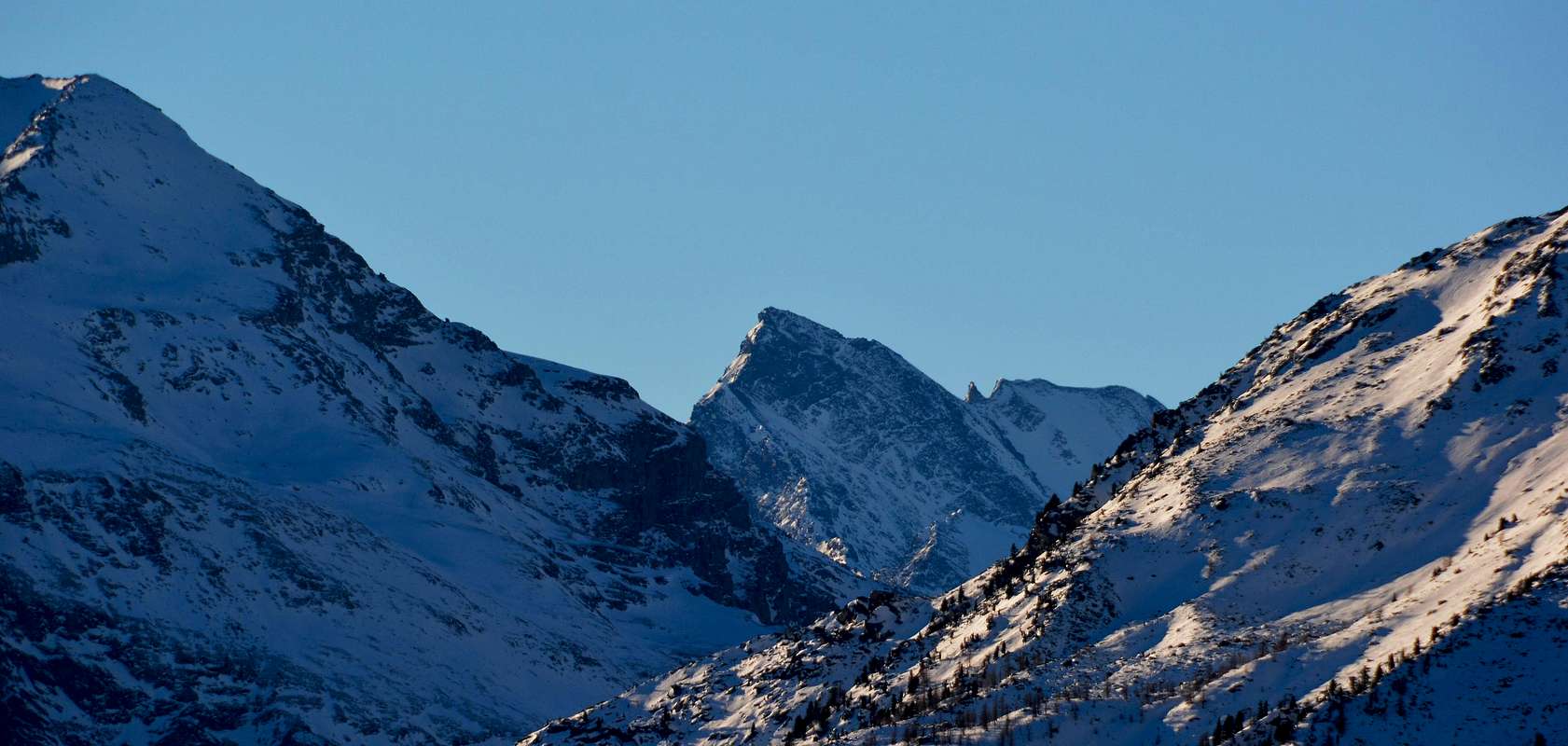
The Grande Rousse (3.607m) is an old lioness who like Tsanteleina, the Granta Parei, the Great Sassière and satellites of the Gran Paradiso have written the History of Alpinism Classic. Then have fallen by the wayside, because everyone went to kneel at the foot of Mount Blanc, now Lord of the Rings. O Lord of Fools. Disappeared large companies of '800, before watered down , then veiled and finally concealed oblivion. The first ascent of "our" bears the date of 4/5 August, 1874 when L. Barale , A. Hammers and Aimé Gorret (yes, one of the Matterhorn) reach the Top with Mountain Guides Valtournenche G.G. Maquignaz and S. Meynet. However, ten years earlier, on 12/13th August, a group had made an attempt to virginity of this. They are T. Blansford, Cuthbert, Neighbour, R.C. Nichols and E.P. Rowsell who try with the Guides J.V. Favret and M. Brunod. All foreign and Grande Rousse defends his clenched teeth "Italianity" but, above all, her virginity. Will come from Glacier of th'Invergnaou the Rousse Pass, placed between the Summit and the South Point (3.577m), but the small wall that meet immediately after the South Ridge will make them desist sending them back home. Glamorous, but fatal. The Great Rousse will sell only ten years following, even when His Majesty the Matterhorn had to surrender. A consortium intrepid which is not satisfied only the first climb, but it also wants to make the first crossing down from the hill to the East Slope soaring above Rhêmes Notre Dame. A large wall that still leaves perplexed nowadays, looking at her from below. But they want to come down and come down with a way not easy, and certainly dangerous along the great wall that, as the Granta Parei, gives its name to the mountain. Grande Rousse or Big Red and a large mountain glacier, as was written in bringing back the name Roizà glacier that is, not only surrounds the glacier in the East if not some seasonal snowfield at the base, while its high and wide wall distinguishes. On the other side, ie from Valgrisa, Glacier of Invergnaou covers its Western Side but only towards the South Point, the less high, because that North is always triangularly rocky. So Grande Rousse or Great Red for the color with which the sun lights his East Wall and the same color which lies at sunset on the ice of its West Face. Of this the Great Rousse annoying and shows, as an old lion, his clawed paw roaring menacingly towards the North-northeast and threatening the poor Tourist who passes on the way to Rhêmes Valley. Then you, the Lioness gives birth to her lion cubs to the South, with a series of tops that align docile under his portly belly.
"An Old Lioness", by Gabriele
La Grande Rousse (3.607 m) é una vecchia Leonessa che come la Tsantèleina, la Granta Parei, la Grande Sassière ed i satelliti del Gran Paradiso hanno scritto la Storia dell'Alpinismo Classico. Poi son cadute nel dimenticatoio, perchè tutti andavan ad inginocchiarsi ai piedi del Monte Bianco, ormai Signore degli Anelli. O Signore degli Stolti. Scomparvero le grandi imprese dell''800, prima annacquate, poi velate ed infine celate nell'oblio. La prima salita della "nostra" porta la data del 4/4 di Agosto 1874 quando L. Barale, A. Martelli ed Aimé Gorret (si, proprio quello del Cervino) raggiungon la Cima insieme alle Guide di Valtournenche G.G. Maquignaz e S. Meynet. Ma già dieci anni prima, il 12 e 13 di Agosto, una comitiva aveva attentato alla verginità di questa. Sono T. Blansford, Cuthbert, Neighbour, R.C. Nichols ed E.P. Rowsell che ci provan con le Guide J.V. Favret e M. Brunod. Tutti stranieri e la Grande Rousse difende a denti stretti la sua Italianità ma, soprattutto, la sua verginità. Arriveranno dal Ghiacciaio dell'Invergnaou al Colle della Grande Rousse, posto tra la Cima e la Punta Sud (3.577 m), ma il piccolo muro che incontran subito dopo sulla Cresta Sud li farà desistere rimandandoli a casa. Un'inezia, ma fatale. La Grande Rousse cederà solo diec'anni appresso, quando anche Sua Maestà il Cervino aveva dovuto arrendersi. Una cordata intrepida che non si accontenta sol della prima salita, ma che vuol compiere anche la prima traversata scendendo dal colle pel vertiginoso Versante Est sopra Rhêmes Notre Dame. Una grande parete che lascia ancor perplessi oggidì, guardandola dabbasso. Ma voglion scendere e scendono con una via non facile e, sicuramente, pericolosa lungo quella grande parete che, come per la Granta Parei, dà il nome alla montagna. Grande Rousse ovvero Grande Rossa e non grande montagna del ghiacciaio, come é stato scritto riconducendo il toponimo a Roizà cioé ghiacciaio; non un solo ghiacciaio la cinge ad Oriente se non qualche nevaio stagionale alla sua base, mentre la sua alta e larga parete la contraddistingue. Dall'altra parte, cioé dalla Valgrisa, il Ghiacciaio dell'Invergnaou ricopre il suo lato Occidentale ma soltanto verso la Punta Sud, la men elevata, perché quella Nord rimane sempre triangolarmente rocciosa. Quindi Grande Rousse o Gran Rossa per il colore con il quale il sole accende la sua Parete Est e per lo stesso colore che s'adagia al tramonto sui ghiacci della sua Faccia Ovest. Di questo la Grande Rousse s'infastidisce e mostra, come vecchio leone, la sua zampa artigliata ruggendo minacciosamente verso Nord-nordest e minacciando il povero Turista che transita sulla strada per Rhêmes. Poi Lei, la leonessa, partorisce verso Mezzogiorno i suoi leoncini, con una serie di punte che si allinean mansuete sotto il suo ventre corpulento.
"Listen to the Roar of an Old Lionunicorn", by emilius
technical & historic OVERVIEW
North Wall of Northern Summit & Across the entire watershed to the South, by Marco Cossard "Crevassino"
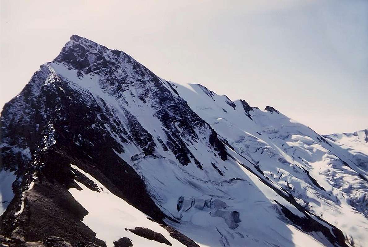
With the first ascent of the Grande Rousse began his story, at least that mountaineering. We are in 1885 when Filippo Vallino with the famous Guides Giovan Battista Bich of Valtournanche and Angelo Castagneri of the Susa Valley July 30th, rising from the Glacier of Mount Forciaz the North Ridge, which has passages III° and IV° on the rock rather crumbly, not many days later, on 25 August, are the Christian Almer Junior Swiss Guide with the very famous Reverend W.A.B. Coolidge to follow a path just to the left of the small spur climbing Normal West-northwest. Then July 30, 1888 North Ridge is crossed again, but from the Eastern Slope of Rhemes for the Glacier Torrent rejoining the previous 3.261 meters upstream portion of the collar with the Point Rabuigne; are the renowned Rhêmes Mountain Guide Casimire Thérisod with G. Jaccod that trace a path starting from their home. The route will be the same route again in the month of August 1934 by N.G. Bertoglio with a partner, but stay in the far left (South) wall before the conjunction. Also in 1988 along Casimire with Giovanni Bobba repeats and August 4th goes along the Walloon of Fos reaching the South Point and then crossing in the North. In August of 1914, Pier Ferdinando "Nino" Quaini with some companions realize the uphill route of 1874, on which the G.A. De Petro, August 11th, 1924, completes the first solo. Concludes this epic story of the "discovery" Aldo Bonacossa who, with his wife Ester, August 7th, 1926 celebrates the first ascent along the Spur West-northwest at South Summit, with glacial slopes up to 45°. We are always around to III° with a few passing + and some other things -, considering, however, that the safety factor, in those days, was donated exclusively to ice ax, crampons (not always present) and rope, hemp logically and then heavy. You must wait until the sixties to see something more, and regards the Southwest Ridge of Becca Fos (3.457m), located, shaped tower, on the top of the Buttress South-southeast of Great Rousse South after an attempt to Massimo Mila with Caesar Poma, carried in 1966, which came under the wall terminal, are the Guide Valtournanche Luigi Hérin with Lorenzo Rossi di Montelera that June 25th, 1967 making the climb a route of 400 meters and passages of IV° and V° in the final part below the tower of Summit, the last 120 meters join with the South Summit do not create problems. This final stretch of via was already August 4th, 1888 by Bobba with Thérisod coming, in descent, from the Grande Rousse and has a hundred metres of III°, the other ridge on Becca of Fos, or Southeast, was being driven, always downhill and with the same difficulty, Thérisod with mountaineer Genoese Giovanni Battista Bozzino July 2th, 1910. There remained the North Face that is rising in the right (West), through a snowy gully, by a rope a climbers Guide Valgrisenche Danilo Garin together with Alberto Sciardi in July 1980 with a vertical drop of 600 meters and difficulties to AD/ AD+ on rock very friable. Remains the mystery of the great East Wall, just to the right of the 1874 route, which has a vertical wall of more than 800 meters above the minuscule Glacier of Pellaud, but even in this area the rock does not seem to offer anything good, and for this reason, perhaps, has never been addressed.
Western Faces, by "Mathias Zehring"
Con la prima salita la Grande Rousse inizia la sua storia, almeno quella alpinistica. Siamo nel 1885 quando Filippo Vallino con le famose Guide Giovan Battista Bich di Valtournanche ed Angelo Castagneri della Valle di Susa il 30 di Luglio, salgono dal Ghiacciaio del Mont Forciaz la Cresta Nord, che presenta passaggi di III° e IV° su roccia piuttosto friabile; non molti giorni dopo, il 25 Agosto, sono la Guida Svizzera Christian Almer Junior con il celeberrimo Reverendo W.A.B. Coolidge a tracciare una via appena a sinistra della Normale salendo lo Speroncino Ovest-nordovest. Poi il 30 Luglio 1888 viene percorsa nuovamente la Cresta Nord, ma dal versante di Rhemes per il Ghiacciaio del Torrent ricongiungendosi alla precedente a quota 3.261 metri a monte del colletto con la Punta Rabuigne; sono la conosciuta Guida della Val di Rhêmes Casimire Thérisod con G. Jaccod che tracciano una via partendo da casa loro. Lo stesso itinerario sarà percorso nuovamente nel mese di Agosto 1934 da parte di N.G. Bertoglio con un compagno, ma restando più a sinistra (Sud) nella parete prima della congiunzione. Sempre nel 1988 Casimiro insieme a Giovanni Bobba si ripete ed il 4 Agosto sale lungo il Vallone del Fos raggiungendo la Punta Sud e quindi in traversata la Nord. Nell'Agosto del '14 Pier Ferdinando "Nino" Quaini con alcuni compagni realizzano in salita la via del 1874, sulla quale lo 11 Agosto 1924 G.A. De Petro compie la prima solitaria. Conclude questa epopea della "scoperta" Aldo Bonacossa che, insieme alla moglie Ester, il 7 dell'Agosto 1926 compie la prima salita lungo lo sperone Ovest-nordovest alla Punta Sud, con pendenze glaciali fino a 45°. Siamo sempre intorno al III° con qualche passaggio di + e qualche altro di -, condiderando però che il fattore sicurezza, a quei tempi, era devoluto esclusivamente a piccozza, ramponi (non sempre presenti) e corda, logicamente in canapa e quindi pesante. Si deve attendere fino agli Anni Sessanta per vedere qualche cosa di più e riguarda la Cresta Sudovest della Becca di Fos (3.457 m), cima posta, a guisa di torrione, sul Contrafforte Sud-sudest dell Grande Rousse Sud: dopo un tentativo di Massimo Mila con Cesare Poma, effettuato nel 1966, che giungeva sotto al muro terminale, sono la Guida di Valtournanche Luigi Hérin con Lorenzo Rossi di Montelera che il 25 Giugno 1967 effettuano la salita con una via di 400 metri e passaggi di IV° e V° nel tratto finale sottostante il torrione sommitale; gli ultimi 120 metri congiungenti con la Cima Sud non creano problemi. Questo tratto terminale era già stato percorso il 4 Agosto 1888 da Bobba con Thérisod arrivando in discesa dalla Grande Rousse e presenta una trentina di metri di III°; l'altra cresta della Becca di Fos, o Sudest, era sta percorsa, sempre in discesa e con identiche difficoltà, da Thérisod con l'alpinista genovese Giovan Battista Bozzino 1l 2 Luglio 1910. Rimaneva la Parete Nord che viene salita nel suo settore di destra, per mezzo di un canalino innevato, dalla Guida di Valgrisenche Danilo Garin insieme ad Alberto Sciardi nel Luglio 1980 con un dislivello di 600 metri circa e difficoltà da AD+ ad AD su roccia molto friabile. Rimane il mistero della grande Parete Est, subito a destra della via del 1874 che presenta un muro verticale di oltre 800 metri sopra il minuscolo Glacier de Pellaud; ma anche in questo settore la roccia non sembra offrir nulla di buono e per questo motivo, forse, non é mai stato affrontato.
North/Oriental Slopes, by "maria grazia s"
It climbs Winter? The first ascent of the South Point takes place March 7th, 1948 by E. Giraudo, N. Morino and R. Venco via a route that, after reaching the Glacier Giasson from Forciaz Mountain or Alp (2.180m), comes almost to hill with same name (3.154m) and then change direction significantly in the Northeast. Crossing at the base of the watershed partition and rounding to the left of the West Spur Point Tina (3.523m), will gradually slopes of the same West and South, reaching the Grande Rousse Pass and through the North-northeast ridge, the Summit. One way, in our opinion, very dangerous "cuts" the whole mountain exposing themselves to avalanches and landslides; surely, even in poor condition, it is preferable to the West Couloir, or Normal Route, which allows for less of support on the rocks of the little Spur West-northwest or Variant 1885. But the First Winter at Northern Point? A mystery. It is an ascent with skis on 27/28th March, 1971 by B. Galli, Lorenzo Rossi di Montelera and E. Villa, always starting from Valgrisenche with reaching the Summit via the South-southwest Ridge, or Standard Route from the Pass of the Grande Rousse (3.490/5m, just below the rocky altitude 2516 metres, such as to mark the "mauvais pas" that determined the return of the a group of rope climbers, 1864). Almost certainly the same could be reached the Via Normal route and, in any case, the climb took place on a date now, although a little time outside that of the Winter. Via this, over time, has become a classic of Ski-climbing, but only directed to OSA, that is for Excellent Skiers Mountaineers, then with the proper preparation for this purpose.
Towards the END of the DIVIDE, as from Spring to Winter "by livioz, buxlex, andreaperino & Antonio"
E le salite Invernali?La prima ascensione della Punta Sud viene effettuata il 7 Marzo 1948 da parte di E. Giraudo, N. Morino e R. Venco tramite un itinerario che, dopo il raggiungimento del Ghiacciaio di Giasson dalla Montagna di Forciaz (2.180 m), arriva quasi all'omonimo colle (3.154 m) per poi cambiar decisamente direzione in Nordest. Attraversando alla base dello spartiacque divisorio e doppiando a sinistra lo Sperone Ovest della Punta Tina (3.523 m), si porta gradualmente sui pendii Occidentali della medesima e della Grande Rousse Sud raggiungendo il colle e, tramite la Cresta Nord-nordest, la Vetta. Una via, a nostro avviso, molto pericolosa che "taglia" tutta la montagna esponendosi alle valanghe e slavine; sicuramente, anche in cattive condizioni, risulta preferibile il Canalone Ovest, o Via Normale, che consente per lo meno d'appoggiare sulle rocce dello Speroncino Ovest-nordovest o Variante 1885. Ma la prima Invernale alla Punta Nord? Un mistero. Risulta una ascensione con gli sci del 27/28 Marzo 1971 da parte di B. Galli, Lorenzo Rossi di Montelera ed E. Villa, sempre partendo dalla Valgrisenche con raggiungimento della Sommità per mezzo della Cresta Sud-sudovest, o Via Normale dal Colle della Grande Rousse (3.490/5 metri circa, appena più in basso della rocciosa quota 2.516 metri tale da segnare il "mauvais pas" e tal da determinare il rientro della cordata del 1864). Quasi sicuramente lo stesso venne raggiunto tramite la Via Normale e, comunque, la salita avvenne in una data ormai, anche se di poco tempo, fuori da quella dell'inverno. Questa Via, nel tempo, é diventata una classica dello Sci-alpinismo, ma rivolta esclusivamente ad OSA, cioé ad Ottimi Sciatori Alpinisti, quindi con la preparazione adeguata per effettuarla.
Winter & Western Walls, by "marco979"
Getting There
BY CAR:
From Torino, Milano, etc: Motorway A5. Exit in Aosta Ovest. Drive to the near Aymavilles. Follow in the direction of Valle di Cogne.
From Switzerland: through the Grand St. Bernard Tunnel or the homonym Pass). Drive to Aosta, then follow Courmayeur direction on SS.26. Just after Sarre, turn to the left, in the direction of Valle di Cogne.
From France: through Mont Blanc Tunnel or Petit St. Bernard Pass). It isn't necessary to enter in Motorway A5, you can drive through SS.26 Aosta direction. Before arriving at the Village of Leverogne, follow the sign and turn right towards Grisenche Valley.
BY PLANE:
Aeroporto "Corrado Gex" Saint Christophe (Aosta).
Specific Itinerary Road.
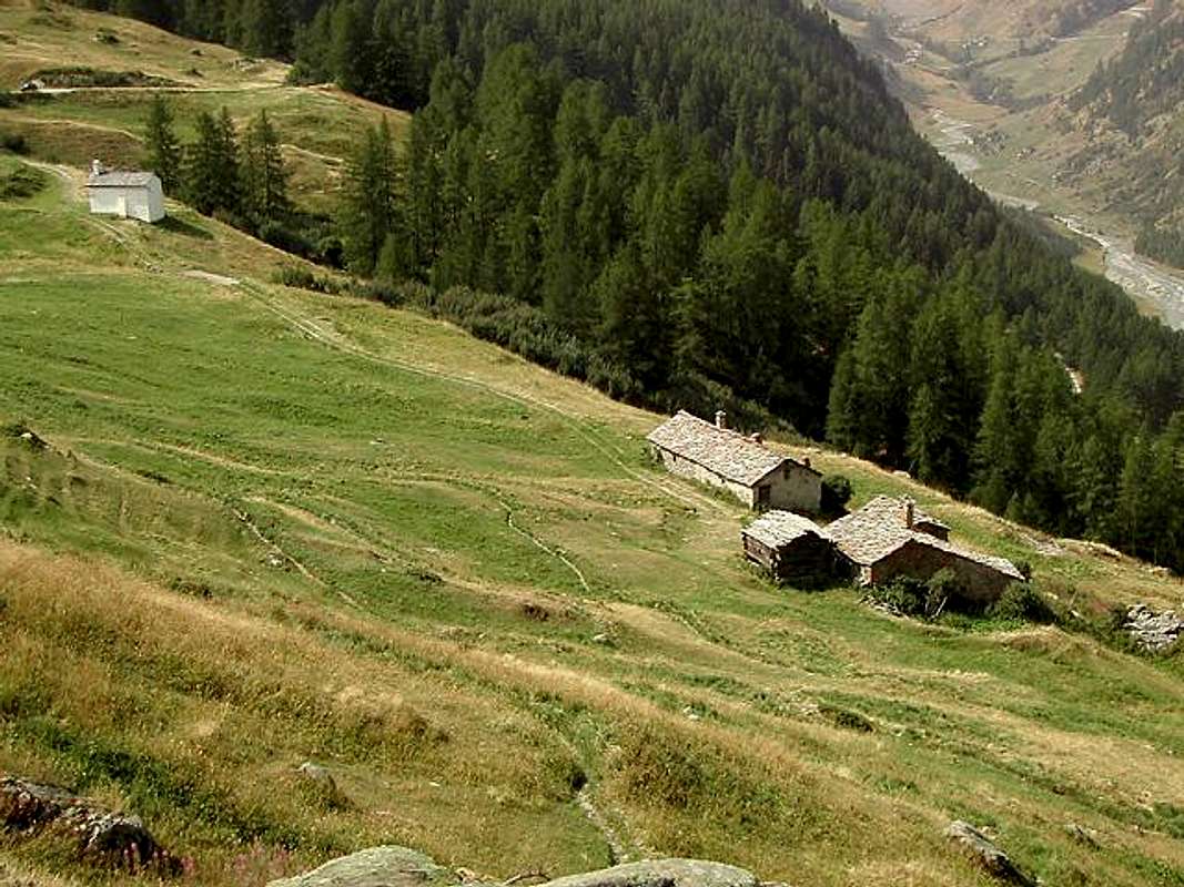
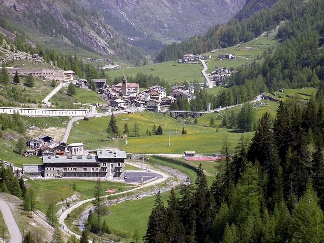
Whether arriving from West to East that (Aosta SS n. 26 to 15 km) to reach the Hamlet of Leverogne (740m) and with winding road to reach in succession Garin (796m), Ra(e)voire (950m; rock gjm) Villages and, with beautiful views to the ruins of the grim Castle Montmajeur sited on hanging rocky promontory, to reach Villages of Chamençon (1278m), which is left to the East, and Chamin (1.278m), the next Fraction of Planaval mouth of the walloon, is discarded right and continue to the South to the Villages of Revers (1.530 m), Prariond (1.548m), Céré (1.605m) and La Bethaz (1.615m) to finally reach the Chief-lieu of Valgrisenche (1.661m) and the nearby Village of Mondanges (1.652m), just below the front of the Beauregard Dam.
Sia arrivando da Ovest che da Est (Aosta S.S. n. 26 a 15 Km) raggiungere il Borgo di Leverogne (740 m) e con stretti tornanti raggiungere in successione Garin (796 m), Ra(e)voire (950 m; palestra di roccia) e, con bella vista sui resti dell'arcigno Castello di Montmajeur sospeso sul soprastante promontorio roccioso, raggiungere i Villaggi di Chamençon (1.278 m), che si lascia ad Est, e Chamin (1.399 m); la successiva Frazione di Planaval (1.557 m), all'imbocco dell'omonimo vallone, si scarta a destra continuando a Mezzogiorno verso i Villaggi di Revers (1.530 m), Prariond (1.548 m), Céré (1.605 m) e La Bethaz (1.655 m) pervenendo infine al Capoluogo di Valgrisenche (1.661 m) e la vicina Frazione di Mondanges (1.652 m), proprio sotto il fronte della Diga di Beauregard.
Approaches
From Mondanges Fraction(1.652m) through paths n°9/9A/10 to moraines under the Invergnaou Glacier.
Dalla Frazione di Mondanges(1.652 m) con la combinazione tra i sentieri n°9/9A/10 alle morene sottostanti il Ghiacciaio dell'Invergnaou.
From Surrier/Usellières Villages(1.785, 1.784m) with the paths n°9A/10 to Invergnaou frontal moraine and Glacier.
Dal Villaggi di Surrier-Usellières(1.785 m, 1.784 m) coi sentieri n° 9A/10 al Ghiacciaio ed alla morena frontale di Invergnaou.
To L'Epée Shelter(2.377m), below the Mounts Forciaz, through the path n°9/High Route 2 and from refuge to lateral right moraine of Inverngnaou Glacier by the paths n°9A/10.
Al Rifugio dell'Epée(2.377m), sotto i Mont Forciaz, tramite il sentiero n°9/Alta Via 2 e dal rifugio alla morena laterale destra del Ghiacciaio d'Invergnaou per mezzo dei sentieri n°9A/10.
To Ravelli Bivouac(2.860m) through the combination of paths from Mondanges also Usselières n°9 or 9A/10/HRG (High Glacial Route), and from this, with right crossing on frontal moraine of Mount Forciaz Glacier, towards Invergnaou Glacier and to Western Couloir.
Al Bivacco Ravelli(2.860 m) con la combinazione dei sentieri da Mondanges o da Usselières n°9 oppure 9A/10/HRG (Alta Via Glaciale), e da questo, con traversata verso destra sulla morena frontale del Ghiacciaio di Mont Forciaz, in direzione del Ghiacciaio dell'Invergnaou all'inizio del Canalone Ovest.
Route Description
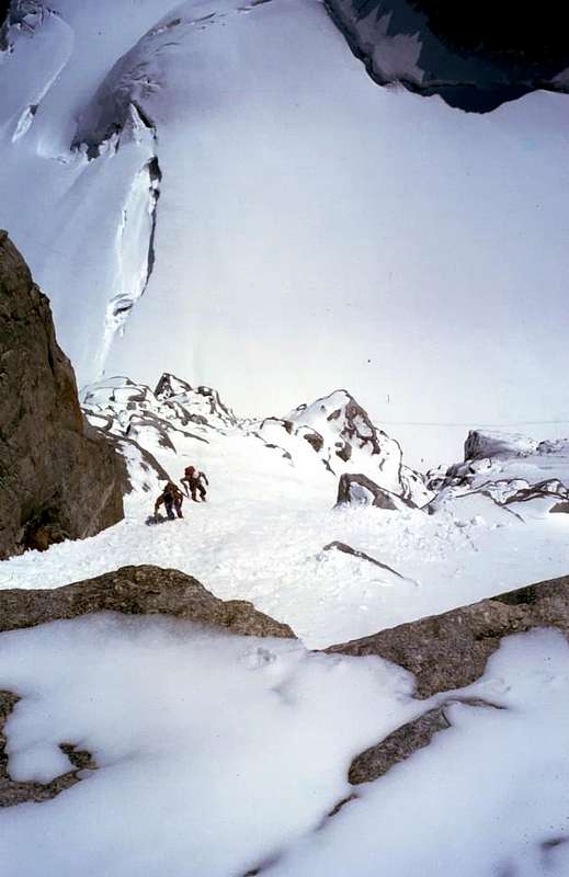
First part of the traverse, by "Antonio"
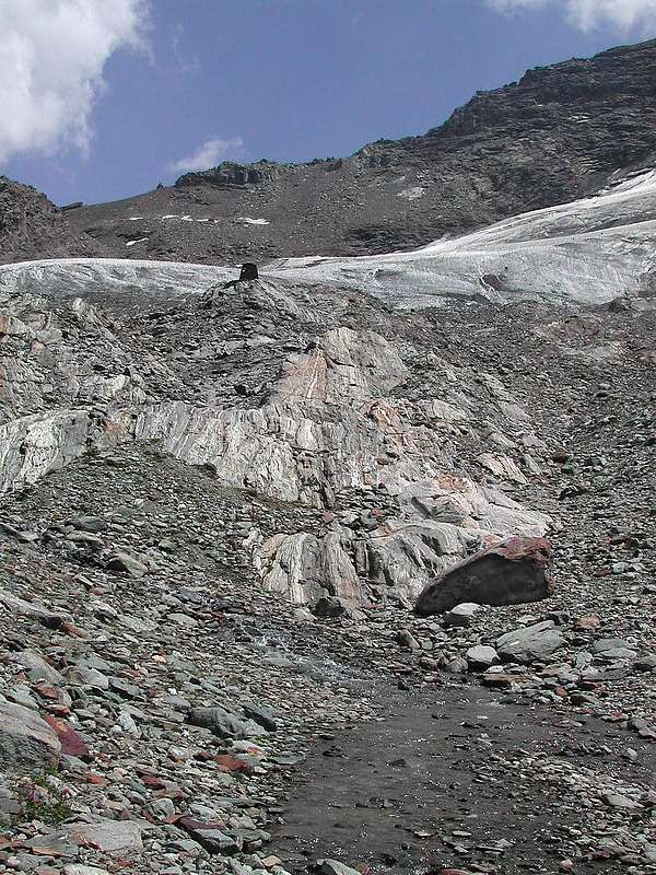
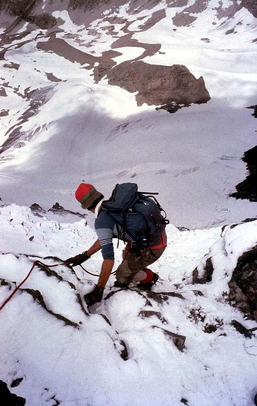
This ascent that ends with a great crossing, can be performed in a single day, as we did in 1980, when there were no shelters or bivouacs support; or to more easily starting from the Refuge of th'Epéee or Bivouac Ravelli. But they are completely different things, because the first way to go is in tune with the classic climbs, the other "fit" the new comfort though, apparently, the result is the same So you divide the world from that of Fake Real. More or less. Already arrive at the base, starting from Mondanges or Usellières, is a beautiful physical effort. Climb, descend and cross, in day, brings to mind the hocks of steel '800. When you are starting from the bottom of the valley, you reach the moraines at the base of the Glacier Invergnaou, not Invergnan, at an altitude of 2.750/800 meters you already have enough arouse the same directly and join the terminal crevasse at about 3.250/65 meters and start to rise to the Western Couloir. If there is ice or snow is dangerously abundant you lean to the left. Exit at Grande Rousse Pass, turn always to the left, walk through the Ridge South-southwest; after a small bumps at an altitude of 3.516 meters (III°-) easily reach the North Summit, the highest. The descent is identical. But in the presence of snow or ice is not a walk, and the music changes. Prudence and assessment of the least grip are needed.
"Before you look, then you begin, go upwards & back down", by Marco Cossard "Crevassino", Camille & Osw
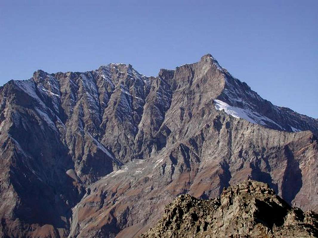
From the pass of the Grande Rousse in front of you the Ridge Northeast of the South Summit, and the same is easy and with a passage of III° - after a small antesummit (3.552m) in the form of a square tower, leads you to the South Top (3.577m). The crossing to the Southwest to the next Tina Point (3.523m) does not create any problems. The crest is air, nice and easy, snow permitting. It comes down, again by blocks of rock, with equal difficulty to Barmaverin Collar (3.400m), the climb to the homonymous Point (3.472m), in less than an hour (pay attention to the snowy frames), is via blocks on the North-northeast Ridge. The descent along the Crest South-southwest is similar, but requires some circumvention facing East, delicate in the presence of snow and where you should be able to find the way. From this, always in the Southwest, it bypasses the Cima of Fos (3.444m), reaching, with the same type of route, that of St. Martin or Fos South Summit (3.363m). This section of the watershed ridge was explored by mountaineer C.A.I. Ligure Giovan Battista Bozzino with B. Ségor August 24th, 1909, and always with the same, June 17th, 1910, starting from the Hill of Fos (3.294m). From this point to decide whether to go down the same along the South-southeast Crest in short, after a share (3.326m; II°-), it easily reaches or from Point of San Martino descend towards the West in the direction of the Glacier Giasson. In this last case, after a short stretch of broken rocks and snowfields, we reach the Hill (3.154m), wanting to finish in beauty you can also reach the same name Becca (3.215m) through a snowy hump followed by small broken rocks. Doing so closes the circle with a semi-circular via that gets space on the Glaciers of Invergnaou and Giasson, the descent is through this last, more and more reduced in the last few decades, bringing us through a long journey to the Northwest route. Ascension is not difficult but that requires training, especially if approached in the day from the valley floor, and some experience in knowing how to choose the passages to be performed.
"Then you must come down. Go boy, go well! / Poi si deve anche scendere. Vai ragazzo, che vai bene!", by Camillo Roberto Ferronato
Questa ascensione che si conclude con una grande traversata, può esser effettuata in un'unica giornata, come da noi fatto nel 1980, allorché non esistevan rifugi o bivacchi a supporto, oppur partendo più tranquillamente dal Rifugio de l'Epéee od anche dal Bivacco Ravelli. Ma son cose completamente diverse, perché il primo modo di andare risulta in sintonia con le salite classiche; gli altri si "adattan" alle nuove comodità anche se, apparentemente, il risultato é il medesimo. Così si divide il Mondo dei Veri da quello dei Finti. Più o meno. Già arrivare alla base, partendo da Mondanges o da Usellières, é un bel impegno fisico. Salire, attraversare e scendere, in giornata, riporta in mente i garretti di acciaio dell'800. Quando tu, partendo dal fondo valle, raggiungi le morene alla base del Ghiacciaio di Invergnaou, e non di Invergnan, a quota 2.750/800 metri circa ne hai già abbastanza; risali lo stesso direttamente e raggiungi la crepaccia terminale a 3.250/65 metri circa ed inizi a salire per il Canalone Ovest. Se vi é ghiaccio o la neve é pericolosamente abbondante t'appoggi a sinistra. Esci al Colle della Grande Rousse e, voltando ancora a sinistra, percorri la Cresta Sud-sudovest; dopo una piccola asperità a quota 3.516 metri (III°-), facilmente raggiungi la Cima Nord, la più elevata. La discesa é identica. Ma in presenza di neve fresca o ghiaccio non é una passeggiata e la musica cambia. Prudenza e valutazione del più minimo appiglio son necessari.
"After, towards the Southern Summit, beyond more & more and better & better", by Camillo Roberto Ferronato
Dal Colle della Grande Rousse hai di fronte la Cresta Nord-nordest della Punta Sud; la stessa é facile e con un passaggio di III°-, dopo una piccola antecima (3.552 m) in forma di squadrata torretta, ti conduce alla Sommità Meridionale (3.577 m). La traversata verso Sudovest alla successiva Punta Tina (3.523 m) non crea particolari problemi. La cresta é aerea, bella e facile, neve permettendo. Si scende, sempre tramite blocchi di roccia, con uguali difficoltà al Colletto Barmaverin (3.400 metri circa); la salita all'omonima Punta (3.472 m), in meno di un'ora (attenzione alle cornici nevose), avviene tramite blocchi sulla Cresta Nord-nordest. La discesa lungo la Cresta Sud-sudovest é analoga, ma richiede qualche aggiramento esposto ad Est, delicato in presenza di neve fresca e dove bisogna essere capaci di rintracciare la via. Da questa, sempre a Sudovest, si scavalca la Cima di Fos (3.444 m) raggiungendo, con identica tipologia di percorso, quella di San Martino o Cima di Fos Meridionale (3.363 m). Questo tratto di cresta spartiacque venne esplorato dall'alpinista del C.A.I. Ligure Giovan Battista Bozzino con B. Ségor il 24 Agosto 1909 e, sempre con il medesimo, il 17 Giugno 1910 partendo dal Colle di Fos (3.294 m). Da questo punto decidere se scendere sul medesimo lungo la Cresta Sud-sudest che in breve, dopo una quota (3.326 m; II°-), facilmente lo raggiunge oppure dalla Punta di San Martino calare verso Ovest in direzione del Ghiacciaio di Giasson. In siffatt'ultimo caso, dopo un breve tratto di rocce rotte e nevai, si raggiunge il colle (3.154 m); volendo finire in bellezza si tocca anche l'omonima Becca (3.215 m) tramite una gobba nevosa seguita da roccette rotte. Sì facendo si chiude il cerchio con percorso semi circolare che fà spaziare sui Ghiacciai dello Invergnaou e del Giasson; la discesa avviene tramite quest'ultimo, sempre più ridotto in quest'ultimi decenni, riportandoci tramite una lunga traversata verso Nordovest alla via dell'andata. Ascensione non difficile, ma richiedente allenamento, soprattutto se affrontata in giornata dal fondovalle, ed una certa esperienza nel saper "scovare" i passaggi da effettuare.
Traverse to South, second and third phases of the crossing, by "Antonio"
Difficulties & Equipment
From PD/PD+ to AD- (short passages of II°/II°+ and III°-).
Da PD/PD+ ad AD- (brevi passaggi di II°/II°+ e III°-).
For Mountaineering: rope, ice-axe and crampons.
Da Alpinismo con corda, piccozza e ramponi.
Campings
Remember that free camping is forbidden (except for emergency reasons, over 2.500m, from darkness until dawn).
Mountain Conditions
You can get meteo information at the official site of the Regione Valle d'Aosta:


 7553 Hits
 87.76% Score
 25 Votes