
-
 6715 Hits
-
 71.04% Score
-
 3 Votes
|
|
Mountain/Rock |
|---|---|
|
|
34.02720°N / 111.88839°W |
|
|
Hiking |
|
|
Spring, Fall, Winter |
|
|
5100 ft / 1554 m |
|
|
Overview
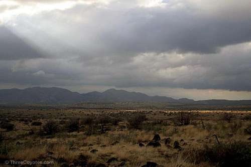
Grapevine Mesa in the Tonto National Forest is one of a few mesas that form the headwaters of New River and is nearly spilt into quarters by canyons running east to west. The largest of these canyons, Grapevine Canyon, appears to host a sizeable riparian area. The eastern side of the mesa has been carved out by the upper reaches of Cave Creek and runs roughly north to south with little interruption. Go for a hike out here to appreciate the stark beauty and never see a soul.
Grapevine Mesa is mostly covered with tall grass with juniper trees and low shrubs scattered about. Various cacti including prickly pear as well as agave and yucca fill out the vegetation. Brown and black volcanic rocks and boulders are everywhere. After a rain the soil on the mesa-top turns into a very sticky mud that builds up on hiking boots and makes things difficult.
The referenced summit is at 5,100' and has a prominence of about 192 feet and is about 1.7 miles south of the prominent Blackjack Point 5,397'.
Getting There
Drive Cave Creek Road east from the town of Cave Creek until you enter the Tonto National Forest and the road becomes known as Road 24/Cave Creek Road/Seven Springs Road. Just past Sears-Kay Ruins, Road 24 becomes unpaved, but usually it is passable in a passenger car. Note that the drive on the unpaved portion of Road 24 to Grapevine Mesa is better than 14 miles and I would strongly recommend a high-clearance vehicle for the drive. However, based on the condition of your vehicle and how you choose to drive it on this stretch of road, a normal passenger car could very well work out for you. In any case, follow Road 24 past Seven Springs Campground and a few miles past the junction with Road 41 (New River Canyon). Just below Blackjack Point (not signed, check the map), a "Jeep trail" departs from Road 24 and heads northeast (left when travelling north) uphill - this is the trail to Grapevine Mesa. Find a spot to park off Road 24 in this area. Hike the Jeep trail into Brush Basin and then onto the top of Grapevine Mesa for some great views of the surrounding mesas and the New River Mountains. Shortly after reaching the mesa-top an ill-defined trail splits off and heads south then west to the southwestern tip of Grapevine mesa (around 4 miles).
Red Tape
None.
Camping
Camping is allowed in the Tonto National Forest.