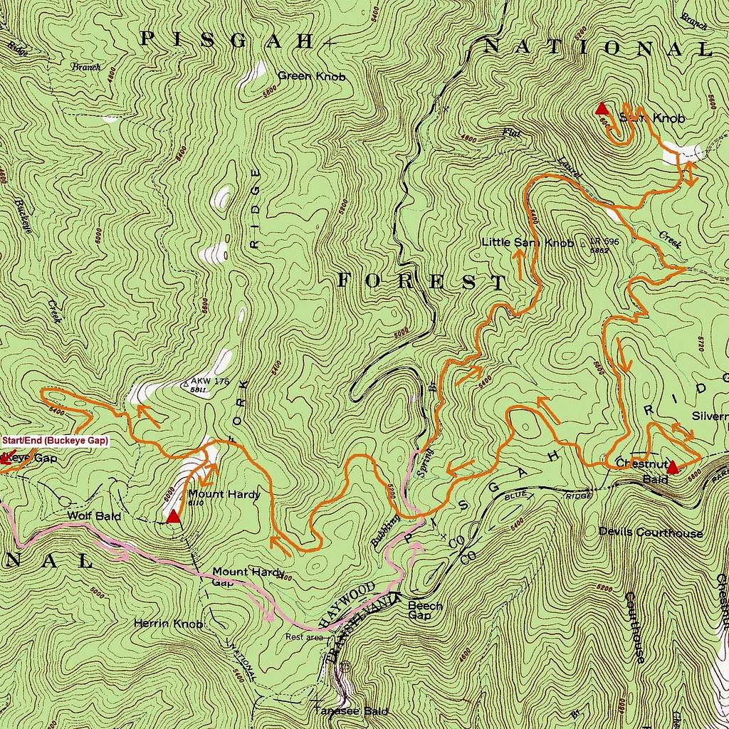
Great Balsam 3-Fer Route Map
My approximate route to Sam Knob, Chestnut Bald, and Mt. Hardy...I'd begin and end at Buckeye Gap (also known as Rough Butt Overlook). I then biked (pink trail) down the Parkway and NC-215 to the Flat Laurel Creek Trailhead. From there I first followed the Flat Laurel Creek and Sam Knob Trails to the summit of Sam Knob. Backtracking the Sam Knob Trail I then followed the Flat Laurel Creek, Little Sam Knob, and Mountains-to-Sea Trails over to Chestnut Bald. Finally, I followed the Mountians-to-Sea all the way back to Buckeye Gap making the side trip to Mt. Hardy on the way.
Overall estimate of mileage...3 miles by bike and 15-16 by trail...


