Toggle navigation
Mountains
Routes
Images
Trip Reports
Forum
What's New
People
Areas & Ranges
Articles
Trailheads
Canyons
Huts & Campgrounds
Albums
Logistical Centers
Fact Sheets
Lists
Custom Objects
Gear
Plans & Partners
WELCOME TO SUMMITPOST
SIGN IN
REGISTER
Gran Paradiso GROUP
Additional Parents
Image
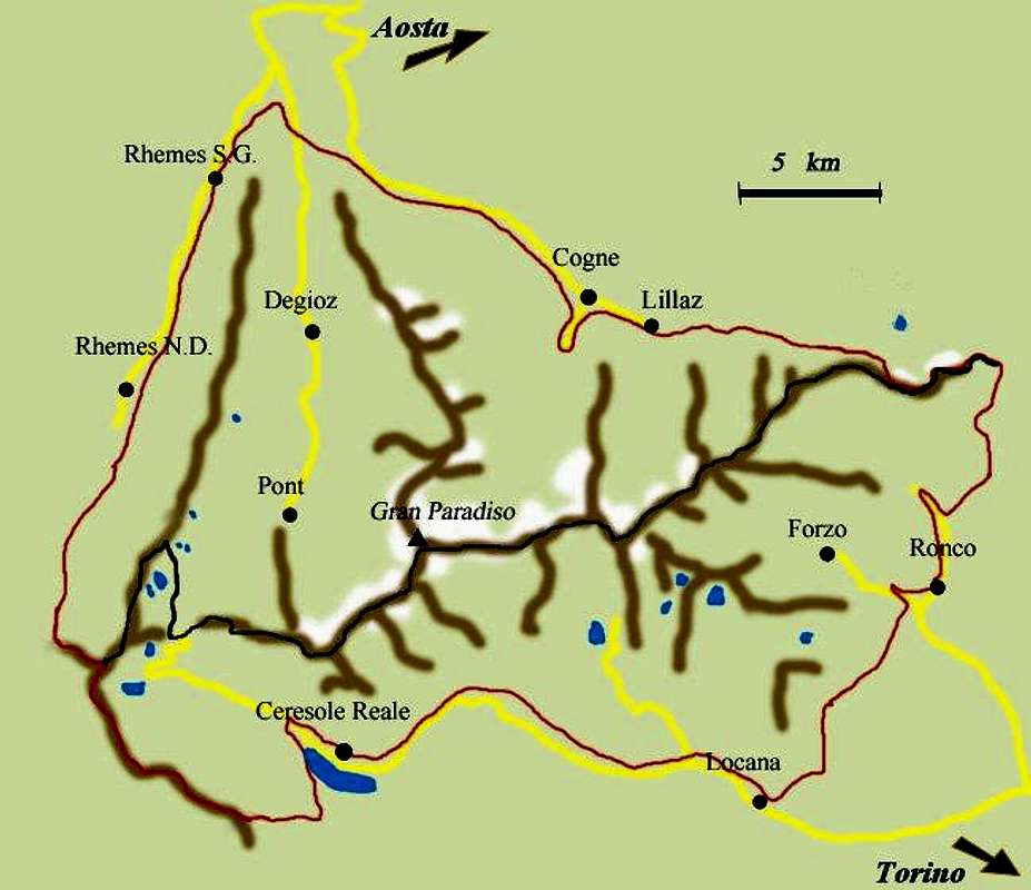
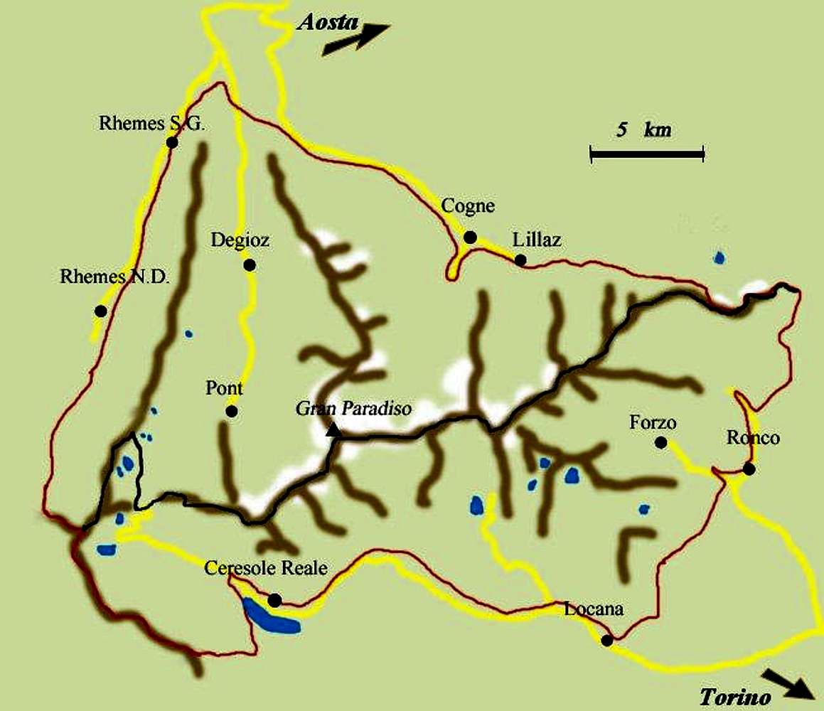
Handmade map of the Gran Paradiso National Park
View High-Resolution Image
Handmade map of the Gran Paradiso National Park
Handmade map of the Gran Paradiso National Park. In red the limits of the Park, in black the border between the northern sector (Valle d'Aosta) and the southern one (Piemonte).
« PREV
NEXT »
livioz
on
Nov 17, 2004 11:40 am
Comments & voting
Other parents
Image Type(s):
Topo/Diagram
Image ID:
78530
14299 Hits
76.66
% Score
7
Votes
Log in to vote
Comments
No comments posted yet.
to post!
Don't have an account?
Gran Paradiso GROUP
(Area/Range)
« PREV
Viewing
#276 of 826
GALLERY
NEXT »
livioz's Image Gallery
« PREV
Viewing
#786 of 1637
GALLERY
NEXT »
×
You need to login in order to vote!
User Name
Password
Remember me
Forgot your password?
Log me out when I close my browser.
Keep me logged in all the time.
sign in as a user
Don't have an account?
Register now for FREE
Rating available
Suggested routes for you
People who climb the same things as you
Comments Available
Create Albums
Register Here


