
-
 19137 Hits
-
 81.39% Score
-
 14 Votes
|
|
Mountain/Rock |
|---|---|
|
|
63.44840°N / 20.2604°W |
|
|
Hiking, Scrambling |
|
|
Spring, Summer, Fall |
|
|
928 ft / 283 m |
|
|
Overview
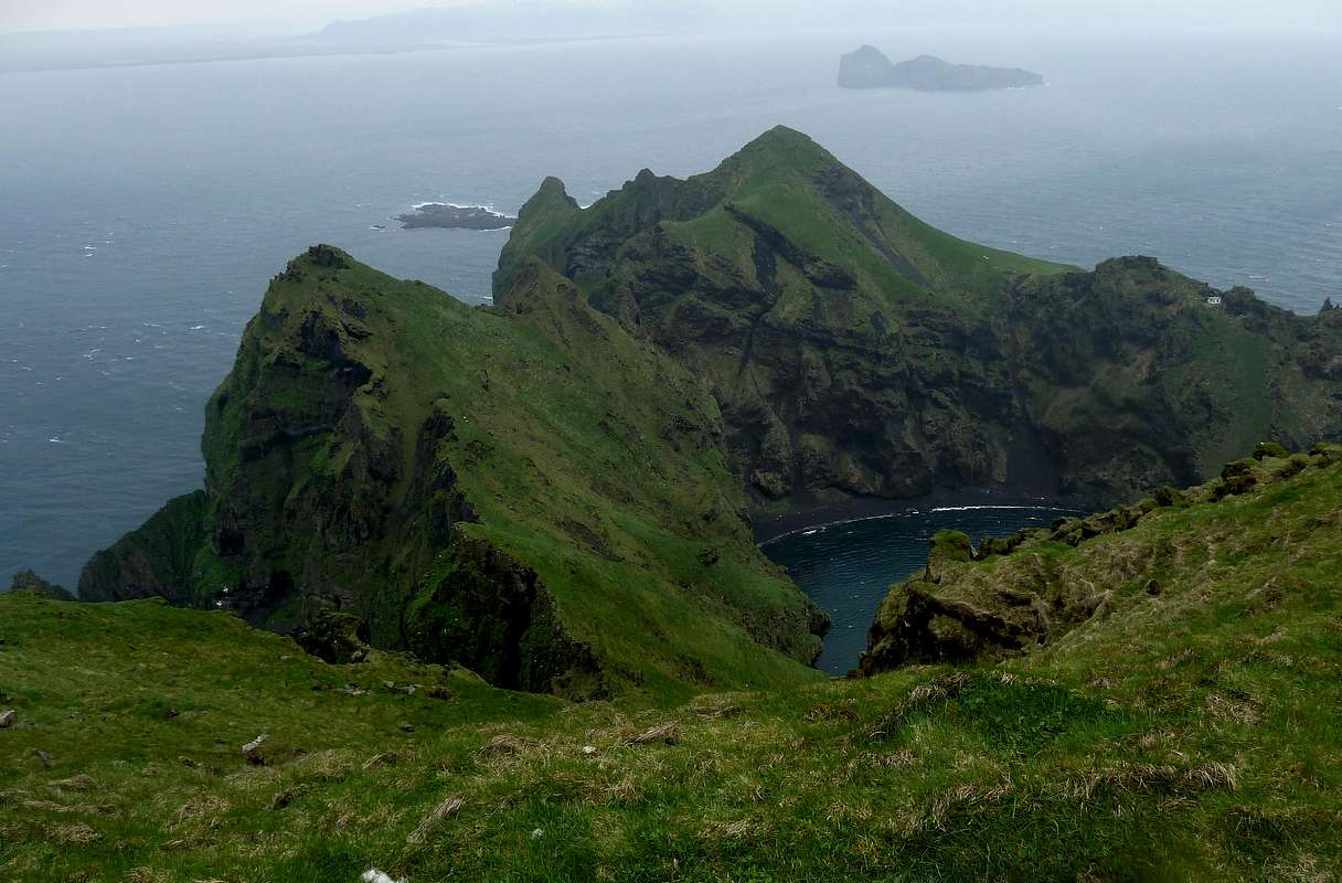
Ten miles south of the Icelandic mainland, as the Mid-Atlantic Ridge dives under the heaving North Atlantic, a final handful of its peaks poke valiantly above the surface. These are Vestmannaeyjar, the Westman Islands. Heimaklettur, on the island of Heimaey, is the highest peak in this craggy and windswept archipelago.
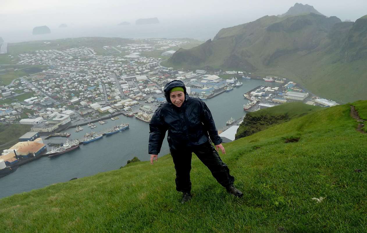
A hike to the top of Heimaklettur takes you above a stupendous seacliff, nearly a thousand feet high, for coastal scenery that is breathtaking even by Iceland's high standards. It also takes you above Heimaey's famous volcano, Eldfell, and gives you the ideal perch to take in the lava flow from the 1973 eruption that nearly blocked the harbor of Iceland's top fishing port.
Getting There
Getting there is half the drama of this little peak. Contrary to what you'll read in many tourist publications, the easiest and cheapest way to get to Vestmannaeyjar is to take the 40-minute Eimskip ferry from Landeyjahöfn, a tiny port located at the end of Route 254 directly across from the islands. Fares are quite reasonable, with adult passengers paying about 10 euros one-way, and vehicles (which can be quite useful on Heimaey) costing about 20 euros to bring over. Watch the schedule--departures are not all that frequent--and be sure to make advance reservations if you want to take a vehicle.
Dress for the sea spray and stay on deck! The tortuous, narrow entry into Heimaey's harbor is not to be missed, with the massive swiss-cheese-like cliffs of Heimaklettur towering hundreds of feet above the ship.
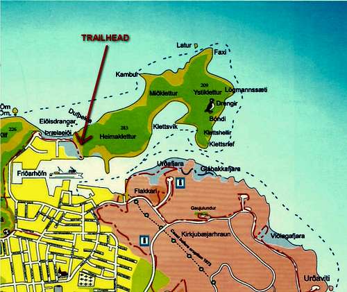
The ferry docks on the south side of the harbor. Once off the boat, you'll need to walk or drive about 1.5 kilometers around the west end of the harbor to its north side. The trailhead for this hike is at the very end of Eiðisvegur Street, directly across the water from the ferry terminal. There's a big dirt parking lot and a prominent trailhead sign.
Route
|
|
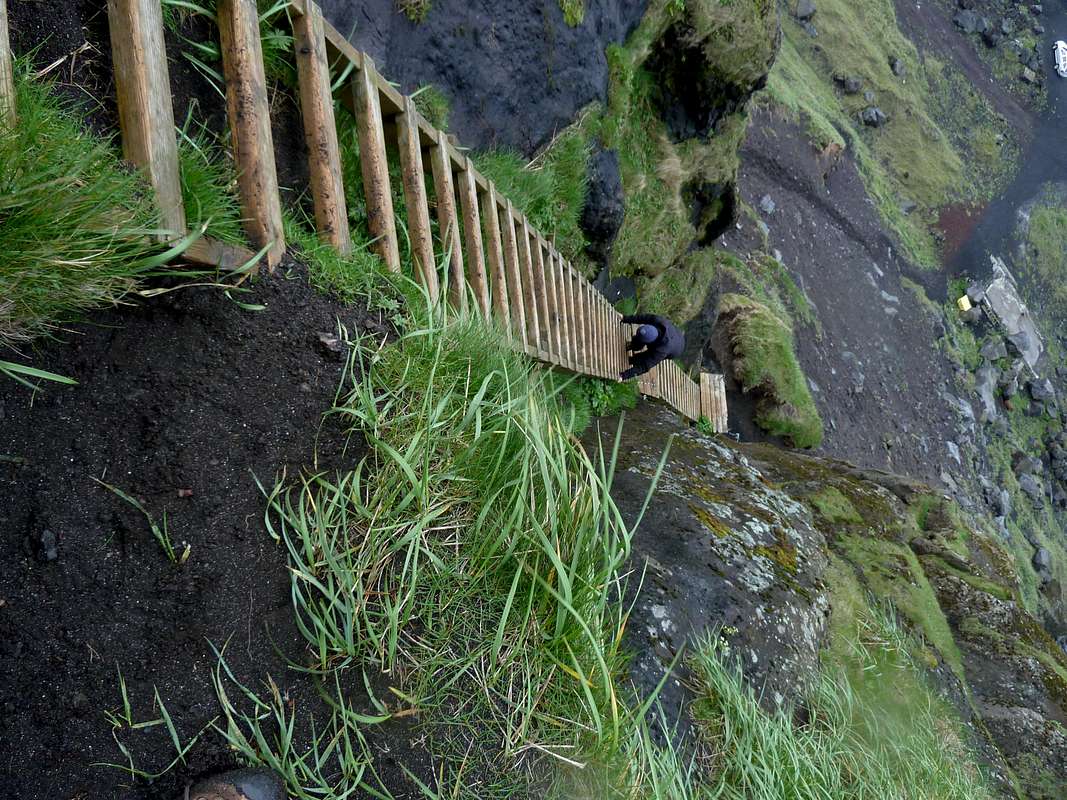

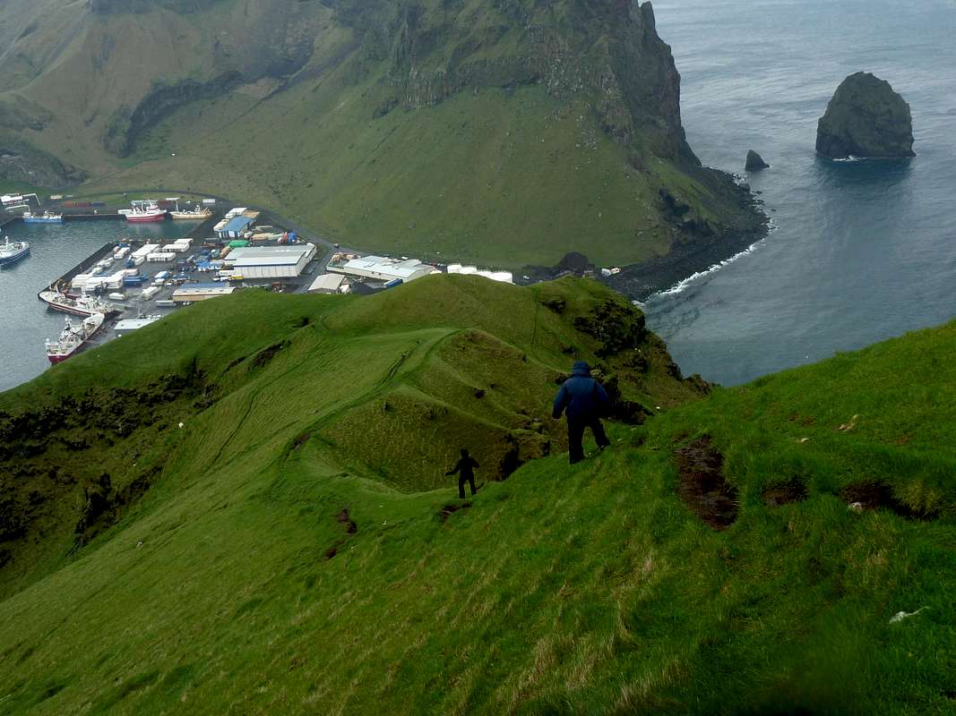
The regular route up Heimaklettur starts just behind the trailhead sign and goes up an obvious wooden ladder to get past the first cliff band. There are several of these ladders at the beginning, at an angle of about 70 degrees--not so steep as to be strenuous, but scary for people afraid of heights. If you can handle the first couple of ladders, you'll be fine all the way to the top. About a hundred vertical meters above the start, the ladders end and the trail zigzags a steep hillside to reach a spectacular clifftop ridge, which it follows to the summit. Most people will need 30 minutes to an hour to get to the top. Since you start right at sea level, the elevation gain is about 900 feet (just under 300 meters).
The route is never truly dangerous in good conditions, but it might feel that way to some. In snowy or icy weather, there could be some real risk traversing the steep slopes just beyond the ladders.
Summit Views
|
|
The Island of Heimaey
It's hard to think of a five-square-mile island anywhere that packs in as much scenery, geographic drama, and quirky history as Heimaey, the "home island" of the Westman group. The islands took their name from a group of Irish thralls, or "Westmen," who fled to Heimaey after killing their Viking master. The islands made a fabulous fishing base, and a tough population endured many hardships to live there--including a long series of raids culminating in an attack by Algerian slavers that carried off hundreds and killed many of the rest. The biggest threat to their survival, however, came in 1973, when a volcanic vent opened half a mile outside the main settlement, pouring out a square mile of new lava and nearly blocking the entrance of the vital fishing port. Today Heimaey supports a human population of 4200. Together with the smaller islands in the group, it is the largest puffin colony in the world, with 830,000 pairs, or 20% of the world's population of Atlantic puffins, breeding in the archipelago.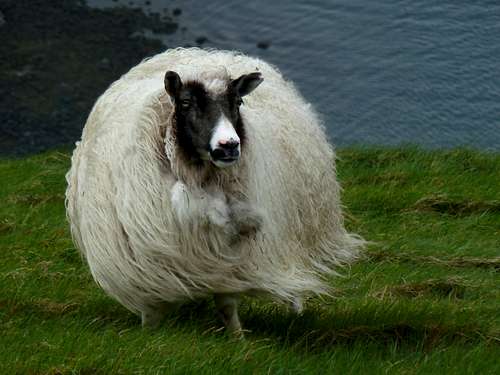 If you are a sheep on Heimaklettur, it helps to be really woolly
Links
National Geographic video of HeimaeyVestmannaeyjar weather forecast
Ferry schedule
Stóraklif (another scramble peak on Heimaey)
Map showing regular hiking trails on Heimaey
Guesthouse Hreiðrið (Vestmannaeyjar)
Helgason puffin study (used as a source above)