Toggle navigation
Mountains
Routes
Images
Trip Reports
Forum
What's New
People
Areas & Ranges
Articles
Trailheads
Canyons
Huts & Campgrounds
Albums
Logistical Centers
Fact Sheets
Lists
Custom Objects
Gear
Plans & Partners
WELCOME TO SUMMITPOST
SIGN IN
REGISTER
The Frey (Cerro Catedral)
Additional Parents
Image
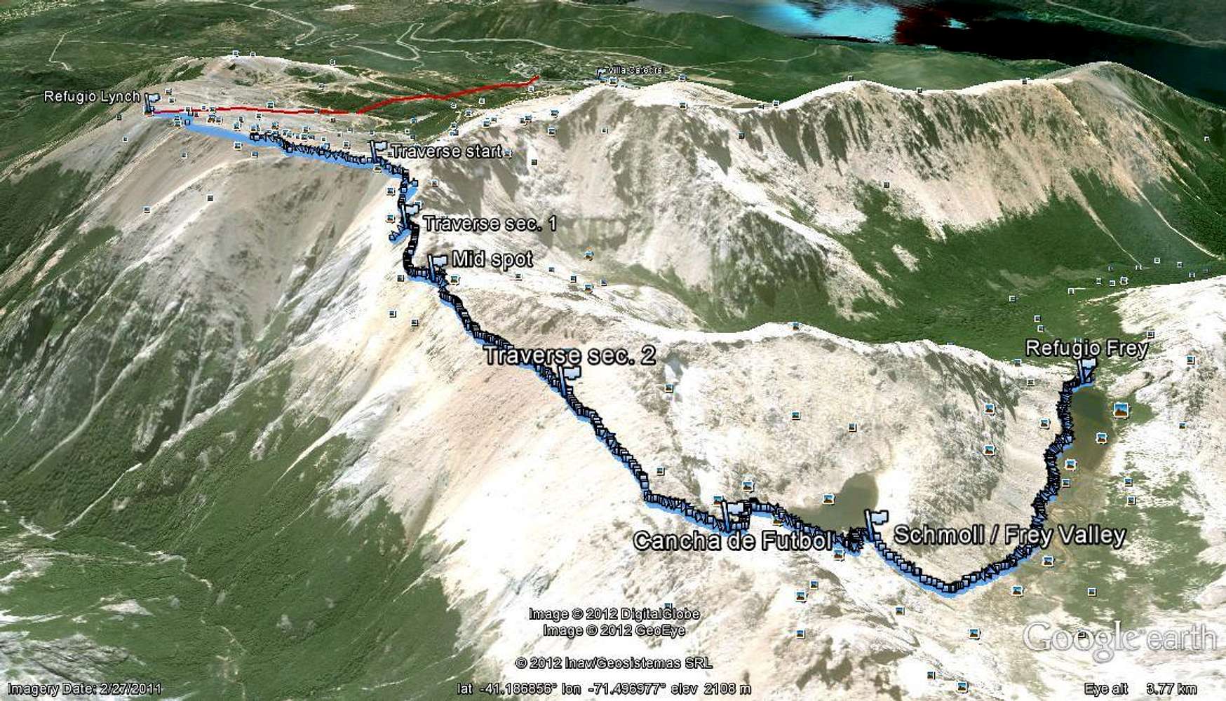
High road to Frey
View High-Resolution Image
High road to Frey
Route to Frey via the ridge top. Red line marks ski-lift path up from Villa Catedral. Image from Google Earth.
« PREV
NEXT »
Baarb
on
Feb 19, 2012 10:22 pm
Comments & voting
Other parents
Lat/Lon:
41.19209°S / 71.50349°W
Image Type(s):
Topo/Diagram
Image ID:
777394
2531 Hits
71.06
% Score
1
Votes
Log in to vote
Comments
No comments posted yet.
to post!
Don't have an account?
The Frey (Cerro Catedral)
(Area/Range)
« PREV
Viewing
#66 of 103
GALLERY
NEXT »
Baarb's Image Gallery
« PREV
Viewing
#277 of 361
GALLERY
NEXT »
×
You need to login in order to vote!
User Name
Password
Remember me
Forgot your password?
Log me out when I close my browser.
Keep me logged in all the time.
sign in as a user
Don't have an account?
Register now for FREE
Rating available
Suggested routes for you
People who climb the same things as you
Comments Available
Create Albums
Register Here


