
Comments
No comments posted yet.
|
|
Trip Report |
|---|---|
|
|
44.13657°N / 113.77954°W |
|
|
Download GPX » View Route on Map |
|
|
Jul 19, 2014 |
|
|
Scrambling |
|
|
Summer |
One late winter hike, while solving world problems, my best friend Stacy Austin and I decided to make hiking Mt. Borah, Idaho's highest peak, our goal for the upcoming summer. Little did Stacy realize this would turn me into a peakbagging junkie. The date was set, the training hikes were done, all there was left was to tackle the beast and I severely sprained my ankle with just 3 weeks to go. I decided to give it a shot anyway.
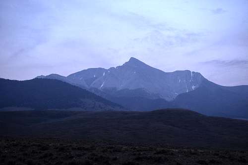
The week leading up to the climb, the forecast called for gail force winds and a high chance of thunderstorms. The Boise valley was covered in smoke from surrounding forest fires. We decided to go anyway and worst case we turn around and come home. So off we went. As we rounded the corner and the Lost River Range came into a very smokey/hazy view, my heart started racing in anticipation and dread. Mt. Borah sits at 12,662 ft. The climb is 3.5 miles up 5300 ft with the infamous "Chicken-out Ridge", a 1 ft wide snow bridge and a class 3 scramble up the peak. We drove past the turn out to the trailhead to get a good look at what we'd be climbing. Not going to lie, when I saw that 5,682 ft prominent peak (#27 of the top 100 lower US prominent peaks) I wasn't sure I was up to the challange after all.
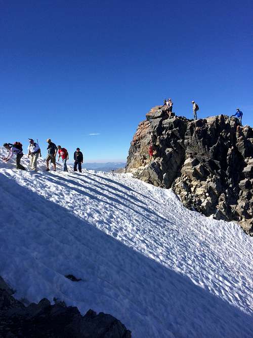
From here we made our way to the trailhead, set up camp, chatted with a few other climbers, prepared our backpacks and crashed out. At 0h-dark-thirty (0345) the horrible alarm woke us. First thing I did was look outside to a clear star lit sky, with no a whiff of smoke. We were doing this. We set out at 0445. This trail does not ease you into elevation gain, it throws you into it. First mile into it was rough. Stacy had nausea, headache and dizziness and wasn't doing very good. It was slow going, but she just kept pressing on. As the sun started to rise and the trees started getting scarce we stopped for a break. We started hiking with a LDS young mens group of 16 year olds at this point. Talking with group leaders and the kids helped the grunt fest go by just a little faster. Every corner we turned the trail just kept getting steeper. Then came Chicken-out Ridge. A ridge justly named because this is were a lot of people see it and chicken out. I'd read about it and saw pictures and figured I wouldn't have a problem, because I'm not really afraid of heights.
I froze. Not because of a fear of heights, but because of my daughter waiting for me at home. The group of teenagers are the ones that got me through it. They literally talked me off the ledge. One foot and hand hold at a time. I slowly but surely made my way over the ridge and was then faced with the snow bridge. A narrow patch of snow with sheer drop offs of either side.
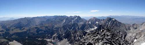
After the snow bridge we made our way along the mountain side and came around the corner to our first real view of the summit.
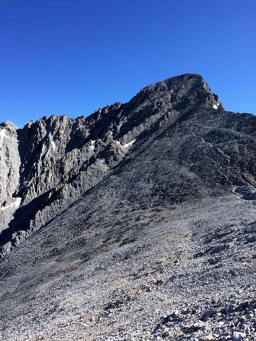
This part was the fun part. Up 1 step, slide down 3. Take 5 steps, stop and rest. Repeat. Man was it worth the view!