Toggle navigation
Mountains
Routes
Images
Trip Reports
Forum
What's New
People
Areas & Ranges
Articles
Trailheads
Canyons
Huts & Campgrounds
Albums
Logistical Centers
Fact Sheets
Lists
Custom Objects
Gear
Plans & Partners
WELCOME TO SUMMITPOST
SIGN IN
REGISTER
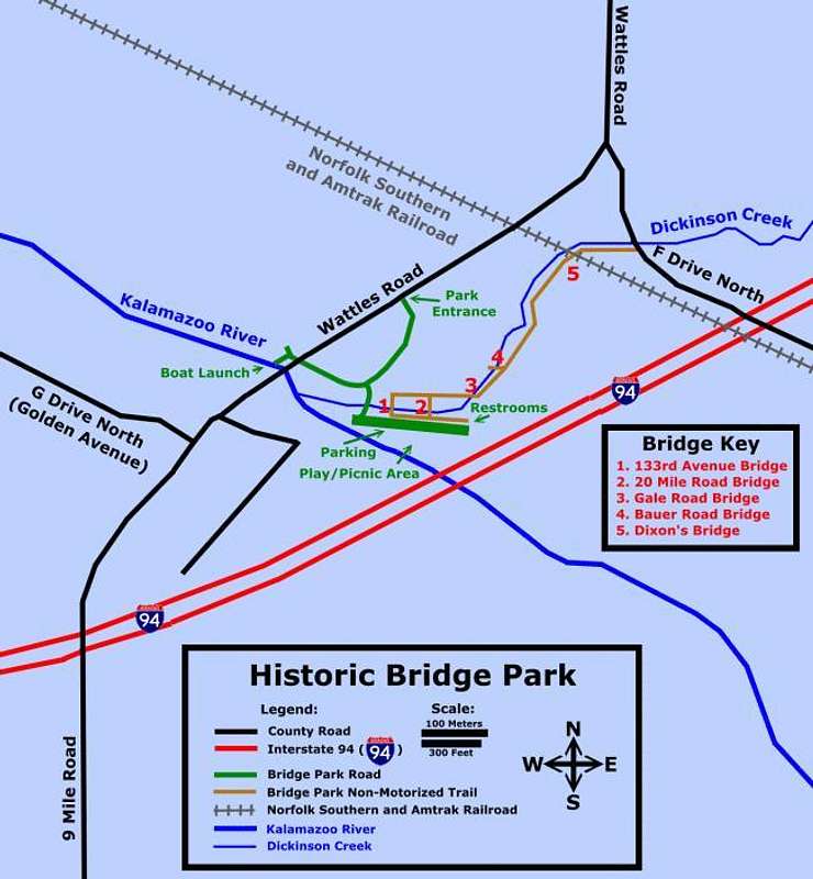
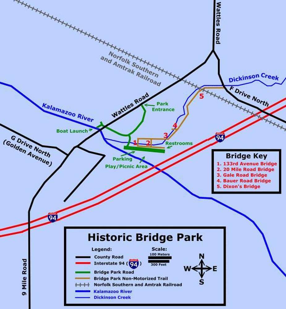
Historic Bridge Park map
View High-Resolution Image
Historic Bridge Park map
This is a nice map of the park created by the people at Historic Bridges (historicbridges.org).
« PREV
NEXT »
Chinigo
on
May 4, 2010 9:13 pm
Comments & voting
Other parents
Lat/Lon:
42.30000°N / 85.1°W
Image Type(s):
Informational
Image ID:
618812
2067 Hits
0
% Score
0
Votes
Log in to vote
Comments
No comments posted yet.
to post!
Don't have an account?
North Country Trail - MI-02: Marshall to 76th Street
(Route)
You are at
the First
Image
Viewing
#1 of 1
GALLERY
You are at
the Last
Image
Chinigo's Image Gallery
« PREV
Viewing
#261 of 1187
GALLERY
NEXT »
North Country Trail - MI-02: Marshall to 76th Street
(Route)
Loading....
North Country Trail - Historic Bridge Park to Wattles Park
(Trip Report)
Loading....
Photo of the Hour
(Album)
Loading....
×
You need to login in order to vote!
User Name
Password
Remember me
Forgot your password?
Log me out when I close my browser.
Keep me logged in all the time.
sign in as a user
Don't have an account?
Register now for FREE
Rating available
Suggested routes for you
People who climb the same things as you
Comments Available
Create Albums
Register Here


