

pcole8787 - Mar 12, 2017 12:02 pm - Hasn't voted
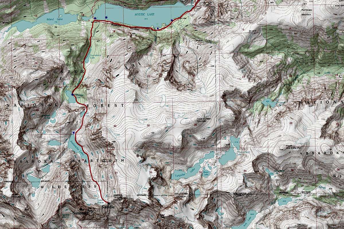
Adjust that approachLots of horror stories about huge boulders on the princess-cold-avalanche approach. In 2008 I took the longer snowmelt lakes option. It is quite scenic and involves a minimum of scree. Camped at the first lake and summited the next afternoon. The boulders at the north end of avalanche lake can be minimized if you don't go up too high before starting your traverse. I found countless meadows that could be linked together all the way to the south end of the lake. Bit of a slog to the saddle but there were some snow tongues along the way that made the going easier.
Photos @ http://petercolephoto.com/content/gallery.php
Click Alpine and select Montana. There are 3 albums to choose from.
Peter

Matt Lemke - Mar 23, 2017 4:00 pm - Hasn't voted
Re: Adjust that approachYes I also did the snowball lakes option, but was told by everyone that the Cold Lake option is supposed to be much better, faster and shorter. You're the first I've heard say otherwise...


Comments
Post a Comment