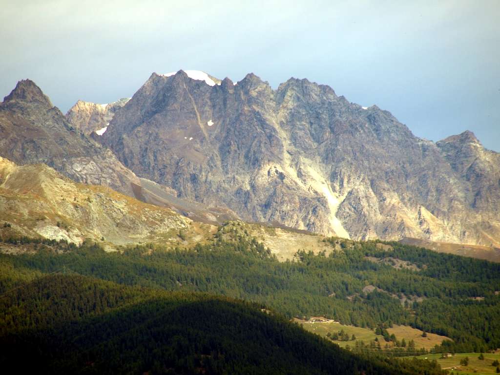
Hummm, summer is dying on the V'elan
The watershed (By's Basin/Menouve-Molline Valleys) from the rocky pyramid of La Salliaousa (3322 meters, in extreme left margin or Southwest). In distance: Quota 3678 meters on Western Ridge (from Colle d'Annibale also Hannibal's Pass, 2992 metres) of Mont Velan (3734m).
In the middle: Quota 3672 meters just over the South-southwestern rocky Face projected into Menouve/Molline Valley.
To the right or E-SE: the partial and highest watershed of the Mont Velan Ice Cup or V'lan": from Quota about 3650 meters downhill up the three V'lan's Horns (Mini, Broken (this last bifid and with a small and halved summit), Western 3620 meters, Eastern Brèche 3610/12 metres about, Mini Central 3615 metres about (also this with with a broken little summit), Eastern about 3618m), five Velan's Jags (from 3570 metres around up to the 3595 meters), Little Velan's Tooth (just detached East-southeast; about 3530/35 metres), Tête d'Ariondet (3485m) and Mont Capucin (3395m), just preceding the Doigt du Velan, Col des Chamois, Mont Cordine, the inclined Plateau de Cordine and the Col de Valsorey (3107m).
September 24th, 2019. Foto by Osvaldo Cardellina


