


Mathias Zehring - Aug 19, 2008 4:22 am - Voted 10/10
elevation?This is more or less exactly the point where I had to abandon my climb back in 1998 due to heavy storm (in fact our german guide ordered to turn around). Can you estimate the elevation of this point? How long did it take you from there to the summit? Was the summit ridge exposed so that it is a risk in heavy storm? That's what I ask myself since 10 years now...

Herb - Aug 20, 2008 6:36 am - Hasn't voted
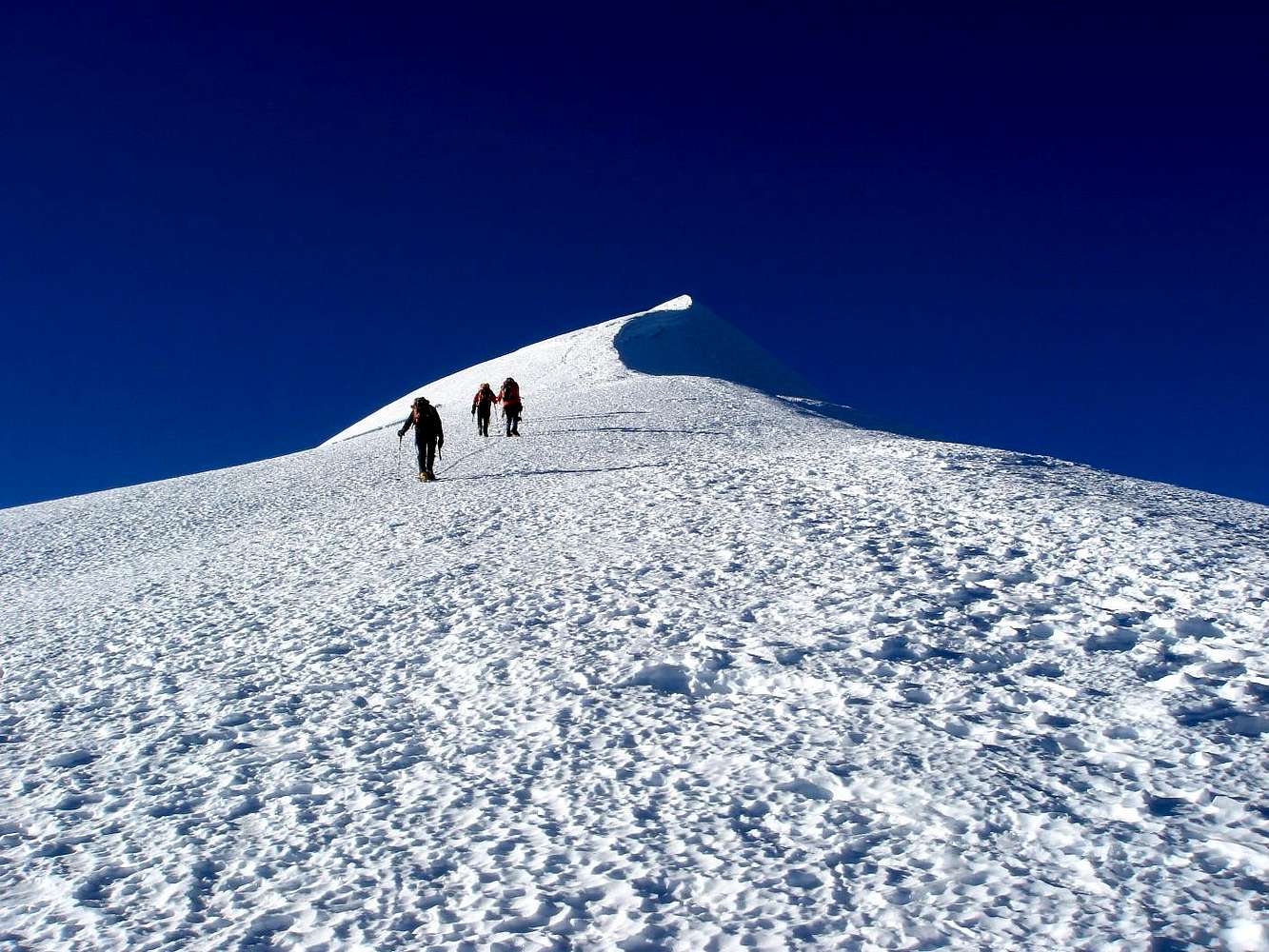
Re: elevation?Mathias, the picture was taken at the kind of "saddle" between Pico Norte, Pico Central and Pico Sur and after the steepest part and crux section of the normal route located at app. 6.200m (I'm sure you remeber this... ;o)) So I guess the elevation is slightly more than 6.300m (there are maybe 100m of height gain from here to the "false summit").
From here it took us about 45 minutes to the real summit - it looks shorter and less steep than it is from this viewpoint (not only on the picture, we underestimated it in reality, too). And anyway, it is already quite high and therefore strenuous.
The summit ridge itself is exposed, but it is broad, flat and more or less horizontally (as you can see on this picture: Illimani summit ridge).
So it should be possible to negotiate this section as a rope team in stormy conditions, too (although I cannot judge, how heavy the storm during your approach was). We were lucky and had nearly no wind that day (unfortunately that changed dramatically on Sajama...).
I hope this helps you to answer some of your ten years old questions :o)
Cheers,
Herbert
P.S. By the way - I just read "Die Anden" by Hermann Kiendler and recognized, that you contributed some really beautiful photos to this book. Congrats!
Mathias Zehring - Aug 21, 2008 6:44 am - Voted 10/10
Re: elevation?Thank you for your detailed comment!
45 min - so long still to go! Then the decision was right because weather detoriated quckly. Perhaps I turned around a little higher - here I uploaded my highest picture. My Thommen showed 6330m but you cannot trust it exactly without adjusting it to a fixed point.
Herb - Aug 21, 2008 6:53 am - Hasn't voted
Re: elevation?Yes, if you compare it side by side, your picture was definitely taken from a higher position than mine. So maybe it would have been half an hour our slightly less to the summit.


Comments
Post a Comment