Comments
No comments posted yet.
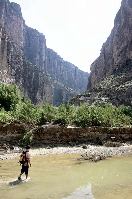
Santa Elena Canyon in Big Bend National Park, TX is a narrow, 1500-foot deep gash in the mountains through which the Rio Grande River flows. Even on the Google® Earth map, should you chose to bring that up, you can see this impressive canyon. You can hike a short ways into it via a trail that is accessible from the Santa Elena Canyon Overlook parking area. My son, Curtis, is crossing Terlingua Creek looking for the rock cairn that identifies the trailhead. The confluence with the Rio Grande is just out of the image to the left. We very much wanted to canoe through the canyon, but all access to it had been closed because of heavy flooding. Indeed, it had only opened up for hiking just a few hours earlier (after we'd waited three days!) and it was extremely muddy once we entered the mouth of the canyon. Looking at the image, that's Mexico on the left and the U.S. on the right. Imaged in August 2005.


