All valleys have a Church, a Castle or Tower and even both or a Mountain with hallmarks. Characteristic for each that applies even to entire Aosta Valley.For every trip in each of them presents this trio almost unbreakable, because it represents the history, culture and traditions in the Centuries and Millennia to the firsts, and Eternity for the latest. When we think of a valley, immediately it comes to mind its highest mountain, or more beautiful that inevitably stands as a symbol of that. So for the Mont Blanc or the Grandes Jorasses in the two Courmayeur Vény and Ferret Valleys, Mont Velan and Grand Combins into the Great St. Bernard, Matterhorn in Valtournanche, Lyskamm in Ayas, Monte Rosa at the Lys Valley or Gressoney, Grand Paradis in Cogne and Valsavarenche, Grande Rousse to Val de Rhêmes, Sassière to Valgrisa and Rutor in La Thuile. But even those
"minor" flaunt their favorite mountain as
Grande Rochère, the Mont Fallère, Becca Luseney, Becca Viou, Faroma, Aver, Zerbion, Torché, Mont Glacier or Rosa dei Banchi, Tersiva or Emilius in their valleys. A combination that becomes even more distinctive if we add a Church, a Tower or a Castle that represent in terms Religious or what heraldic, chanting the History and the Life of the Population. One aspect that the Mountaineers,
"hasty" to reach the goal and yet ignore the Hikers preferring to leave out the majesty of the views or the exclusive admiration for Nature. Fall in this way into oblivion if not in total anything despite the remaining observations that these may be the key to understand the uses and customs of a place, always a bit different from each other. A total disregard for all that has kept alive a mountain, a valley or just a country. An oversight almost incomprehensible as unforgivable that we think to regain at least part of reviving the life of the mountains, always inscrutably still in place, with that of the
People who live at the base of the same, being born here, living and ending their journey ...
![]()
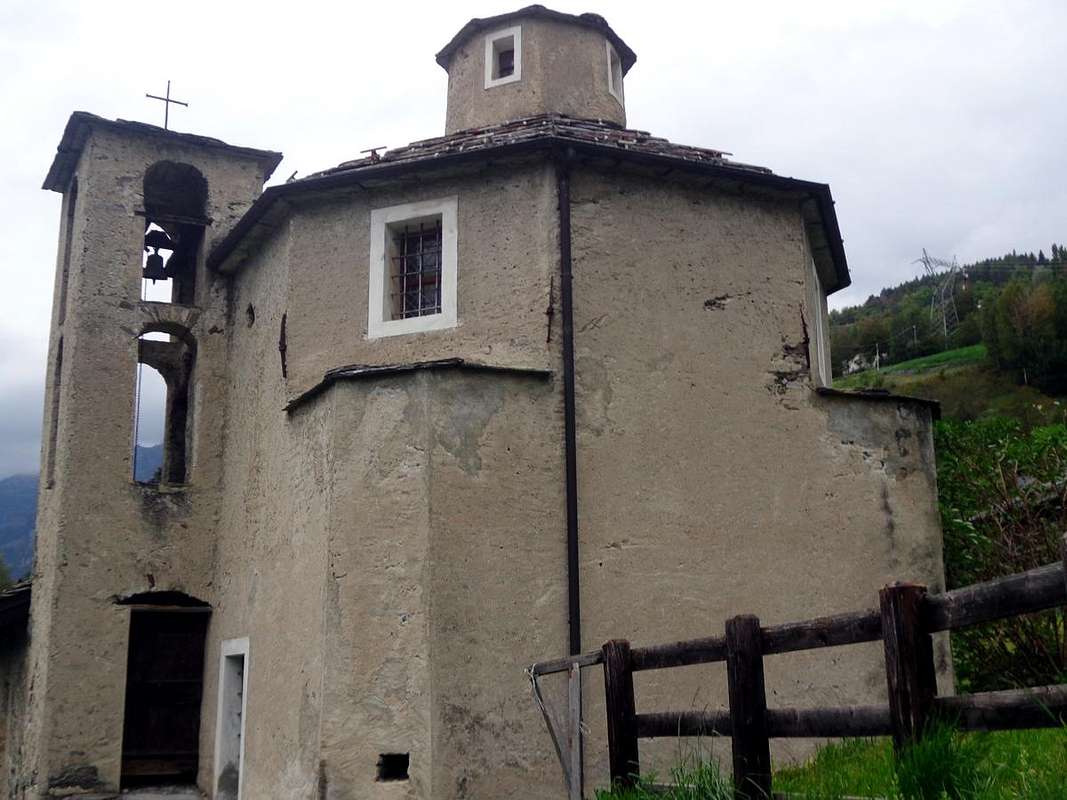
Ecours ancient Chapel of year 1200 just above La Salle Common
by Osw
Le valli hanno una Chiesa, un Castello, una Torre od entrambe ed una Montagna che le contraddistiguono. Caratteristica per ciascuna valente pur per la Valle.
Infatti ogni viaggio effettuato in ognuna d'esse presenta questo trinomio quasi indissolubile, poiché rappresenta la storia, la cultura e la tradizioni nei Secoli e nei Millenni per le prime, nonché l'Eternità per le ultime. Quando pensiamo ad una valle, subito ci viene in mente la sua montagna più elevata o più bella che inevitabilmente si erge a simbolo della medesima. Così per il Monte Bianco o le Jorasses a Courmayeur, Mont Velan e Grand Combins al Gran San Bernardo, Cervino in Valtournanche, Lyskamm ad Ayas, Monte Rosa nella Valle del Lys o di Gressoney, Gran Paradiso a Cogne e Valsavarenche, Grande Rousse in Val di Rhêmes, Sassière a Valgrisa e Rutor a La Thuile. Ma anche quelle
"minori" ostentano la loro montagna preferita come la
Grande Rochère, il Mont Fallère, Becche di Luseney e Viou, Monte Faroma, Becca d'Aver, Monte Zerbion, Becca Torché, Mont Glacier o Rosa dei Banchi, Punta Tersiva o Monte Emilius nelle rispettive vallate. Connubio che diventa ancora più caratterizzante se acciò aggiungiamo una Chiesa, una Torre o un Castello che le rappresentino sotto il profilo Religioso oppure quello araldico, scandendo la Storia e la Vita di quella Popolazione. Un aspetto che gli Alpinisti,
"frettolosi" di raggiungere la meta ignorano e che pure gli Escursionisti tralasciano preferendo la maestosità dei panorami o l'esclusiva ammirazione per la Natura. Cadon così nel dimenticatoio se non nell'oblio più totale le restanti osservazioni nonostante che queste possano costituire la chiave di volta per comprendere usi e costumi di una località, sempre un pò diversi l'un dall'altro. Una totale disattenzione per tutto ciò che ha tenuto in vita una montagna, una valle o semplicemente un paese. Una dimenticanza quasi incomprensibile quanto imperdonabile che pensiamo di recuperare almeno in parte riallacciando la vita delle montagne, sempre imperscrutabilmente ferme e piazzate al lor posto, con quella delle
Genti che vivono alla base delle medesime, qui nascendo, vivendo e concludendo il loro cammino ...
![]()
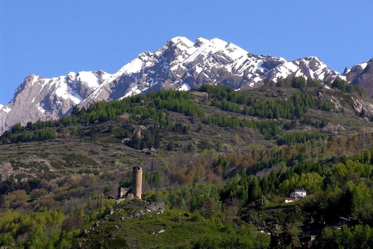
Tour Chatelard 1235 by Provost Grossy below Little & Grande Rochère
by Osw
Valdigne Getting There
By car:
- From TORINO, MILANO, etc: Motorway A5. Exit at IVREA or Quincinetto (PIEDMONT)
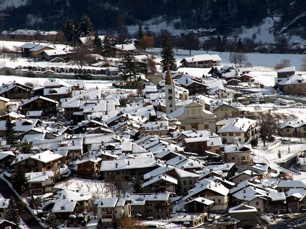
From IVREA Town: in West towards Pont Saint Martin, Donnas, Bard, St. Vincent, Châtillon, Nus, Quart, Aosta, Sarre, St. Pierre, Villeneuve, Arvier, La Salle Municipalities.
From Courmayeur Resort: in East towards Pré Saint Didier, Morgex, La Salle Municipalities.
![]()
From Courmayeur in East or by Aosta West towards La Salle and Morgex Communes through State Road n° 26
From La Salle 1001m), with Regional Road, towards Challancin (1610m), Cheverel, Morges (1829m), Planaval Hamlets (1750m); from this, through dirt road in North-northeast, passing Maison Blanche Pasture, to Rantin (2333m) and Bonalé (2340m) Alpages, in Upper Planaval Vallon.
From La Salle, with Regional Road, towards Challancin Village, Ponteilles (1741m), Arpilles (1862m) Pastures to Bard Pass (2178m) in Arpilles Conca.
From Morgex Commune (927m), with Regional Road in East up to the alternative 914 metres or from La Salle in West on the National Road No. 26 and from this with the Municipal in asphalt reach the small Hamlets of La Ruine-Dessous (923m), Château Pascal, La Ruine-Dessus; this towards Chatelard Castle with its Tower.
![]()
- From FRANCE: through the Mont Blanc Tunnel to Entrèves-crossroads to Vény/Ferret Valleys - Mountain Guides of Courmayeur - La Saxe Rock Gym - Courmayeur. By Little Saint Bernard Pass, closed since November until half May to La Thuile Valley - Pré Saint Didier - Courmayeur.
It is not necessary to take Motorway A5: you can drive on State Road n° 26, in the direction of AOSTA - IVREA - TURIN.
By plane:
- Aeroporto Internazionale "Corrado Gex" Saint Christophe (Aosta)
Some Walk & Hike
1)- Court de Bard from Challancin (La Salle Hamlet) dominating Chatelard Tower. From La Salle Municipality come up with the paved road to the overlying Fractions or small Villages of Croix des Prés
(989 m), Chatelard-Beauregard, Villarenson, Places then Cheverel (
(1486m;
*** Alternative Road here you get also with the Municipal Road passing farther East through the Villages Cours, Moyes, Cottin, Arbetey, Chaffiery and Places) and Challancin (
1610m; small parking lot on the side and at the end of the road) from this village up towards the Northeast through the path
n° 2 coming to Les Ponteilles Pastures
(1731m). Abandoning the left (North) trail that climbs
n° 2A to Les Ors, mostly in Southeast instead continue reaching Arpilles Pasture (
1862m; wooded fountain), take an immediate right into the path that goes into the woods and climb with short diagonal alternating hairpin bends that back with beautiful views of the iced North Face Mont Paramont which stands directly opposite. Crossed two small Torrents of Arpilles and Charvaz with a diagonal more moderate to the right to reach the Bard Pass
(2176m). From this worth making a detour to get to the South, crossing a vast grassy plateau and small rocks into the end always with the path, the bastion of the Court de Bard
(2262m) with great view of the Grivola
(3968m) and Grand Nomenon (
E/F; 1h'45/2h'15).
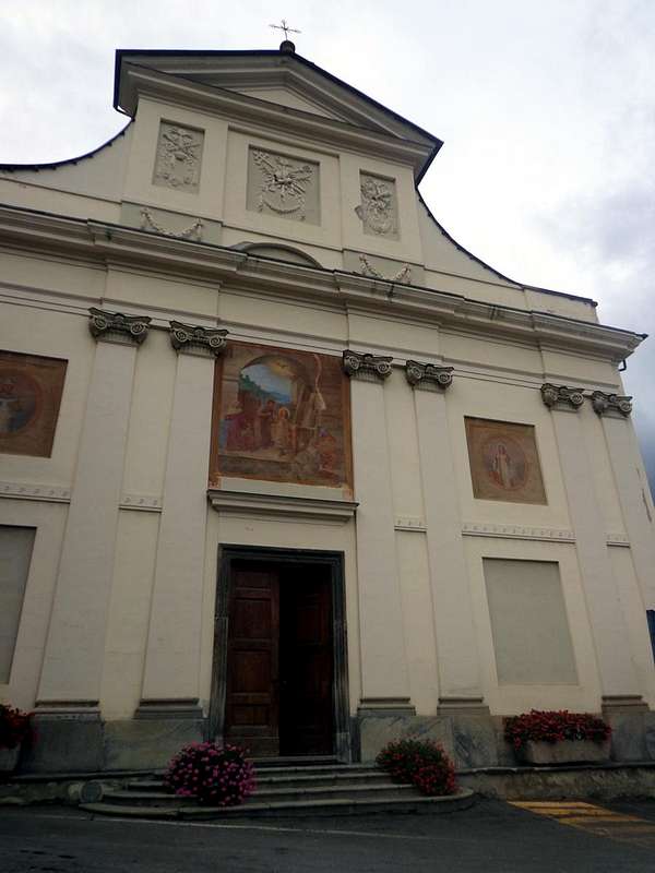
2)- Hike from La Salle towards Challancin Hamlet passing neighboring Ecours Chapel and De Cours Tower. From the central square of La Salle (1003m) and at the Parish Church of the Thirteenth Century up to the asphalt road towards the Northeast reaching the small Village of Ecours or Cours (1086m; ancient Chapel of
"Notre Dame de la Visitation" of 1200 with remarkable frescoes on the front side) at the eponymous tower or De Cours. On the Southern part of the Chapel goes up the trail
n° 2 with reports in yellow. Dubbed the same, continues shall be directed towards the Northeast protected by a wooden fence; left almost immediately to the right (East) branch
n° 1B dating back to the bottom of the valley reaching the Village Charvaz
(1518m), instead continue in the preceding direction to the one just above of Prarion
(1150m) and from this bend in Northwest reaching Moyes. From this last climb decisively towards the North and the Torrent des Arpilles up to the junction
1360 metres for Saint Pantaleon (1518m) and Chez-les-Coccoz
(1514m). A final short stretch leading to the Village Challancin whence the previous itinerary towards the Court de Bard (
1610 m;
E/F; 1h'20/1h'40).
3)- Hike from La Salle towards Charvaz Village with connection to Challancin Hamlet or towards Col de Bard. With the previous route to the junction above the Torrent des Arpilles; leaving left (North) the trail
n° 2 towards Challancin Hamlet, instead continue to the right (Southeast) reaching the Pastures of Fenêtre
(1148m), where on the other side also comes a farm dirt road concomitant with the trail
n° 1 from Villaret in valley floor
(862m) passing near the small Village of Montagnoulaz
(1594m). From these, rounding the watershed and addressing himself to the Northeast towards the Torrent de Charvaz reaching the village of the same name
(1518m), the Western slopes of the Court de Bard
(2262m). From this two possibilities:
a)- continue with
unnumbered path towards Northwest reaching Challancin (
E/F; 1h'30/1h'45);
b)- to the nearby junction at Torrent des Arpilles continue Eastward reaching at the first, through the path
not numbered, and then
n° 2 on the Col de Bard (
1610 m;
E/F; 3h'15/3h'45).
4)- Walk from La Salle Common towards the Chatelard Tower-Castle of 1235. Always by La Salle directed West-northwest reaching the locality of Croix des Prés
(984m) and from this flexing more in Northwest to get to the overhanging Village Chatelard (
1061m; St. Michel Church); with the trail
n° 5B quickly reach the Château with its distinctive round Tower positioned on top of a sharp rock that dominates the Valley of Baltea among the neighboring Municipalities of Morgex La Salle (
1170/1 m;
T/F; 0h'40).
5)- Walk by Morgex-La Ruine towards Tower-Castle Chatelard passing Château Pascal. By the Municipality of Morgex
(927m) to the East or to the West from La Salle Commune reach the alternative
914 metres on the National Road No. 26 and from this with the Municipal in asphalt reach the Hamlet of La Ruine-Dessous
(923m) and from this, past the Château Pascal, to that of Dessus. This last begins to the East-southeast the route
n° 5 which goes to Chatelard Tower (
T/F; 0h'40 from La Ruine-Dessus).
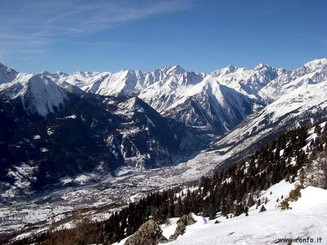
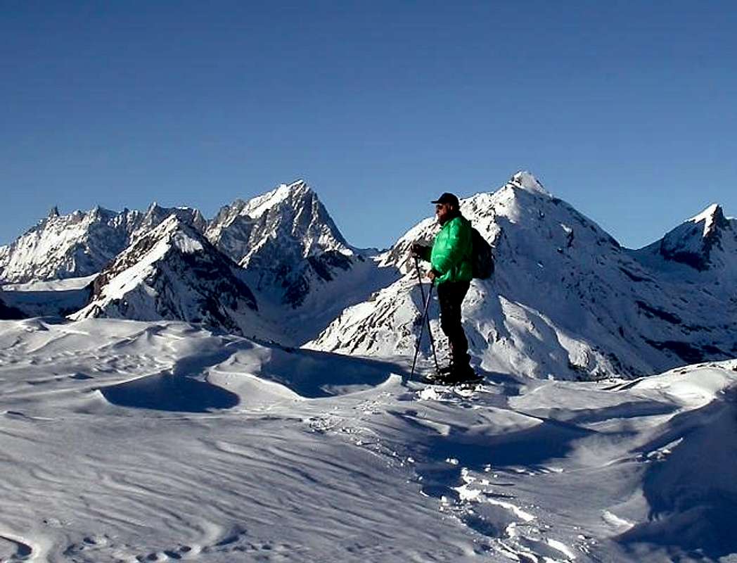
![]() Grandes Jorasses & Grande Rochère from Court de Bard or Southeast
Grandes Jorasses & Grande Rochère from Court de Bard or Southeast
by Antonio1)-
Court de Bard da Challancin (Villaggio di La Salle) dominando la Torre Chatelard. Dal Comune di La Salle salire con la strada carrozzabile verso le soprastanti Frazioni o Villaggetti di Croix de Prés
(989 m), Chatelard-Beauregard, Villarenson, Places e poi di Cheverel (
1486 m;
*** Strada Alternativa a questo punto s'arriva anche con la Strada Municipale passando più ad Est attraverso i Villaggetti di Cours, Moyes, Cottin, Arbetey, Chaffiery e Places) e Challancin (
1610 m; piccolo parcheggio in terra battuta sul ciglio ed al termine della strada), lasciando sulla sinistra la continuazione per Morge e Planavalle. Da questo villaggio salire verso Nordest tramite il sentiero
n° 2 arrivando all'Alpe Les Ponteilles
(1731 m). Abbandonando a sinistra (Nord) il sentiero
n° 2A che sale al Tramail Les Ors, continuare invece maggiormente a Sudest raggiungendo gli Alpeggi di Arpilles (
1862 m; fontana nel tronco); prendere subito a destra il sentiero che addentrandosi nel bosco e risale con brevi diagonali alternati a stretti tornanti che lo risalgono con bella vista sulla ghiacciata Parete Nord del Mont Paramont stagliantesi proprio affronte. Attraversati i due piccoli Torrents des Arpilles e Charvaz con un diagonale più moderato verso destra si raggiunge il largo Col de Bard
(2176 m). Da questo merita effettuar digressione a Sud per raggiungere, attraverso un vasto plateau erboso e roccette nella parte terminale, sempre con evidente sentiero, l'ampio spalto della Court de Bard
(2262 m) con gran vista su Grivola
(3968 m) e Nomenon (
E/F; 1h'45/2h'15).
2)- Escursione da La Salle verso il Villaggio di Challancin passando nelle vicinanze della Cappella e Torre di Ecours o De Cours. Dalla piazza centrale di La Salle (1003 m) e presso la Chiesa Parrocchiale del XIiI° Secolo salire con la strada in asfalto verso Nordest raggiungendo il Villaggetto di Ecours oppure Cours (
1086 m; antica Cappella di
"Notre Dame de la Visitation" del 1200 con notevoli affreschi sulla facciata frontale) presso l'omonima Torre o di De Cours. Sul lato Meridionale della Cappella parte il sentiero
n° 2 con segnalazioni in giallo. lo stesso, doppiata la medesima, si indirizza verso Nordest protetto da una staccionata in legno; lasciata quasi subito sulla destra (Est) la diramazione
n° 1B che risale verso il fondo del vallone raggiungendo il Villaggio di Charvaz
(1518 m), continuare invece in direzione di quello appena soprastante di Prarion (1150 m) e da questo piegare a Nordovest raggiungendo Moyes. Da questo ultimo rientrare decisamente verso Settentrione ed il Torrent des Arpilles fino al bivio
1360 metri per Saint Pantaleon (1518 m) e Chez-les-Coccoz (1514 m); un ultimo e breve tratto conduce al Villaggio di Challancin donde al precedente itinerario (
1610 m;
E/F; 1h'20/1h'40).
3)- Escursione da La Salle verso il Villaggio di Charvaz con collegamento a quello di Challancin oppure al Col de Bard. Con il precedente itinerario fino al bivio soprastante il Torrent des Arpilles; lasciando a sinistra (Nord) il sentiero
n° 2 in direzione di Challancin, continuare invece a destra (Sudest) raggiungendo gli Alpeggi di Fenêtre
(1148 m), dove dal lato opposto arriva anche una poderale concomitante al sentiero
n° 1 dal Villaret
(862 m) passando nei pressi del Villaggetto di Montagnoulaz
(1594 m). Da questi, doppiando lo spartiacque ed indirizzandosi a Nordest verso il Torrent de Charvaz raggiungere l'omonimo villaggio
(1518 m), alle pendici Occidentali della Court de Bard. Da questo due possibilità:
a)- continuare con sentiero
non numerato verso Nordovest arrivando a Challancin (
E/F; 1h'30/1h'45);
b)- al soprastante bivio presso il Torrent des Arpilles proseguire verso Oriente raggiungendo per mezzo del sentiero dapprima
non numerato e successivamente
n° 2 il Col de Bard (
2176 m;
E/F; 3h'15/3h'45).
4)- Passeggiata da La Salle alla Torre-Castello di Chatelard del 1235. Sempre da La Salle indirizzarsi ad Ovest-nordovest raggiungendo la località di Croix des Prés
(984 m) e da questa flettendo più verso Nordovest arrivare al Villaggio di Chatelard (
1061 m; Chiesa di St. Michel); con il sentiero
n° 5B in breve tempo raggiungere il Château con la sua caratteristica Torre arrotondata posizionata al di sopra di un aguzzo roccione che domina la Valle della Dora trai vicini Comuni di Morgex e La Salle (
1170/1 m;
T/F; 0h'40).
5)- Passeggiata da Morgex-La Ruine alla Torre-Castello di Chatelard del 1235 passando dal Château Pascal. Dal Comune di Morgex
(927 m) verso Est oppure da La Salle verso Ovest raggiungere il bivio
914 metri sulla Strada Statale n° 26 e da questo con la Municipale arrivare alla Frazione di La Ruine-Dessous
(923 m) e da questa, oltrepassando il Château Pascal, a quella di Dessus. Da quest'ultima parte verso Est-sudest il sentiero
n° 5 che arriva alla Torre Chatelard (
T/F; 0h'40 da La Ruine-Dessus).