overcoming with narrow and steep bends reaches the rocky promontory which is inherent in the Lac Mort (
).
that is directed to the Northeast reaching the Torrent de Méod at Vulmian Pasture
; another farm dirt road dates back more to the North, reaching two unnamed pastures
from Verrogne below Village. From this quickly towards the Alpe di Loé (
).
).
: reached from East by Sarre Common and West by St. Nicolas, go up into the homonyn vallon through the trail
; this a dirt road, always concomitant with the same path, take to the Northeast at junction
preceding Plan Neyret. From here through a
small path towards East-southeast crossing Bois de Verrogne and reaching the altitude
sited on South Crest. Following North the same and bypassing the rocky quota
from which the narrow track, progressively more steep, arrives on the small wooded Cross of the little Summit.
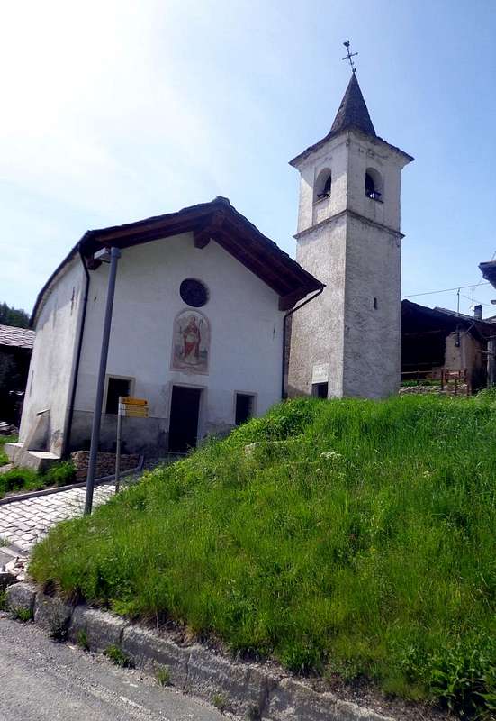
, in East of Verrogne, and neighboring the Village Homené Dessous reach from the following alternative (
; little Church) the above Hamlet of Homené Dessus; from this part a farm dirt road that in short time reach with the large winding road
the above Village Combellin, semi destroyed and burned after a hard thunderstorm. This part in Northwest through a long diagonal route
that, bypassing a semi dry brook and crossing the above Bois de Verrogne, rejoining the preceding itinerary nearby the Plan Neyret.
: beyond the village and with opposite direction goes up through the grassy fields an
trace that reaches the forest; through the same a small path arriving at a little depression followed by a rocky band, climbing the same reach the South Crest in altitude of
and on watershed towards previous via.
is wedged Northward reaching the adjacent Valley of Clusellaz above Thouraz Village. From here at the locality of
reaches the Plan de Golette. A series of very tight bends snail-shaped door, always along the watershed with path so tiring that fascinating, in the Bois du Plan d'Arsine reaching the
.
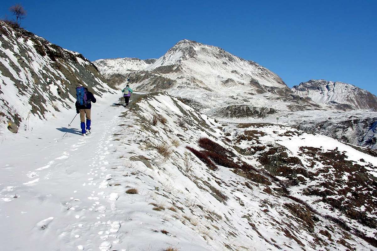
if made by snowshoe, also in relation to the real conditions of the same).
1)- Al Lago Leysser nel Vallone di Leysser attraverso il Laghetto, la Sella ed il Mont Joux partendo dal Villaggetto di Vens all'ingresso nel Vallone di Vertosan.
Da Saint Nicolas salire con la strada carrozzabile verso le soprastanti Frazioni o Villaggetti di Fossaz
(1242 m), Clavel, Cerlogne
(1580 m) fino a raggiungere Vens (1750; + Chiesetta). Da qui parte verso Nordovest il sentiero
n° 19 che sale alla Sella di Joux
(1930 m) oltrepassando appena prima l'omonimo laghetto
(1907 m), collocato subito ai piedi del Mont Joux (
1978 m;
T/F; 1h'10/1h'30). Dal colletto, lasciata a sinistra la poderale che scende verso il lungo Vallone di Vertosan, continuare invece maggiormente a Settentrione con quella concomitante al precedente sentiero raggiungendo gli Alpeggi di Bettex al di sotto della Punta Aouilletta
(+; 2616 m); da questi, flettendo più a Nordest raggiungere il punto
2041 metri, oltrepassando i Torrenti Rognette e Leysser, dove la stessa termina e prosegue solo il sentiero. Raggiunta la quota
2106 metri nel Pian di Leysser in breve si raggiunge l'omonimo lago collocato sotto il Monte Rosso di Vertosan (
2418 m;
E/F; 1h'30/1h'45 dalla Sella di Joux;
2h'45/3h'15 complessivamente).
2)- Escursione da Vetan-Dessus all'Alpi Grandes Arpilles sotto la Punta Leissé e Chaz Creuse ai piedi dell'Aouilletta o a quest'ultima direttamente da Fossaz.a)- Lasciata ad Ovest la diramazione verso Vens, continuare invece verso destra raggiungendo Grand Sarriod, Gerbore, Vetan Dessous e Dessus
(1445 m, 1633 m, 1670, 1737 m). Da quet'ultima parte una strada poderale verso Settentrione che in alcuni tratti concomitante al sentiero
n° 13, passando per l'Alpe di Thoules
(1944 m), raggiunge quella di Grandes Arpilles (
2091 m;
T/F; 1h'15/1h'30) alle pendici Meridionali della Punta Leissé
(2771 m). Lasciata a destra la diramazione che porta tramite il colletto
2206 metri nel Vallone di Verrogne, si continua invece con la strada poderale verso Occidente raggiungendo dapprima il bivio
2237 metri presso l'Alpe Pesse Damon; da questo, flettendo più a Nordovest verso il valloncello del Gaboé si raggiunge lo omonimo torrent. Guadato il medesimo in breve tempo si raggiunge la piccola, caratteristica nonché isolata Alpe di Chaz Creuse o Tsecreousa (
2398 m;
E/F; 0h50/1h10 da Grandes Arpilles;
2'10/2h'30 da Vetan Dessus), ai piedi del Versante Est di Punta Aouilletta
(+; 2616 m).
b)- Anche dal Villaggio di Fossaz
(1242 m) si può raggiungere l'Alpe di Chaz Creuse
(2398 m) ai piedi del Versante Sudest della Aouilletta
tramite due differenti possibilità:
b1)- salire verso Settentrione con il sentiero
n° 26, passando per l'Alpe Darbelley
(1566 m); da questa tramite un sentierino
non numerato si può raggiungere facilmente il piccolo e boschivo
Mont Greume (
1821 m;
TE/F; 1h'45/2h'15). A questo si può arrivare anche dal Villaggio
Gerbore (1633 m) con partenza da Oriente sopra St. Nicolas con il sentiero
n° 17. Quindi con il medesimo, attraversando verso Ovest il Torrent Gaboz e passando per l'Alpe Letanaz Dèsott, si raggiunge quella di Barmaveraz
(1894 m) Qui abbandonando il medesimo che, continuando verso Ovest perviene alla Sella di Joux, raggiungere al tornante
2077 metri con il sentiero
n° 29A la soprastante strada poderale da Letanaz Dèsott
(1860 m). Sempre con la medesima, dopo avere oltrepassata l'Alpe Setseun
(2153 m) si perviene a quella di Chaz Creuse (
2398 m;
E/F; 3h'30/4'00).
b2)- Dal Villaggio di Fossaz, raggiungibile con Strada Regionale sia dal Comune di St. Nicolas (Est) che da quello d'Avise, pervenire con la stessa verso Ovest al tornante
1278 metri appena oltre il Torrent Gaboz; da qui, lasciando a sinistra la strada asfaltata che scende ai Villaggi di Charbonnière
(1287 m) e di Cerellaz
(1254 m) nel sottostante Comune di Avise, continuare con il sentiero
n° 27 raggiungendo i Villaggetti di Clavel e Vens
(1480 m, 1697 m). Appena prima di raggiungere questo ultimo abbandonare il medesimo e, tramite un sentierino
non numerato attraverso la
"Comba di Gollie" raggiungere l'Alpeggio di Barmaveraz, donde al precedente itinerario (
E/F; 3h'15/3'30)
3)-/3bis Escursione da Vetan-Dessus verso l'Alpe Thoules con collegamento al Vallone di Verrogne e Alpe Les Crottes donde al Lago Morto ai piedi del Fallère. 3a)- Con il precedente itinerario per Chaz Creuse, a destra (Est) del Torrent de Vetan, fino all'Alpe di Grandes Arpilles e da questa a destra (Est-nordest) fino al colletto
2206 metri soprastante il Torrent de Méod all'ingresso dell'adiacente Vallone di Verrogne. Da questo continuare sempre tramite la strada poderale, concomitante al sentiero
n° 13, passando ad Est dello Spallone Orientale della Punta Leissé
(2617 m) e lasciando in basso il fondovallone, fino a raggiungere una presa dell'acqua. Lasciando a sinistra (Ovest) il sentiero
n° 13A verso il soprastante Colle di Paletta
(2707 m), continuare invece con un sentierino
non numerato, lasciando a destra i cinque Lacs des Grenouilles
(2383 m, 2363 m) raggiungendone un successivo
(2377 m) appena prima di giungere all'Alpe Les Crottes dalle caratteristiche stalle a forma semicircolare (
2385 m;
E/F; 2h'00/2h'30).
3b)- Oppure, sempre da Vetan, raggiungere la località Granzettaz, posta in piccolo promontorio boschivo subito ad Oriente (
1780 m; mini parcheggio). Da questa parte a Nord il sentiero
n° 12 che, oltrepassata un'alpe innominata
(1799 m), raggiunge il Torrent Isollettaz e subito dopo l'Alpe Thoules dalla quale con sentiero
n° 13 al Grandes Arpilles.
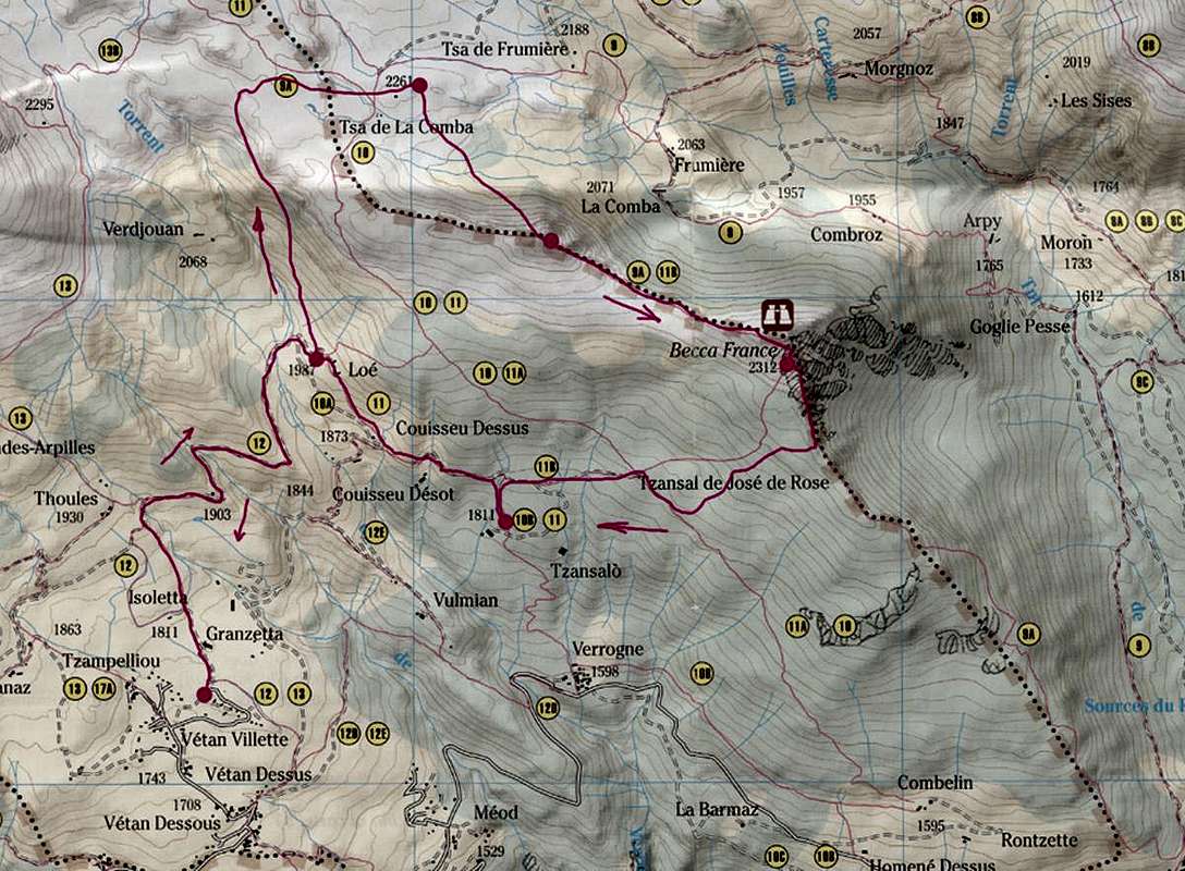
Lago Morto (2634 m) oppure Col Fenêtre (2728 m)
![]()
Below P. Leissé to (right) Verrogne Vallon, Lake Morto & Fenêtre Hill3bis)- Da Les Crottes lasciare a sinistra il sentiero
n° 13 che, percorrendo il fondovalle, raggiunge il Col Fenêtre (
2728 m;
EE/F; 1h'15/1h30); prendere invece un sentierino
innumerato sulla destra che superando con stretti e ripidi tornanti raggiunge il promontorio roccioso nel quale é insito il Lac Mort (
2634 m;
EE/F; 1h'00/1h15).
4)- Passeggiata da Vetan-Dessous alle Alpi Vulmian, Loè e Verdjouan o dal Villaggio di Verrogne verso le Alpi Champ Salò e Loé, tutte nel Vallone di Verrogne.4a)- Dal sottostante Villaggio di Vetan-Dessous
(1670 m) prendere la strada poderale concomitante con il sentiero
n° 12D/12E che si indirizza a Nordest raggiungendo il Torrent de Méod presso l'Alpe Vulmian
(1644 m); un'altra poderale risale più a Settentrione raggiungendo due pascoli innominati
(1768 m, 1856 m) e, dopo avere attraversato il Torrent de Verrogne, il bivio
1896 metri all'incrocio con il sentiero
10A/11 proveniente da Verrogne. Da questo in breve tempo all'Alpe di Loé (
1986 m;
T/F; 0h'50/1h'10).
4b)- O salendo direttamente da Verrogne
(1598 m) con il sentiero
n° 12D/12E che, oltrepassata l'Alpe Champ Salò
(1812 m), si ricongiunge al precedente (
T/F; 1h'00).
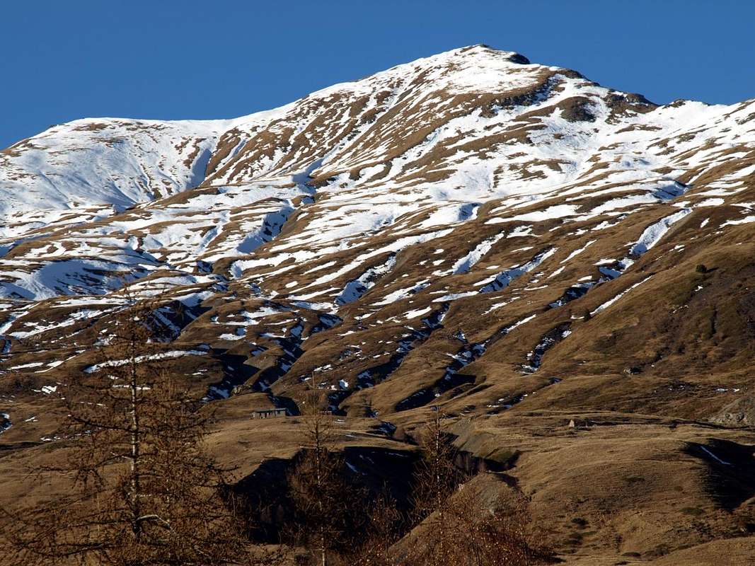
![]() Becca France SW Slope & S Crest or Normals over Bois de Verrogne
Becca France SW Slope & S Crest or Normals over Bois de Verrogne
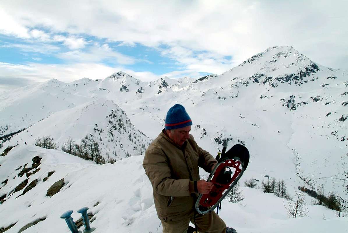
5)- Escursione, anche tramite racchette da neve, partendo dai Villaggi di Verrogne, Homené Dessous o Dessus e Bellun tutti posizionati sulla "Via dei Salassi".
5a)- Da Verrogne (1598 m): raggiungibile da Est dal Comune di Sarre e da Ovest da St. Nicolas, salire nell'omonimo vallone tramite il sentiero n° 10A/11 fino all'Alpe Champ Salò (1812 m); da questa una poderale sempre concomitante al medesimo sentiero porta verso Nordest al bivio 1885 metri precedente il Plan Neyret. Da qui con un sentierino non numerato ad Est-sudest ed attraversando il Bois de Verrogne si perviene alla quota 2114 metri sulla Cresta Sud; seguendo verso Nord la medesima e oltrepassata la rocciosa quota 2179 metri si raggiunge la forcella 2247 metri dalla quale la traccia, diventando progressivamente più ripida, raggiunge la piccola Croce in legno della Cima.
5b)- Da Homené Dessous, Dessus e Combellin (1451 m, 1493m, 1586 m): sempre dalla "Strada dei Salassi", ad Est di Verrogne, e nei pressi del Villaggio di Homené Dessous si raggiunge dal successivo bivio (1493 m; Agriturismo "Les Ecureils"; Chiesetta) Homené Dessus; da qui parte una poderale che in breve tempo raggiunge con il largo tornante 1556 metri il soprastante Villaggio di Combellin, semidistrutto poiché andato a fuoco dopo un temporale. Da questo parte con lungo diagonale a Nordovest il sentiero n° 10A/11 che, oltrepassato un torrentello semiessiccato ed attraversando il soprastante Bois de Verrogne, và ricongiungendosi al precedente percorso presso il Plan Neyret.
Variante: dietro al villaggio e con direzione opposta sale attraverso i prati una traccia non numerata e neppur segnalata raggiungente il bosco; attraverso questo un sentierino arriva ad una piccola depressione seguita da fascia rocciosa, scalando la quale si arriva alla Cresta Sud a quota 1832 metri e sullo spartiacque all'itinerario precedente.
5c)- Da Bellun (1392 m): inoltre é possibile salire dal viciniore Villaggio di Bellun, posto là dove la "Strada dei Salassi" si incunea verso Nord raggiungendo il Vallone di Clusellaz. Da qui presso il "Gros Berrio" risale attraverso il Bois de Bellon il sentiero n° 9A raggiungente il Plan de Golette. Una serie di tornanti molto stretti a forma di chiocciola porta, sempre percorrendo lo spartiacque con percorso tanto faticoso quanto affascinante, dentro il Bois du Plan d'Arsine raggiungendo quota 1832 metri della precedente Variante.
(EE/F; 2h'30/3'00 rispetto alle varie località di partenza; EE/A/F+1h'30/2h00 in più se effettuate con racchette da neve, anche in rapporto alle condizioni della medesima).
![]()
Bca France over Verrogne, Combellin & Homené Villages to Fallère Group