
|
|
Mountain/Rock |
|---|---|
|
|
33.93185°N / 111.45213°W |
|
|
Gila & Maricopa |
|
|
Hiking |
|
|
Spring, Summer, Fall, Winter |
|
|
5027 ft / 1532 m |
|
|
Overview
Located alongside the Beeline Highway (AZ-87) about an hour northeast of Phoenix, Iron Dike is a notable peak featuring rocky slopes and old stone walls on its flat summit. The peak lies less than a half-mile from the highway, directly across from Mount Ord. The climb is short and the views are nice in all directions.
Getting here is easy, and there are parking and camping options nearby. It’s a good peak to combine with others, such as Mount Ord or Pine Butte, while in the area. A hike up and down Iron Dike usually takes just a little over an hour.
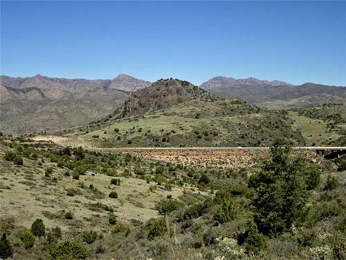
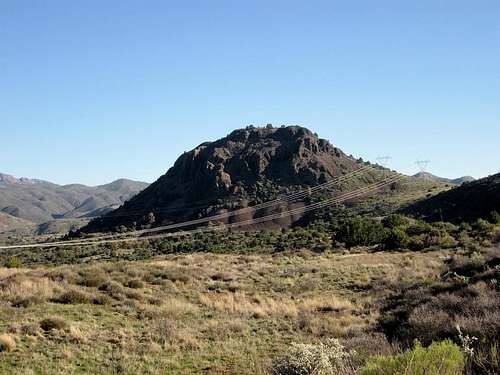 Iron Dike as seen from the south
 Getting There
From Phoenix, head east to the Beeline Highway (AZ-87). Options include following Shea Boulevard, McDowell Road, or the Loop-202 Freeway, all of which connect to AZ-87. Proceed northbound about 40 miles to where the highway reaches a highpoint. This the Gila-Maricopa County line and you’ll see a sign for Mount Ord (to the right) and Sycamore Creek (to the left). Iron Dike is the rocky summit to the left, north and west of the highway. Mileages will vary depending on how you get there. You’ll know you’re there when you see the signs. If you miss the turn-off, then the highway drops steeply to the east side of the Mazatzal Range. Turn left onto the road toward Sycamore Creek. There are parking pullouts almost immediately. Pick any one.
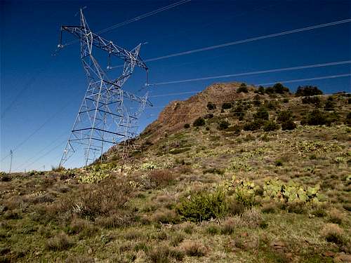 Power lines near the base of the peak.
 Route
From where you park, walk back to the highway, then walk north along the shoulder of the southbound lanes for less than a half mile. Cars will whiz past you the whole time. Walk to a dirt track that comes off the highway and makes a sharp left turn, going up a hill. Follow this track up the hill, through a wire gate, then past a stock tank. Soon you’re at the east base of Iron Dike, near some power lines. At some point, leave the track and barge uphill to the top. The slopes are brushy and rocky, with lots of agave. The brush can be thick, but the climb is fast. The highest point is somewhere up here. Walk around until you feel you got it.
On the south end of the summit are stone walls about 2-3 feet high, running about 40 feet, then angling for another 40 feet. Inside is a stone circle about 15 feet in diameter. The walls are just stones fitted together. There was no evidence of their purpose. It seems unlikely ranchers would do this since this seems an odd place to want to corral animals. Nearby Indian ruins are usually not as sloppy as these walls are. I don’t know their history.
The one way hike is about a mile with about 500 feet of gain.
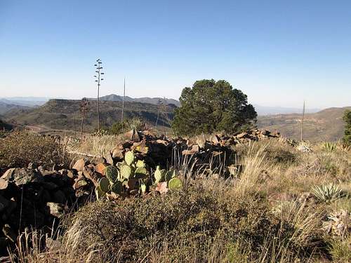 Rock walls Rock walls |
 More rock walls More rock walls |
Red Tape
There is no red tape. This is Forest land so be mindful of fire restrictions, and always leave the place clean when you leave.
When to Climb
The hike is short enough so that it could be done any time of year. When it’s very hot, it could be a sweaty hike, but temperatures this high usually don’t top out much beyond 100 F. In winter, Mount Ord and surrounding areas may get snow, which could impact access for a few days at a time. Spring and Fall would be ideal.
Brush is thick, so look out for the critters, especially the hissing ones with no legs.
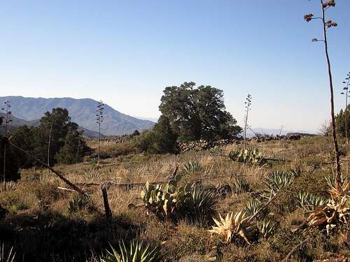
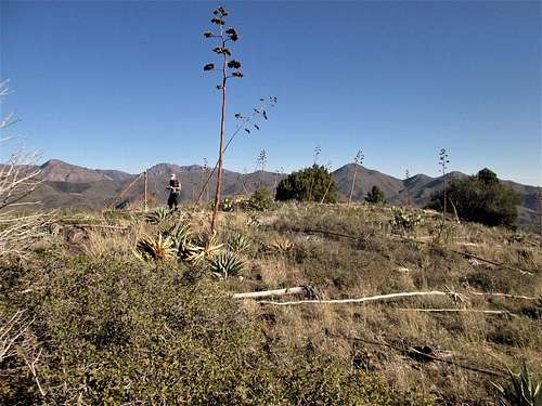 The summit is up here somewhere.
Camping
You can camp along the forest roads here. There are pullouts to choose from. Better spots may be closer down by Sycamore Creek.
External Links
 Iron Dike AZ