
|
|
Mountain/Rock |
|---|---|
|
|
47.13120°N / 121.4446°W |
|
|
King |
|
|
Summer, Fall, Winter |
|
|
5121 ft / 1561 m |
|
|
Overview
Kakawak Peak
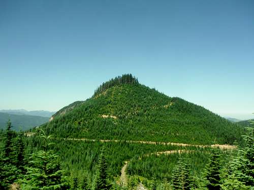
Kakawak Peak , located northeast of Mount Rainier is not a very well known summit. At only 389 feet of prominence it misses being an official summit by Washington State standards by 11 feet. That being said this is an interesting summit that sits right between a couple more popular hiking destinations in Kelly Butte, Colquhoun Peak and Pyramid Peak. When looking at it from the east this summit appears to have most of its trees cut off with exception to the summit which is forested but still has some views through the trees looking north. Literally twenty feet from the summit to the west though is a clearing in which there are good views to the north and excellent views to the south. Mount Rainier shows up very strongly along with the sharp cliffs of Colquhoun Peak as well.
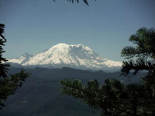 Mount Rainier to the south | 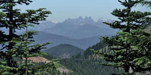 Overcoat and Chimney Rock in the north |
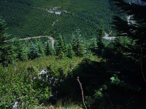
Part of the lack of popularity of this summit is that the only way to get to the summit is by bushwhacking to it. Most people who summit Kakawak Peak do it from its eastern side where one can bushwhack through 10 foot tree seedlings for about 500 feet to the summit. I have also read of people bushwhacking from Colquhoun Peak but I did not see a good slope to bushwhack/ scramble from. I recommend that if you were to do this peak you should one of the neighboring peaks as well such as Pechugh Peak or Kelly Butte. Though this peak is well worth it, the lack of effort or time it takes to get to summit should free someone up to get multiple peaks on their trip.
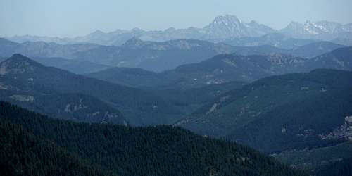 Mount Stuart from Kakawak | 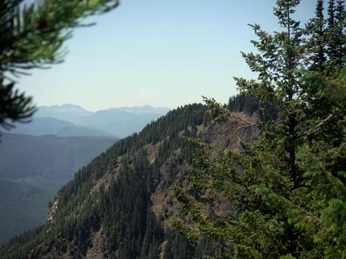 Colquhoun Peak's eastern cliff from Kakawak |
Getting There
From Route 410 in Greenwater: Just south of Greenwater turn east on NAD 70 and stay on it roughly 7.5 east. Stay on the road until you run into NAD 7030 where you want to head north (left) and follow the road as it rises up all the up to a gap where there will be a T way intersection. You want to head make a right onto Route 7060. Roughly two mile on the road you will run into a gap between Kakawak Peak and Pechugh Peak. Park here by the fire pits.Route

Map of the route
This is a very basic bushwhack from the parking turnout from the gap between Pechugh Peak and Kakawak Peak. From the parking area head west straight up between where the two roads intersect. If you choose going up the two road your bushwhack will be much thicker and more intense. The gap between the two roads has the least amount of vegetation and towards the bottom it actually has a bit of a boot-path. Bushwhack all of the way up to the true summit. 20 feet beyond the true summit there will be an opening with excellent views of Rainier to the south and decent views to the north.
 Bushwhack terrain up from the eastern side | 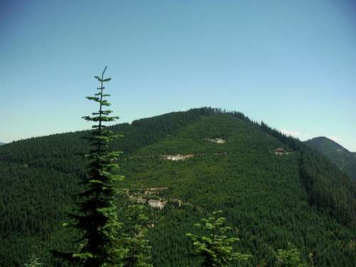 Pechugh Peak from Kakawak |
Red Tape
NO PERMITS REQUIRED!When to Climb
It is best to climb here when the forest road is open. This is a bushwhack in summer so maybe some snow may help but only if the road is open. Fall might be the best time because some of the vegetation will be changing color and temperatures will be cooler. I did it on a hot day in summer and this trip was unpleasant for me. .Camping
Apparently the parking area here isn't a bad place to camp judging by the fire rings. It would make an excellent place to view Rainier and the surrounding areas.External Links