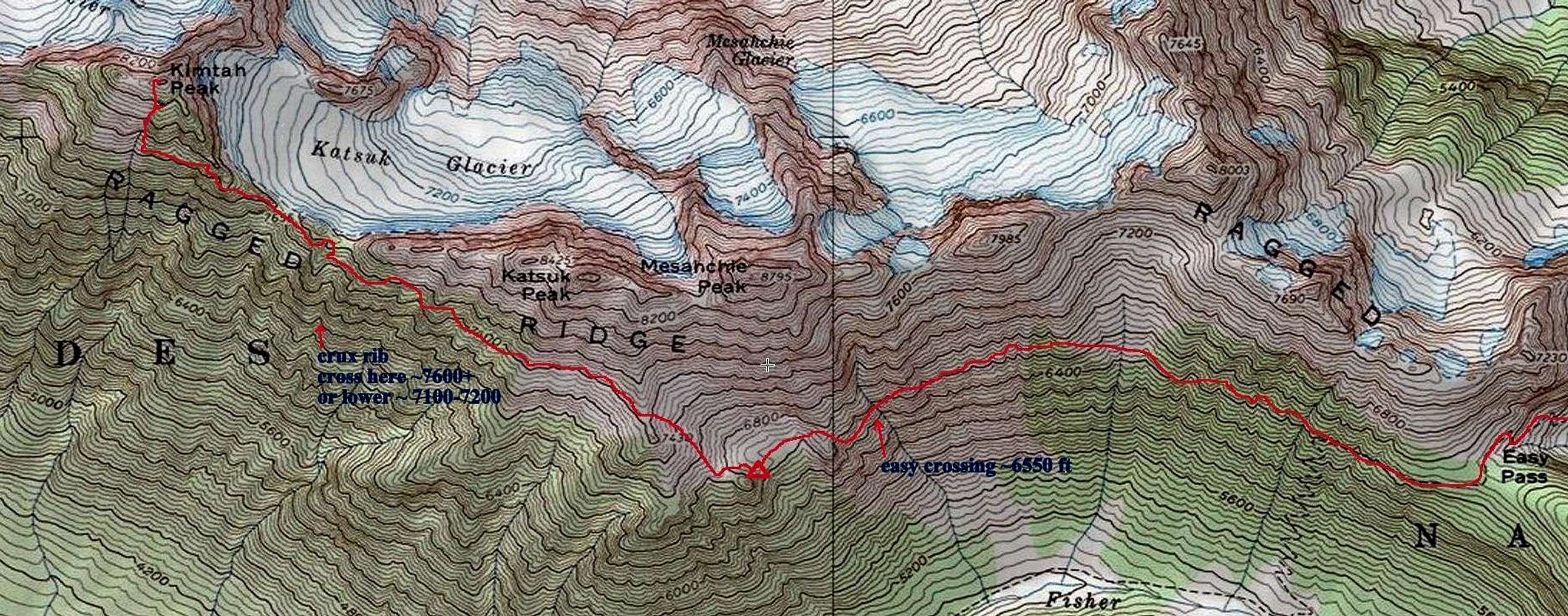
This outlines the traditional Ragged Ridge traverse option for the summit of Kimtah Peak. This map is hand drawn based on my GPS track. Your route will certainly vary based on your route finding.
From Easy Pass I would recommend following the trail down until it makes it's first switchback and take off cross country from there. Some will recommend to take off cross country straight from Easy Pass (which I did on my trip) but side hilling sucks. Do yourself a favor and take as much trail as you can.
You'll basically want to stay between 6400 and 6800 ft as you traverse across towards camp. Use your route finding skills to find the best route. The most difficult part comes at the last large water crossing before camp where a nice easy trail like crossing can be found at ~6550 ft. From the crossing traverse a bit more until you are forced uphill by a cliffy rib. This will spit you out above the camp basin and you'll have to descend a bit from there to reach camp.
From camp, make your way to the saddle north of point 7430. If you are blocked by snow continue north until you find passage. From the saddle head cross country staying around 7400 - 7600 ft. The traverse is an endless maze of ribs and gullies and you will cross easily over a dozen ribs on the traverse. Route finding here is critical although for the most part if you spot a route that looks like the easiest route but aren't sure if it will go, chances are it goes. The most difficult part is a rib about half way through. You'll know you are getting close when you see the Grotesque Gendarmes. This rib is very cliffy and there are two ways to go.
You can descend to ~7200 ft and look for two ledges that offer passage seen
here and on topo
here.
This route shows a high route. Once you reach the rib ascend towards the saddle where you can crest the rib before dropping down into the next gully. From here look for the obvious red ledge that crosses at the base of a couple of the Grotesque Gendarmes before traversing across ~7800 feet through a cliffy cave section and finally to a couple gullies that will lead you to the summit.


