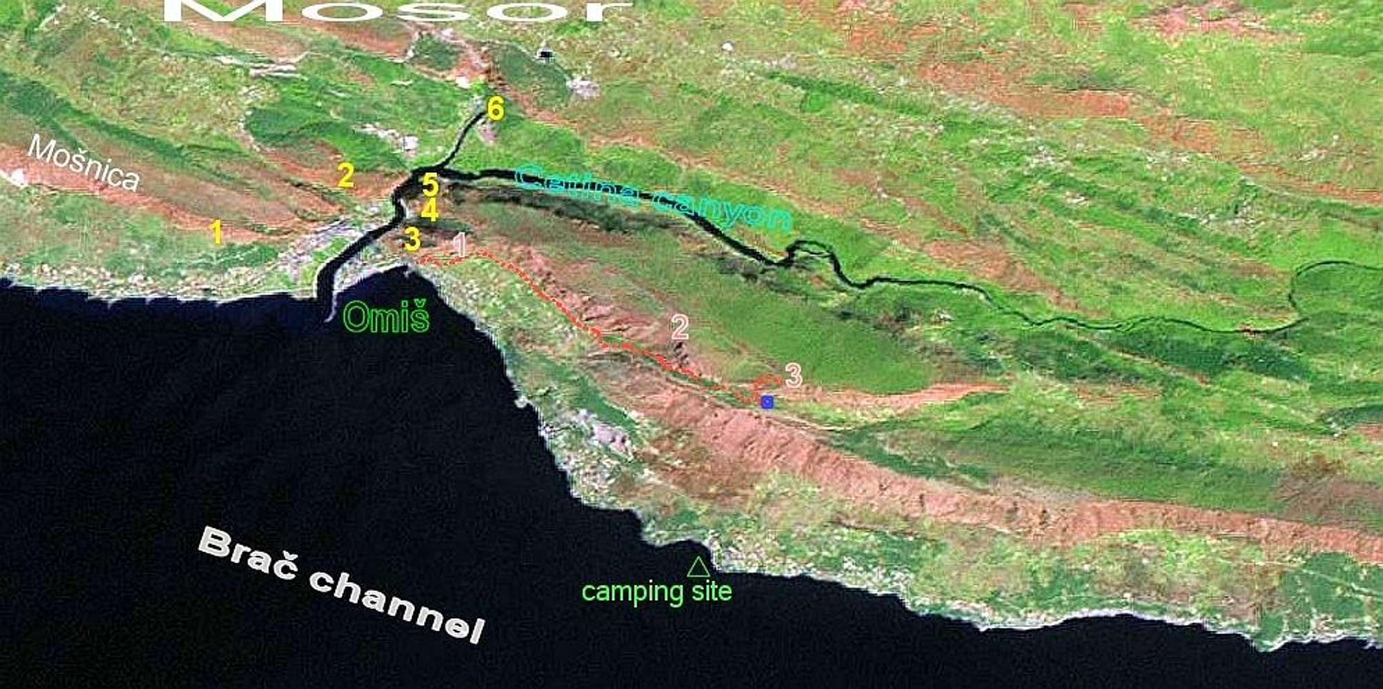
Satellite view of Omiska Dinara.
Red numbers:
1. Fortica peak with Fortisa fortress
2. Strazina
3. Kula peak. Nearest water source indicated with blue circle. The bivouac is next to the water source
Red dotted line indicates normal route
Yellow numbers are climbing crags:
1. Stomorica
2. Babjaca
3. Peovo
4. Planovo
5. Babina bara
6. Ilinac
(2 campinggrounds near Stomorica and Babjaca not indicated by mistake)


