Comments
No comments posted yet.
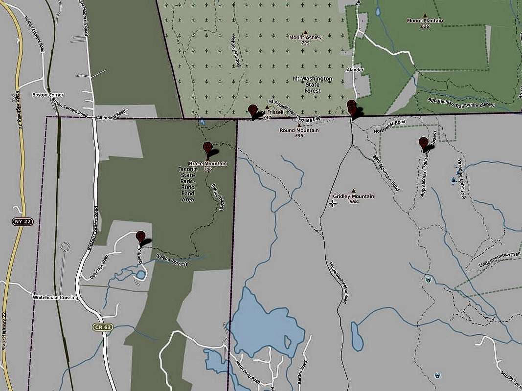
On the map above C is the highpont of CT, B is Bear Mountain (the highest mountain in CT), A is Brace Mountain, and D is the trail head for Brace. One can hike from Brace to the tri-state (NY, CT, MA) corner then to highpoint of CT and then to Mount Frissells summt. E= parking for Mt. Frissell, F = parking for Bear Mountain. Highway 41 and Mount Riga State Park are located to the right (east) point B off of this map. State Highway 22 is located west of point D.
This photo was added to the Mount Frissell (Southwest Shoulder) page. See https://www.summitpost.org/mount-frissell-southwest-shoulder/152455

You are at the First Image | You are at the Last Image |

