
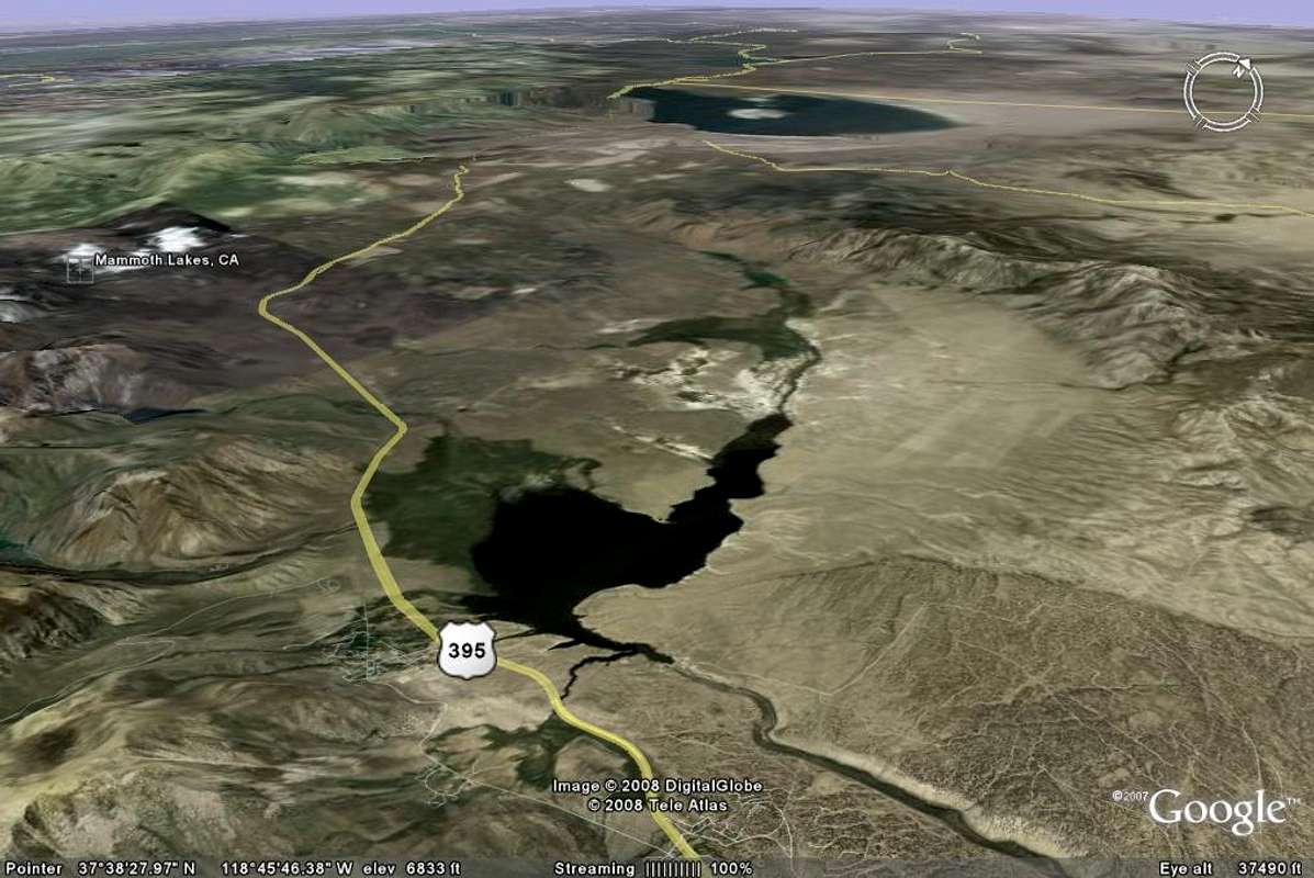
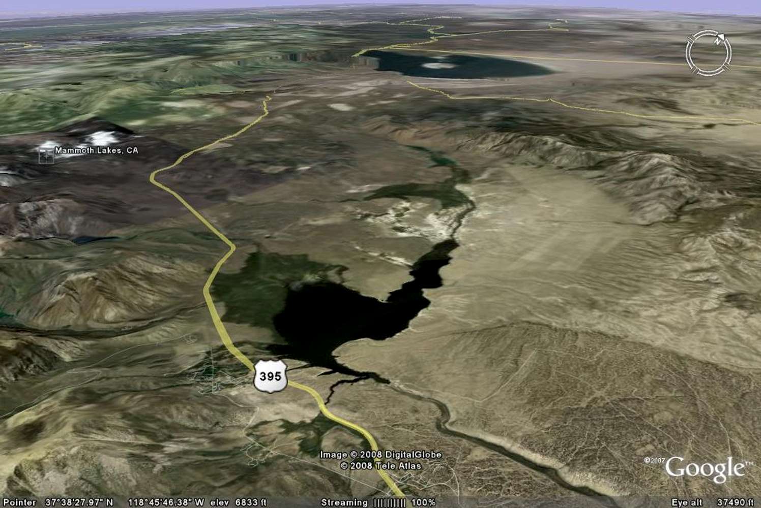
Long Valley Caldera - Google Earth Rendition
Google Earth image of the Long Valley Caldera. Lake Crowley is to the south, Glass Mountain range to the east, High Sierra Nevada to the west, and Mono Lake further north. Highway 395 cuts through the western portion of the Caldera. The Owens River Gorge cutting through the Bishop Tuff south of Lake Crowley is also visible.


