Toggle navigation
Mountains
Routes
Images
Trip Reports
Forum
What's New
People
Areas & Ranges
Articles
Trailheads
Canyons
Huts & Campgrounds
Albums
Logistical Centers
Fact Sheets
Lists
Custom Objects
Gear
Plans & Partners
WELCOME TO SUMMITPOST
SIGN IN
REGISTER
Longs Peak
Additional Parents
Image
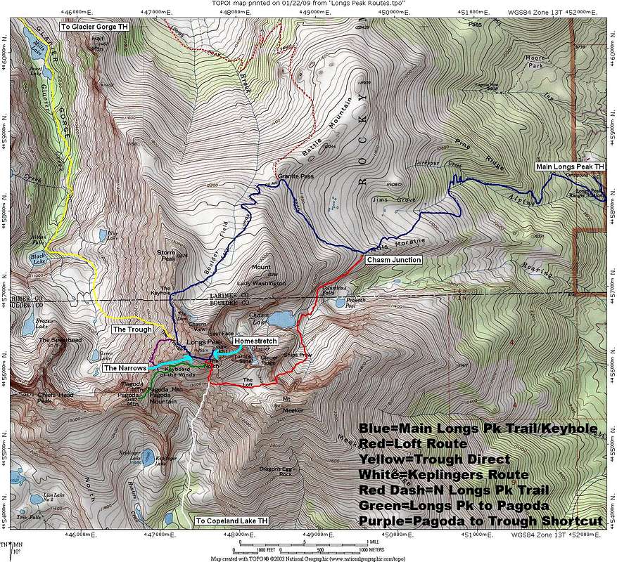
Longs Peak TOPO Overview
View High-Resolution Image
Longs Peak TOPO Overview
This map is meant as an overview of the non-technical routes up Longs Peak. Routes are approximate and may vary slightly, but the general routes are correct. Please let me know if anything is amiss.
« PREV
NEXT »
thebeave7
on
Jan 22, 2009 4:38 pm
Comments & voting
Other parents
Lat/Lon:
40.25474°N / 105.61582°W
Image Type(s):
Hiking
Image ID:
482664
5016 Hits
0
% Score
0
Votes
Log in to vote
Comments
No comments posted yet.
to post!
Don't have an account?
Longs Peak
(Mountain/Rock)
« PREV
Viewing
#1070 of 1098
GALLERY
NEXT »
thebeave7's Image Gallery
« PREV
Viewing
#375 of 376
GALLERY
NEXT »
×
You need to login in order to vote!
User Name
Password
Remember me
Forgot your password?
Log me out when I close my browser.
Keep me logged in all the time.
sign in as a user
Don't have an account?
Register now for FREE
Rating available
Suggested routes for you
People who climb the same things as you
Comments Available
Create Albums
Register Here


