Toggle navigation
Mountains
Routes
Images
Trip Reports
Forum
What's New
People
Areas & Ranges
Articles
Trailheads
Canyons
Huts & Campgrounds
Albums
Logistical Centers
Fact Sheets
Lists
Custom Objects
Gear
Plans & Partners
WELCOME TO SUMMITPOST
SIGN IN
REGISTER
Gunsight Peak
Additional Parents
South Ridge
Image
Malad Valley
View High-Resolution Image
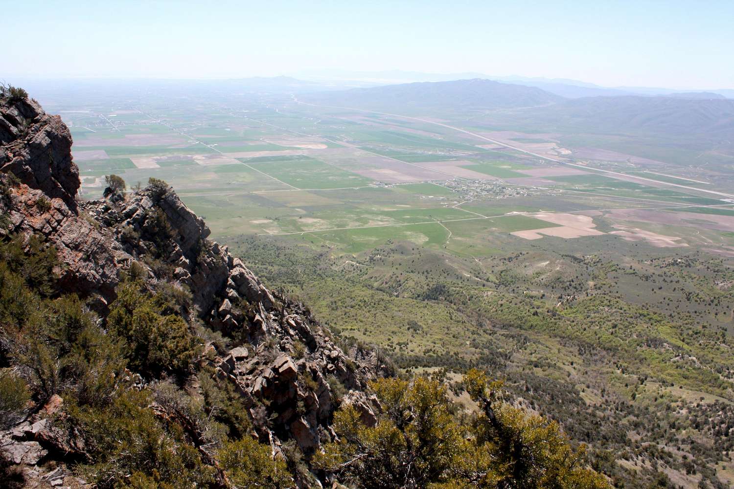
Malad Valley
Malad Valley seen from the south ridge of Gunsight Peak. The town of Plymouth and Interstate-15 can be seen below. The Samaria Mountains are located on the other side of the valley
« PREV
NEXT »
mountaingazelle
on
May 21, 2009 3:35 am
Comments & voting
Other parents
Lat/Lon:
41.92434°N / 112.12719°W
Image ID:
515039
2688 Hits
83.69
% Score
17
Votes
Log in to vote
Comments
No comments posted yet.
to post!
Don't have an account?
Gunsight Peak
(Mountain/Rock)
« PREV
Viewing
#10 of 24
GALLERY
NEXT »
mountaingazelle's Image Gallery
« PREV
Viewing
#333 of 515
GALLERY
NEXT »
South Ridge
(Route)
Loading....
×
You need to login in order to vote!
User Name
Password
Remember me
Forgot your password?
Log me out when I close my browser.
Keep me logged in all the time.
sign in as a user
Don't have an account?
Register now for FREE
Rating available
Suggested routes for you
People who climb the same things as you
Comments Available
Create Albums
Register Here


