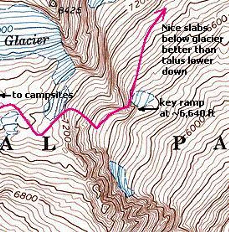
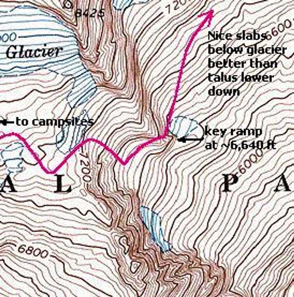
Map showing the best late-season* route from the Sahale Arm camp area to Horseshoe Basin. Skirt below the ice patch at 7,200 ft, take a ramp eastward below it, turn right (downhill) before crossing the major stream, continue down west of the stream all the way to talus (Class 3), cross the stream at about 6,700 ft, then contour across and down to the last bushes on the buttress on the other side to find a key ledge that drops around the buttress at ~6,640 ft.
*In snowier conditions the downclimb might be merely a steep snow descent.


