|
|
Mountain/Rock |
|---|---|
|
|
36.17314°N / 121.62772°W |
|
|
4031 ft / 1229 m |
|
|
Overview
Marble Peak is an undistinguished bump on a coastal ridge in Big Sur. It is notable for being the destination point of the Marble Peak Trail, which starts at Arroyo Seco and traverses the heart of the Ventana Wilderness. It was used by the Esselen tribe and homesteaders to reach the coast.
There are also shorter approaches from Highway 1 to the west, as described below.
A dirt road, the North Coast Ridge Road, passes within a few hundred feet of Marble Peak, but is closed to vehicles and bicycles.
Getting There
Enter "Arroyo Seco Campground" in Google maps.
Or - use the directions from the Los Padres Nat'l Forest website: https://www.fs.usda.gov/recarea/lpnf/recarea/?recid=81844 "Direction from nearest town: From the South (Paso Robles), take Highway 101 to the Arroyo Seco exit into Greenfield. Make a left turn on Elm St. Go west to Arroyo Seco Road and turn left; Recreation Area is at the end of Arroyo Seco Road, approximately 20 miles. "From the North, take Highway 101 just pass Soledad. Go west to Arroyo Seco Road and turn left; Recreation Area is at the end of Arroyo Seco Road."
Beyond the day-use area and the campground, there is a small parking lot at the trailhead. $10 per day as of March 2018. On busy summer weekends, all available parking might be full and you will be turned away. However - if it's hot enough for people to play in the river, it's probably too hot to hike the Marble Peak trail anyway.
Route
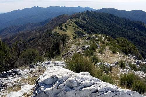
From the east, starting at Arroyo Seco - here is a photo-rich description by Leor Pantilat: https://pantilat.wordpress.com/2015/01/20/marble-peak-50k/ Round trip to the peak and back is approximately 30 miles, with roughly 8,000' of climbing. View of the trail from the peak:
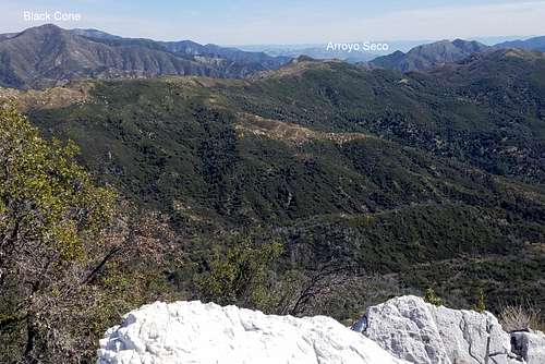
View South from Marble Peak
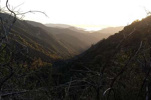
View down the Willow Creek drainage:
Willow creek has countless crossings, none of them bad. Here's a typical one - after heavy rains, in March 2018:

Brush grows back quickly and can make the trail difficult or impassible if not cleared. For recent trail conditions, check: http://www.ventanawild.org/forums/ventana-wilderness-trails/255
From the west - Highway 1 - - Description by Pantilat: https://pantilat.wordpress.com/2014/05/01/boronda-ridge-marble-peak/ - Bob Burd trip report: http://www.snwburd.com/bob/trip_reports/timber_top_1.html
Red Tape etc
Here is the Forest Service site for the Ventana Wilderness: https://www.fs.usda.gov/recarea/lpnf/recarea/?recid=10974 Briefly - You need a permit for any kind of fire, including a stove. You don't need a permit for hiking and camping. You can't use any vehicle with a motor, or anything with wheels.
Bear sightings are rare in Big Sur and Ventana: http://www.ventanawild.org/forums/ventana-discussion/314 However raccoons and other animals will be happy to steal your food if unprotected. I keep mine in my tent, along with my dog.
The area supposedly hosts the largest population of mountain lions in the U.S. They'll see you, but you almost certainly won't see them.
Far more dangerous than lions or bears are deer ticks - common in this area. Consider spraying your pant legs with permethrin, and check your body for attached ticks at least once per day.

Blackflies aren't deterred much by insect repellent, but a wide-brimmed hat will help keep them out of your eyes and ears - they don't like to hover under the brim
Poison oak is one of the most common plants and is impossible to avoid. However brushing against it shouldn't be a problem as long as the leaves are undamaged - the irritating agent, urishiol, is in the sap, not on the surface. But best to wear long pants and don't touch the outer fabric until washed.
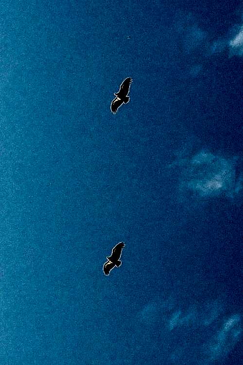
Marble Peak is California Condor territory. The day I climbed, a flock of seven of them spent a half-hour circling us.
When to Climb
Spring and Fall. Spring has more running water, but some streams are perennial - click on the campsite logos in the link below. Winter if you're prepared for long cold nights and freezing rain. Summer is too hot and buggy.
Camping
There are several campgrounds along the route, some of which are listed on the topo map. Each has just a single fire ring, but some have additional spaces for tents. Detailed descriptions can be found by clicking on the campsite logos at: http://bigsurtrailmap.net/trailconditionsmap.html
External Links etc
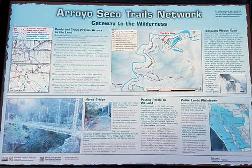
Info board at trailhead: