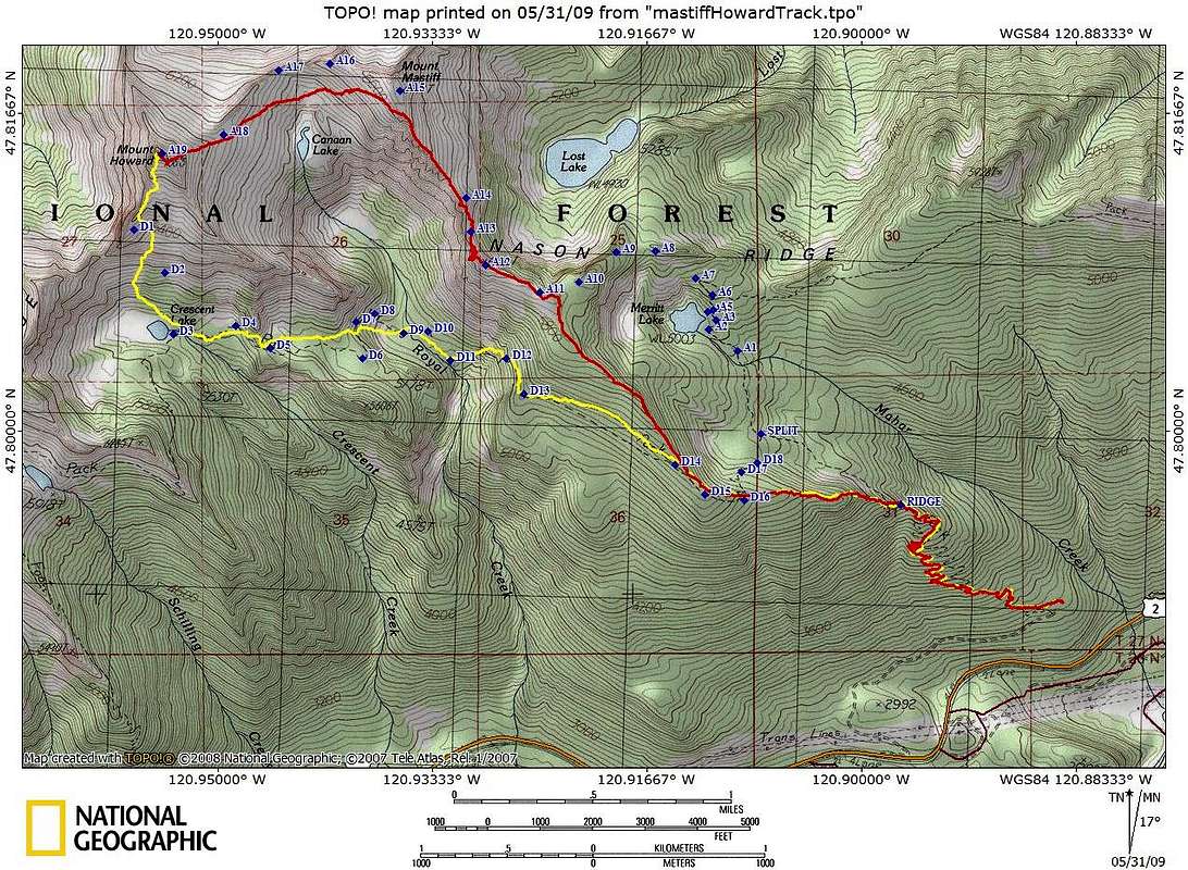
We ascended the red route (5.8 mi, 4950' gain) and descended the yellow (5.75 mi, 800' gain). The wayoints were obtained from a trip report posted on http://nwhikers.net on 5/08, and the TOPO! USGS map. The nwhiker's route goes around Merritt Lake, and stays higher on the ridge between Mastiff and Howard.
We left the trail at 4400', and followed the ridge that leads to the Mastiff summit. We were totally on snow around 4800'. The
crux is a section somewhere between A12 and A13 where you need to descend down from the ridge a bit. (Looking at the pictures, maybe you can follow the ridge more than we did?) Once the snow is gone, negotiating the ridge is considered a straight-forward scramble, rated "T3" by Goldman. With snow, it's more like a "T5" snow scramble, and as the snow melts and becomes a veneer over the rock, it becomes interesting "
mixed scrambling." We dropped down to the left of the Mastiff-Howard ridge, and then
climbed up to the summit ridge. After our second lunch on the Mt Howard summit, we headed down the SSW ridge looking for the best way to descend to
Crescent Lake. The beta warned of
cliff bands, but it wasn't too steep (maybe 30-35 deg so an axe is needed), and we just followed the easiest way down. The cliffs below D13 are visible from D11, which is where I had a brief "on crap" moment, "We have to climb way up there!?" From D13, you traverse until intersecting your ascent tracks. 10.5 hrs car-to-car, 12 mi, 5750' gain


Comments
Post a Comment