Toggle navigation
Mountains
Routes
Images
Trip Reports
Forum
What's New
People
Areas & Ranges
Articles
Trailheads
Canyons
Huts & Campgrounds
Albums
Logistical Centers
Fact Sheets
Lists
Custom Objects
Gear
Plans & Partners
WELCOME TO SUMMITPOST
SIGN IN
REGISTER
Mid Tallac trail as it follws...
View High-Resolution Image
Mid Tallac trail as it follws...
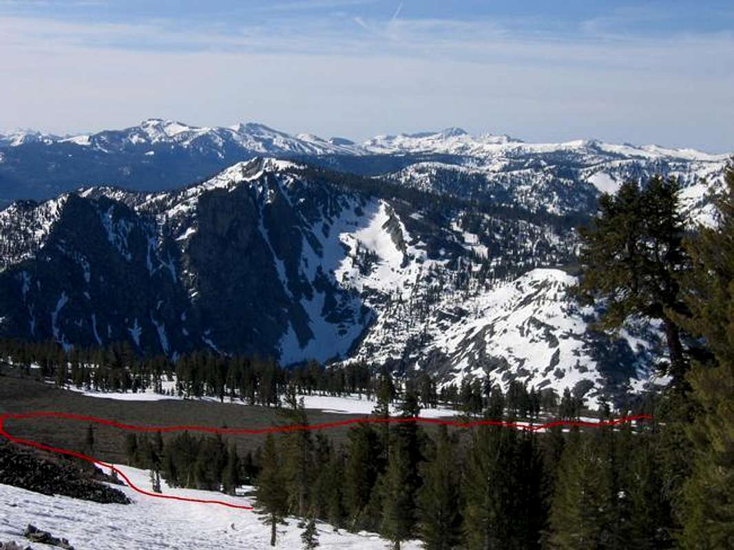
Mid Tallac trail as it follws through the flat section from the split towards Gilmore Lake. Looking SE towards Angora peak. Note the "Halls of God" Ski/board decent visible on angora peak. Photo take May, 2004
« PREV
NEXT »
mountainvoodoo
on
Oct 19, 2004 11:32 am
Comments & voting
Other parents
Lat/Lon:
38.90610°N / 120.0978°W
Image ID:
74476
3686 Hits
72.08
% Score
2
Votes
Log in to vote
Comments
No comments posted yet.
to post!
Don't have an account?
Mount Tallac
(Mountain/Rock)
You are at
the First
Image
Viewing
#1 of 1
GALLERY
You are at
the Last
Image
mountainvoodoo's Image Gallery
« PREV
Viewing
#26 of 33
GALLERY
NEXT »
Mount Tallac
(Mountain/Rock)
Loading....
Mid Tallac Trail
(Route)
Loading....
×
You need to login in order to vote!
User Name
Password
Remember me
Forgot your password?
Log me out when I close my browser.
Keep me logged in all the time.
sign in as a user
Don't have an account?
Register now for FREE
Rating available
Suggested routes for you
People who climb the same things as you
Comments Available
Create Albums
Register Here


