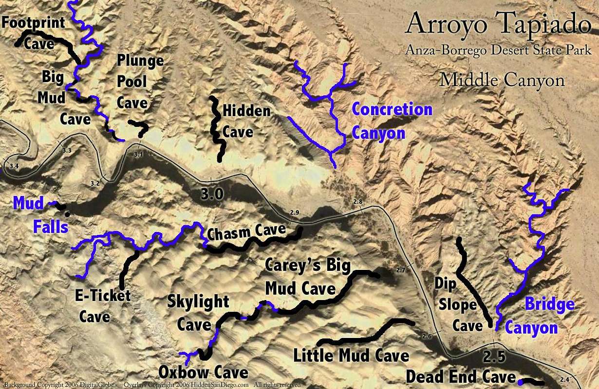
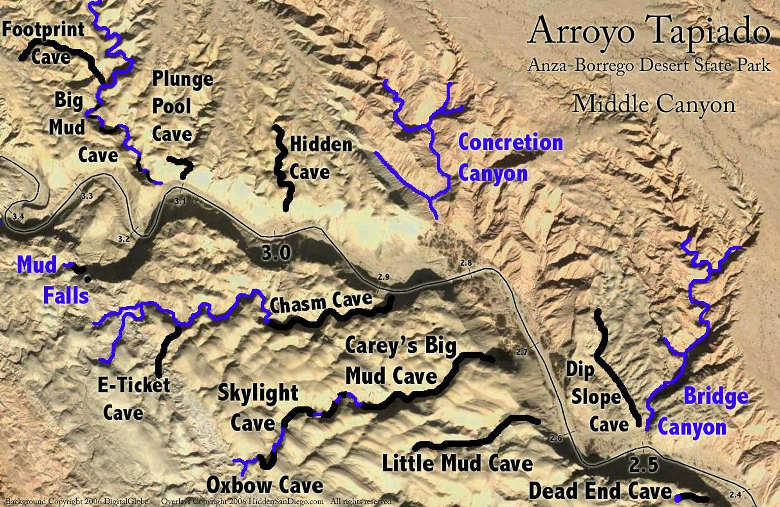
This series of maps shows the location and name of different cave systems in the Arroyo Tapiado. The labeled distances reflect how far each entrance is from the mouth of the canyon.
Original image taken from Abandoned San Diego. Posted with Patrick's permission.


