


-
 2864 Hits
-
 82.48% Score
-
 15 Votes
|
|
Route |
|---|---|
|
|
45.69266°N / 7.46782°E |
|
|
Note
|
La montagna chiama i suoi figli, ed essi rispondono fedelmente al suo appello… Osvaldo Cardellina, Diario alpinistico, 1964-65 Page texts: @ OsvaldoCardellina "Osva", passed away on May 2, 2022. Page owners: Christian Cardellina e Osvaldo Cardellina. Any updates from September 12, 2022: Antonio Giani, page administrator, friend and climbing companion. Testi della pagina: @ OsvaldoCardellina "Osva", scomparso il 2 maggio 2022. Proprietari pagina: Christian Cardellina e Osvaldo Cardellina. Eventuali aggiornamenti dal 12 settembre 2022: Antonio Giani, amministratore della pagina, amico e compagno di salite. |
Overview
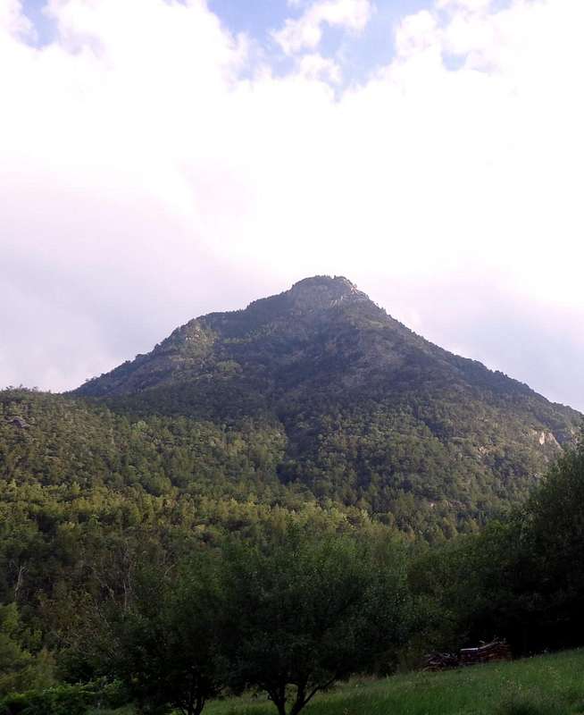
This little Summit is part of the small Subgroup of Grand Avert (2.991m), constituting the last Summit to Northwest over the entrance in the Valley or Vallon of St. Marcel, while on the other side (Northeast) it plunges with a short but steep rock face in the direction of the underlying Villages Seissogne (1.066m) and Plout (968m). The other sides (Eastern and Western) are almost entirely by dense forest that ends on the small rocky promontory of the Summit. A small rocky saddle (2.260m) separates it from the overlying Mount Corquet (2.531m), which is connected via the Ridge North-northwest of the latter. This Summit is rarely visited by the one that the other side, lavishes beautiful views at the middle of the Central Valley of Dora Baltea and beautiful shots of eye of the Chain of Great Roise (3.357m), which is located directly opposite from the Punta Ilario Antonio Garzotto (3.274m) towards Becca and Tour de Salé (3.187m, 3.073m) above the more than overhanging Eastern wild Vallon Arpisson, projected toward the bottom of the Valley of St. Marcel. Best known for its iron mines and copper than for hiking, also because its paths, as easy, are not always straightforward to track and follow.
![]()
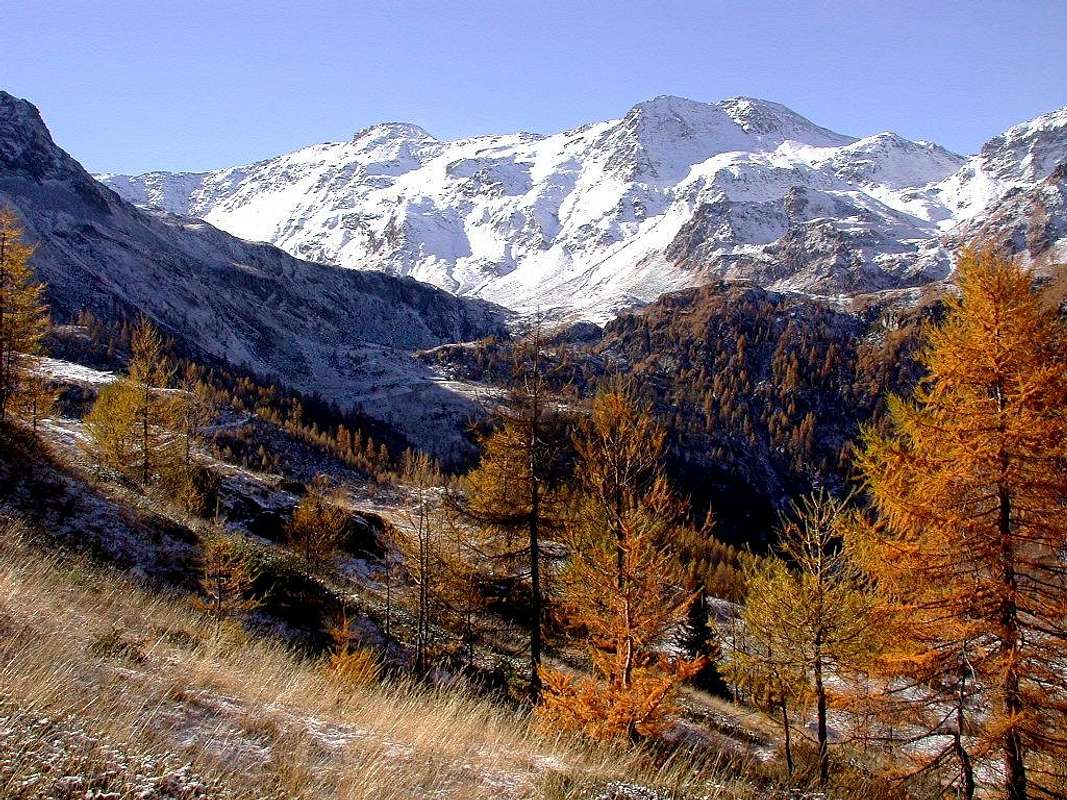
Watershed between St. Marcel (West) & Fènis-Clavalité Valleys from Petit Avert (2.946m) towards Mont Roux (2.277m; left), by Zed
Little hatch Topographical and Toponymical: from the Grand Avert (2.991m), the highest elevation of this small Subgroup, down to the Northeast a long ridge, which would separate the Valley of Fénis-Clavalité East to those overlying the Saint Marcel Commune below the homonym valley. In fact from Punta Tersiva (3.515m) down a watershed that, after forming the Punta del Tessonet and the two Averts ((Great and Little; 2.991m, 2.946m), reaches Mont Corquet (2.531m); here the same splits sending a branch North-northeast toward the Torasse (1.895m) and Mont St. Julien (1.834m), which ends above the Village of Fénis, and a second North-northwest reaching the Mont Roux (2.277m) with its mines iron and copper, and just above the plateau of Druges at an average altitude of about 1.600 meters. The specification of Mont Roux (Red Mountain) St. Marcel is necessary to distinguish it from the many existing homonyms in Aosta Valley (see the Mont Roux in Champorcher, also and always it placed in an area minerararia), although to tell the truth this name is little known even to the local inhabitants used to identify and call this area as "Les Druges or Servette Zone".
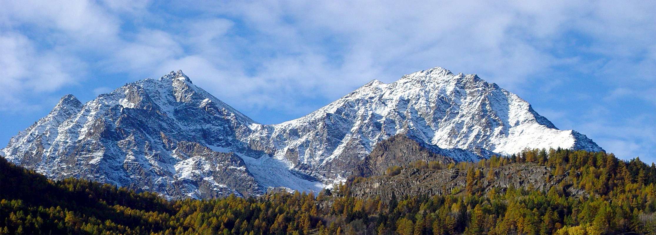
Mont Corquet (2.531m) and Mont Roux (2.277m; right) above Corquet Forest with Northeastern view, by Antonio
Little hatch Topographical and Toponymical: from the Grand Avert (2.991m), the highest elevation of this small Subgroup, down to the Northeast a long ridge, which would separate the Valley of Fénis-Clavalité East to those overlying the Saint Marcel Commune below the homonym valley. In fact from Punta Tersiva (3.515m) down a watershed that, after forming the Punta del Tessonet and the two Averts ((Great and Little; 2.991m, 2.946m), reaches Mont Corquet (2.531m); here the same splits sending a branch North-northeast toward the Torasse (1.895m) and Mont St. Julien (1.834m), which ends above the Village of Fénis, and a second North-northwest reaching the Mont Roux (2.277m) with its mines iron and copper, and just above the plateau of Druges at an average altitude of about 1.600 meters. The specification of Mont Roux (Red Mountain) St. Marcel is necessary to distinguish it from the many existing homonyms in Aosta Valley (see the Mont Roux in Champorcher, also and always it placed in an area minerararia), although to tell the truth this name is little known even to the local inhabitants used to identify and call this area as "Les Druges or Servette Zone".
 |
Anche questa Cima fà parte del piccolo Sottogruppo del Grand Avert (2.991 m), costituendo l'ultima Cima verso Nordovest sopra l'ingresso nella Valle o Vallone di St. Marcel, mentre sul lato opposto (Nordest) precipita con una breve ma ripida parete rocciosa in direzione dei sottostanti Villaggi di Seissogne (1.066 m) e Plout (968 m). Gli altri versanti (Orientale ed Occidentale) sono quasi esclusivamente da una fitta foresta che termina sul piccolo promontorio roccioso della Sommità. Una piccola sella rocciosa (2.260 m) lo separa dal soprastante Mont Corquet (2.531 m), al quale é collegato tramite la Cresta Nord-nordovest di questo ultimo. Sommità raramente visitata sia tramite lo uno che lo altro versante, dispendia belle vedute sulla parte mediana della Valle Centrale della Dora Baltea nonché splendidi colpi di occhio sulla Catena della Grande Roise (3.357 m), che si erge proprio dirimpetto a partire dalla Punta Ilario Antonio Garzotto (3.274 m) fino alla Becca e Tour de Salé (3.187 m, 3.073 m) queste ultime sovrastanti il più che selvaggio Vallone Orientale dello Arpisson proiettato verso la parte inferiore della Valle o Vallone di St. Marcel. Più conosciuto per le sue miniere di ferro e rame che non per le escursioni.
![]()
Tersiva, Tessonet and Grand Avert downhill to Mont Roux, by Gangolf Haub
Breve tratteggio Topografico e Toponomastico: dal Grand Avert (2.991 m), massima elevazione di questo piccolo Sottogruppo, scende verso Nordest una lunga cresta che, atta a separare il Vallone di Fénis-Clavalité Oriente da quello soprastante il Comune di St. Marcel con l'omonimo Vallone. Infatti dalla Punta Tersiva (3.515 m) scende uno spartiacque che, dopo avere formato la Punta del Tessonet ed i due Averts (2.991 m, 2.946), raggiunge il Mont Corquet (2.531 m); qui il medesimo si sdoppia inviando un ramo a Nord-nordest verso la Torasse (1.895 m) ed il Mont St. Julien (1.834 m), dove termina sopra l'abitato di Fénis, ed un secondo a Nord-nordovest raggiungente il Mont Roux (2.277 m) con le sue miniere di ferro e rame ed appena sopra il pianoro delle Druges ad un'altitudine media di circa 1.600 metri. La specificazione di Mont Roux (Monte Rosso) di St. Marcel é necessaria per distinguerlo dai molti omonimi esistenti in Valle di Aosta (vedi il Mont Roux a Champorcher, anche esso collocato in un'area minerararia), anche se ad onore del vero questo toponimo risulta misconosciuto pure agli abitanti locali abituati ad identificare e chiamare questa zona come "Les Druges o Servette".
![]()
Mont Roux (2277m) above Chuc-Servette Coppermines (1.810m) with in foreground the Grande Roise Mountain Chain (3.357m), by emilius

Breve tratteggio Topografico e Toponomastico: dal Grand Avert (2.991 m), massima elevazione di questo piccolo Sottogruppo, scende verso Nordest una lunga cresta che, atta a separare il Vallone di Fénis-Clavalité Oriente da quello soprastante il Comune di St. Marcel con l'omonimo Vallone. Infatti dalla Punta Tersiva (3.515 m) scende uno spartiacque che, dopo avere formato la Punta del Tessonet ed i due Averts (2.991 m, 2.946), raggiunge il Mont Corquet (2.531 m); qui il medesimo si sdoppia inviando un ramo a Nord-nordest verso la Torasse (1.895 m) ed il Mont St. Julien (1.834 m), dove termina sopra l'abitato di Fénis, ed un secondo a Nord-nordovest raggiungente il Mont Roux (2.277 m) con le sue miniere di ferro e rame ed appena sopra il pianoro delle Druges ad un'altitudine media di circa 1.600 metri. La specificazione di Mont Roux (Monte Rosso) di St. Marcel é necessaria per distinguerlo dai molti omonimi esistenti in Valle di Aosta (vedi il Mont Roux a Champorcher, anche esso collocato in un'area minerararia), anche se ad onore del vero questo toponimo risulta misconosciuto pure agli abitanti locali abituati ad identificare e chiamare questa zona come "Les Druges o Servette".
Getting There
BY CAR:
![]()
Connection Fènis on Pieiller Vallon to Les Druges, by Osw
- From TORINO, MILANO, etc: MOTERWAY A5. Exit at IVREA or Quincinetto (PIEDMONT).
- From IVREA Yown: in West (Southern side) to Pont Saint Martin, Donnas, Bard, Champdepraz, Pontey, Fénis, Saint Marcel.
- From Fénis Commune (537m) on Pieiller small Vallon towards Le-Pieiller-de-Sermaz, Maison Longue, Le Plany Hamlets (1.075m, 1.112m, 1.174m); through asphalt road) and subsequent connection with La Morgetta(z), Pressunettaz, alternative before Champremier (1.383m) at Les Druges Lower and Upper small Villages (1.567m, 1.600m).
- From Saint Marcel Commune (630m) to Saint Marcel Vallon and Turati Reserve up to the Mulac and Grande Chaux Hunting Houses and Alp (1.937m, 2.370m).
SPECIFIC ROAD
- By SS.26, 15 Km by Aosta Town, crossing the stonebridge over the Dora Baltea, just after the Country of Nus (output Motorways A5), arriving at the junction 539 meters, and immediately after the field of Football, leave the roundabout to the left on the same (various large signals), and go up to the Chief Lieu.
- From FRANCE: through the MONT BLANC TUNNEL to Entrèves-crossroads to Vény/Ferret Valleys - Mountain Guides of Courmayeur - La Saxe Rock Gym - Courmayeur. By Little Saint Bernard Pass, closed since November until half May to La Thuile Valley - Pré Saint Didier - Courmayeur.It is not necessary to take Motorway A5: you can drive on SS.26, in the direction of AOSTA - IVREA - TURIN.
BY PLANE:
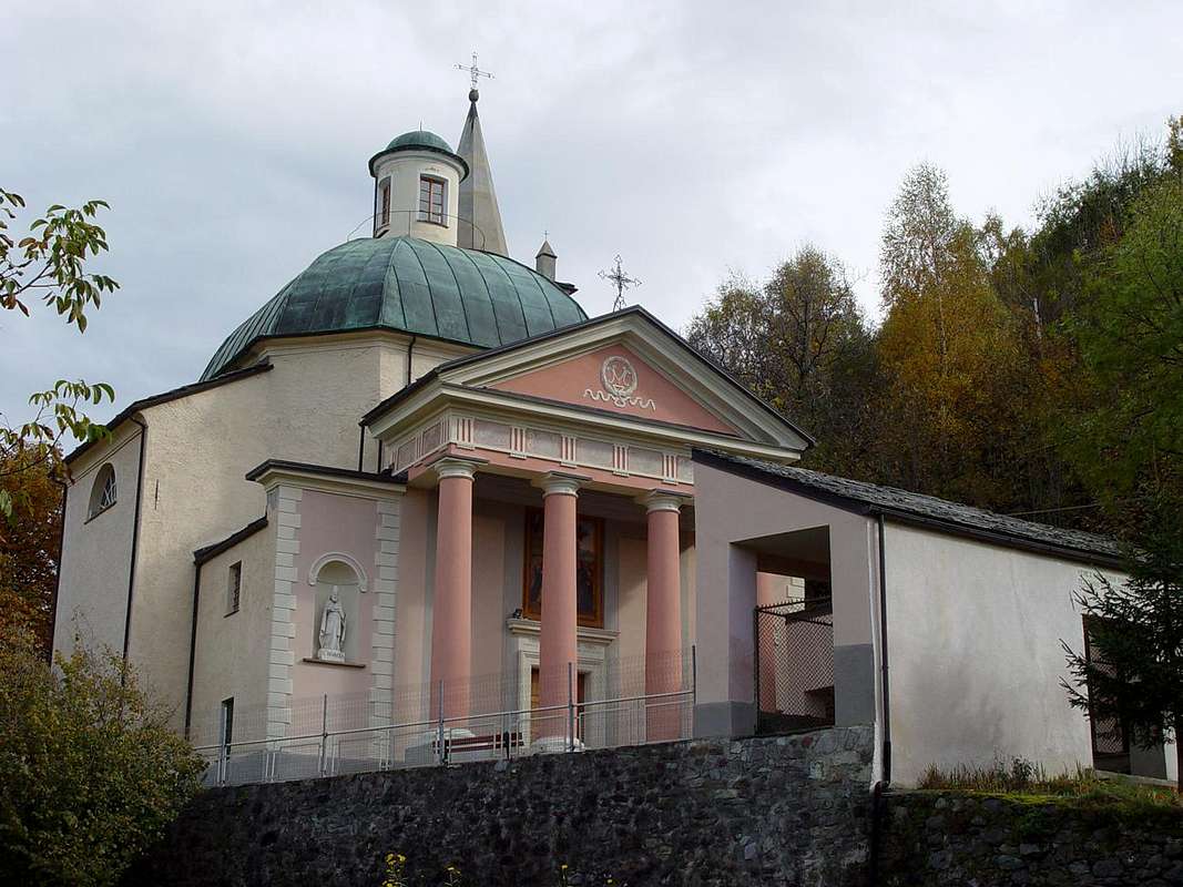
![]()
Plout Shrine since 1200, above St. Marcel, by emilius
Via A)- (Dalle Druges "Alte" attraverso gli Alpeggi di Fontanafredda, Bren, Prapremier e l'Alpe Corquet)
Partendo da Les Druges "Alte" o dall'Area Picnic (1.600 metri circa) od ancora, dopo una discesina, dalla palina con cartello di divieto (Legge Regionale del 24 Aprile 1985; attenzione, disponibili solo tre posti auto), indirizzarsi col sentiero n° 14 appena dietro ad un caratteristico nonché piccolo squadrato "rascard" in legno (fontana in pietra subito a lato), in direzione d'una vicina Cappelletta dedicata a San Bernardo raggiungendo la poderale che, attraverso gli Alpeggi di Fontana Fredda (1.823 m) e Bren (1.961 m), raggiunge l'ultima diroccata di Prapremier (2.011 m; palina con cartello giallo appena sopra l'alpe). Appena dietro la stessa abbandonare sulla sinistra il bivio per il Tramouail de la Rossa o per il Mont Corquet (2.531 m) tramite il Col de Crotey (2.458 m) dirigendosi invece verso Ovest con sentiero non sempre evidente e non segnalato dentro la foresta e poi tra cespugli in mezzo a sconvolte pietraie verso l'Alpe Corquet (2.124 m), pressocchè diroccata. Da questa su sentierucolo puntare decisamente ad Occidente raggiungendo la Selletta 2.260 metri circa e da questa, volgendo a Settentrione, salire per mezzo della breve nonché facile Cresta Meridionale (EE/F; 0h'50; 2h'30/2h'45 in totale; tempo molto variabile nello sci d'alpinismo o in progressione con racchette da neve; nel primo caso aumentarlo di circa la metà, mentre nel secondo raddoppiarlo ed anche più).
Route B)- (From Les Druges "Alte" through the Servette Coppermines and Western Slope)
Specific and direct route: before making the descent to the waterfall, goes up, instead through the trail n° 16 above the dirt road, reaching the various upper mines amongst the renovating Miners Village. From these, however, you can also be reached through other paths of entry, continue with the path which now becomes exclusively n° 18. But abandon it when the same direction varies from Southeast to South in altitude of about 2.050/60 meters and, without forced trail inside the thick forest, following a small dried torrent by 2.059 to 2.202 meters (caution for presence of wild boars!) to reach the small saddle 2.260 meters around, from which join with the previous route through Fontanafredda, Bren, prapremier Pastures and by the Southern Crest from Alp Corquet (EE/F; 1h'30/2h'00 from the highest Coppermine of Servette; 2h'45/3h'15 in all).
![]()
Just before we must abandon the dirt road taking the path n° 16/18 towards Servette Coppermines, by Osw 2015
Via B)- (Da Les Druges "Alte" transitando dalle Miniere di rame di Servette e Versante Occidentale)
- Aeroporto "Corrado Gex" Saint Christophe (Aosta).
Routes
Route A)- (From Les Druges "Alte" through the Fontanafredda, Bren, Prapremier Pastures & Corquet Alp)Les Druges "Alte or Upper" or from subsequent Picnic Area (about 1.600 meters)
also even, after a little downhill, the pole with sign forbidding (Regional Law of 24th April 1985; attention, only three parking spaces), goes up by the path n° 14 immediately behind a small stone fountain, near a splendid squared wooden "rascard", towards a nearby and tiny Chapel dedicated to St. Bernard getting the dirt road that trough Fontana Fredda (1.823m) and Bren (1.961m) Pastures reach the ruined Alp of Prapremier (2.011m). From this last, just behind the house, (stakes), leave on the left side the path to the Tramouail de la Rossa or towards the Mont Corquet (2.531m) through the Col de Crotey following Westward (path not always easy to find) toward the ruins of very old Corquet Alp (2.124m). Herefrom continue to the West by a track-path not reported, not always evident, into the forest and scree reaching the small saddle 2.260 metres around at the base of short, easy Southern Crest(EE/F; 0h'50 by Corquet; 1h'45/2h'15 in all; rather varying in case by ski-mountaineering or snowshoes; in the first to increase of around the half the time of route, while in the second to double it and even more).Via A)- (Dalle Druges "Alte" attraverso gli Alpeggi di Fontanafredda, Bren, Prapremier e l'Alpe Corquet)
Partendo da Les Druges "Alte" o dall'Area Picnic (1.600 metri circa) od ancora, dopo una discesina, dalla palina con cartello di divieto (Legge Regionale del 24 Aprile 1985; attenzione, disponibili solo tre posti auto), indirizzarsi col sentiero n° 14 appena dietro ad un caratteristico nonché piccolo squadrato "rascard" in legno (fontana in pietra subito a lato), in direzione d'una vicina Cappelletta dedicata a San Bernardo raggiungendo la poderale che, attraverso gli Alpeggi di Fontana Fredda (1.823 m) e Bren (1.961 m), raggiunge l'ultima diroccata di Prapremier (2.011 m; palina con cartello giallo appena sopra l'alpe). Appena dietro la stessa abbandonare sulla sinistra il bivio per il Tramouail de la Rossa o per il Mont Corquet (2.531 m) tramite il Col de Crotey (2.458 m) dirigendosi invece verso Ovest con sentiero non sempre evidente e non segnalato dentro la foresta e poi tra cespugli in mezzo a sconvolte pietraie verso l'Alpe Corquet (2.124 m), pressocchè diroccata. Da questa su sentierucolo puntare decisamente ad Occidente raggiungendo la Selletta 2.260 metri circa e da questa, volgendo a Settentrione, salire per mezzo della breve nonché facile Cresta Meridionale (EE/F; 0h'50; 2h'30/2h'45 in totale; tempo molto variabile nello sci d'alpinismo o in progressione con racchette da neve; nel primo caso aumentarlo di circa la metà, mentre nel secondo raddoppiarlo ed anche più).
 |
 |
 |
 |
 |
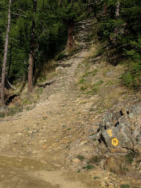
Route B)- (From Les Druges "Alte" through the Servette Coppermines and Western Slope)
Going through the whole valley by Les Druges towards Mulàc and Grande Chaux Hunting Houses:
from Les Druges "Low" (1.567m) a last bend in the road asphalt leads to the "High", where shortly afterwards becomes paved farm road not more (signs in brown at the last house). From Les Druges "Alte" suddenly into the forest leads to the Picnic Area beyond which a short descent leads to the cartel prohibition for the cars just before the Pouria Pasture (1.586m; no more than three cars). Continuing uphill the private dirt road reaches, with soft ascent, a grassy esplanade at the edge of the forest with to the North an ancient ruined alp and in South the construction known as "Garages" below the ruins of the "Trèves Furnace", just before the fork in the torrent (still many yellow signs up at the furnace in left and down at Viplana Village in right (1.346m) with path n° 3). Continuing on the farm road to the West through a long diagonal leading to the location Vargney (1.676m) at some dumps of ore burned. Take Southbound the small path n° 16/18 addressed to the Coppermine of Servette and then to Lavanche Pasture (2.071m; suggestive way to transport the mineral with high stone walls and connecting with the Mines Praborna) and Crotey Dèsott Alp (2.348m), under Mont Roux (2.277m). Also starting from the small and last lay-by beyond the rocky-wooden dump of the above abandoned Coppermines Chuc-Servette, and after rounding the cape entering the real vallon. A short descent leads to the base of a small trickle of water (not drinking dirty because with the sour taste of soil and copper) with the foot a rocky escarpment that rushes to the Torrent de Saint Marcel. Keep going towards South flexing a little to the right (South-southwest) with beautiful views of the overlying dry stone walls and the stone buildings designed to house the miners. Pass a new short ascent with beautiful views of the Group of Rouèses and wild Vallon Arpisson. Another descent, after leaving to the left (East) deviation n° 16 for Servette, leading to the end of the same. After passing a small gate (signals of private property and border of the "Preserve of Grand Avert" by Marquis Turati of Turin ex Baron Giuseppe Antonio Beck Peckoz of Gressoney) and after a short descent bypassing Eteley Pasture (1.750m) and abandoning Northwest the crossroads with path n° n° 4G towards the Alp Choulet and Arpisson Vallon, remount passing through Mulàc Hunting House (1.937m; beautiful fountain with wooden steinbock) boarding on the right (Northwest) the ancient Manganesemine of Praz Bornaz also Prabor(g)na, reached from alternative 1.836 meters through deviation not numbered and abandoned for years now (1.882m; E/F; 2h'00/2h'30). This must be considered the Basic Itinerary from which branch all variants for Mines Servette and Praborna, they exclude the underlying Chuc Copperminne. Specific and direct route: before making the descent to the waterfall, goes up, instead through the trail n° 16 above the dirt road, reaching the various upper mines amongst the renovating Miners Village. From these, however, you can also be reached through other paths of entry, continue with the path which now becomes exclusively n° 18. But abandon it when the same direction varies from Southeast to South in altitude of about 2.050/60 meters and, without forced trail inside the thick forest, following a small dried torrent by 2.059 to 2.202 meters (caution for presence of wild boars!) to reach the small saddle 2.260 meters around, from which join with the previous route through Fontanafredda, Bren, prapremier Pastures and by the Southern Crest from Alp Corquet (EE/F; 1h'30/2h'00 from the highest Coppermine of Servette; 2h'45/3h'15 in all).
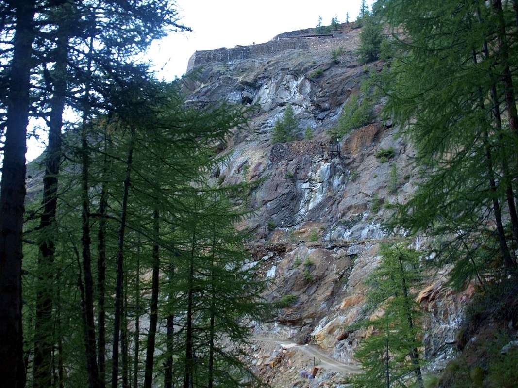
Just before we must abandon the dirt road taking the path n° 16/18 towards Servette Coppermines, by Osw 2015
Via B)- (Da Les Druges "Alte" transitando dalle Miniere di rame di Servette e Versante Occidentale)
Percorrendo l'intero vallone: da Les Druges "Basse" (1.567 m) un ultimo tornante della strada in asfalto conduce a quelle "Alte", dove poco dopo si trasforma in strada poderale non più asfaltata (cartelli in colore marrone presso l'ultima casa). Da Les Druges "Alte" un tratto nella foresta conduce all'Area Pic Nic, oltrepassando la quale una breve discesa conduce al cartello di divieto per i mezzi appena prima della località Pouria (1.586 m; non più di tre posti auto). Continuando in leggera salita la strada poderale raggiunge una spianata erbosa ai limiti della foresta con a Settentrione un'antica alpe diroccata ed a Sud una costruzione cosiddetta "Garages" appena prima della biforcazione del torrente (ancora vari cartelli gialli, in alto in direzione della soprastante Fornace Trèves" nonché delle abitazioni dei minatori ed in basso verso il Villaggetto di Viplana (1.346 m) con sentiero n° 3). Continuando sulla poderale verso Occidente un lungo diagonale porta alla località Vargney (1.676 m) presso alcuni piazzali sovrastati dalle discariche del minerale combusto. Prendere verso Ovest il sentierino n° 16/18 indirizzato dapprima alla Miniera di Servette e poi agli Alpeggi Lavanche o lavanché (2.071 m; suggestiva strada per il trasporto del minerale con alte mura in pietra su di un ponticello e collegamento con le Miniere di manganese di Praborna) e Crotey Dèsott (2.348 m)), con percorso sempre al di sotto del Versante Occidentale del Mont Roux (2.277m). Oppure a partire dalla piccola piazzola al di là dell'ultima discarica dell'abbandonata miniera di rame Chuc-Servette, e dopo aver doppiato il promontorio roccioso-boschivo entrando nel vero e proprio Vallone di Saint Marcel. Una breve discesina conduce alla base di un rivoletto d'acqua proveniente dalle miniere di rame (non bere perché sporca di terriccio e con il sapore acidulo del rame) con ai piedi una scarpata rocciosa precipitante verso il Torrent de Saint Marcel. Proseguire ancora verso Mezzogiorno flettendo un poco più a destra (Sud-sudovest) con bella vista sui soprastanti muraglioni di pietra costruiti a secco e sulle abitazioni in pietra atte ad alloggiamento dei minatori. Superare una nuova breve risalita con bella vista sulla Catena delle Rouèses e sul selvaggio Vallone di Arpisson; un'altra discesa, dopo avere lasciato a sinistra (Est) la deviazione n° 16 per le Miniere di Servette, porta al termine dell'area medesima. Dopo aver superato un cancelletto (segnalazioni di proprietà privata e confine della "Riserva del Grand Avert" di proprietà del Marchese Attilio Turati di Torino, nonché ex Riserva di proprietà del Barone Giuseppe Antonio Beck Peckoz di Gressoney) e dopo una breve discesa superando l'Alpe di Eteley (1.750 m) e lasciando a Nordovest il bivio con sentiero n° 4G per l'Alpe Choulet ed il Vallone d'Arpisson, rimontare passando affianco alla Casa di Caccia di Mulàc (1.937 m; bella fontana con stambecco in legno), con immediatamente sulla destra (Nordovest) l'antica miniera di manganese, raggiungibile dal bivio con deviazione non numerato ed abbandonata ormai da molto, di Praz Bornaz o Praborna od ancora Praborgna (1.882 m E/F; 2h'00/2h'30). Questo deve esser considerato l'Itinerario di base dal quale si dipartono tutte le varianti per le Miniere di Servette e Praborna, esclusa quindi quella di Chuc.
Via specifica e diretta: prima d'effettuare la discesa verso la cascatella, proseguire invece tramite il sentiero n° 16 soprastante alla poderale raggiungendo le varie miniere superiori presso le abitazioni del ristrutturando Villaggio dei Minatori. Da queste, peraltro raggiungibili anche tramite altri sentieri d'ingresso, continuare con il suddetto, che diventa esclusivamente n° 18, ma abbandonarlo quando varia direzione da Sudest verso Sud a quota 2.050/60 metri circa e senza percorso obbligato dentro la fitta foresta, seguendo un torrentello essiccato da 2.059 a 2.202 metri (prestare attenzione causa la presenza di cinghiali!), raggiungere la piccola Sella 2.260 metri circa, donde congiungersi con il precedente itinerario dall'Alpe Corquet e tramite la breve Cresta Meridionale (EE/F; 1h'30/2h'00 dalla miniera superiore di Servette; 2h'45/3h'15 complessivamente).
![]()
Just after the Upper Mine taking the path n° 18 towards Crotey & Levanché Alps always below the Western slope Mont Roux, by Osw 2015
These routes can be considered E/F or EE/F+ (Experts Hikers) in winter (even by snowshoes or Ski), but require ability to track the path.
Gli itinerari sono da classificarsi in E/F oppure EE/F+ (Escursionisti Esperti) in inverno (anche tramite Racchette da neve od in Scialpinismo), ma richiedono capacità di rintracciare il percorso.
![]()
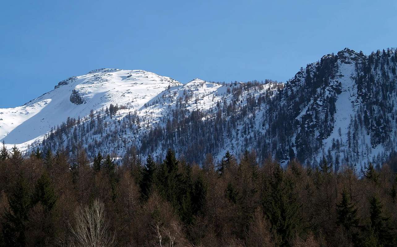
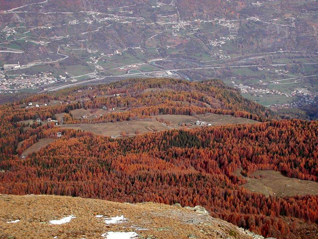
Northern Slopes above St. Marcel high hill, by Maria Grazia Schiapparelli
EQUIPMENT
Hiking gear, in winter as for Ski-Mountaineering or with Snowshoes.
Da Escursionismo, in inverno da Scialpinismo o con Racchette da neve.
Via specifica e diretta: prima d'effettuare la discesa verso la cascatella, proseguire invece tramite il sentiero n° 16 soprastante alla poderale raggiungendo le varie miniere superiori presso le abitazioni del ristrutturando Villaggio dei Minatori. Da queste, peraltro raggiungibili anche tramite altri sentieri d'ingresso, continuare con il suddetto, che diventa esclusivamente n° 18, ma abbandonarlo quando varia direzione da Sudest verso Sud a quota 2.050/60 metri circa e senza percorso obbligato dentro la fitta foresta, seguendo un torrentello essiccato da 2.059 a 2.202 metri (prestare attenzione causa la presenza di cinghiali!), raggiungere la piccola Sella 2.260 metri circa, donde congiungersi con il precedente itinerario dall'Alpe Corquet e tramite la breve Cresta Meridionale (EE/F; 1h'30/2h'00 dalla miniera superiore di Servette; 2h'45/3h'15 complessivamente).
Just after the Upper Mine taking the path n° 18 towards Crotey & Levanché Alps always below the Western slope Mont Roux, by Osw 2015
Difficulty & Equipment
DIFFICULTIESThese routes can be considered E/F or EE/F+ (Experts Hikers) in winter (even by snowshoes or Ski), but require ability to track the path.
Gli itinerari sono da classificarsi in E/F oppure EE/F+ (Escursionisti Esperti) in inverno (anche tramite Racchette da neve od in Scialpinismo), ma richiedono capacità di rintracciare il percorso.
EQUIPMENT
Hiking gear, in winter as for Ski-Mountaineering or with Snowshoes.
Da Escursionismo, in inverno da Scialpinismo o con Racchette da neve.
Campings
Remember that free camping is forbidden (except for emergency reasons, over 2.500m, from darkness until dawn).Mountain Condition
- You can get meteo information at the official site of the Regione Valle d'Aosta:
- Valle d'Aosta Meteo
Webcam
- WEBCAM on Aosta Valley:
- Webcam
Books and Maps
BOOKS:- "Guida delle Alpi Occidentali" di Giovanni Bobba e Luigi Vaccarone C.A.I. Sezione di Torino Volume II (parte II), 25 Maggio 1896.
- "Guida dei Monti d'Italia – Emilius Rosa dei Banchi-Parco del Mont Avic" di Giulio Berutto e Lino Fornelli - Club Alpino Italiano/Touring Club Italiano, Marzo 2005.
- "Guida della Regione Autonoma Valle d'Aosta" di Mario Aldrovandi; Ed. S.P.E. di Carlo Fanton, Torino 1964.
- "Diari Alpinistici" di Osvaldo Cardellina e Indice Generale accompagnato da Schedario Relazioni Ascensioni 1964-2019 (inediti).
 |
 |
 |
 |
MAPS:
- Kompass "Gran Paradiso Valle d'Aosta Sentieri e Rifugi" Carta Turistica 1:50.000.
- L'Escursionista "Tour de la Vallée de Cogne Grand Paradis" Carta dei sentieri 1:25.000.
- Hapax "Les Sentiers" Comunità Montana Monte Emilius, Luglio 2000 1:25.000.
- Enrico Editore Ivrea-Aosta "Gruppo del Gran Paradiso" 1:50.000.
- L'Escursionista "Valle di Cogne" Carta dei Sentieri 1:25.000.
Important Information
- REGIONE AUTONOMA VALLE D'AOSTA the official site.
- FONDAZIONE MONTAGNA SICURA Villa Cameron, località Villard de la Palud n° 1 Courmayeur (AO) Tel: 39 0165 897602 - Fax: 39 0165 897647.
- A.I.NE.VA. (Associazione Interregionale Neve e Valanghe).
Useful numbers
- Protezione Civile Valdostana località Aeroporto n° 7/A Saint Christophe (Ao) Tel. 0165-238222.
- Bollettino Meteo (weather info) Tel. 0165-44113.
- Unità Operativa di Soccorso Sanitario Tel. 118.