
|
|
Mountain/Rock |
|---|---|
|
|
34.02371°N / 111.49516°W |
|
|
Gila and Yavapai |
|
|
Spring, Fall |
|
|
7358 ft / 2243 m |
|
|
Overview
Mount Catherine (Peak 7,358 on topographic maps) resides within the Mazatzal Mountains, 1.6 miles NNW of Mount Peeley 7,030’. While not nearly as popular as Mount Peeley, it is not difficult to summit from the Mount Peeley trailhead. A hike to the summit is long, but mostly on the Arizona Trail until the last half mile.
The Mazatzal Mountains are generally rugged peaks but see some traffic due to the proximity to the Phoenix Valley. The trailhead is located just over 55 miles from the 101 Freeway and Shea Blvd in Scottsdale and just over 56 miles from the junction between the 202 Freeway in Mesa and the Beeline Highway (State Route 87)
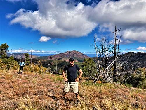
Mount Catherine can be combined with Mount Peeley to make a long day hike. Some route-finding is required, but ultimately not difficult for experienced hikers.
The best time to hike Mount Catherine is spring or fall. Summer is to be avoided due to excessive heat. Wintertime there is often some snow at this elevation and it’s preferable to hike around the valley during that time when temperatures are comfortable.
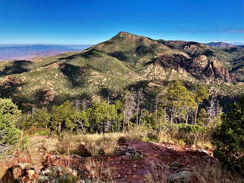
Summit views reflect the diversity of the area, from the rocky mountainsides of the Mazatzal Mountains to the desert floor below. With good visibility, all sorts of landscapes can be seen from this vantage point between the desert and the forest.
Getting There
As described on the Mount Peeley page, the road is best suited for a high clearance vehicle. 4WD isn’t required but recommended. The road isn’t too bad as long as conditions are dry.
From Phoenix takes State Route 87 towards Payson and turn left onto Sycamore Canyon after mile marker 222 across from the road to Mount Ord. Drive 1.2 miles on this paved road to FR 25 and turn right onto the dirt road. Follow this another 1.2 miles to FR 201. At this point the road worsens, with intermittent stretches of loose rock and ruts. The road is unfortunately just wide enough for one car in many places, and it can be really difficult to find places to pull off if you run into another vehicle. Take this all the way to the end, which is another 8.3 miles.
Route
There is a sign at the trailhead showing the route. Start hiking for a little over half a mile until reaching a signed junction with the Arizona Trail, running from Mexico to Utah. Hook right towards Utah and the trail begins switch-backing up the east slopes of Mount Peeley. After about two miles from the trailhead, there’s a cairn marking the use trail up to Mount Peeley. If wanting to combine it with Mount Catherine, this adds about 500’ of elevation gain and a mile round trip. If not, continue for another 4 ¼ miles or so up the Arizona Trail as it winds around the north side of Mount Catherine.
There’s a saddle here between Mount Catherine and its north summit, which is 7,260’, but doesn’t quite make the 300’ of prominence. The route to the north summit is pretty rugged.
If hiking up Mount Catherine, you don’t want to go all the way to the saddle. Rather, it is best to approach up the forest where there is a moderate slope that avoids too much brushy terrain. This is about a tenth of mile before reaching the saddle.
Hike off-trail up this gully to a higher saddle at about 7,100’. From here it appears pretty brushy. However, if hiking along the right side, there is a semblance of a path avoiding the brush. Once higher up, it is a clear path to the summit. If studying satellite maps, it becomes pretty clear that a route exists that isn’t too challenging.
The one way hiking distance is almost 7 miles, with an elevation gain of over 2,900'. If adding Mount Peeley, it is over 3,400' and about 15 miles round trip.
Red Tape
There are no permits needed to hike from the trailhead. There is at large camping available along the drive to the trailhead with no amenities. Be aware that the road is narrow and watch for cars coming so either of you can pull off to the side if necessary.
External Links
Peakbagger Ascent Map: https://peakbagger.com/climber/ascent.aspx?aid=1907887