Comments
No comments posted yet.

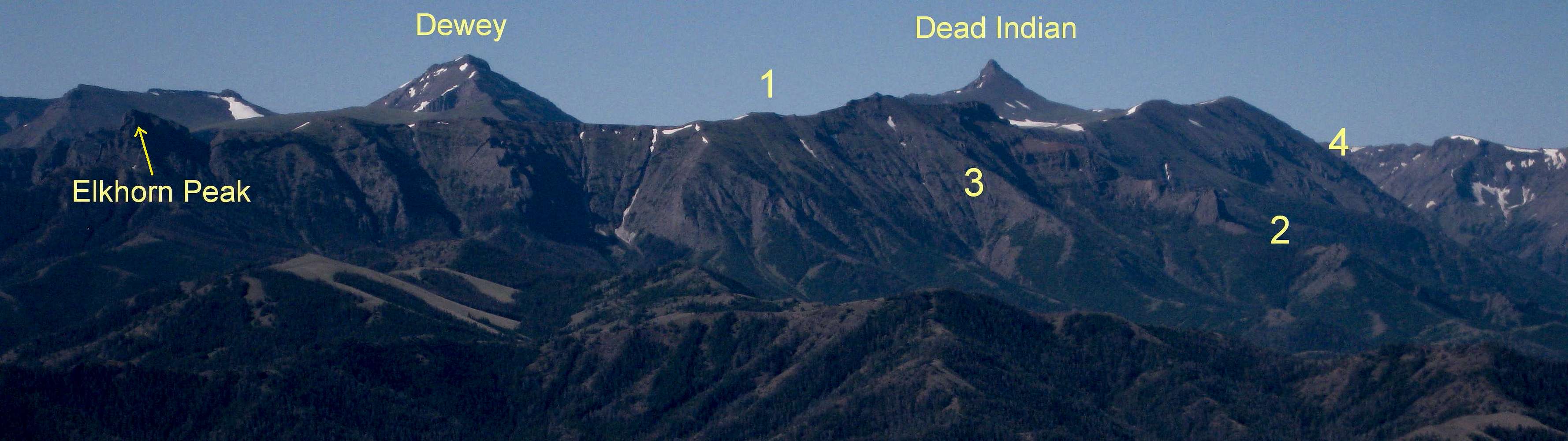
This view is from White Mountain.
After reading the caption, please view in the original size to see the details better. There has been a lot of cropping to the point that resolution has suffered, but this should still help illustrate route options pretty well.
There is no such named geographical feature as "Gravelbar Ridge"; it is a working name for the high ridge (it rises above Gravelbar Creek) seen in front of Dewey (left) and Dead Indian (right) here. Also, although Dead Indian is part of the ridge, Dewey is not and is actually two drainages away.
1: "Gravelbar Ridge," which must be gained to reach Dead Indian.
2: The spur I ascended in August 2011. You can see the big formation that forces one off the ridge proper. The spur reaches the crest at almost 10,800', and then Dead Indian is 3.7 miles away. Better details and more explanation can be found with this picture.
3: The spur I descended in 2011. It is pretty good going until it drops into the trees, where a pretty awful bushwhack of about 1.5 mi awaits. Not recommended.
4: The vicinity of the spur we ascended in July 2010. It put us on the ridge at about 11,000' and two miles from Dead Indian. We left Gravelbar Creek about 4.5 miles from the trailhead. The spur had a lot of dense, very steep bushwhacking and then, above treeline, steep hiking and scrambling up scree.
Absaroka Range, WY-- August 2011


