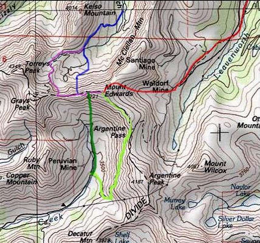
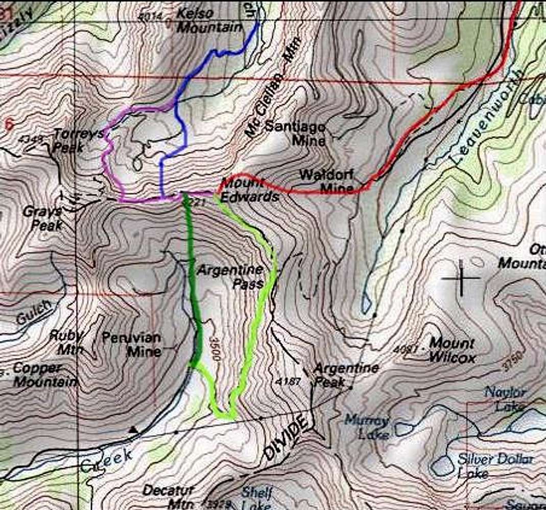
Mount Edwards Routes Overview: Topo! topographical maps - www.topo.com
Purple: west ridge, from Grays Peak Trailhead.
Blue: Goatfinger, from Grays Peak Trailhead.
Red: East slopes, from Leavenworth Creek.
Light green:Southwest slopes, Argentine Pass, from Horseshoe Basin
Trailhead.
Dark green: South face, from Horseshoe Basin Trailhead.


