Overview
![Index]() Mount Index
Mount IndexI have never really been too familiar with the Highway 2 area in terms of mountaineering. Residing in Skagit County, I have usually focused most of my attention on the North Cascades Highway, Mount Baker Highway and the Mountain Loop. So when SP's own Gimpilator contacted me with an ambitious plan for a 2 day assault on Mt. Index, I was curious to say the least. It turned out he and Redwic had made an attempt the previous June but timed out 1,100' short of the summit via the West Ridge, this year however, we assembled a crack team of ambitious locals with the common goal for a good mid Spring summit. Armed with much supplies, rations and first class route beta we met in Sultan around 7:30 before convoying to the Gate on FR 62, about 7 miles from its junction with highway 2.
![Index]() From camp
From campAscent
![Index]() Camp
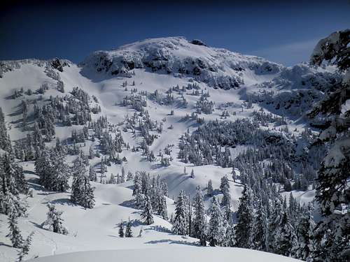
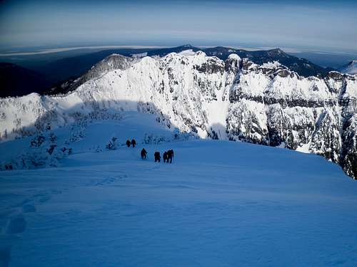
Camp![Index]() First view of our objective
First view of our objective For this trip we had a fairly large crew, possibly the largest assembled group of competent mountaineers I have ever climbed with. Attempting the summit this trip was Gimplilator, Redwic, Greg, Ryan & Tyler a couple climbers from the Arlington area, Nate the man responsible for my first excursion to the sub alpine, and myself. We donned our packs amidst a cloudy, cold and relatively damp morning before setting off on our bicycles to the start of our climb, I believe all of us were surprised to see how low the snow level had fallen the previous night. After about six miles of pedaling we stashed our bikes and started up an old logging road spur that had succombed to the slow return of many Alder sapplings, although pretty slow going through the wet vegetation, I assume it would be far worse had the sapplings been covered in leaves, though Ryan and Tyler may disagree having chosen external frame packs. As the brush grew denser we rounded a couple switchbacks before the sapplings gave way to snow and we put on our snowshoes, at this point we recommended Greg stay at the rear of the team for he had neglected to bring snowhoes on this excursion. Crossing a couple snow gullys we left the road bed and started our ascent up sometimes 50 degree slopes taking turns breaking trail through the 12 inches of fresh snow. The going was slow with full packs in the light falling snow and dense fog, and roughly 2 hours after leaving the road bed we crossed under a beautiful cornice and descended on our camp at around 4,800' and a quarter mile south of the 4,900' ridge saddle.
![Index]() Set up
Set up
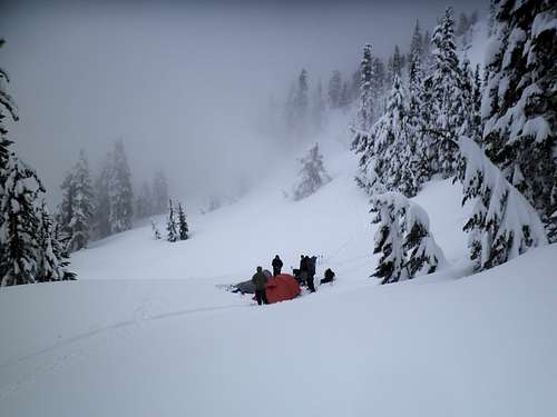
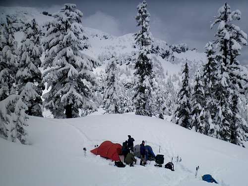
Camp was assembled pretty quick and almost as quick the weather started to change for the better, we soon got our first view of our objective and felt a little better about the days journey. In an effort to speed up the next mornings travel Gimpilator, Redwic and myself decided to break a path from camp onto the ridge and maybe beyond that evening, we decided to maintain a level traverse on moderate forested slopes leading directly to the 4,900' saddle. At this point Gimpilator turned back while Redwic and myself continued another 200' up the ridgeline and got some neat views of camp. Returning back to camp, the seven of us prepared dinner, boiled water and told tales before getting to bed for an early start on the summit push, hopefully before avalanche conditions thwarted our effort.
Summit
![Index]() First Light
First Light![Index]() Gimpilator is excited!
Gimpilator is excited!![Index]() Breaking trail
Breaking trail 4:30 came quick under clear skies and crisp air, we made a quick breakfast and hurried on to the saddle. Ascending the forested ridge went pretty quick and we were soon out of the trees and descending into a small col at the base of a 60 degree 90' tall slope. We discussed our options and decided to remove our snowshoes while Ryan broke a quick boot path up, a decision that proved to be great fun! From there Tyler and I took turns breaking a path to the summit with snowshoes while the others booted up behind, the views were really opening up by now and all of us were now free and clear, I am sure everyone was feeling great at this point.
![Index]() Ryans turn
Ryans turn![Index]() Summit Party
Summit Party
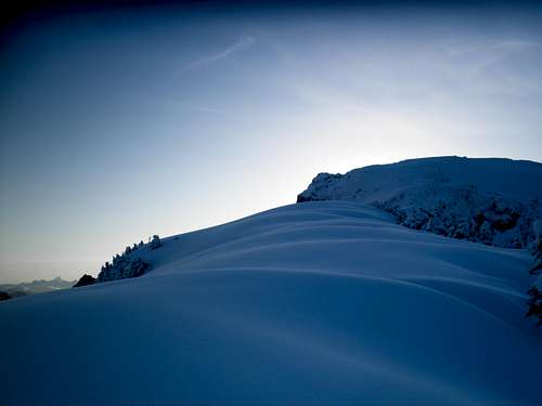
Soon we were standing atop Mount Index! Naming peaks and soaking in the views we enjoyed as much as we could before accepting the fact that time was a major issue and quickly descended hoping to break camp and make it back to the road bed before the slopes warmed to a dangerous level.
![Index]() Looking SE from the Summit
Looking SE from the Summit![Index]() Views East
Views EastDescent
![Index]()
Descending the upper ridge went fairly quick and without incident and soon we were at camp all packed up and watching the tree bombs fall left and right. On our descent of the steep forested slopes above the roadbed we opted for bare boots and found conditions to be not too scary. We made quick work of the trek and returned to the roadbed to find a gully had let loose since we had crossed. As was the story for some other gullys on the upper roadbed but none proved much of a challenge. When reaching the sappling infested section I was delighted to remember how much easier travel was going downhill through this type of brush, for the most part traveling the same direction as the branch growth and far drier than the day before. We were soon at our bikes and moving at breakneck speeds down the gravel roads. Racing to the bottom of the last good hill I managed to puncture my rear tire and as a result watched the 6 of them slowly pedal off into the horizon, oops. Twenty minutes of walking and I was packing up my gear, bragging with my peers and making way for town. Truly a great trip with a great team, I do believe we could have had some of the more pleasant travel conditions in comparison to other parties attempts.
![Index]() Flat Tire, Oops
Flat Tire, OopsLOST!
If anybody decides to climb this peak, on our descent we lost an ice axe shortly above were you would stash the bikes. It's a Petzl with Orange covers, if you find it please contact me, thanks!


Comments
Post a Comment