
-
 12707 Hits
-
 74.87% Score
-
 8 Votes
|
|
Mountain/Rock |
|---|---|
|
|
51.35382°N / 117.53844°W |
|
|
10545 ft / 3214 m |
|
|
Overview
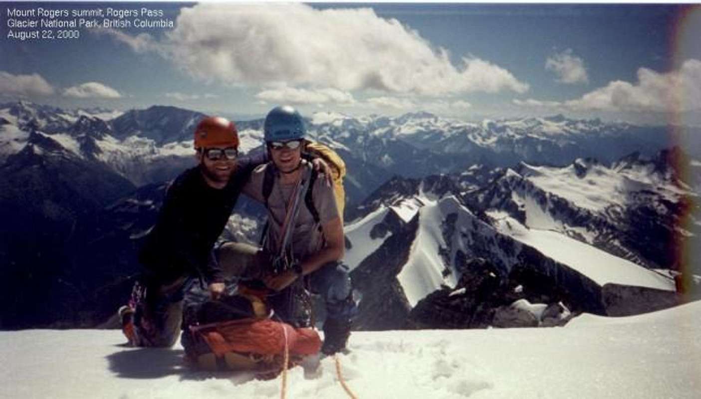 I adopted this neglected peak and attached the photos as well as added some information. I however do not know this peak so should someone come along who does, please contact me if you wish this page. William Marler
The Rogers Pass area provides access to several peaks from a convenient basecamp setting. Eventhough the area is easily accessible, crowds do not seem to be an issue. Hermit meadows can be reached via a two-hour hike from the Trans-Canada Highway. Peaks around Hermit meadows include Sifton, Rogers, Swiss, Hermit, and Tupper. Rogers is the highest at 2942 metres. Terrain involves glacier traverse, scrambling over rock, and snow climbing. Route descriptions can be found in "The Columbia Mountains of Canada Central," edited by John Fox, published by the AAC. A trip to Hermit Meadows can be combined with a climb of Uto or Sir Donald across the valley.
I adopted this neglected peak and attached the photos as well as added some information. I however do not know this peak so should someone come along who does, please contact me if you wish this page. William Marler
The Rogers Pass area provides access to several peaks from a convenient basecamp setting. Eventhough the area is easily accessible, crowds do not seem to be an issue. Hermit meadows can be reached via a two-hour hike from the Trans-Canada Highway. Peaks around Hermit meadows include Sifton, Rogers, Swiss, Hermit, and Tupper. Rogers is the highest at 2942 metres. Terrain involves glacier traverse, scrambling over rock, and snow climbing. Route descriptions can be found in "The Columbia Mountains of Canada Central," edited by John Fox, published by the AAC. A trip to Hermit Meadows can be combined with a climb of Uto or Sir Donald across the valley.
Getting There
Rogers Pass is located in Glacier National Park in southeastern British Columbia, 342 km west of Calgary and 643 km east of Vancouver. The nearest communities are Golden, 80 km east, and Revelstoke, 72 km west. Rogers Pass is easily accessible from the Trans-Canada Highway. There is a parking lot 1.5 km east of the visitor centre at the trailhead. Make sure to display a park permit on your windshield.
Red Tape
Backcountry permits are required. They are available from the park office at the Rogers Pass information centre for $6 a night. The staff are helpful and knowledgeable of climbing in the area.
When To Climb
The mountain seems to be a summer climb, June - September. The area is popular with backcountry skiers as well. Yamnuska offers a climbing school in the area.
Camping
Most climbers bivy or camp in Hermit Meadows. Wooden platforms are provided for tenting in between the boulders in the meadow. A small stream flows through the camp area. The park allows backcountry camping anywhere over 5 km from a paved road. Some climbers climb Rogers straight from the parking lot and back.
Mountain Conditions
Avalanche conditions. for Glacier National Park are available online. Weather reports for Revelstoke and Golden are also available. The park office can be reached by telephone at (250) 837-7500 or email at revglacier_reception@pch.gc.ca.
The Alpine Club of Canada
Joining a club such as The Alpine Club of Canada is recommended when climbing in Canada. While it is not obligatory, useful information can be had at any of their Clubhouse in Canmore, or at their website which is open to everyone. http://www.alpineclubofcanada.ca/ Staying at the club in Canmore is 18$ Canadian for members and 19$ for non-members. It can get quite crowded in the summer so a reservation is recommended.
Ski Mountaineer - Jul 19, 2006 7:46 pm - Hasn't voted
Rogers Pass Interactive Maphttp://yellowmaps.com/topo/_glacier_bc/index2.htm Yellowmaps interactive map of Rogers Pass area