


-
 4609 Hits
-
 77.48% Score
-
 8 Votes
|
|
Route |
|---|---|
|
|
45.80310°N / 7.11539°E |
|
|
Hiking, Mountaineering, Trad Climbing |
|
|
Spring, Summer, Fall, Winter |
|
|
Most of a day |
|
|
II |
|
|
Note
|
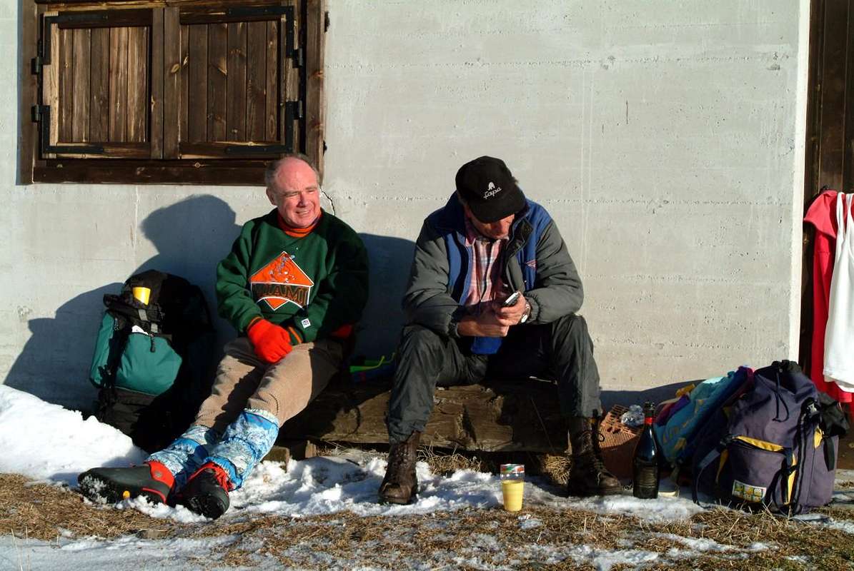
La montagna chiama i suoi figli, ed essi rispondono fedelmente al suo appello… Osvaldo Cardellina, Diario alpinistico, 1964-65 Page texts: @ OsvaldoCardellina "Osva", passed away on May 2, 2022. Page owners: Christian Cardellina e Osvaldo Cardellina. Any updates from September 12, 2022: Antonio Giani, page administrator, friend and climbing companion. Testi della pagina: @ OsvaldoCardellina "Osva", scomparso il 2 maggio 2022. Proprietari pagina: Christian Cardellina e Osvaldo Cardellina. Eventuali aggiornamenti dal 12 settembre 2022: Antonio Giani, amministratore della pagina, amico e compagno di salite. |
For almost Everyone Overview
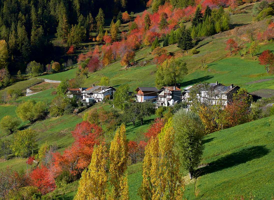
The Aosta Valley is a small Region in the size of the entire Alpine Arch from Ligurian Sea to the East and up the Adriatic Sea to the West, however, has a multitude of places where you can make beautiful and easy hikes and excursions. His thirteen Valleys and the many secondaries Vallons offer varied opportunities to attend and meet her and not cé need to climb Mont Blanc or Grandes Jorasses both into the same Mountain Chain, Matterhorn or Cervino, Monte Rosa or Gran Paradiso Group to achieve this result. Indeed these climbs, ranging over everything and everyone, often do not give a true knowledge of the same, often becoming unrealistic and out of the normality to be the Mountain and its most intrinsic particular features. In this little work, however, is meant to make known her to you completely, at least in all its main Valleys, proposing a series trips, ten for this first part, however, is meant to make known her to you completely, at least in all its main Valleys, proposing a series trips, one for each of them, with the primary objective of making you a 360° range across this Valley. On the whole, but above all, because in all the same involve the taking of the whole direct vision.
![]()
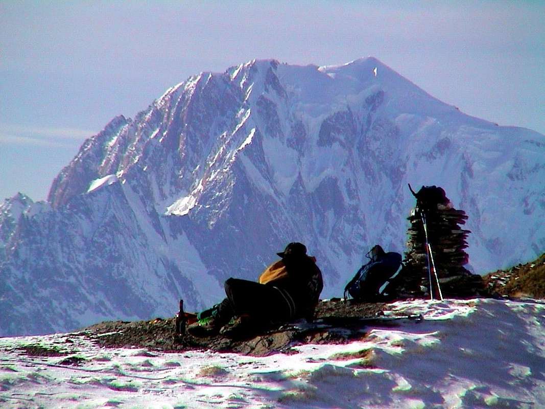
"A good break reflexive never hurts ...", by emilius
Can be, but is the certainty of feasibility of this arrival point, although with a single trip for each of them. For this raison this work is divided into three distinct parts or better areas that will give rise to three distinct pages and where, in this, we will visit a dozen major and minor valleys in Northwest of Dora Baltea ranging then those from the Valley of the Gran San Bernardo reach the "Conca" of By in front of Mont Velan Grand Combins de Valsorey, Grafeneire, Tsassette.
This time starting from West to East these are being affected and that come down to the Dora Baltea: Val Ferret, Val Sapin, Vallons of Planavalle, Vertosan Basin Vetan and still Vallons of Verrogne, Clusellaz and Met, with the latter consisting of a series of small vallons that radiate overhang ringing the towns of Saint Pierre, Sarre, Aosta and Gignod. Besides opening dates back to large fan Valley of Gran San Bernardo with a series of more or less small vallons (Buthier, Arsy, Flassin, Citrin, Serena, Merdeux, Thoula, Leisasses, Fenetre), the waters of which flow into first in Rio de Artanavaz or Buthier de Bosses and Buthier of Ollomont and then unite with the Buthier of Valpelline and generally become the "Buthier", which flows into the Dora Baltea in Aosta after the Arch of Augustus. The ancient Celtic "Bu and Boud" and Roman "Buthiacus and Bautegius" in the Middle Ages become "Balteus" as for the "Dora" in which just pours. Both have left ominous signs in the Valley. Together with Dora Ferret and the Torrents Sapin, Planavalle, Vertosan, Clusellaz constitute the largest catchment area of this vast area, which now has more lakes fed by glaciers that now almost completely disappeared. In fact, for someone ritrovarene it is necessary to climb to Etroubles where the Glacier du Mont Velan powers the Menouve Torrent or, on the opposite side, the small glaciers at the base of the ridge border between Col de Valsorey and the Fenetre Durand. Instead resists the Glacier du Mont Gelé but gradually disappears under the Becca Crevaye, Trident de Faudery, various Morions, Mont Clapier and towards Punta Cesare Fiorio and neighbor Mont-de-Berrio, above Ollomont and Valpelline Municipalities.
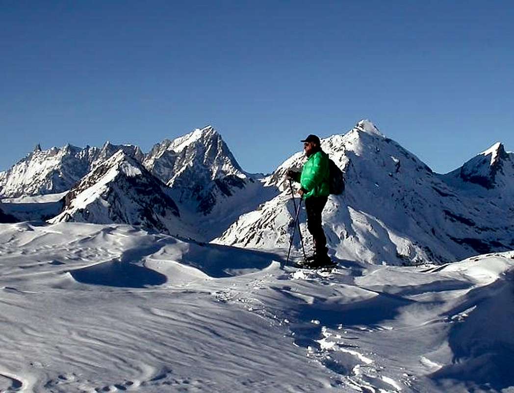
So an area, Velan excluded, more suitable for the practice of Hiking that facing away from the Mountaineering or Climbing; an area specifically indicated for Walking to the lakes.
Seven are also considered the requirements for basic routes description, with the elasticity of only two factors missing for each, which can be summarized in this way:
1) - : paths or marked trails, or failing this, simply always detectable both up during descent and where possible coincident. In any case always easy to identify and to follow.
2) - : easy route with itineraries aimed at E (Walkers) or EE (Expert Hikers), with the occasional use of the upper limbs; difficulties on rock from F (Easy) At the F+ ((middle intermediate grade more), with steps not greater hardly ever than I°/I°+ (U.I.A.A. Scale or Union of the International Mountaineering and Climbing Federation).
3) - : lack of glaciers or marginal traverses on thereof; snowfields or presence of glacial-snow-capped with a slope of no more than 30/35 degrees and possibly free of crevasses.
4) - : possibility of having at not great distances good support points as camps, bivouacs or shelters, generally always well marked along the entire way.
5) -: in the absence of these, there are points of cover from the elements as natural shelters, caves in the rock, Alps or "Casotti" (Cabins) by the Parks or Forest Rangers Huts.
6) - : absence of large and more or less obvious objective dangers over the path (falling stones, landslides, avalanches, snowslides or simply collapsing scaffoldings glacial).
7) - : vantage point of first order of the entire valley visited, possibly central and still to allow the full view on the same and in distance at least over a part of the Valley of Aosta.
![]()
"From the trail that pass Comba Thoula towards Grand Golliaz" by Osw
A very huge or at least exaggerated claim?
This time starting from West to East these are being affected and that come down to the Dora Baltea: Val Ferret, Val Sapin, Vallons of Planavalle, Vertosan Basin Vetan and still Vallons of Verrogne, Clusellaz and Met, with the latter consisting of a series of small vallons that radiate overhang ringing the towns of Saint Pierre, Sarre, Aosta and Gignod. Besides opening dates back to large fan Valley of Gran San Bernardo with a series of more or less small vallons (Buthier, Arsy, Flassin, Citrin, Serena, Merdeux, Thoula, Leisasses, Fenetre), the waters of which flow into first in Rio de Artanavaz or Buthier de Bosses and Buthier of Ollomont and then unite with the Buthier of Valpelline and generally become the "Buthier", which flows into the Dora Baltea in Aosta after the Arch of Augustus. The ancient Celtic "Bu and Boud" and Roman "Buthiacus and Bautegius" in the Middle Ages become "Balteus" as for the "Dora" in which just pours. Both have left ominous signs in the Valley. Together with Dora Ferret and the Torrents Sapin, Planavalle, Vertosan, Clusellaz constitute the largest catchment area of this vast area, which now has more lakes fed by glaciers that now almost completely disappeared. In fact, for someone ritrovarene it is necessary to climb to Etroubles where the Glacier du Mont Velan powers the Menouve Torrent or, on the opposite side, the small glaciers at the base of the ridge border between Col de Valsorey and the Fenetre Durand. Instead resists the Glacier du Mont Gelé but gradually disappears under the Becca Crevaye, Trident de Faudery, various Morions, Mont Clapier and towards Punta Cesare Fiorio and neighbor Mont-de-Berrio, above Ollomont and Valpelline Municipalities.
So an area, Velan excluded, more suitable for the practice of Hiking that facing away from the Mountaineering or Climbing; an area specifically indicated for Walking to the lakes.
Seven are also considered the requirements for basic routes description, with the elasticity of only two factors missing for each, which can be summarized in this way:
1) - : paths or marked trails, or failing this, simply always detectable both up during descent and where possible coincident. In any case always easy to identify and to follow.
2) - : easy route with itineraries aimed at E (Walkers) or EE (Expert Hikers), with the occasional use of the upper limbs; difficulties on rock from F (Easy) At the F+ ((middle intermediate grade more), with steps not greater hardly ever than I°/I°+ (U.I.A.A. Scale or Union of the International Mountaineering and Climbing Federation).
3) - : lack of glaciers or marginal traverses on thereof; snowfields or presence of glacial-snow-capped with a slope of no more than 30/35 degrees and possibly free of crevasses.
4) - : possibility of having at not great distances good support points as camps, bivouacs or shelters, generally always well marked along the entire way.
5) -: in the absence of these, there are points of cover from the elements as natural shelters, caves in the rock, Alps or "Casotti" (Cabins) by the Parks or Forest Rangers Huts.
6) - : absence of large and more or less obvious objective dangers over the path (falling stones, landslides, avalanches, snowslides or simply collapsing scaffoldings glacial).
7) - : vantage point of first order of the entire valley visited, possibly central and still to allow the full view on the same and in distance at least over a part of the Valley of Aosta.
La Valle di Aosta é una piccola Regione nella grandezza dell'intero arco alpino dal Mare Ligure a Levante e fino all'Adriatico a Ponente, però possiede una infinità di posti dove si posson effettuare belle e facili escursioni. Le sue tredici Valli ed i molteplici Valloni offrono variegate opportunità di frequentarla e conoscerla e non cé bisogno di scalare il Monte Bianco, Grandes Jorasses, Cervino, Monte Rosa od il Gran Paradiso per raggiungere questo risultato. Anzi queste salite, che spaziano sopra tutto e tutti, spesso non danno una vera conoscenza della medesima, diventando spesso irreali e fuori dal quotidiano essere della Montagna e delle sue più intrinseche peculiarietà. In questo piccolo lavoro, invece, si ha la pretesa di farvele conoscere completamente, almeno in tutte le sue principali Vallate, proponendo una serie di gite, una per ognuna d'esse, con l'obiettivo primario di farvi spaziare a 360° su tutta la Valle di Aosta. Su tutta ma, soprattutto, in tutta perché le medesime comportano la presa in visione diretta dell'intero territorio. Una pretesa decisamente enorme o perlomeno esagerata? Può darsi, ma esiste la certezza della fattibilità di questo punto d'arrivo, anche se con una singola gita per ciascuna d'esse. Per questo il lavoro viene diviso in tre distinte parti o meglio settori che daranno adito a tre distinte pagine e dove, in questa, andremo a visitare una dozzina di vallate principali e secondarie a Nordovest della Dora spaziando poi su quelle che dalla Valle del Gran San Bernardo raggiungono la "Conca" di By affronte a Mont Velan e Grand Combin.
Partendo questa volta da Ovest verso Est queste son quelle interessate e discendenti verso la Dora Baltea: Val Ferret, Val Sapin, Valloni di Planavalle, Vertosan, Bacino di Vetan ed ancora Valloni di Verrogne, Clusellaz e Met, con quest'ultimo consistente in una serie di valloncelli che a raggiera sovrastano accerchiando i Comuni di Saint Pierre, Sarre, Aosta e Gignod. Oltre risale aprendosi a grande ventaglio la Valle del Gran San Bernardo con tutta una serie di più o meno piccoli valloni (Buthier, Arsy, Flassin, Citrin, Serena, Merdeux, Thoula, Leisasses, Fenetre), le acque dei quali confluiscono dapprima nel Rio Artanavaz o Buthier de Bosses e nel Buthier d'Ollomont per poi unificarsi con il Buthier de Valpelline e genericamente diventare il "Buthier", che sfocia nella Dora Baltea ad Aosta subito dopo l'Arco d'Augusto. L'antico celtico "Bu e Boud" e romano "Buthiacus e Bautegius" che nel Medioevo diventerà "Balteus", come per la "Dora Baltea" nella quale appunto si riversa. Entrambi hanno lasciato segni funesti nella Valle. Insieme alla Dora di Ferret ed ai Torrents Sapin, Planavalle, Vertosan, Clusella costituiscono il grande bacino imbrifero di questa vastissima area, che ormai é alimentata più dai laghi che dai ghiacciai ormai quasi del tutto scomparsi. Infatti per ritrovarne qualcuno é necessario salire ad Etroubles dove il Glacier du Mont Velan alimenta il Torrent de Menouve oppure, sul versante opposto, ai ghiacciaietti alla base della cresta di frontiera tra Col de Valsorey e Fenetre Durand. Resiste il Glacier du Mont Gelé che però progressivamente và sparendo sotto a Becca Faudery e Crevaye, Trident de Faudery, vari Morions, Clapier, nonché verso Punta Fiorio e viciniore Mont-de-Berrio, sopra Ollomont e Valpelline.
Quindi una zona, Velan escluso, più idonea alla pratica dell'Escursionismo che non rivolta all'Alpinismo ed all'Arrampicata; un'area molto indicata anche per le Passeggiate ai laghi.
Sette, inoltre, sono i requisiti per la descrizione degli itinerari di base ed altri, con l'elasticità di solo due fattori mancanti per ognuna, e così in sintesi riassumibili:
1) - : sentieri o percorsi segnalati, oppure in mancanza, sempre semplicemente individuabili sia in fase di salita che discesa, laddove possibile coincidenti ed inoltre piuttosto facili.
2) - : facilità della via con itinerari rivolti ad E (Escursionisti) oppure ad EE (Escursionisti Esperti), con l'utilizzo saltuario degli arti superiori; difficoltà su roccia da F (Facile) al massimo a F+ (Facile superiore), con passaggi che non vanno quasi mai oltre il I°/I°+ (Scala U.I.A.A. o dell'Unione Internazionale delle Associazioni Alpinistiche).
3) - : mancanza di ghiacciai od attraversamento marginale dei medesimi; presenza di nevai o glacio-nevati con pendenza non superiore ai 30°/35° e possibilmente non crepacciati.
4) - : possibilità di avere a non grandi distanze buoni punti di appoggio come accampamenti, bivacchi o rifugi, in genere sempre ben segnalati lungo l'intero percorso.
5) - : in mancanza di questi, esistenza di punti di riparo dalle intemperie come ricoveri naturali, grotte, Alpeggi o Casotti dei Parchi o della Forestale (attenzione, in genere privati).
6) - : assenza di grandi e più o meno evidenti pericoli oggettivi sovrastanti il percorso (cadute di pietre, possibilità di frane, valanghe, slavine o semplicemente crolli glaciali).
7) - : punto panoramico di primordine sull'intera vallata visitata, possibilmente centrale e comunque tale da consentire la vista completa sulla medesima nonché in lontananza.
![]()
"Wandering with my Friend above Gr. S. Bernardo" by Osw
BY CAR:
![]()
![]()
![]()
BY PLANE:
![]()
"Never bite off more than you can chew ... "by Massimo Centelleghe
![]()
"Watch where you put your feet: is shy but bites ... "by Camillo Roberto Ferronato
![]()
"If you are tired sit and smile to Life ... "by Marco Cossard "Crevassino"
![]()
"If you are "boiled" lying down and see the Map ... "by Marco Cossard "Crevassino"
![]()
"If you do not know where you are control signs ... "by emilius
![]()
"Do not disturb Peace and not pollute Environment ... "by emilius
![]()
"Winter Sun always good, Summer not too much ... "by emilius
![]()
"Check always good tools: before, during and after ... "by Osw
![]()
"If you're thirsty you drink the water fresh and pure ... "by emilius
![]()
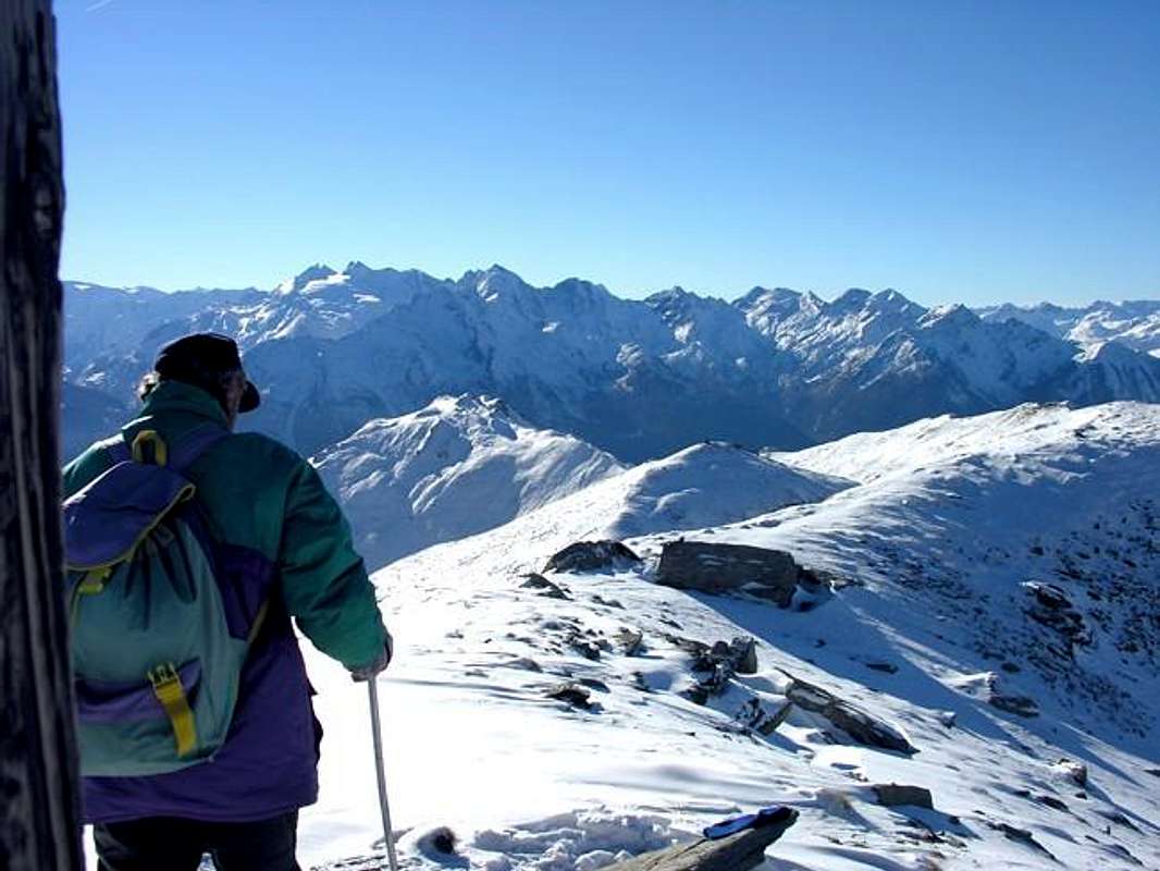
"Occasionally admires the Panorama & the Landscape, otherwise what you going to do in the mountains? ... "by Osw
![]()
North Ranges among By, St. Bernard, Ferret, de Bagnes, d'Entremont, Valsorey e Swiss Ferret Valleys, East to Westby Antonio, marked by Osw
Partendo questa volta da Ovest verso Est queste son quelle interessate e discendenti verso la Dora Baltea: Val Ferret, Val Sapin, Valloni di Planavalle, Vertosan, Bacino di Vetan ed ancora Valloni di Verrogne, Clusellaz e Met, con quest'ultimo consistente in una serie di valloncelli che a raggiera sovrastano accerchiando i Comuni di Saint Pierre, Sarre, Aosta e Gignod. Oltre risale aprendosi a grande ventaglio la Valle del Gran San Bernardo con tutta una serie di più o meno piccoli valloni (Buthier, Arsy, Flassin, Citrin, Serena, Merdeux, Thoula, Leisasses, Fenetre), le acque dei quali confluiscono dapprima nel Rio Artanavaz o Buthier de Bosses e nel Buthier d'Ollomont per poi unificarsi con il Buthier de Valpelline e genericamente diventare il "Buthier", che sfocia nella Dora Baltea ad Aosta subito dopo l'Arco d'Augusto. L'antico celtico "Bu e Boud" e romano "Buthiacus e Bautegius" che nel Medioevo diventerà "Balteus", come per la "Dora Baltea" nella quale appunto si riversa. Entrambi hanno lasciato segni funesti nella Valle. Insieme alla Dora di Ferret ed ai Torrents Sapin, Planavalle, Vertosan, Clusella costituiscono il grande bacino imbrifero di questa vastissima area, che ormai é alimentata più dai laghi che dai ghiacciai ormai quasi del tutto scomparsi. Infatti per ritrovarne qualcuno é necessario salire ad Etroubles dove il Glacier du Mont Velan alimenta il Torrent de Menouve oppure, sul versante opposto, ai ghiacciaietti alla base della cresta di frontiera tra Col de Valsorey e Fenetre Durand. Resiste il Glacier du Mont Gelé che però progressivamente và sparendo sotto a Becca Faudery e Crevaye, Trident de Faudery, vari Morions, Clapier, nonché verso Punta Fiorio e viciniore Mont-de-Berrio, sopra Ollomont e Valpelline.
Quindi una zona, Velan escluso, più idonea alla pratica dell'Escursionismo che non rivolta all'Alpinismo ed all'Arrampicata; un'area molto indicata anche per le Passeggiate ai laghi.
Sette, inoltre, sono i requisiti per la descrizione degli itinerari di base ed altri, con l'elasticità di solo due fattori mancanti per ognuna, e così in sintesi riassumibili:
1) - : sentieri o percorsi segnalati, oppure in mancanza, sempre semplicemente individuabili sia in fase di salita che discesa, laddove possibile coincidenti ed inoltre piuttosto facili.
2) - : facilità della via con itinerari rivolti ad E (Escursionisti) oppure ad EE (Escursionisti Esperti), con l'utilizzo saltuario degli arti superiori; difficoltà su roccia da F (Facile) al massimo a F+ (Facile superiore), con passaggi che non vanno quasi mai oltre il I°/I°+ (Scala U.I.A.A. o dell'Unione Internazionale delle Associazioni Alpinistiche).
3) - : mancanza di ghiacciai od attraversamento marginale dei medesimi; presenza di nevai o glacio-nevati con pendenza non superiore ai 30°/35° e possibilmente non crepacciati.
4) - : possibilità di avere a non grandi distanze buoni punti di appoggio come accampamenti, bivacchi o rifugi, in genere sempre ben segnalati lungo l'intero percorso.
5) - : in mancanza di questi, esistenza di punti di riparo dalle intemperie come ricoveri naturali, grotte, Alpeggi o Casotti dei Parchi o della Forestale (attenzione, in genere privati).
6) - : assenza di grandi e più o meno evidenti pericoli oggettivi sovrastanti il percorso (cadute di pietre, possibilità di frane, valanghe, slavine o semplicemente crolli glaciali).
7) - : punto panoramico di primordine sull'intera vallata visitata, possibilmente centrale e comunque tale da consentire la vista completa sulla medesima nonché in lontananza.

Getting There
Southern, Western, Northwestern & Northeastern Getting ThereBY CAR:
- From TORINO, MILANO, etc: Motorway A5. Exit at IVREA or Quincinetto (PIEDMONT).
- From IVREA Town: in West towards Pont Saint Martin, Donnas, Hône-Bard, Champdepraz, Saint Vincent, Châtillon Pontey, Fénis, Saint Marcel, Grand Brissogne, Pollein, Charvensod, Gressan, Jovençan, Aymavilles, to Villeneuve, Arvier, Avise, Morgex and to Pré Saint Didier, Courmayeur Municipalities.
- From Courmayeur Resort: in East to Morgex, La Salle, Saint Pierre, Sarre, Aosta Municipalities.
![]()
Southtern Side:
From Courmayeur-Resort to Gignod Commune - From Courmayeur-Villair Dessus (1.282m), with Municipal Road and through dirt road to fork 1.470 meters and path to Refuge Bertone in Val Sapin.
- From La Salle 1.001m), with Regional Road, towards Challancin (1.610m), Cheverel, Morges (1.829m), Planaval Hamlets (1.750m); from this, through farms dirt road in North-northeast, passing Maison Blanche Pasture, towards the Rantin (2.333m) and Bonalé (2.340m) Alpages, in Upper Planaval small Valley.
- From La Salle, with Regional Road, towards Challancin Village, Ponteilles (1.741m), Arpilles (1.862m) Pastures to Bard Pass (2.178m) in Arpilles Conca
- From Saint Pierre-Pommier (783m) towards Champretavy, Rumiod, alternative just after Persod (1.351m), Ravoise, Chaillod, Clavel, Cerlogne (1.580m) and Vens small Villages (1.750m), with Regional Road in West-northwest. From this last to Joux Saddle (1.930m); through short, always by dirt road, descent to Vertosan small Valley
- From Saint Pierre-Château Sarriod de la Tour, Rumiod, Petit and Grand Sarriod (1.444/5m), Gerbore, Vetan Dessous (1670m) and Dessus (1.737m), with Regional Road to Vetan Basin. From this, through dirt road, towards Genevrine Pasture, Chatalanez, Toules, Grand Arpilles Alps to Chaz Creuse small Basin (2.398m).
- From Sarre (657m), with Regional Road, towards Plèod, Vert Dessous and Dessus, Vareille, Caillod/Ville sur Sarre/Remondet, Moulin/la Cort, forks 1.225, 1.301 meters, Salet, Chavalançon (1.426m) small Villages to Thouraz Dessous and Dessus Hamlets (1.652m); from the last to Closella and Met small Valleys.
- From Aosta North Town with Main Route of From Aosta City towards the Great Saint Bernard Valley to alternative nearby Grand Signayes Hamlet (737m); through the deviation, in asphalt, to Arpuilles (1.010m), Excenex (1.046m) Fractions. From these by farm dirt roads or various paths, numbered or not, to Tsa de Metz or "Les Arpes Vieilles" (1.419m), below Checotteyes (1.715m) Alp on Arpilles small Valley. From this point to Met Hill, Met Summit and Croix de Chaligne.
![]()
Western Side:
From Aosta Town to Merdeux Basin - From Gignod Commune (988m) with Great Saint Bernard SS.27 to alternative nearby Condemine Hamlet (1.137m); leaving left through Municipal Road to Grand e Petit Buthier Villages (1.302m, 1.439m) in Chaligne Comba. From this last, with private dirt farms roads and through Mendey, Roncaille, Rombason Pastures up to the Chaligne Shelter (1.936m), below Costa Tardiva (2.380m), Tardiva Hill (2.410m) and neighbor the Punta Chaligne (2.608m)
- From Etroubles Commune (1.270m), with dirt road and through Champ-Reclos (1.425m), Yettes (1.591m), Eteley (1.716m), fork before Praz-Gallet (1.626m), Ars (1.975m) Pastures on Arsy Vallon, up to Chaz d'Arsy (2.543mn); from this paths to Ars Pass (2.534m), Costa Labiez (2.632m).
- From Etroubles Commune (1.270m), with dirt road through Champex (1.411m; fork), Flassin de Meitin (1.654m), Flassin (1.700m), Tsa de Flassin (2.258m) Pastures on Flassin Vallon; from this paths to Fenêtre Pass (2.729m), Flassin Hill (2.605m), Testa Cordella (2.663m) and Tête Bois de Quart (2.248m).
- From Saint-Oyen Commune (1.377m), with SS.27 to alternative 1.502 meters; leaving North the same to great St. Bernard Hill, continue West to St. Leonard Fraction.
- From this to Citrin Vallon up to the Mont Flassin (2.772m) Citrin Hill (2.484m), Punta Valletta (2.801m) and La Raye du Sodzé (2.640m).
From Saint-Oyen Commune (1.377m), with previous Municipal Road to Mottes (1.660m) Fraction, Farettes (1.666m) Village; from this, with path through Arp du Bois Dèsott Pastures (1.936m), alternative 1.959 meters to Serena Vallon up to the Hill Serena (2.547m) and Testa Serena (2.830m). Variant: continue West from Farettes Village to Saint Michel (1.732m) Fraction; from this last, tourning South always with Municipal Road, to Arp du Bois Dèsott Pastures.
Northwestern Side:
From Malatrà Hill up to the Grand Saint Bernard Basin and Pass
- From Saint-Oyen (1.377m), with previous road to Mottes, continue West-northwest to Devies Village (1.723m) at the beginning of Merdeux Comba; from this with paths through Merdeux Dèsott (1.919m), Cotes (1.930m), Manda (1.973m), Tsa de Merdeux (2.285m) Pastures to Malatrà Hill (2.928m).
- From Saint Rhémy en Bosses Commune (1619m), through Municipal Road, on Merdeux Comba to Tsa de Merdeux (2.285m) and Malatrà Hill (2.928m).
- From Saint Rhémy en Bosses Commune (1.619m) to Tula Comba to Saulié Pass (2.817m), Aiguille des Cengles (2.869m) and Angroniettes Pass (2.936m).
- From Saint Rhémy en Bosses Commune (1.619m) to Grand Saint Bernard Valley up to the Crévacol Hill and Testa (2.498m, 2.610m) Saint Rhémy Hill (2.540m), Mont Rodzo (2.632m), Pain de Sucre (2.900m), Mont Fourchon (2.902m), Fenêtre de Ferret Hill (2.600m) and Grand Saint Bernard Hill (2469m).
Northeastern Side:
From Allain/Doues to Ollomont/Valpelline Communes with By Basin
- From Allein Commune (1.251m), with Regional and Municipal Roads, to By Basin; from the entrance of this (various alpages reached by private dirt farms roads), through paths, up to the Mont Saron Southern Antesummit (2.681m) and traverse on crest to Tête de la Praz (2.751m) and Crou de Bleintse (2.824m).
- From Doues Commune (1.176m), with in asphalt Municipal Road, to By Basin; from this, with paths or dirt roads, to Mont Saron (2.681m), Crou de Bleintse (2.824m), Letey Refuge below Champillon Pass (2.430), Mont Chenaille two Summits (3.144m), Tsa d'Ansermin (2.388m) and Monte Rotondo (2.572m).
- From Ollomont Commune (1.356m), trhough noumerous paths and variaous upper dirt farms roads, to By Conca; from this various routes in all directions up to the Maria Cristina Rosazza at Savoie Bivouac (2.674m) at Boégno Bà Hill, Refuge Franco Chiarella-Amiante (2.979m) under Grand' Tete de By, Filon Alp (2.478m), Bonne Mort Pass (2.646m), Fenêtre Durand Hill (2.797m), Nino Regondi Bivouac (2.599m) and Lakes below Morions Range, Tsa de Berrio Alp (2.165m), Cormet Hill (2.354m) and Breuson Hill (2.194m).

- From FRANCE: through the Mont Blanc Tunnel to Entrèves-crossroads to Vény/Ferret Valleys - Mountain Guides of Courmayeur - La Saxe Rock Gym - Courmayeur. By Little Saint Bernard Pass, closed since November until half May to La Thuile Valley - Pré Saint Didier - Courmayeur. It is not necessary to take Motorway A5: you can drive on SS.26 , in the direction of AOSTA - IVREA - TURIN.
BY PLANE:
- Aeroporto "Corrado Gex" Saint Christophe (Aosta).
Any advice and recommendation ... small Decalogue


30 Routes Description

The choice of these 30 routes is always targeted to the 7 pre above requirements.
It is designed to identify the most suitable excursion to the parameters predicted and that the best way to represent a valley, in general all the proposals are aimed at ascents ranging on average between 2.750 to 3.350 metres with a few exceptions. However it has also tried to offer alternative opportunities, presenting on the single territory other two proposals; the same are more equally synthesized but always containing all the basic information you need. Or simply to provide more tips and suggestions, with the division into three bands enough diversified.
Band One: is the basic tour designed to represent the specific valley; is described in detail, numerous annotations, timing only indicative and various suggestions.
Band Two: Excursion similar to the previous one, with the same altitude but also in less differentiated (usually) or more; viewpoint completely different from the first proposal.
Band Three: Excursion of less effort and duration and also, more suited to the path even with children or boys, also to use as "backup" in case of uncertain weather.
La scelta di questi 30 Itinerari risulta sempre mirata ai 7 prerequisiti sopra esposti.
Si é pensato di individuare la Escursione più consona ai parametri predetti e tale da rappresentare nel modo migliore una valle, in genere tutte le proposte sono rivolte ad ascensioni che vanno mediamente tra i 2.750 ai 3.350 metri con qualche eccezione. Comunque s'é cercato d'offrire anche opportunità alternative, presentando all'interno del medesimo territorio altre due proposte; le stesse sono maggiormente sintetizzate pur contenendo ugualmente tutte le indicazioni di base necessarie. Oppure semplicemente per offrir ulteriori suggerimenti e proposte maggiormente variegate, con la suddivisione in tre fasce ben diversificate.
Fascia Uno: gita di base atta a rappresentare la specifica vallata; viene descritta con dovizia di particolari, numerose annotazioni, tempistica solo indicativa e suggerimenti varii.
Fascia Due: gita similare alla precedente, con altitudine uguale o differenziata in meno (generalmente) od in più; punto panoramico completamente diverso dalla prima proposta.
Fascia Tre: Escursione di minor impegno ed anche durata, più adatta al percorso anche con bambini o ragazzi, da utilizzarsi come "riserva" in caso di tempo incerto.
![]()
Val Ferret
1/A) - Petit Golliaz (3.234m).
Si é pensato di individuare la Escursione più consona ai parametri predetti e tale da rappresentare nel modo migliore una valle, in genere tutte le proposte sono rivolte ad ascensioni che vanno mediamente tra i 2.750 ai 3.350 metri con qualche eccezione. Comunque s'é cercato d'offrire anche opportunità alternative, presentando all'interno del medesimo territorio altre due proposte; le stesse sono maggiormente sintetizzate pur contenendo ugualmente tutte le indicazioni di base necessarie. Oppure semplicemente per offrir ulteriori suggerimenti e proposte maggiormente variegate, con la suddivisione in tre fasce ben diversificate.
Fascia Uno: gita di base atta a rappresentare la specifica vallata; viene descritta con dovizia di particolari, numerose annotazioni, tempistica solo indicativa e suggerimenti varii.
Fascia Due: gita similare alla precedente, con altitudine uguale o differenziata in meno (generalmente) od in più; punto panoramico completamente diverso dalla prima proposta.
Fascia Tre: Escursione di minor impegno ed anche durata, più adatta al percorso anche con bambini o ragazzi, da utilizzarsi come "riserva" in caso di tempo incerto.
1/A) - Petit Golliaz (3.234m).
Approach from Courmayeur-Lavachey-Arnouva: towards Col de Belle Combe (3.000m; EE; 4h'00/4h'30 from Arnouva) and through quite easy Southwestern Crest, formed by rocks very broken and debris bypassing some short distance to the left (West) (EE/A/F+; 1h'00/1h'15 by Bellecombe Pass; 5h'30/6h'00 from Arnouva).
![]()
Val Ferret
1/A) - Petit Golliaz (3.234 m).
1/B) - Aiguile de Bellecombe (3.087m).
1/B) - Aiguille de Bellecombe (3087 m).
Avvicinamento da Courmayeur: al Col de Belle Combe tramite il sentiero n° 26 passando dalle Alpi Bellecombe Dèsott e Damon (2.192 m, 2.256 m); da quest'ultima con sentiero non numerato insino a quota 2.320 metri circa ed infine con una traccia o residui di nevati ad Est-sudest piegando più a sinistra nella parte finale (3.000 m; EE/F; 4h'00/4h'30 da Arnouva). Dal colle tramite la Cresta Nord, corta ed abbastanza facile nonché formata da scisti affilati (EE/A; 0h'30 dal colle; 4h'30/5h'00 dal parcheggio).
![]()
1/C) - Pointe de Combette (2.761m).
1/C) - Pointe de Combette (2.761 m).
Avvicinamento da Arnouva-Pré de Bar Alpe (Rifugio Elena): con salita dentro il Vallone del Ban Darrey per mezzo del sentiero n° 25 passando dall'alpe innominata (2.264 metri; deviazione a Settentrione per il Colle del Grand Ferret verso la Val Ferret svizzera) e poi con sentiero non numerato fino all'omonimo colle (2.696 m), dopo aver superato una piccola fascia rocciosa nei pressi del torrente e più che facile Crestina Sud-sudovest nel finale (E/F; 1h'15/1h'30 dal rifugio; 3h'00/3h'30 dal parcheggio d'Arnouva).
![]()
Val Sapin
2/A) - Mont de la Saxe (2.345m).
1/A) - Petit Golliaz (3.234 m).
Avvicinamento da Courmayeur-Lavachey-Arnouva: al Col de Belle Combe (3.000 m; EE; 4h'00/4h'30 da Arnouva) e tramite l'abbastanza facile Cresta Sudovest, formata da roccette alquanto rotte con detriti ed aggirando qualche breve tratto a sinistra (Occidente) (EE/A/F+; 1h'00/1h'15 dal colle; 5h'30/6h'00 dal piazzale d'Arnouva).
1/B) - Aiguile de Bellecombe (3.087m).
Approach from Courmayeur: towards Col de Belle Combe through the path n° 26 passing the Alps Bellecombe Dèsott e Damon (2.192m, 2.256m); from this last with unnumbered path upto the altitude 2.320 meters around and finally by a track or remains of snowfields to the East-southeast flexing more towards left in final part (3.000m; EE; 4h'00/4h'30 from Arnouva) and through Northern Crest, short, fairly easy and consists of schist sharpened (EE/F; 0h'30 from pass; 4h'30/5h'00 by Arnouva).
1/B) - Aiguille de Bellecombe (3087 m).
Avvicinamento da Courmayeur: al Col de Belle Combe tramite il sentiero n° 26 passando dalle Alpi Bellecombe Dèsott e Damon (2.192 m, 2.256 m); da quest'ultima con sentiero non numerato insino a quota 2.320 metri circa ed infine con una traccia o residui di nevati ad Est-sudest piegando più a sinistra nella parte finale (3.000 m; EE/F; 4h'00/4h'30 da Arnouva). Dal colle tramite la Cresta Nord, corta ed abbastanza facile nonché formata da scisti affilati (EE/A; 0h'30 dal colle; 4h'30/5h'00 dal parcheggio).
1/C) - Pointe de Combette (2.761m).
Approach from Arnouva-Pré de Bar Alp (Refuge Elena): with ascent with path into the Ban Darrey Vallon, through the trail n° 25 passing the unnamed pasture (2.264 meters; deviation to the North towards the Grand Ferret Hill with crossing in Swiss Ferret Valley) and after by not numbered path up to the homonym pass (2.696m) after passing a small rocky area near the stream and more than easy South-southwestern Crest in terminal part (E/F; 1h'15/1h'30 from refuge; 3h'00/3h'30 from parking).
1/C) - Pointe de Combette (2.761 m).
Avvicinamento da Arnouva-Pré de Bar Alpe (Rifugio Elena): con salita dentro il Vallone del Ban Darrey per mezzo del sentiero n° 25 passando dall'alpe innominata (2.264 metri; deviazione a Settentrione per il Colle del Grand Ferret verso la Val Ferret svizzera) e poi con sentiero non numerato fino all'omonimo colle (2.696 m), dopo aver superato una piccola fascia rocciosa nei pressi del torrente e più che facile Crestina Sud-sudovest nel finale (E/F; 1h'15/1h'30 dal rifugio; 3h'00/3h'30 dal parcheggio d'Arnouva).

2/A) - Mont de la Saxe (2.345m).
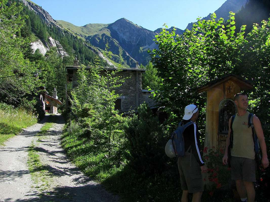
Approach from Courmayeur-Villair towards Val Sapin: from Courmayeur to Villair Dessus Fraction with Regional Road (at the end signal no transit); through the path n° 42 to Refuge Giorgio Bertone, on woodes-rocky promontory at the beginning of Mount de la Saxe easily walked toward North. In descent, to Northwest, with path n° 3/TMB/Haute Route n° 1 in Northwest to Ferret Valley, lower part nearby Planpincieux (E/F; 1h'45/2h'15 in ascent; 1h'10 down; 3h'00/3h'30 for complete traverse).
![]()
Val Sapin
2/A) - Mont de la Saxe (2.345m).
2/B) - Tête de la Tronche and Testa Bernarda (2.584m, 2.534m).
Approach from Courmayeur Villair Fraction: by Courmayeur Center neighbor the "Alpine Museum" (1.220m about), take the Municipal Road to the North in Val Sapin, in parallel towards East with this more important and wide of the Val Ferret, that reaches the eponymous hill where the end Graians and begin the Pennine Alps to which belong the Summits addressed in this Route (Tête de la Tronche and Testa Bernarda). Reached Villair Dessus (Upper) where this ends for the use without its permission (1.382m; cartel ban immediately after the village); from this point start to climb towards the Northeast, through the same one that coincides with the path n° 38 until you reach the junction 1.470 meters which, through the n° 42/TMB to the West-northwest, reaches the Refuge Giorgio Bertone, very scenic towards the Mont Blanc and on a meadow-rocky promontory at the beginning of the watershed of Mont de la Saxe. Abandoned this on the left, proceed on the valley floor always with the Northeast direction until you come to the next Village of La Trappa (1.505m) and from this, exclusively through the same path to the equally tiny Village Tsapy (1.635m), very close the famous "Trou des Romains" or "Hole Roman", where there is an ancient Roman Goldmine, now long abandoned and closed as very dangerous and subject to frequent landslides (E/F; 1h'00/1h'15).
Route from Tsapy or Chapy Hamlet (1.635m) towards Sapin Hill (2.435m): from the Village Tsapy, collocated at the center of the valley and at the end of the dirt road, leaving to the North the old route that runs along the bottom of the valley along the Torrent de Tsapy then navigate to the Northeast to the hill, climb decidedly to the East via the trail n° 43/44, which quickly reaches the Pasture of Freydevaz (1.739m). From here with sharp bends and hemicircular path towards the Northeast to the alternative 2.962 meters, just before the Currù Torrent in the adjacent vallon. Discarded South deviation, that by the trail n° 43A leads to Alpages La Suche (1.810m), just after you reach the torrent. From this you leave on the right (East) the deviation with the trail n° 44 that leads to Liconi Hill, Lake and Tête de Liconi or Licony (2.674m, 2.555m, 2.929m), now above La Salle and Morgex Municipalities, continuing, by means of a short descent, the path followed up to here which comes in a short time the Alp of Currù (1.964m); from here a long diagonal to the North, dominating from the high the vallon, easily leads to the hill by a long series of small and narrow hairpin bends (E/F; 2h'15/2h'30).
Variant with ancient route on valley floor: from Tsapy, where both the private dirt road that the concomitant trail n° 38, ends, continue in the same direction, but with a smaller path and not numbered, going for a short time along the shore hydrographic right of the Torrent de Sapin for then wade the same and continue on the other side until the altitude 1.732 meters, where you will return with a new ford to the West. From this point the trail, always going up next to the same torrent, bends most at Northwest reaching the altitude of 2.164 meters, where it ends; reach through grassy slopes-detrital subsequent to following altitude 2.223 meters at two branches that give rise to the creek and, after crossing a small secondary vallon toward the Northeast, always using the same type of ground in a short time to reach the Sapin Hill (2.435m; EE/F; 1h'45/2h'15). From Col Sapin (2.435m), left to right branch that goes down to the Tsa (more high Alp) de Sécheron (2.260m) into the adjacent Armina Vallon, continue with the path n° 42 in the Northwest Crest, or just under the edge of the ridge, of Tête de la Tronche (2.584m) to reach the same easily and quickly hence the same, down more to the West, reaches a wide saddle (2.495m), after which you reach, wanting to go on the trail, the nearby Testa Bernarda (2.534m; E/F; 1h'15/1h'30 or 2h'00).
2/B) - Teste della Tronche e Bernarda (2.584 m, 2.533 m).
Avvicinamento da Courmayeur-Villair: dal Centro di Courmayeur, nei pressi del "Museo Alpino" (circa 1.220 m), prendere la Strada Municipale che s'indirizza a Nord verso la Val Sapin, parallela ad Oriente della più importante ed estesa Val Ferret, che raggiunge l'omonimo colle dove terminano le Alpi Graie ed iniziano quelle Pennine alle quali appartengono le Sommità trattate in questa Route. Raggiunto il Villair-Dessus (Superiore), ove questa termina per l'utilizzo dei mezzi privi di relativo permesso (1.382 m; cartello di divieto subito dopo il villaggio). Da questo punto iniziare a salire verso Nordest, tramite la stessa che coincide con il sentiero n° 38 fino a raggiungere il bivio 1.470 metri che, tramite il sentiero n° 42/TMB verso Ovest-nordovest, perviene al Rifugio Giorgio Bertone all'inizio del lungo spartiacque del Mont de la Saxe e posizionato su di un panoramico promontorio prativo-roccioso. Abbandonato questo sulla sinistra, procedere invece sul fondovalle sempre con direzione Nordest sino a pervenire al successivo Villaggetto di La Trappa o Trappe (1.505 m) e da questo, esclusivamente tramite il medesimo sentiero, all'altrettanto minuscolo Villaggio di Tsapy (1.635 m), nelle strette vicinanze del famoso "Trou des Romains", ove esiste un'antica Miniera d'oro dei Romani, ormai da tempo abbandonata poiché pericolosa e soggetta a frequenti franamenti (E/F; 1h'00/1h'15).
Via dal Villaggio di Tsapy o Chapy verso il Col Sapin: da Tsapy o Chapy (1.635 m) al termine della poderale, lasciata sulla sinistra la vecchia via percorrente il fondo del vallone lungo il Torrent de Tsapy per poi traversare verso Nordest al colle, salire invece decisamente ad Oriente tramite il sentiero n° 43/44, che in breve tempo raggiunge l'Alpeggio di Freydevaz (1.739 m). Da qui con stretti tornanti e percorso semicircolare verso Nordest si raggiunge il bivio 2.962 metri, poco prima del Torrent de Currù nell'adiacente vallone. Scartata a Sud la deviazione, che tramite il sentiero n° 43A conduce all'Alpe La Suche (1.810 m), subito dopo si raggiunge il torrente. Da questo s'abbandona sulla destra (Est) la deviazione che con il sentiero n° 44 porta al Colle di Liconi, Lago e Testa di Liconi o Licony (2.674 m, 2.555 m, 2.929 m) ormai al di sopra dei Comuni di La salle e Morgex, proseguendo, per mezzo d'una discesina, col sentiero sin qui seguito, che arriva in breve tempo all'Alpe del Currù (1.964 m); da questo punto un lungo diagonale a Settentrione, dominando dall'alto il vallone, conduce facilmente al colle per mezzo di una numerosa serie di stretti tornantini (2.435 m; E/F; 2h'15/2h'30).
Variante sul fondovalle: da Tsapy, al termine della poderale e del concomitante sentiero n° 38, si prosegue sempre nella stessa direzione, ma con un sentierino non numerato, salendo per breve lungo la sponda idrografica destra del Torrent de Sapin per poi guadare lo stesso e proseguire sulla sponda opposta fino alla quota di 1.732 metri, dove si ritorna con un nuovo guado ad Ovest. Da questo punto il sentiero, salendo sempre affianco al torrente medesimo, flette maggiormente a Nordovest raggiungendo l'altitudine di 2.164 metri, dove termina; pervenire per mezzo di pendii erboso-detritici alla successiva di 2.223 metri presso due rami che originano il Torrente di Sapin e, dopo aver brevemente attraversato verso Nordest un valloncello secondario, sempre tramite stessa tipologia di terreno, in breve tempo raggiungere il Col Sapin (2.435 m; EE/F; 1h'45/2h'15). Dal Col Sapin (2.435 m), lasciata a destra la diramazione che scende alla Alpe di Sécheron, continuare con il sentiero n° 42 sul filo di cresta oppure subito al di sotto della Cresta Nordovest della Tête de la Tronche (2.584 m) raggiungendo la medesima facilmente ed in breve tempo; da qui lo stesso, scendendo più ad Ovest, raggiunge una larga sella (2.495 m), dopo la quale si raggiunge, volendo proseguire, la viciniora Testa Bernarda (2.534 m; E/F; 1h'15/1h'30 oppure mezz'ora in più dal Col Sapin).
![]()
Planavalle Vallon
3/A) - Grande Rochère (3.226m).
2/A) - Mont de la Saxe (2.345m).
Avvicinamento da Courmayeur-Villair: da Courmayeur con la Regionale per la Frazione del Villair Dessus (al termine segnale di divieto); tramite il sentiero n° 42 al Rifugio Giorgio Bertone, sul promontorio boschivo-roccioso all'inizio della cresta del Mont de la Saxe (facile verso Nord). In discesa, a Nordovest, con quello n° 3/TMB/Haute Route n° 1 verso Nordovest in direzione della Val Ferret, parte inferiore presso Planpincieux (E/F; 1h'45/2h'15 in salita; 1h'10 in discesa; 3h'00/3h'30 per la completa traversata).
2/B) - Tête de la Tronche and Testa Bernarda (2.584m, 2.534m).
Approach from Courmayeur Villair Fraction: by Courmayeur Center neighbor the "Alpine Museum" (1.220m about), take the Municipal Road to the North in Val Sapin, in parallel towards East with this more important and wide of the Val Ferret, that reaches the eponymous hill where the end Graians and begin the Pennine Alps to which belong the Summits addressed in this Route (Tête de la Tronche and Testa Bernarda). Reached Villair Dessus (Upper) where this ends for the use without its permission (1.382m; cartel ban immediately after the village); from this point start to climb towards the Northeast, through the same one that coincides with the path n° 38 until you reach the junction 1.470 meters which, through the n° 42/TMB to the West-northwest, reaches the Refuge Giorgio Bertone, very scenic towards the Mont Blanc and on a meadow-rocky promontory at the beginning of the watershed of Mont de la Saxe. Abandoned this on the left, proceed on the valley floor always with the Northeast direction until you come to the next Village of La Trappa (1.505m) and from this, exclusively through the same path to the equally tiny Village Tsapy (1.635m), very close the famous "Trou des Romains" or "Hole Roman", where there is an ancient Roman Goldmine, now long abandoned and closed as very dangerous and subject to frequent landslides (E/F; 1h'00/1h'15).
Route from Tsapy or Chapy Hamlet (1.635m) towards Sapin Hill (2.435m): from the Village Tsapy, collocated at the center of the valley and at the end of the dirt road, leaving to the North the old route that runs along the bottom of the valley along the Torrent de Tsapy then navigate to the Northeast to the hill, climb decidedly to the East via the trail n° 43/44, which quickly reaches the Pasture of Freydevaz (1.739m). From here with sharp bends and hemicircular path towards the Northeast to the alternative 2.962 meters, just before the Currù Torrent in the adjacent vallon. Discarded South deviation, that by the trail n° 43A leads to Alpages La Suche (1.810m), just after you reach the torrent. From this you leave on the right (East) the deviation with the trail n° 44 that leads to Liconi Hill, Lake and Tête de Liconi or Licony (2.674m, 2.555m, 2.929m), now above La Salle and Morgex Municipalities, continuing, by means of a short descent, the path followed up to here which comes in a short time the Alp of Currù (1.964m); from here a long diagonal to the North, dominating from the high the vallon, easily leads to the hill by a long series of small and narrow hairpin bends (E/F; 2h'15/2h'30).
Variant with ancient route on valley floor: from Tsapy, where both the private dirt road that the concomitant trail n° 38, ends, continue in the same direction, but with a smaller path and not numbered, going for a short time along the shore hydrographic right of the Torrent de Sapin for then wade the same and continue on the other side until the altitude 1.732 meters, where you will return with a new ford to the West. From this point the trail, always going up next to the same torrent, bends most at Northwest reaching the altitude of 2.164 meters, where it ends; reach through grassy slopes-detrital subsequent to following altitude 2.223 meters at two branches that give rise to the creek and, after crossing a small secondary vallon toward the Northeast, always using the same type of ground in a short time to reach the Sapin Hill (2.435m; EE/F; 1h'45/2h'15). From Col Sapin (2.435m), left to right branch that goes down to the Tsa (more high Alp) de Sécheron (2.260m) into the adjacent Armina Vallon, continue with the path n° 42 in the Northwest Crest, or just under the edge of the ridge, of Tête de la Tronche (2.584m) to reach the same easily and quickly hence the same, down more to the West, reaches a wide saddle (2.495m), after which you reach, wanting to go on the trail, the nearby Testa Bernarda (2.534m; E/F; 1h'15/1h'30 or 2h'00).
2/B) - Teste della Tronche e Bernarda (2.584 m, 2.533 m).
Avvicinamento da Courmayeur-Villair: dal Centro di Courmayeur, nei pressi del "Museo Alpino" (circa 1.220 m), prendere la Strada Municipale che s'indirizza a Nord verso la Val Sapin, parallela ad Oriente della più importante ed estesa Val Ferret, che raggiunge l'omonimo colle dove terminano le Alpi Graie ed iniziano quelle Pennine alle quali appartengono le Sommità trattate in questa Route. Raggiunto il Villair-Dessus (Superiore), ove questa termina per l'utilizzo dei mezzi privi di relativo permesso (1.382 m; cartello di divieto subito dopo il villaggio). Da questo punto iniziare a salire verso Nordest, tramite la stessa che coincide con il sentiero n° 38 fino a raggiungere il bivio 1.470 metri che, tramite il sentiero n° 42/TMB verso Ovest-nordovest, perviene al Rifugio Giorgio Bertone all'inizio del lungo spartiacque del Mont de la Saxe e posizionato su di un panoramico promontorio prativo-roccioso. Abbandonato questo sulla sinistra, procedere invece sul fondovalle sempre con direzione Nordest sino a pervenire al successivo Villaggetto di La Trappa o Trappe (1.505 m) e da questo, esclusivamente tramite il medesimo sentiero, all'altrettanto minuscolo Villaggio di Tsapy (1.635 m), nelle strette vicinanze del famoso "Trou des Romains", ove esiste un'antica Miniera d'oro dei Romani, ormai da tempo abbandonata poiché pericolosa e soggetta a frequenti franamenti (E/F; 1h'00/1h'15).
Via dal Villaggio di Tsapy o Chapy verso il Col Sapin: da Tsapy o Chapy (1.635 m) al termine della poderale, lasciata sulla sinistra la vecchia via percorrente il fondo del vallone lungo il Torrent de Tsapy per poi traversare verso Nordest al colle, salire invece decisamente ad Oriente tramite il sentiero n° 43/44, che in breve tempo raggiunge l'Alpeggio di Freydevaz (1.739 m). Da qui con stretti tornanti e percorso semicircolare verso Nordest si raggiunge il bivio 2.962 metri, poco prima del Torrent de Currù nell'adiacente vallone. Scartata a Sud la deviazione, che tramite il sentiero n° 43A conduce all'Alpe La Suche (1.810 m), subito dopo si raggiunge il torrente. Da questo s'abbandona sulla destra (Est) la deviazione che con il sentiero n° 44 porta al Colle di Liconi, Lago e Testa di Liconi o Licony (2.674 m, 2.555 m, 2.929 m) ormai al di sopra dei Comuni di La salle e Morgex, proseguendo, per mezzo d'una discesina, col sentiero sin qui seguito, che arriva in breve tempo all'Alpe del Currù (1.964 m); da questo punto un lungo diagonale a Settentrione, dominando dall'alto il vallone, conduce facilmente al colle per mezzo di una numerosa serie di stretti tornantini (2.435 m; E/F; 2h'15/2h'30).
Variante sul fondovalle: da Tsapy, al termine della poderale e del concomitante sentiero n° 38, si prosegue sempre nella stessa direzione, ma con un sentierino non numerato, salendo per breve lungo la sponda idrografica destra del Torrent de Sapin per poi guadare lo stesso e proseguire sulla sponda opposta fino alla quota di 1.732 metri, dove si ritorna con un nuovo guado ad Ovest. Da questo punto il sentiero, salendo sempre affianco al torrente medesimo, flette maggiormente a Nordovest raggiungendo l'altitudine di 2.164 metri, dove termina; pervenire per mezzo di pendii erboso-detritici alla successiva di 2.223 metri presso due rami che originano il Torrente di Sapin e, dopo aver brevemente attraversato verso Nordest un valloncello secondario, sempre tramite stessa tipologia di terreno, in breve tempo raggiungere il Col Sapin (2.435 m; EE/F; 1h'45/2h'15). Dal Col Sapin (2.435 m), lasciata a destra la diramazione che scende alla Alpe di Sécheron, continuare con il sentiero n° 42 sul filo di cresta oppure subito al di sotto della Cresta Nordovest della Tête de la Tronche (2.584 m) raggiungendo la medesima facilmente ed in breve tempo; da qui lo stesso, scendendo più ad Ovest, raggiunge una larga sella (2.495 m), dopo la quale si raggiunge, volendo proseguire, la viciniora Testa Bernarda (2.534 m; E/F; 1h'15/1h'30 oppure mezz'ora in più dal Col Sapin).
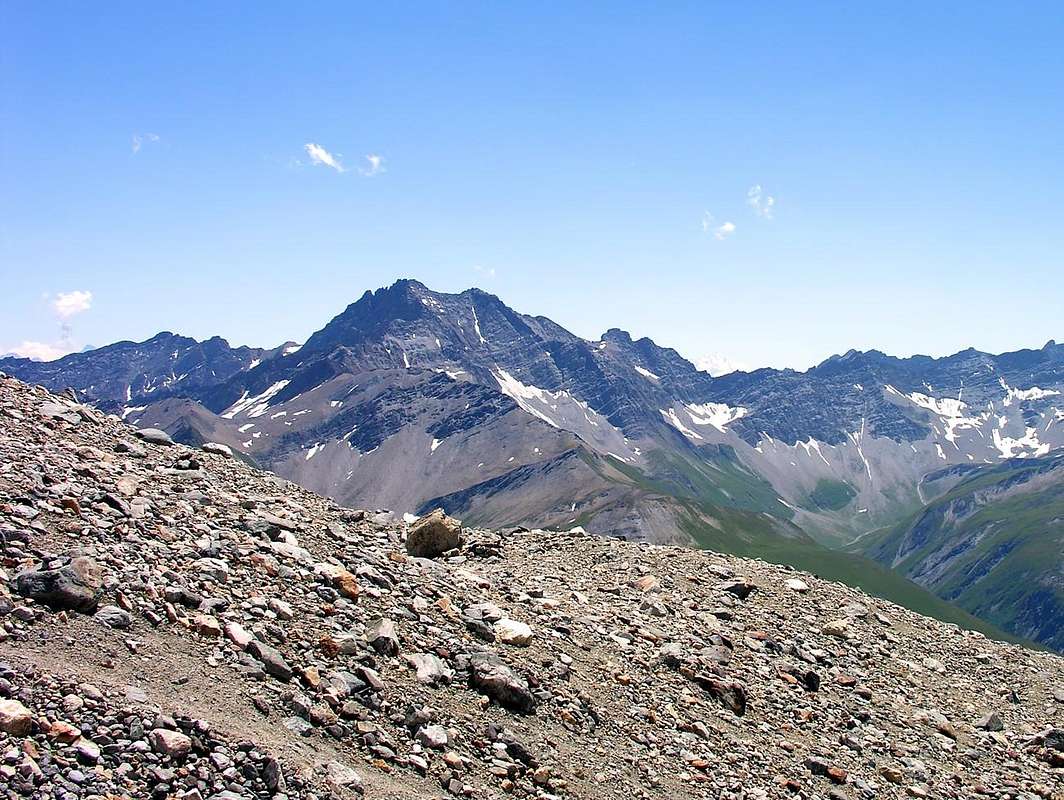
3/A) - Grande Rochère (3.226m).
Approach from Planavalle Village: from Planavalle or Planaval Hamlet (1.750m), before through dirt road, after with the muletrack-path n° 6/7 towards Rantin (2.333m), Pra Barlet (2.358m) and Bonalé or Bonalex Pastures (2.340m; EE/F; 1h'30/2h'00). Cross the vallon floor of the hanging valley on a faint trail, aiming for the grassy slopes to the left of a characteristic beak-shaped promontory above a cliff. Continue in a couloir with light-colored rocks aiming for the shoulder that comes down directly from Petite Rochère (not for the scree-filled gully). Past a couple of steep slopes made of calceschists and grassy turf, reach a faint but very scenic trail that leads, through scree and patches of snow, to the col between Grande Rochère and Petite Rochère. From there, climb through scree and broken rocks to reach the Summit. The route is not difficult, but steep and the trail is discontinuous. The Top trigonometric marker (3.326m) is visible from below. (EE/F+; 2h'45/3h'15 from Bonalé Alpage; 4h'45/5h'15 by Planavalle Hamlet).
![]()
Vallone di Planavalle
3/A) - Grande Rochère (3.226m).
3/B) - Aiguille de Bonalé (3.201m).
Approach and route from Planavalle or Planaval Hamlet (1.750m): , before through dirt road, after with the muletrack-path n° 6/7 towards Rantin (2.333m), Pra Barlet (2.358m) and Bonalé or Bonalex (2.340m) Pastures (EE/F; 1h'30/2h'00). From this last continue with unnumbered path towards North-northwest and then almost at its end to cross to the West side in a secondary vallon with grassy-detritus and finally snowfields that leads to Col de Bonalé (2.925m). Continue via the Southwest Ridge meeting at beginning of a partition wall that is exceeded by a chimney (I°+/II°-) and steep scree and debris to reach the Top (EEA/PD-/F+; 1h'00 from pass; 4h'30/5h'00 Planaval).
![]()
3/B) - Aiguille de Bonalé (3.201m).
3/C) - Aiguille d'Artanavaz (3.071m).
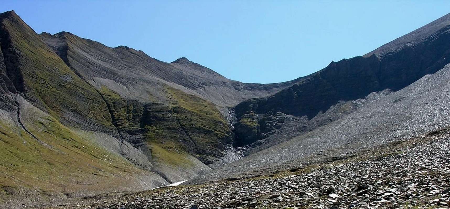
Approach and route from Planavalle Village : from Planavalle tiny Village (1.750m), below Bec de l'Aouille (2.535m), proceed with the previous itineraries to reach before the Alp Rantin (2.338 m), where the valley splits sending a branch to the Northeast towards the Serena Hill, and after that of Bonalé or Bonalex (2.340m; source) located immediately to the West of the long ridge called Côte de Serena (2.785m, on South Ridge of Crêton du Midi), here this ends. Leaving Northwest the way to the Great Rochère, continue further North through a small path not numbered nor reported running out towards the 2.415 meters at the end of the South "Crestone" of Crêton du Midi (3.071m). Ending the path next to the stream at the bottom vallon, progressively it flexes just right following a steep grassy promontory placed between two secondary torrents reaching the altitude of 2.740 meters. Cross the undulating vallon above, leaving the left (West) Aiguille de Bonalé, to reach the Lac de Bonalex (2.782m), just below that of Malatrà (3.142 m; E/F; 1h'15/1h'30). The final part is made up of easy and even toppo steep scree slopes, where snow usually remains until the beginning of summer. The tour is in fact quite popular in Ski-Mountaineering and lets achieve this important topographic node consists of three sides turned to Northwest of Val Ferret (Vallon de Malatrà), North of the Valley of the Gran San Bernardo (Combe du Merdeux) and precisely in South to the Valley of Dora Baltea (Vallon of Planavalle) (E/F; 3h'30/3h'45).
3/C) - Aiguille d'Artanavaz (3.071 m).
Avvicinamento e Via da Planavalle: dal Villaggetto di Planaval (1.750, m), sottostante il Bec de l'Aouille (2.535 m), procedere con i precedenti itinerari, utilizzando il lungo diagonale verso Settentrione della strada poderale sospesa sopra al vallone, fino a raggiungere dapprima l'Alpe Rantin (2.338 m), dove il medesimo si sdoppia inviando un ramo verso Nordest al Col Serena, e poi, doppiato a sinistra il costolone dalla Quota 2.710 metri, quella di Bonalé (2.340 m; sorgente) posta subito ad Occidente della lunga cresta chiamata Côte de Serena (2.785 m), ove questa ha termine. Lasciando a Nordovest la via verso la Grande Rochère, proseguire più a Settentrione tramite un sentierino non numerato e neppure segnalato che si esaurisce verso i 2.415 metri circa al termine del Crestone Meridionale del Crêton du Midi (3.071 m). Terminando il percorso a fianco del torrente lungo il suo lato idrografico di destra (Ovest) sul fondo vallone, progressivamente si flette appena sulla destra seguendo un ripido promontorio prativo posto tra due torrentelli secondari raggiungendo l'altitudine di 2.740 metri. Attraversare l'ondulata conca soprastante in genere con residui nevati, lasciando sulla sinistra (Ovest) l'Aiguille de Bonalé, per pervenire al Lac de Bonalex (2.782 m), subito al di sotto di quella di Malatrà ad Ovest e del Grand Crêton ad Est(3.142 m, 3.071 m; E/F; 1h'15/1h'30). La parte finale é costituita da facili e nemmeno toppo ripidi pendii detritici con qualche elementare roccetta, dove in genere permane la neve fino all'inizio dell'estate. La gita infatti é abbastanza frequentata nello Sci-Alpinismo e permette di raggiungere quest'importante nodo topografico costituito tra tre versanti rivolti a Nordovest alla Val Ferret (Vallone di Malatrà), a Nord alla Valle del Gran San Bernardo (Combe du Merdeux) ed appunto a Meridione alla Valle della Dora Baltea (Bacino o Vallone di Planavalle) (E/F; 3h'30/3h'45).
![]()
3/D) - Grand Crêton (3.071m).
3/D) - Grand Crêton (3.071 m).
Avvicinamento e Via dal Villaggio di Planavalle: da Planavalle seguire la precedente via per l'Aig. d'Artanavaz fino al Lac de Bonalé (2.782 m), sotto l'Aiguille de Malatrà; da qui, abbandonando a sinistra (Nord-nordovest) quest'itinerario, proseguire invece direttamente verso Nordest raggiungendo la base del ripido versante Sudovest a quota 2.845 metri circa. Percorrere il medesimo con qualche roccetta e detriti, facendo attenzione ai numerosi tratti ricoperti da erba, raggiungendo la Cima (EE/F; 3h'45/4h'00).
Variante: dal lago salire alla depressione tra l'Aiguille di Artanavaz ed il Grand Crêton (2.950 metri circa); raggiunta questa piegare a destra e salire tramite la Cresta Nordovest con percorso abbastanza facile ma certamente più sicuro: scavalcata la quota (3.062 metri, in breve tempo si arriva alla vetta (passaggi di I°/I°+; esposto a Nord; 4h'00/4h'15). Questa montagna, come i viciniori Crêton du Midi (2.945 m) e la Côte de Serena (2.785 m), sono assai raramente percorsi; sono itinerari più delicati che difficili, a causa della cattiva qualità della roccia e della presenza di strati erbosi sopra la medesima. Quindi maggiormente adatti per Cacciatori che non per Escursionisti od anche Alpinisti.
![]()
Vertosan Vallon
4/A)- Crossing Court de Bard, Punte Felita or Fetita, Testa dei Frà, Testa di Serena, Corléans Crest, Punta Valletta towards the Col Citrin (2.261m, 2.623m, 2.818m, 2.830m, 2.807m, 2.782m, 2.801m, 2.484m).
3/A) - Grande Rochère (3.226m).
Avvicinamento dal Villaggio di Planavalle: dal Villaggio di Planavalle o Planaval (1.750 m), dapprima tramite la poderale, indi con il sentiero-mulattiera n° 6/7 verso le Alpi Rantin (2.333 m), Pra Barlet (2.358 m) e Bonalé o Bonalex (2.340 m: EE/F; 1h'30/2h'00). Attraversare il fondo del vallone sospeso su d'una appena accennata traccia, mirando ai pendii erbosi di sinistra di una caratteristica promontorio a forma di becco sopra ad un salto roccioso. Continuare nel canalone con rocce chiare che portano alla spalla discendente direttamente dalla Petite Rochère (non per il canalone detritico-riempita). Oltrepassati alcuni ripidi pendii composti sa calcescisti frammisti a tratti erbosi, raggiungere una esigua traccia che con percorso molto panoramico conduce, attraverso ghiaioni e chiazze di neve, alla selletta tra Grande Rochère e Petite Rochère. Da questa salire attraverso ghiaioni triti e rocce molto rotte ma facili per raggiungere la Vetta . Percorso non difficile ma abbastanza ripido con traccia molto discontinua. Sul Vertice segnale trigonometrico (3.326 m), visibile sin dal basso. (Tre ore da Bonalé Hut, cinque ore da Planaval (EE/F+; 2h'45/3h'15 dall'Alpeggio di Bonalé; 4h'45/5h'15 da Planavalle).
3/B) - Aiguille de Bonalé (3.201m).
Approach and route from Planavalle or Planaval Hamlet (1.750m): , before through dirt road, after with the muletrack-path n° 6/7 towards Rantin (2.333m), Pra Barlet (2.358m) and Bonalé or Bonalex (2.340m) Pastures (EE/F; 1h'30/2h'00). From this last continue with unnumbered path towards North-northwest and then almost at its end to cross to the West side in a secondary vallon with grassy-detritus and finally snowfields that leads to Col de Bonalé (2.925m). Continue via the Southwest Ridge meeting at beginning of a partition wall that is exceeded by a chimney (I°+/II°-) and steep scree and debris to reach the Top (EEA/PD-/F+; 1h'00 from pass; 4h'30/5h'00 Planaval).
3/B) - Aiguille de Bonalé (3.201m).
Avvicinamento dal Villaggio di Planavalle o Planaval (1.750 m):
dapprima tramite la poderale, indi con il sentiero-mulattiera n° 6/7 verso l'Alpi Rantin (2.333 m), Pra Barlet (2.358 m) e Bonalé o Bonalex (2.340 m). (EE/F; 1h'30/2h'00). Da quest'ultima continuare con sentierino non numerato verso Nord-nordovest quindi quasi al suo termine traversare ad Ovest in un valloncello secondario con erba e detrito ed infine nevati conducente al Colle di Bonalé (2.925 m). Proseguire con la Cresta Sudovest incontrando all'inizio una paretina superabile tramite stretto camino (I°+/II°-) e per ripidi sfasciumi detritici raggiungere la Vetta (EEA/PD-/F+; 1h'00 dal colle; 4h'30/5h'00 da Planaval).3/C) - Aiguille d'Artanavaz (3.071m).
Approach and route from Planavalle Village : from Planavalle tiny Village (1.750m), below Bec de l'Aouille (2.535m), proceed with the previous itineraries to reach before the Alp Rantin (2.338 m), where the valley splits sending a branch to the Northeast towards the Serena Hill, and after that of Bonalé or Bonalex (2.340m; source) located immediately to the West of the long ridge called Côte de Serena (2.785m, on South Ridge of Crêton du Midi), here this ends. Leaving Northwest the way to the Great Rochère, continue further North through a small path not numbered nor reported running out towards the 2.415 meters at the end of the South "Crestone" of Crêton du Midi (3.071m). Ending the path next to the stream at the bottom vallon, progressively it flexes just right following a steep grassy promontory placed between two secondary torrents reaching the altitude of 2.740 meters. Cross the undulating vallon above, leaving the left (West) Aiguille de Bonalé, to reach the Lac de Bonalex (2.782m), just below that of Malatrà (3.142 m; E/F; 1h'15/1h'30). The final part is made up of easy and even toppo steep scree slopes, where snow usually remains until the beginning of summer. The tour is in fact quite popular in Ski-Mountaineering and lets achieve this important topographic node consists of three sides turned to Northwest of Val Ferret (Vallon de Malatrà), North of the Valley of the Gran San Bernardo (Combe du Merdeux) and precisely in South to the Valley of Dora Baltea (Vallon of Planavalle) (E/F; 3h'30/3h'45).
3/C) - Aiguille d'Artanavaz (3.071 m).
Avvicinamento e Via da Planavalle: dal Villaggetto di Planaval (1.750, m), sottostante il Bec de l'Aouille (2.535 m), procedere con i precedenti itinerari, utilizzando il lungo diagonale verso Settentrione della strada poderale sospesa sopra al vallone, fino a raggiungere dapprima l'Alpe Rantin (2.338 m), dove il medesimo si sdoppia inviando un ramo verso Nordest al Col Serena, e poi, doppiato a sinistra il costolone dalla Quota 2.710 metri, quella di Bonalé (2.340 m; sorgente) posta subito ad Occidente della lunga cresta chiamata Côte de Serena (2.785 m), ove questa ha termine. Lasciando a Nordovest la via verso la Grande Rochère, proseguire più a Settentrione tramite un sentierino non numerato e neppure segnalato che si esaurisce verso i 2.415 metri circa al termine del Crestone Meridionale del Crêton du Midi (3.071 m). Terminando il percorso a fianco del torrente lungo il suo lato idrografico di destra (Ovest) sul fondo vallone, progressivamente si flette appena sulla destra seguendo un ripido promontorio prativo posto tra due torrentelli secondari raggiungendo l'altitudine di 2.740 metri. Attraversare l'ondulata conca soprastante in genere con residui nevati, lasciando sulla sinistra (Ovest) l'Aiguille de Bonalé, per pervenire al Lac de Bonalex (2.782 m), subito al di sotto di quella di Malatrà ad Ovest e del Grand Crêton ad Est(3.142 m, 3.071 m; E/F; 1h'15/1h'30). La parte finale é costituita da facili e nemmeno toppo ripidi pendii detritici con qualche elementare roccetta, dove in genere permane la neve fino all'inizio dell'estate. La gita infatti é abbastanza frequentata nello Sci-Alpinismo e permette di raggiungere quest'importante nodo topografico costituito tra tre versanti rivolti a Nordovest alla Val Ferret (Vallone di Malatrà), a Nord alla Valle del Gran San Bernardo (Combe du Merdeux) ed appunto a Meridione alla Valle della Dora Baltea (Bacino o Vallone di Planavalle) (E/F; 3h'30/3h'45).
3/D) - Grand Crêton (3.071m).
Approach and route from Planavalle Village: Planavalle (1.750m) follow the previous way to the nearby Aig. d'Artanavaz up to the Lac de Bonalé (2.782m), below Aig. de Malatrà; from here, leaving left (North-northwest) this route, go instead directly toward Northeast reaching the base of the steep Southwestern Slope at an altitude of 2.845 meters about. Take the same with some small rocks and debris, making sure on the many traits covered with grass "olline" before reaching the Summit (EE/F; 3h'45/4h'00).
Variation: from the lake up to the depression between the Aiguille Artanavaz Grand Crêton (2.950 meters around); reached this turn right and go up through the Northwest Ridge, with pretty easy but certainly safer route: bypassed the altitude (3.062 meters, in a short time you get to the Vertex (passages of I°/I°+; exposure facing North or San Bernard Valley; 4h'00/4h'15). This mountain, like the neighbors Crêton du Midi (2.945m) and the Côte de Serena (2.785m), are rarely paths; route are more delicate that difficult, because of the very bad rock quality and the presence of grassy layers above the same. Therefore greater emphasis on Hunters than to Hikers or even Mountaineers.3/D) - Grand Crêton (3.071 m).
Avvicinamento e Via dal Villaggio di Planavalle: da Planavalle seguire la precedente via per l'Aig. d'Artanavaz fino al Lac de Bonalé (2.782 m), sotto l'Aiguille de Malatrà; da qui, abbandonando a sinistra (Nord-nordovest) quest'itinerario, proseguire invece direttamente verso Nordest raggiungendo la base del ripido versante Sudovest a quota 2.845 metri circa. Percorrere il medesimo con qualche roccetta e detriti, facendo attenzione ai numerosi tratti ricoperti da erba, raggiungendo la Cima (EE/F; 3h'45/4h'00).
Variante: dal lago salire alla depressione tra l'Aiguille di Artanavaz ed il Grand Crêton (2.950 metri circa); raggiunta questa piegare a destra e salire tramite la Cresta Nordovest con percorso abbastanza facile ma certamente più sicuro: scavalcata la quota (3.062 metri, in breve tempo si arriva alla vetta (passaggi di I°/I°+; esposto a Nord; 4h'00/4h'15). Questa montagna, come i viciniori Crêton du Midi (2.945 m) e la Côte de Serena (2.785 m), sono assai raramente percorsi; sono itinerari più delicati che difficili, a causa della cattiva qualità della roccia e della presenza di strati erbosi sopra la medesima. Quindi maggiormente adatti per Cacciatori che non per Escursionisti od anche Alpinisti.

4/A)- Crossing Court de Bard, Punte Felita or Fetita, Testa dei Frà, Testa di Serena, Corléans Crest, Punta Valletta towards the Col Citrin (2.261m, 2.623m, 2.818m, 2.830m, 2.807m, 2.782m, 2.801m, 2.484m).
Approach from Vens Village: From Vens (1.734/50m, in West by Vetan) up with the paved road towards the overlying Saddle of Joux (1.930m; little parking at the namesake lake) to the beginning of the long Vertosan Vallon; by this first fall with the farm road, concomitant with the trail n° 30/VA, to the north up to the bottom of the vallon reaching Alp Maison de Plan. A detour n° 20 first Southward and then n° 3/8 North leads to Zette Mountain (1.965m); this goes up to the North through the trail n° 3/8 arriving at the crossroads just before Or de Bard Damon Pasture (2.177m). Reversing the path and with the path n° 3 is reached by a long diagonal to the Bard Pass (2.176m; E/F; 1h'00/1h'15). From this worth making a detour to get to the South, crossing a vast grassy plateau and small rocks into the end always with the path, the bastion of the Court de Bard (2.262 meters; E/F; 0h'30). After returning to the hill and continue on the ridge dividing the North and go to the next Borromein Pass (2.319m), and always with the same kind of path, after a round antesummit 2.442 meters, the two Punta Fetita or Felita (2.623m; E/F; 1h'30 from the Col de Bard). In short it comes down to the underlying and namesake hill (2.557m) continuing, the same direction along the Southern Crest of three Testa dei Frà (2.818m, the highest) through a small trail that rises up debris, blocks and broken rocks (E/F; 0h'45 from the Felita Pass; 4h'00/4h'30 by Joux Saddle). Easy before to get off the Ridge North-northeast and, after, in ascent through the Crest South-southwest, of easy rock routes, to reach the Testa di Serena (2.830m) above Dziule Lochs, where the watershed Planavalle/Vertosan ends (EE/F+; 0h'45; 5h'00/5h'30 in total). Wanting to "close the loop" you can continue on the ridge dividing Vertosan/Great St. Bernard, and bowing to the Northeast across the Crest of Corléans or Corbian consists of four elevations (2.807m, the highest); the ridge is longer than 2 km. but easy enough. But caution because the rock is broken, with grass and often covered with soil and, after the downhill more Eastern Top (2.782m), the next notch turf starts to climb with similar characteristics on West-southwest Crest of Punta Valletta (2.801m; A/PD-/PD; 0h'40 by Testa Serena. The descent is via the Southeast Ridge easily to Col Citrin (2.484m; E/F; 0h'25), whence the route n° 10/VA are reached Sorace (2.207m), Tronchey (1.947m) Alps at the Vertosan Torrent; with trail n° 20/VA again concomitant to dirt road, Jovençan and Breuil/Or de Breuil (1.845m), Maison de Plan following Alps. From here a short ascent, passing Maisonnettes and Neuves Alps, leads to the Joux Saddle (E/F; 1h'15/1h'30 downhill; 7h'30/8h'30 total).
![]()
Vallone di Vertosan
4/A)- Traversata Court de Bard, Punte Felita o Fetita, Testa dei Frà, Testa di Serena, Cresta di Corléans, Punta Valletta sino al Col Citrin (2.261 m, 2.623 m, 2.818 m, 2.830 m, 2.807 m, 2.782 m, 2.801 m, 2.484 m).
![]()
Vetan Basin
5/A)- Aouilletta/Punta Leissé Traverse (2.618m, 2.771m).
4/A)- Traversata Court de Bard, Punte Felita o Fetita, Testa dei Frà, Testa di Serena, Cresta di Corléans, Punta Valletta sino al Col Citrin (2.261 m, 2.623 m, 2.818 m, 2.830 m, 2.807 m, 2.782 m, 2.801 m, 2.484 m).
Avvicinamento dal Villaggio di Vens: Da Vens (1.734/50 m) salire con la Regionale verso la soprastante Sella di Joux (1.930 m; piccolo parcheggio presso l'omonimo laghetto) all'inizio del lungo Vallone di Vertosan; da questo dapprima scendere con la poderale, concomitante col sentiero n° 30/VA, verso Nord fino al fondo del vallone raggiungendo l'Alpe Maison de Plan. Una deviazione n° 20 dapprima verso Sud e poi n° 3/8 a Nord conduce alla Montagna Zette (1.965 m); da questa salire verso Settentrione tramite il sentiero n° 3/8 arrivando al bivio subito prima dell'Alpe Or de Bard Damon (2.177 m). Invertendo percorso e con il sentiero n° 3 si perviene tramite lungo diagonale al Col de Bard (2.176 m; E/F; 1h'00/1h'15). Da questo merita effettuare una digressione verso Mezzogiorno per raggiungere, attraverso un vasto plateau erboso e roccette nella parte terminale sempre con sentiero, lo spalto della Court de Bard (2.262 m; E/F; 0h'30). Ritornati al colle si continua sulla cresta con direzione Nord raggiungendo il successivo Col Borromein (2.319 m) e, sempre con lo stesso tipo di percorso, dopo una arrotondata antecima 2.442 metri, le due Punte Fetita o Fetita (2.623 m; E/F; 1h'30 dal Col de Bard). In breve si scende al sottostante ed omonimo Colle (2.557 m) proseguendo, stessa direzione, lungo la Cresta Sud della Testa dei Frà (2.818 m), tramite una piccola traccia che sale in mezzo a pendii detritici, blocchi e rocce rotte (E/F; 0h'45 dal Colle Felita; 4h'00/4h'30 dalla Sella di Joux). Scendere per la facile Cresta Nord-nordest e, tramite la Cresta Sud-sudovest, di facili rocce rotte, raggiungere la Testa di Serena (2.830 m), ove termina lo spartiacque Planavalle/Vertosan (EE/F+; 0h'45; in totale 5h'00/5h'30). Volendo "chiudere il cerchio" si può continuare in cresta sul divisorio Vertosan/Gran San Bernardo e, piegando a Nordest attraversare la Cresta di Corléans o Corbian formata da quattro elevazioni (2.807 m, la maggiore); il percorso é lungo più di 2 Km ma abbastanza facile. Richiede prudenza poiché la roccia risulta rotta, con erba e spesso ricoperta da terriccio e, superata in discesa la Quota 2.782 metri, dal successivo intaglio erboso si riprende a salire, analoghe caratteristiche, sulla Cresta Ovest-sudovest della Punta Valletta (2.801 m; A/PD-/PD; 0h'40 dalla Testa di Serena. La discesa avviene con la facile Cresta Sudest al Col Citrin (2.484 m; E/F; 0h'25), donde con sentiero n° 10/VA si raggiungono l'Alpi Sorace (2.207 m), Tronchey (1.947 m) presso il Torrent de Vertosan e, con sentiero n° 20/VA concomitante a poderale, Jovençan ed Breuil/Or de Breuil (1.845 m), Maison de Plan. Breve risalita, passando le Alpi Maisonnettes e Neuves, porta alla Sella di Joux (E/F; 1h'15/1h30 in discesa; 7h'30/8h'30 in tutto).
5/A)- Aouilletta/Punta Leissé Traverse (2.618m, 2.771m).
Approach from Vetan Dessus (1.737 m): from the Upper Village of Vetan take the trail n° 13, passing through the Thoules Pasture (1.944m), it reaches to Grandes Arpilles (2.120m). Leaving the farm dirt road to the right towards the Vallon of Verrogne, continues instead to Northwest with what to Alp Chaz Creuse or Tsecreousa (2.398m), at the Eastern Slopes of Punta Aouilletta. For this easy slope reach the Summit formed by several elevations rounded on the highest of which has been placed a black tiny Madonna. From Aouilletta easily continue on the watershed with unnumbered small path towards Northeast reaching the Altitude 2.692 meters, located between the two small saddles 2.555, 2.623 meters and then the West False Summit (2.734m) from which in short to the Punta Leissé or Leysser with great wooden Cross (E/F; 4h'15/4h'45 from Vetan).
Variation: instead of Vetan you can start from Joux Saddle (1.930m) at the entrance in Vertosan Vallon: reaching the collar detour on the road from San Nicolas Common in the direction of Villages Fossaz and Vens (1.750m), continue on easy and "open" Southwest Ridge, entirely covered by the little path n° 29 (E/F; 1h'30/1h'45 from the saddle).
![]()
Conca di Vetan
5/A)- Traversata Oilletta/Punta Leysser (2.616 m, 2.771 m).
![]()
5/B)- Becca France (2.312m).
![]()
5/B) - Becca France (2.312 m).
![]()
Fallère Southern Area (Verrogne, Clusellaz, Met Vallons)
6/A)- Mont Fallère (3.061m).
Variation: instead of Vetan you can start from Joux Saddle (1.930m) at the entrance in Vertosan Vallon: reaching the collar detour on the road from San Nicolas Common in the direction of Villages Fossaz and Vens (1.750m), continue on easy and "open" Southwest Ridge, entirely covered by the little path n° 29 (E/F; 1h'30/1h'45 from the saddle).
5/A)- Traversata Oilletta/Punta Leysser (2.616 m, 2.771 m).
Avvicinamento e Via da Vetan Dessus (1.737 m): dal Villaggio Superiore di Vetan prendere il sentiero n° 13 che, passando per l'Alpe Thoules (1.944 m), raggiunge quella di Grandes Arpilles (2.120 m). Lasciando a destra la poderale verso il Vallone di Verrogne, si continua invece verso Nordovest con quella che raggiunge l'Alpe Chaz Creuse o Tsecreousa (2.398 m), alle pendici Orientali della Punta Aouilletta. Per questo facile versante raggiungere la Sommità formata da diverse elevazioni arrotondate sulla più alta delle quali é posta una Madonnina nera. Dall'Aouilletta continuare facilmente sulla cresta con sentierino non numerato a Nordest raggiungendo la Quota 2.692 metri, posta tra le due sellette 2.555, 2.623 metri e l'Antecima Ovest (2.734 m) dalla quale in breve alla Punta Leissé o anche Leysser con gran Croce in legno (E/F; 4h'15/4h'45 da Vetan Dessus).
Variante: invece che da Vetan si può partire dalla Sella di Joux (1.930 m) all'ingresso nel Vallone di Vertosan: raggiunto il colletto con deviazione sulla strada da San Nicolas in direzione dei Villaggi di fossaz e Vens (1.750 m), si prosegue sulla facile ed "aperta" Cresta Sudovest interamente percorsa dal sentiero n° 29 (E/F; 1h30/1h'45 dalla sella).
Variante: invece che da Vetan si può partire dalla Sella di Joux (1.930 m) all'ingresso nel Vallone di Vertosan: raggiunto il colletto con deviazione sulla strada da San Nicolas in direzione dei Villaggi di fossaz e Vens (1.750 m), si prosegue sulla facile ed "aperta" Cresta Sudovest interamente percorsa dal sentiero n° 29 (E/F; 1h30/1h'45 dalla sella).
5/B)- Becca France (2.312m).
Approach and Route through Southwestern Slope: from Grandzetta Hamlet (1.780m) to a) - passage 1.714 meters to the path by Verrogne Hamlet n° 10A to Loé Alp (1.986m); after through the path n° 10/11 to the small saddle 2.272 meters for the Tsa de Comba (+; 2277 m). Leaving this via and turning Southeast with the trail n° 9A reach the Quota (2.348m), through traverse on Northwest Crest and crossing to saddle 2.221 meters; from this by an easy crest to the Becca France (E/F; 3h'00/3h'15).
Also b) - Variant: from Loé Alp crossing in East through forest before by dirt road and after with the path n° 11B on Plan de Neyret de Verrogne, after moraine to rocky promontory 2.247 meters on final part of South Crest and Summit (E/F+; 2h'45/3h'00). Again c) - : by Plan Neyret reach, through a secondary valley with blocks to the North, the saddle 2.221 meters (E; 2h'30/3h'00). Finally d/e) - : from Combelin small Village (1.586m), reached by a short deviation on the "Road of Salassians" by Aosta or from Sarre, amongst Ville sur Sarre (1.212m), Bellun (1.382m), Homené Dessus (1.493m) Hamlets, through the trail n° 10/11A, under the Rochers de Barma into the Bois de Verrogne, to Plan de Neyret and with path not numbered towards East-southeast to altitude 2.114 meters (here arrive even the trail n° 9A from neighbor Bellun), for to conclude on watershed up to the rocky promontory 2.179 meters and to the preceding route through the small saddle 2.247 meters and Southern Crest (E; 2h'45/3h'15).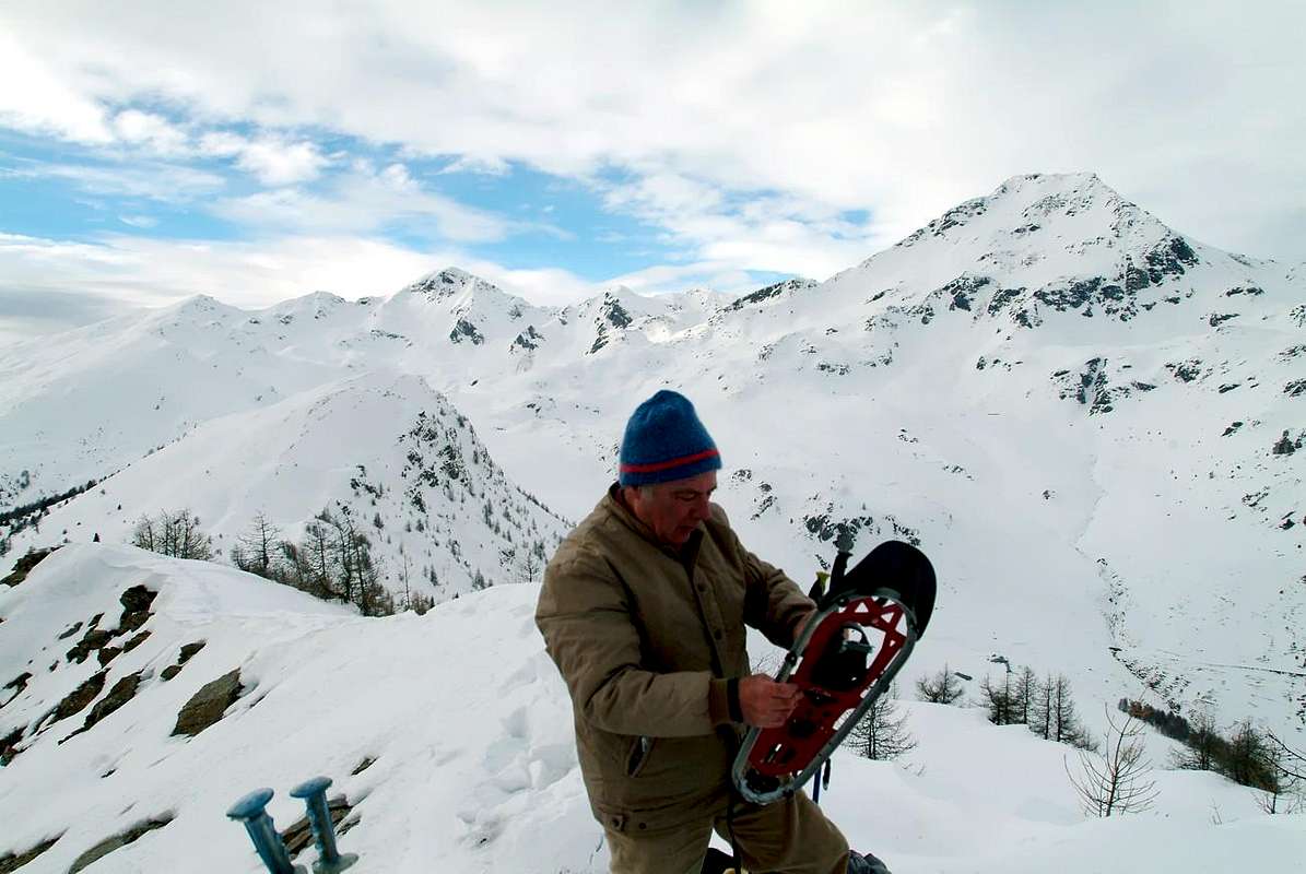
5/B) - Becca France (2.312 m).
Avvicinamento e Via tramite il Versante Sudovest: da Vetan-Grandzetta (1.780 m) con poderale verso a) - il passaggio 1.814 metri) donde al sentiero da Verrogne n° 10A, nell'omonimo vallone, per l'Alpe di Loé (1.986 m). Quindi con il n° 10/11 alla selletta 2.272 m per la Tsa de Comba (+; 2.277 m). Lasciandola e volgendo a Sudest col sentiero n° 9A alla Quota (2.348 m), tramite traversata sulla Cresta Nordovest ed alla successiva selletta 2.221 metri ed infine alla vicina Becca France (2.312 m; E/F; 3h'00/3h'15).
Oppure b) - Varianti: dall'Alpe di Loé attraversando ad Est in mezzo alla foresta dapprima con strada poderale e sentiero n° 11B sul Plan de Neyret de Verrogne; indi tramite morene verso il promontorio roccioso 2.247 metri e tratto finale sulla Cresta Sud sino in Cima (E/F+; 2h'45/3h'00). Ancora c) - : dal Plan Neyret raggiungere, tramite una valletta con blocchi a Nord, la sella 2.221 metri (E; 2h'30/3h'00). Infine d/e) - : dal Villaggio di Combelin (1.586 m), raggiungibile con corta deviazione sulla "Strada dei Salassi" da Aosta o da Sarre, tra Ville sur Sarre (1.212 m), Bellun (1.382 m), Homené Dessus (1.493 m), tramite il sentiero n° 10/11A, sotto i Rochers de Barma nel Bois (Bosco) de Verrogne, al Plan de Neyret e con sentiero non numerato verso Est-sudest alla quota 2.114 metri (dove arriva anche il sentiero n° 9A che parte dai pressi del Villaggio di Bellun), indi sullo spartiacque sin al promontorio roccioso 2.179 metri ed alla precedente tramite la selletta 2.247 metri e Cresta Meridionale nella parte finale (E; 2h'45/3h'15).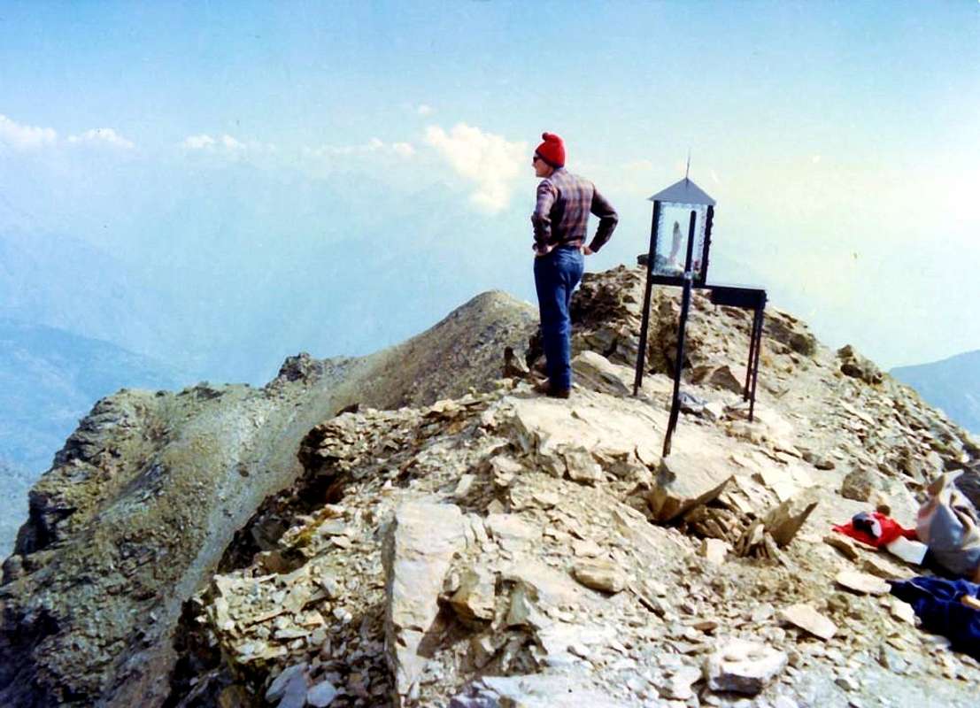
6/A)- Mont Fallère (3.061m).
Approach from Thouraz Hamlet: Normal Route to this mountain that must be considered along the large South Slope. But many variations lead to the peak, especially in approaches that may occur from the Southwest, or from the Tourist Center Vetan (1.671m) through the Verrogne Vallon first and then entering one of Clusella through a small saddle (2.255m) at the base its Southwest Ridge, with path n° 12/10. The same can be achieved more directly starting from the Village of Verrogne (1.582m) and going up the vallon of the same name, but also from the Clusella Vallon starting at the new little Thouraz Hamlet (+; 1.652m) above Ville sur Sarre (1.212m). Typically this is mostly used to climb the Southwest Crest, and from Vetan is a necessary step, going up the vallon to the West is discarded Clusella happening climb directly through the South Side of the base of the mountain that extends Eastward from the aforementioned saddle until it reaches a slightly accentuated and Southeast Edge so as to separate this from the North Slope. The basis of, in a small grassy-rocky bifurcation, there is the bautiful Lake Fallère (2.415m), from which a small path n° 8A goes back to the rocky promontory above and then go to connect with the muletrack-path (n° 9/10, renewed for a little over a decade) that reaches the old Regina Margherita Shelter (2.983m), built in 1884 and is now completely destroyed. This main path goes more to the West and begins between the small Lake Clapin and Chaz de Morgnoz (2.271m); first goes directly to the North then, bending gradually to the East with many bends, reaches remains the same. A slope of rocks and debris easy reach in a short time the West Shoulder or East Top (3.043m); this crossing on the Eastern Edge of about 220 meters leads to Summit. This trait was not long equipped with chains, which exceed a few short sections with challenging rock gear; this crossing is easy but in some short places it is exposed (E/F/F+; 00h'45/1h'00 from base; 1h'30/1h'40 by lake 2.415m; 2h'30/3h'00 from departure on dirt road).
![]()
Fallère Area Meridionale (Valloni di Verrogne, Clusellaz, Met)
6/A)- Mont Fallère (3.061 m).
6/B) - Traverse Col and Punta di Paletta to Monte Rosso of Vertosan (2.707m, 2.810m, 2.940m).
Approach from Verrogne Hamlet: by Verrogne (1.595m) with the trail n° 10A/11 to the Loé Pasture (1.986m) from where you continue with that n° 11A/10 to the Lac de Grenouilles (2.363m; E/F; 2h'20/2h'40). From the pond through the trail n° 13 to the other 2.377 meters and Alp les Crottes (2.385m; 0h'15). From this, crossing toward the Southwest in a small vallon can be reached with the path n° 13A the paletta(z) Pass (2.707m; E/F; 1h'00/1h'15); following the ridge watershed is easy to reach the Punta Paletta (2.810m), from which it descends through the short but exposed North Ridge to a notch (I°+/II-, exposed and to circumvent to the West by a grassy ledge). From this easily along the wide South Crest towards Monte Rosso (2.940m; EE/F+ with a sudden stretch of PD-; 2h'15/2h'45 from les Crottes; 4h'30/5h'00 by Verrogne).
![]()
6/B) - Traversata dal Colle e Punta di Paletta al Monte Rosso di Vertosan (2.707 m, 2.810 m, 2.940 m).
![]()
Fallère Northern Area (Buthier, Arsy, Flassin & Citrin Vallons)
7/A) - Testa di Serena (2.830m).
![]()
7/B) - Traversata Testa Cordella, Mont Flassin, Mont Vertosan, Colle Fenêtre (2.663 m, 2772 m, 2.605 m, 2.758 m, 2.689 m, 2.822 m, 2.729 m).
7/C) - Crossing Punta Chaligne, Tardiva Hill & Crest (2.608m, 2.410m, 2.380m).
Approach from Aosta towards Great St. Bernard by SR.27 and alternative near Condemine Hamlet through variants with possibilities by Snowshoes :
from Condemine alternative on State Road towards the above Villages of Grand Buthier (1.302m), Petit Buthier (1.439m) and Roncailles, Rombason, Crossroads 1.854 meters through the path n° 3A/2A or concomitant with the dirt road, always n° 3A/2A and subsequent crossing from fork 2.150 meters on watershed North/South of Costa Tardiva (2.380m) to Tardiva Hill with path n° 3 (E/F; 3h'00/3h'15). Or by Chaligne Shelter (1.936m; new since years 2000) to Tardiva Hill, through unnumbered trail in Northwest on Southeast Slope (E/F; 0h'45/1h'00). Also by refuge, through small path n° 2 in South, towards the small saddle (2.405m) on Eastern Crest of Punta Chaligne and traverse with short and easy descent to Met Alpage (2.261m; E/F; 1h'00/1h'15), into the Southern Vallon below Eastern slopes of Met Summit and Hill (2.553m, 2.485m). And again by refuge, saddle to the Punta Chaligne through final part of East Crest. Note: must be avoided both the ascent and the descent through the inviting especially the Northeast Slope; have already occurred on the same misfortunes mortal avalanche while backcountry Skiing Excursions. Always in the same season even the Northern Ridge, which sends a branch to the Hill Tardiva and another to La Tsa (2.742m), it is very dangerous; it should always be the first amongst the routes, that takes place inside the forest, and then it is certainly somewhat more safe and secure. Otherwise you must jump over the saddle, losing a little altitude, climb to the Col de Met (2.608m; E/F; 1h'45/2h'15).
![]()
7/C) - Traversata Punta Chaligne, Colle e Cresta Tardiva (2.608 m, 2.410 m, 2.380 m).
![]()
Merdeux Comba & Great Saint Bernard Western Valley
8/A).- Grand Golliaz (3.237m).

6/A)- Mont Fallère (3.061 m).
Avvicinamento partendo dal Villaggio di Thouraz verso la Val Closellaz: Via Normale a questa montagna deve esser considerata quella lungo il Versante Meridionale. Ma molte varianti conducono alla Cima, soprattutto negli avvicinamenti che posson avvenire da Sudovest, ovvero dal Centro Turistico di Vetan (1.671 m) attraversando dapprima il Vallone di Verrogne e poi entrando in quello di Clusella tramite una selletta (2.255 m) posta alla base della sua Cresta Sudovest con sentiero n° 12/10. La stessa può essere più direttamente raggiunta partendo dal Villaggetto di Verrogne (1.582 m) e risalendo l'omonimo vallone, ma pure dal Vallone di Clusella o Clusellaz con partenza dal nuovo Villaggio di Thouraz (+; 1.652 m), sopra Ville sur Sarre (1.212 m). In genere questa viene maggiormente utilizzata per salire la Cresta Sudovest e, mentre da Vetan costituisce un passaggio obbligato, salendo la Valle Clusella viene scartata ad Occidente avvenendo la salita direttamente tramite il Versante Sud. Questo s'allarga dalla predetta sella verso Oriente fino a raggiungere uno Spigolo Sudest poco accentuato e tale da separare questo dal Versante Est; alla base del medesimo, in una piccola biforcazione erboso-rocciosa, è situato il Lago Fallère (2.415 m), dal quale un sentierino n° 8A risale al soprastante promontorio roccioso per andar poi a collegarsi con la mulattiera-sentiero (n° 9/10, rinnovata da poco più d'un decennio) che raggiunge la vecchia Capanna Regina Margherita (2.983 m) costruita nel 1884 ed ormai completamente andata distrutta. Questo sentiero principale sale più ad Occidente ed inizia tra il minuscolo Lago Clapin e la Chaz de Morgnoz (2.271 m); dapprima risale direttamente verso Settentrione poi, piegando gradualmente ad Est con molti tornanti, raggiunge i resti della medesima. Un pendio di roccette e detriti raggiunge in breve lo Spallone Orientale o Cima Est (3.043 m); da questa una traversata sulla Cresta Est di 220 metri circa conduce alla Cima. Questo tratto é stato da non molto attrezzato con catene, superanti qualche tratto impegnativo con roccia marcia; questa traversata é facile ma in alcuni brevi punti risulta esposta (E/F/F+; 00h'45/1h'00 dalla base; 1h'30/1h'40 dal lago 2.415 m; 2h'30/3h'00 dalla partenza).
6/B) - Traverse Col and Punta di Paletta to Monte Rosso of Vertosan (2.707m, 2.810m, 2.940m).
Approach from Verrogne Hamlet: by Verrogne (1.595m) with the trail n° 10A/11 to the Loé Pasture (1.986m) from where you continue with that n° 11A/10 to the Lac de Grenouilles (2.363m; E/F; 2h'20/2h'40). From the pond through the trail n° 13 to the other 2.377 meters and Alp les Crottes (2.385m; 0h'15). From this, crossing toward the Southwest in a small vallon can be reached with the path n° 13A the paletta(z) Pass (2.707m; E/F; 1h'00/1h'15); following the ridge watershed is easy to reach the Punta Paletta (2.810m), from which it descends through the short but exposed North Ridge to a notch (I°+/II-, exposed and to circumvent to the West by a grassy ledge). From this easily along the wide South Crest towards Monte Rosso (2.940m; EE/F+ with a sudden stretch of PD-; 2h'15/2h'45 from les Crottes; 4h'30/5h'00 by Verrogne).
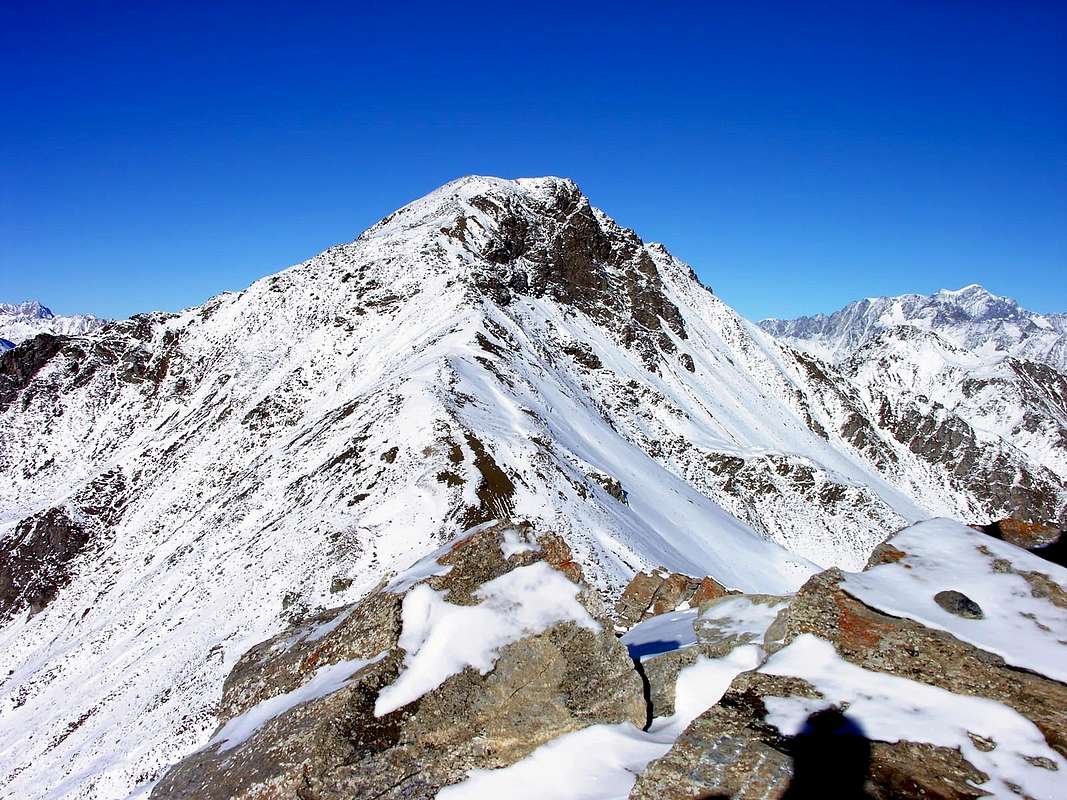
6/B) - Traversata dal Colle e Punta di Paletta al Monte Rosso di Vertosan (2.707 m, 2.810 m, 2.940 m).
Avvicinamento dal Villaggio di Verrogne: da Verrogne (1.595 m) con il sentiero n° 10A/11 per l'Alpe di Loé (1.986 m) dalla quale si prosegue con quello n° 11A/10 fino al Lac de Grenouilles (2.363 m; E/F; 2h'20/2h'40). Dal laghetto tramite il sentiero n° 13 all'altro 2.377 metri ed all'Alpe les Crottes (2.385 m; 0h'15). Da questa, traversando verso Sudovest in un valloncello si raggiunge con il sentiero 13A il Colle di Paletta(z) (2.707 m; E/F; 1h'00/1h'15); seguendo la cresta spartiacque si raggiunge facilmente la Punta di Paletta (2.810 m), dalla quale si scende tramite la corta ma esposta Cresta Nord ad un intaglio (I°+/II°-, esposto ed aggirabile ad Ovest per una cengia erbosa). Da questo facilmente al Monte Rosso lungo la facile e larga Cresta Sud (2.940 m; EE/F+ con un tratto PD-; 2h'15/2h'45 da les Crottes; 4h'30/5h'00 dal Villaggio di Verrogne).
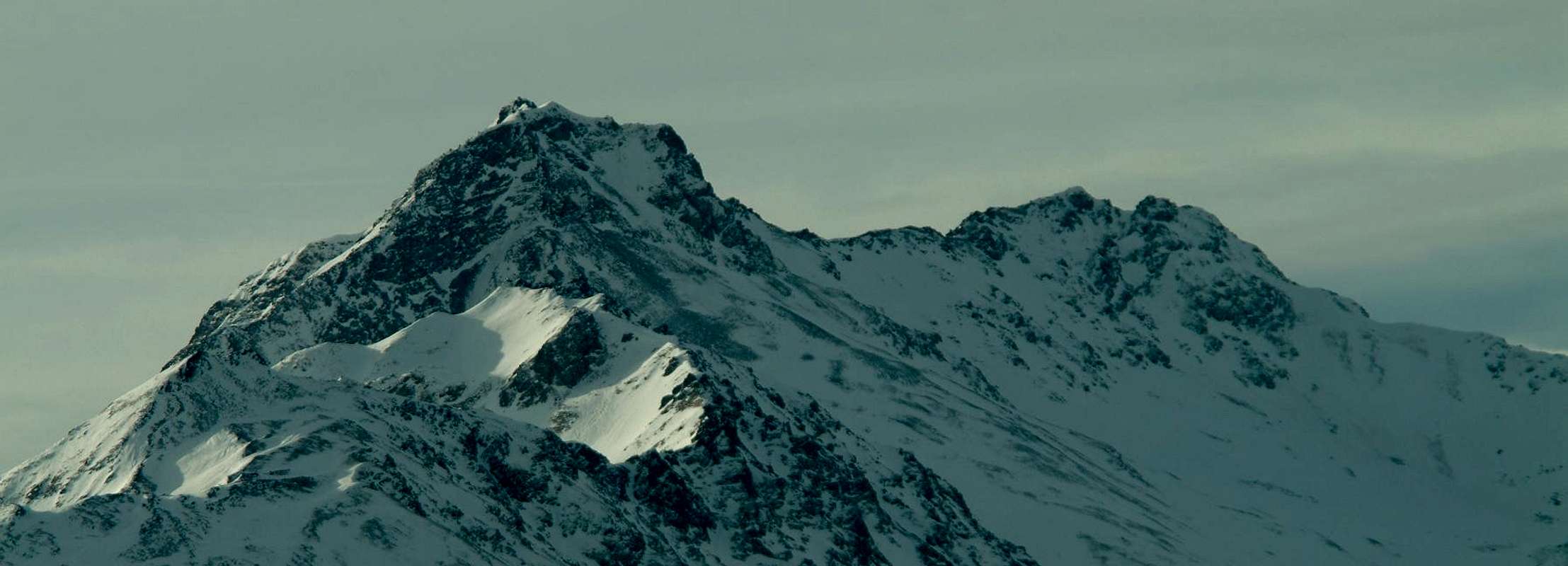
7/A) - Testa di Serena (2.830m).
Approach from the Fraction of Mottes by the State Road towards the Great St. Bernard Pass: by Mottes (1.660/70m, Village of Bosses, accessible from the SS.27 of the Gran San Bernardo) address itself to the West down slightly to pass under the highway to the "big bend". After Rio Artanavaz upon a bridge, can be reached in the progression the Pastures of Maytie (1.676m), Farettes (1.666m) and Arp du Bois Dèsott (1.935m), where comes even a path not numbered from Alpages Merdeux Dèsott (1.919m), Côtes (1.930m) and Potz-Ardusi (1.784m) on trail of the Alta Via n° 1 and at the entrance of the real and long Comba's Merdeux. Continue instead to Southwest through the path n° 29, which goes completely shorter Comba Serena to reach the hill of the same name, also known as "Fenetre de Sereina" (2.547 m; E/F; 2h'30/3h'00). From this climb on brief and easy Crest Northwest, with rotten rocks and debris, reaching before the junction 2.663 meters with the Corléans Ridge (2.807m, towards Northeast) and just after, with trail more to the South on Northern Crest, the Summit (2.830m; EE/F/F+; 0h'45/1h'00 Serena Hill; 3h'30/4h'00 by Mottes).
![]()
Fallère Area Settentrionale (Valloni di Buthier, Arsy, Flassin & Citrin)
7/A)- Testa di Serena (2.830 m).
7/B) - Crossing from Testa Cordella, Mont Flassin, Mont Vertosan towards Fenêtre Pass (2.663m, 2.772m, 2.605m, 2.758m, 2.689m, 2.822m, 2.729m) .
Approach from Aosta Town through the Great St. Bernard SR.27: by the Municipality of Saint-Oyen (1.373m), accessible from the State Road and abandon this, past a bridge over the Rio Artanavaz (Torrent or little stream), come to the Pasture of Pré Neue (1.324m), at the two "Camp del Mulino" (Mill) and "Pineta". Through the farms private dirt road to the trail concomitant n° 7, climb heading Southwest with the Alps of Champex (1.411m) to the East and Rond (1.447m) to reach the nearby Flassin de Meitin (Middle; 1.654m); in a short time through a long diagonal route in South to reach Flassin Pasture (1.700m). From this, going high to the East above the eponymous Torrent reach an altitude of about 2.200 meters, where, turning decidedly to the West, it passes over the coming Tsa (Higher Alp) de Flassin (2.258m; 2h'30/3h'00). From the Upper Alp Flassin or Tsa de Flassin leave the path n° 7 that climbs to Col Flassin, or continue with the same rejoining the hill with the route by Vertosan Vallon (Joux Saddle above Vens Village). Instead go up through the path n° 7B to the Northwest and arrive at an old alp 2.439 meters in ruins. From this continue reaching the Testa Cordella (2.663m) on Southeastern Slope; through this easy trail on watershed to the South, after a small saddle 2.606 meters, reaching a first shoulder or Northern Antesummit (2.767m), from which through the easy West-northwest Crest to the Summit (EE/F+; 1h'00/1h'15 from testa Cordella; 2h'15/2h'45 from Tsa de Flassin; 5h'30/6h'00 by St. Oyen). From Mont Flassin South or better Southeast (2.772m) down through the short, easy, grassy Ridge Southeast towards the below Col Flassin (2.605m), continuing on the watershed, with semi-circular path always Southeast, are reached in succession the Quota 2.758 meters, the carving 2.689 meters or Colle Western Vertosan and soon the Mont Vertosan (2.822m; EE/F; 1h'00/1h'15 by Mont Flassin SE). More than a short descent through the debris Cresta East-northeast leads to the Hill Window (2.729m, stone cairns and numerous positions of hunting). The descent from the same to return in Flassin Vallon is via steep and stony, doubled to the right (East), a rock band, you reach the Tsa (EE/F+; 0h'45/1h'00; with fresh snow the descent is more delicate, calculate almost twice as long; overall EE/F/F+; 7h'30/8h'30 round trip St. Oyen).
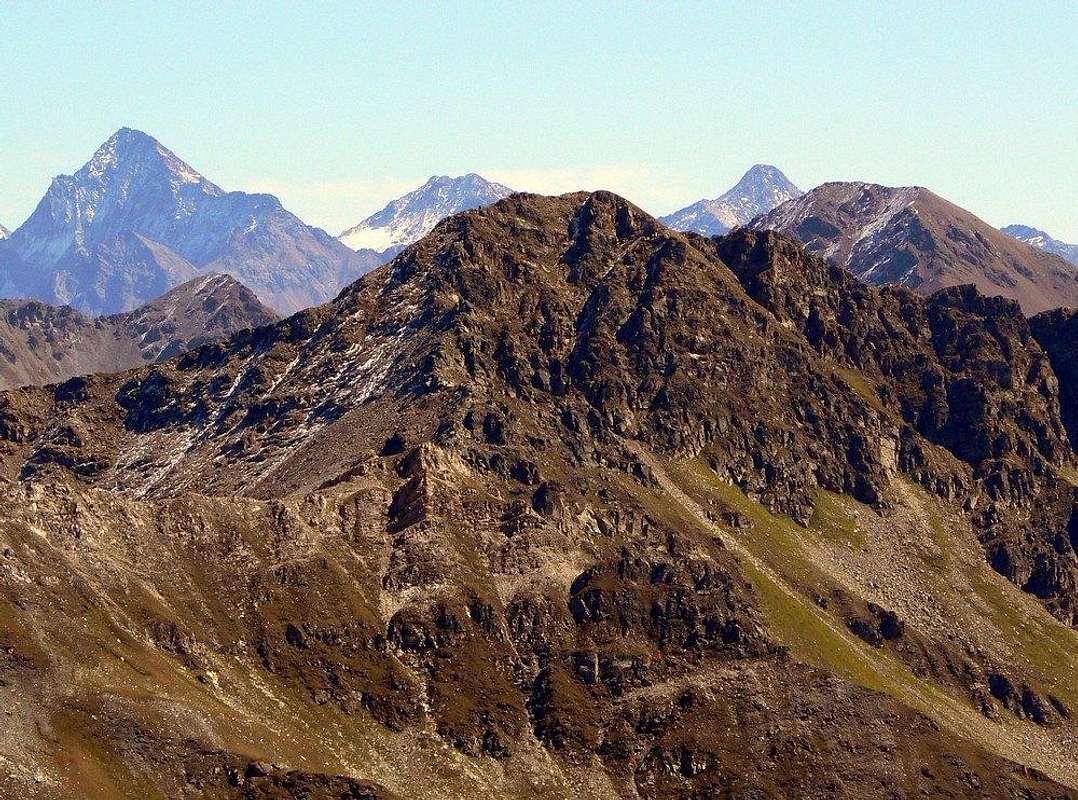
7/A)- Testa di Serena (2.830 m).
Avvicinamento da Mottes dalla Strada Statale del Gran San Bernardo: da Mottes (1.660/70 m, Frazione di Bosses, raggiungibile dalla SS.27 del Gran San Bernardo) indirizzarsi ad Occidente scendendo leggermente a sottopassare l'autostrada alla "grande curva". Superato il Rio Artanavaz su d'un ponticello, si raggiungono in progressione le Alpi di Maytie (1.676 m), Farettes (1.666 m) ed Arp du Bois Dèsott (1.935 m), dove arriva anche un sentiero non numerato dalle Alpi Merdeux Dèsott (1.919m), Côtes (1.930m) e Potz-Ardusi (1.784 m) sul sentiero dell'Alta Via n° 1 nonché all'ingresso della vera e propria nonché lunga Comba del Merdeux. Continuare invece verso Sudovest tramite il sentiero n° 29, che risale completamente la più corta Comba Serena raggiungendo l'omonimo colle, detto e conosciuto anche come "Fenetre de Sereina" (2.547 m; E/F; 2h'30/3h'00). Da questo percorrere la facile e breve Cresta Nordovest raggiungendo dapprima la congiunzione 2.663 metri con la Cresta di Corléans (2.807 m, a Nordest) e subito, con percorso più a Sud sulla seguente Cresta nord, dopo la Cima (2.830 m; EE/F/F+; 0h'45/1h'00 dal colle; 3h'30/4h'00 dalla Frazione di Mottes).
7/B) - Crossing from Testa Cordella, Mont Flassin, Mont Vertosan towards Fenêtre Pass (2.663m, 2.772m, 2.605m, 2.758m, 2.689m, 2.822m, 2.729m) .
Approach from Aosta Town through the Great St. Bernard SR.27: by the Municipality of Saint-Oyen (1.373m), accessible from the State Road and abandon this, past a bridge over the Rio Artanavaz (Torrent or little stream), come to the Pasture of Pré Neue (1.324m), at the two "Camp del Mulino" (Mill) and "Pineta". Through the farms private dirt road to the trail concomitant n° 7, climb heading Southwest with the Alps of Champex (1.411m) to the East and Rond (1.447m) to reach the nearby Flassin de Meitin (Middle; 1.654m); in a short time through a long diagonal route in South to reach Flassin Pasture (1.700m). From this, going high to the East above the eponymous Torrent reach an altitude of about 2.200 meters, where, turning decidedly to the West, it passes over the coming Tsa (Higher Alp) de Flassin (2.258m; 2h'30/3h'00). From the Upper Alp Flassin or Tsa de Flassin leave the path n° 7 that climbs to Col Flassin, or continue with the same rejoining the hill with the route by Vertosan Vallon (Joux Saddle above Vens Village). Instead go up through the path n° 7B to the Northwest and arrive at an old alp 2.439 meters in ruins. From this continue reaching the Testa Cordella (2.663m) on Southeastern Slope; through this easy trail on watershed to the South, after a small saddle 2.606 meters, reaching a first shoulder or Northern Antesummit (2.767m), from which through the easy West-northwest Crest to the Summit (EE/F+; 1h'00/1h'15 from testa Cordella; 2h'15/2h'45 from Tsa de Flassin; 5h'30/6h'00 by St. Oyen). From Mont Flassin South or better Southeast (2.772m) down through the short, easy, grassy Ridge Southeast towards the below Col Flassin (2.605m), continuing on the watershed, with semi-circular path always Southeast, are reached in succession the Quota 2.758 meters, the carving 2.689 meters or Colle Western Vertosan and soon the Mont Vertosan (2.822m; EE/F; 1h'00/1h'15 by Mont Flassin SE). More than a short descent through the debris Cresta East-northeast leads to the Hill Window (2.729m, stone cairns and numerous positions of hunting). The descent from the same to return in Flassin Vallon is via steep and stony, doubled to the right (East), a rock band, you reach the Tsa (EE/F+; 0h'45/1h'00; with fresh snow the descent is more delicate, calculate almost twice as long; overall EE/F/F+; 7h'30/8h'30 round trip St. Oyen).

7/B) - Traversata Testa Cordella, Mont Flassin, Mont Vertosan, Colle Fenêtre (2.663 m, 2772 m, 2.605 m, 2.758 m, 2.689 m, 2.822 m, 2.729 m).
Avvicinamento dalla SS.27 del Gran San Bernardo: Dal Comune di Saint-Oyen (1.373 m), raggiungibile da Aosta con la Statale per il Grande, abbandonare questa e, passato su di un ponte il Torrente Artanavaz, portarsi alla località di Pré Neue (1.324 m), presso i due Campings "del Mulino e Pineta". Tramite la strada poderale, concomitante al sentiero n° 7, salire con direzione Sudovest tra le Alpi di Champex (1.411 m) ad Oriente e Rond (1.447 m) raggiungendo la successiva di Flassin de Meitin (di Mezzo; 1.654 m). In seguito ed in breve tempo raggiungere quella di Flassin (1.700 m). Da questo punto, passando alti sopra all'omonimo torrente, raggiungere la quota di circa 2.200 metri, dove, voltando decisamente ad Ovest, si oltrepassa la Tsa (ultimo alpeggio) de Flassin (2.258 m; 2h'30/3h'00). Da questo, abbandonato il sentiero n° 7 che risale al Col Flassin, oppure continuare col medesimo raggiungendo al colle la via sopraggiungente dal Vallone di Vertosan (cioé dalla Sella di Joux sopra Vens). Invece salire con quello a Nordovest n° 7B ed arrivare presso una vecchia alpe in rovina a quota 2.439 metri. Da qui proseguire sul Versante Sudest raggiungendo la Testa Cordella (2.663 m); per mezzo di facile percorso sullo spartiacque verso Sud, oltrepassata la selletta 2.606 metri, raggiungere una prima spalla o Antecima Settentrionale (2.767 m), dalla quale con la facile Cresta Ovest-nordovest alla Cima (EE/F+; 1h'00/1h'15 dalla Testa Cordella; 2h'15/2h'45 dalla Tsa de Flassin; 5h'30/6h'00 da St. Oyen). Dal Mont Flassin Meridionale o Sudest 2.772 m) scendere tramite la corta, facile ed erbosa Cresta Sudest al Col Flassin (2.605 m), proseguendo sullo spartiacque, con percorso semi circolare sempre a Sudest, si raggiungono in successione la Quota 2.758 metri, l'intaglio 2.689 metri o Colle Occidentale di Vertosan ed in breve il Mont Vertosan (2.822 m; EE/F; 1h'00/1h'15 dal Mont Flassin SE). Una più che breve discesa tramite la detritica Cresta Est-nordest conduce al Colle Finestra (2.729 m; ometti in pietra e postazioni di caccia). La discesa dallo stesso per rientrare nel Vallone di Flassin avviene tramite ripida e "scivolosa" pietraia e, doppiata a destra (Est) una fascia rocciosa, si raggiunge la Tsa de Flassin (EE/F+; 0h'45/1h'00, con neve fresca la discesa é più delicata e calcolare quasi il doppio del tempo; complessivamente EE/F/F+; 7h'30/8h'30 in andata e ritorno da St. Oyen).
7/C) - Crossing Punta Chaligne, Tardiva Hill & Crest (2.608m, 2.410m, 2.380m).
Approach from Aosta towards Great St. Bernard by SR.27 and alternative near Condemine Hamlet through variants with possibilities by Snowshoes :
from Condemine alternative on State Road towards the above Villages of Grand Buthier (1.302m), Petit Buthier (1.439m) and Roncailles, Rombason, Crossroads 1.854 meters through the path n° 3A/2A or concomitant with the dirt road, always n° 3A/2A and subsequent crossing from fork 2.150 meters on watershed North/South of Costa Tardiva (2.380m) to Tardiva Hill with path n° 3 (E/F; 3h'00/3h'15). Or by Chaligne Shelter (1.936m; new since years 2000) to Tardiva Hill, through unnumbered trail in Northwest on Southeast Slope (E/F; 0h'45/1h'00). Also by refuge, through small path n° 2 in South, towards the small saddle (2.405m) on Eastern Crest of Punta Chaligne and traverse with short and easy descent to Met Alpage (2.261m; E/F; 1h'00/1h'15), into the Southern Vallon below Eastern slopes of Met Summit and Hill (2.553m, 2.485m). And again by refuge, saddle to the Punta Chaligne through final part of East Crest. Note: must be avoided both the ascent and the descent through the inviting especially the Northeast Slope; have already occurred on the same misfortunes mortal avalanche while backcountry Skiing Excursions. Always in the same season even the Northern Ridge, which sends a branch to the Hill Tardiva and another to La Tsa (2.742m), it is very dangerous; it should always be the first amongst the routes, that takes place inside the forest, and then it is certainly somewhat more safe and secure. Otherwise you must jump over the saddle, losing a little altitude, climb to the Col de Met (2.608m; E/F; 1h'45/2h'15).
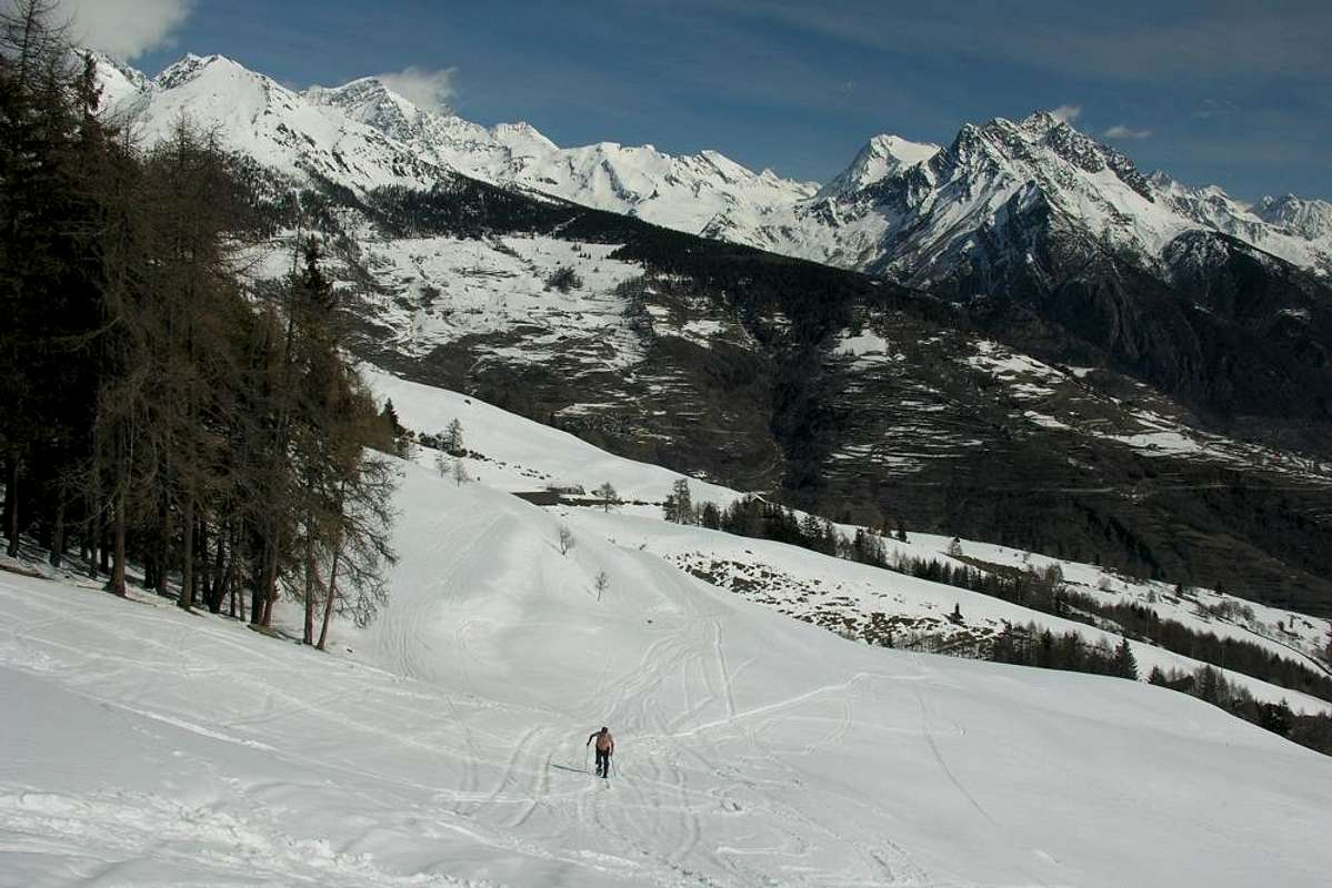
7/C) - Traversata Punta Chaligne, Colle e Cresta Tardiva (2.608 m, 2.410 m, 2.380 m).
Avvicinamento dalla SS.27 del Gran San Bernardo presso il bivio per Condemine con diverse varianti e possibilità d'uso delle Racchette da neve: dal bivio sulla Strada Statale per il Villaggetto di Condemine verso i Villaggi soprastanti di Grand Buthier (1.302 m), Petit Buthier (1.439 m) e gli Alpeggi di Roncailles, Rombason e bivio 1.854 metri tramite il sentiero n° 3A/2A od il concomitante con la poderale sempre n° 3A/2A con susseguente e relativa traversata dal bivio 2.105 metri Nord/Sud sullo spartiacque della Costa Tardiva (2.380 m) insino al Passo Tardiva con sentiero n° 3 (E/F; 3h'00/3h'15). Oppure dal Rifugio Chaligne (1.936 m; nuovo con costruzione degli anni 2000) al Passo Tardiva tramite sentierino non numerato a Nordovest sul Versante Sudest (E/F; 0h'45/1h'00). Oppure dal Rifugio Chaligne, tramite sentierino n° 2 in Sud dapprima all'interno della foresta, verso la selletta (2.405 m) sulla Cresta Est della Punta Chaligne e corta e facile traversata con discesina all'Alpeggio di Met (2.261 m; E/F; 1h'00/1h'15), dentro il Vallone Meridionale al di sotto il Versante Orientale del Colle e Punta di Met (2.485 m, 2.553m) con salita ad entrambi. Ed ancora dal rifugio alla selletta ed alla Punta Chaligne tramite la parte finale della Cresta Est. Nota: in inverno dev'esser evitata sia la salita che la discesa soprattutto attraverso il Versante Nordest; sullo stesso si sono già verificate varie disgrazie mortali per valanga durante escursioni di Sci-Alpinismo. Sempre nella medesima stagione pur la Cresta Nord, inviante una ramificazione verso il Passo Tardiva ed un'altra verso la Cima de La Tsa (2.742 m), risulta alquanto pericolosa; in siffatte condizioni meglio il primo degli itinerari che si svolge all'interno della foresta, certamente più sicuro e protetto. In caso contrario, si deve scavalcare la selletta, perdendo un po'di quota, e risalire tramite il Col de Met (2.608 m; E/F; 1h'45/2h'15).
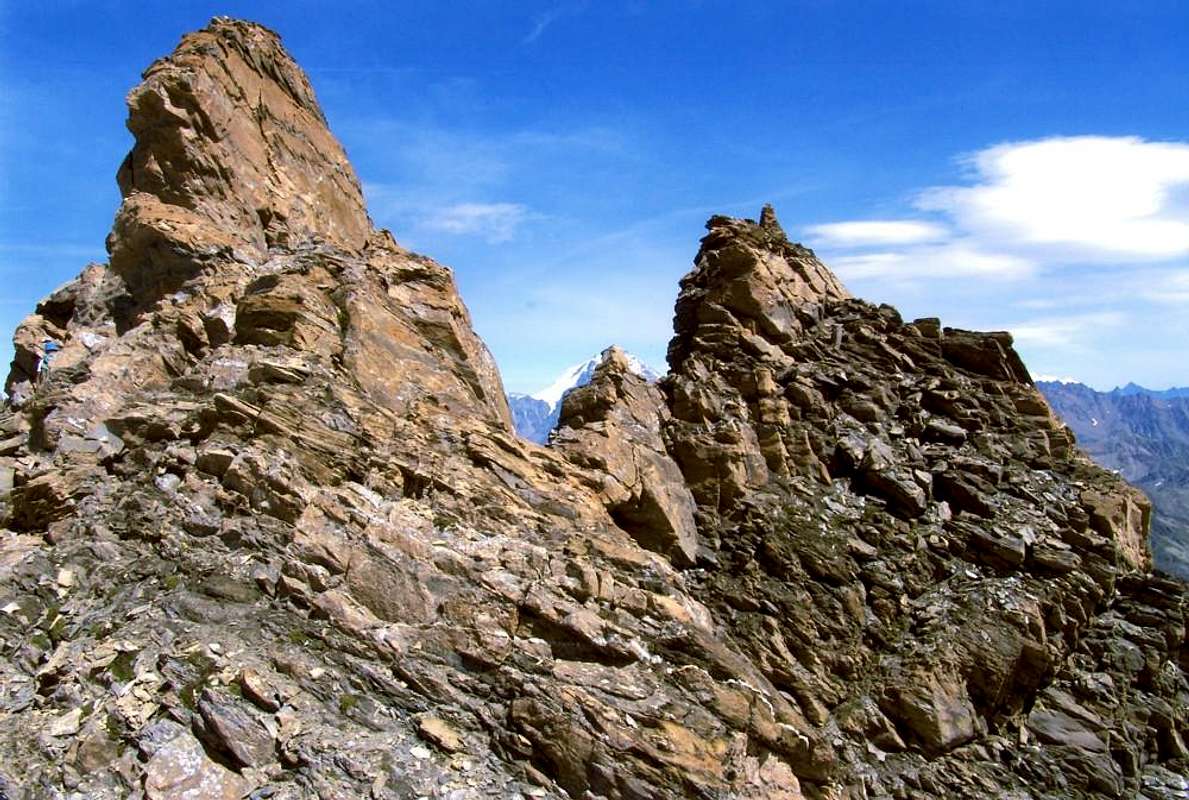
8/A).- Grand Golliaz (3.237m).
Approach from Alpe Muanda (1.441m) by the State Road to Great St. Bernard: from Mottes Village (1.670m, reachable from the route SR.27 towards Gran San Bernardo) to the West, descending a little to pass under the highway near the "big bend". Cross the Artanavaz Stream on a small bridge the on to the Pastures of By (1.767m), Potz-Ardusi (1.784m) and Moindaz, Manda even Muanda (1.973m), bordering the waterfalls of Thoules Torrent. You can arrive here also starting, by Alta Via n° 1, from the Devies car parking, just beyond the "big hairpin bend", through the Pastures of Merdeux Dèsott (1.919m) and Côtes (1.930m). From Muanda cross twice the torrent and follow the Eastern bank till the Pastures of Comba Thoula and near the Saint Rhémy Hill; follow the path coming from it and, passing some dry channels in West, up to the moraine of the small Glacier des Bosses. Get it at 2.700 meters around, leaving on the left (South) the path to Col de Sauliè. On along the moraine (steep and tiring) to get the remains of the glacier; after a short and steep (35°/38°) slope face the rocky bar in the middle, starting from left, then to the right along a system of ledges with some tracks (steps of I°/II°, ice or water with topsoil). Once at the upper debris and snow band, toward Northwest to a narrow very steep rocky gully of about 100 meters (rotten rocks and debris with danger of falling rocks) on the South-southeast Face getting the big cairn on the Vertex (EE/F+/PD-; 2h'15/2h'45 from base; 4h'30/5h'00 in total).
Variant of entrance into the "Comba" Thoule: in the lower part you can get the high Comba Thoula from the hairpin bend 2.079 meters of the SR.27 towards Great St. Bernard just beyond the Praz d'Arc Pasture along the military road towards the overhanging Saint Rhèmy Hill (2.540m), below the Southeast Ridge Aig. de Leisasses.
![]()
Comba del Merdeux e Valle Occidentale del Gran San Bernardo
8/A) - Grand Golliaz (3.237 m).
![]()
8/B) - Aiguille de Saulié and "L'Aiguillon de Saulié" (2.865m, 2.875 metres about) bypassing Saint Rhémy Hill(2560m).
8/B) - Aiguille de Saulié e "L'Aiguillon de Saulié" (2.865 m, 2.875 metri circa) scavalcando il Colle di Saint Rhémy tramite il Versante Orientale (2.560 m).
Avvicinamento dalla SS. Gr. S. Bernardo tramite il Versante Est del Colle di St. Rhémy: dalla SS.27 verso l'Alpe Pra di Farco (2.221 m) ed il Colle di St. Rhémy (2.560 m) col sentiero n° 12 (E/F; 1h'30/1h'45). Continuare sul medesimo lungo il medio Vallone della Thoula in direzione del Col de Saulié (2.816 m) da quota 2.650 metri circa in Sudovest e successiva traversata integrale sulla Cresta Ovest (E/F; 1h'00/1h'15 dal Colle di St. Rhémy; EEA/F+/PD-; 0h'40 all'"'Aiguillon"; 3h'20/3h'40 in totale).
![]()
8/C) - Aiguille de Leisasses or Sasses also Leisache (3.015m).
8/C) - Aiguille de Leisasses o Sasses oppure de Leisache (3015 m).
Avvicinamento dalla S.S. n° 27 presso l'Alpe Praz de Farcoz: dal tornante (2.079 m), subito ad Ovest dell'Alpe Praz d'Arc (1.992 m); raggiunta l'Alpe Praz de Farcoz (2.223 m), seguire il torrente sul fondovallone e, superate alcune vecchie alpi in completa rovina, indirizzarsi ad un valloncello secondario terminante con ripido canalino detritico conducente al Col Fourchon (2.969 m). Superate progressivamente le tre elevazioni 2.833, 2.880, 2.908 metri sull'esposta ma facile Cresta Nordest di frontiera (I°+/II°-) s'arriva all'aereo nonché panoramico Vertice (EEA/F+/PD-; 3h'15/3h'45 dall'Alpe Pra d'Arc). Quest'itinerario é più piacevole poiché permette dei tratti di facile arrampicata e la ricerca della via con qualche piccolo aggiramento verso Settentrione onde superare brevi risalti (altrimenti II°/II°+). Probabilmente percorso per la prima volta nel Settembre del 2000.
Variante o Via Normale: dai vecchi alpeggi (2.357 m) presso vari torrentelli, lasciando sulla destra (Nordovest) la precedente via, continuare invece sulla morena verso Occidente sino a raggiungere una ripida strettoia, generalmente con neve dura; con traversata da destra a sinistra (delicato) nella stessa s'arriva ad un soprastante plateau con residui di nevati. Da questi, tramite minuscola traccia, in direzione della Cresta Sud; salirne il filo (I°, ma esposto ad Ovest) ed abbastanza facilmente concludere alla Cima (EE/F+; 2h'45/3h'15 da Praz de Farcoz). La via risulta sicuramente come sicuramente la più frequentata ed é oggetto anche di pratica dello Sci-Alpinismo per OSA (Ottimi Sciatori-Alpinisti); richiede prudenza nell'attraversamento della piuttosto ripida strettoia, dove stazione neve dura fino all'estate e spesso con presenza di ghiaccio e "verglass". Ancor più cautela bisogna osservare in questo passaggio quando la neve risulti alta e non ancora ben trasformata; meglio optare per la precedente, cioè sulla Cresta Nordest.
![]()
8/D)- Mont Fourchon/Pain de Sucre Traverse (2.902m, 2.900m).
![]()
8/D)- Traversata Mont Fourchon/Pain de Sucre (2.902 m, 2.900 m).
![]()
8/E) - Petite e Grande Chenalette, Drône, Tête de Fonteinte towards Fenêtre de Ferret Crossing (2.665m, 2.889m, 2.949m, 2.775m, 2.698m 2.900m).
8/E) - Traversata Petite e Grande Chenalette, Drône, Tête de Fonteinte sino alla Fenêtre de Ferret (2.665 m, 2.889 m, 2.949 m, 2.775 m, 2.698 m)
Avvicinamento dal Gran San Bernardo: dal Lago del Gran San Bernardo raggiungere l'Ospizio, donde per il facile Versante Sudest alla Petite Chenalette; continuare con sentiero attrezzato (verificare le scale) raggiungendo la Grande. Dopodiché, sempre sullo spartiacque Italia/Svizzera, verso il Drône, Fenêtre d'En Haut, Pointes de Fonteinte Sud e Nord con discesa alla Fenêtre de Ferret ed all'omonimo vallone. Da ultimo ritorno al Grande tramite sentierini subito sopra alla Statale (EE/F; 4h'30/5h'00 andata e ritorno).
![]()
Great Saint Bernard Eastern Valley
9/A) - Mont Velan by Western or "Hannibal Crest" (3.734m).
Variant of entrance into the "Comba" Thoule: in the lower part you can get the high Comba Thoula from the hairpin bend 2.079 meters of the SR.27 towards Great St. Bernard just beyond the Praz d'Arc Pasture along the military road towards the overhanging Saint Rhèmy Hill (2.540m), below the Southeast Ridge Aig. de Leisasses.
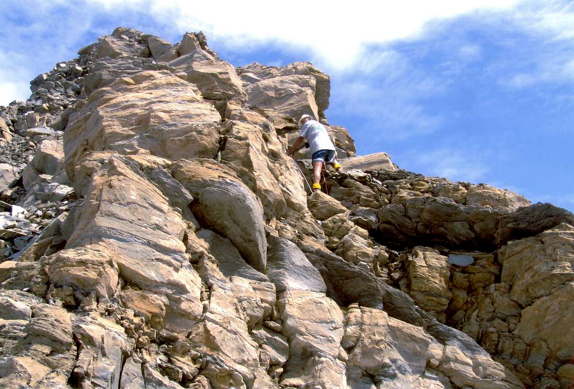
8/A) - Grand Golliaz (3.237 m).
Avvicinamento dall'Alpe Muanda (1.441 m), tramite la Strada del Gran San Bernardo: dalla Frazione di Mottes (1.670 m), raggiungibile dalla SS.27 del Gran San Bernardo) indirizzarsi ad Ovest scendendo di poco onde sottopassare l'autostrada al curvone. Superato il Rio Artanavaz su d'un ponticello, si raggiungono in successione le Alpi di By (1.767 m), Potz-Ardusi (1.784 m) e Manda, Moindaz od ancora Muenda (1.973 m), dopo aver fiancheggiato le cascate del Torrent de Thoules. Qui giunge anche il sentiero dell'Alta Via n° 1 che parte dal parcheggio di Devies, appena oltre il curvone, per le Alpi Merdeux Dèsott (1.919 m) e Côtes (1.930 m). Dall'Alpe Manda attraversare il torrente due volte per proseguire senza percorso obbligato sulla sponda Orientale e portarsi sui pascoli della Comba Tula o Thoule sin nei pressi del Colle di St. Rhémy; seguire il sentiero proveniente dallo stesso e con direzione Ovest, superati alcuni solchi torrentizi prosciugati, puntare alla morena frontale del minuscolo Glacier des Bosses. Raggiungerla a quota 2.700 metri circa, dopo aver lasciato a Sudovest il sentiero per il Col de Saulié. Risalirla con percorso ripido e faticoso raggiungendo ciò che resta del ghiacciaietto; dopo un breve e ripido scivolo (35°/38°) affrontare la fascia rocciosa soprastante nel suo mezzo dapprima a sinistra (Sud), poi a destra su una serie di cengette con tracce (I°/II°, verglass o acqua con terriccio sulla roccia). Raggiunta la falda detritico-nevosa superiore puntare a Nordovest in direzione d'un canalino di rocce rotte e detriti d'un centinaio di metri molto ripidi ed esposti a caduta di pietre sul versante Sud-sudest raggiungendo l'ometto della Cima (EE/F+/PD-; 2h'15/2h'45 dalla base; 4h'30/5h'00 da Mottes).
Variante d'ingresso nella Thoula: Si può accedere all'alta Comba Thoula dal tornante 2.079 metri della SS.27 pel Gran San Bernardo subito nei pressi dell'Alpe Praz d'Arc tramite la comoda strada militare che risale verso il soprastante Colle di St. Rhèmy (2.540 m), sotto la Cresta Sudest dell'Aiguille de Leisache, Leisasses o Sasses.
Variante d'ingresso nella Thoula: Si può accedere all'alta Comba Thoula dal tornante 2.079 metri della SS.27 pel Gran San Bernardo subito nei pressi dell'Alpe Praz d'Arc tramite la comoda strada militare che risale verso il soprastante Colle di St. Rhèmy (2.540 m), sotto la Cresta Sudest dell'Aiguille de Leisache, Leisasses o Sasses.
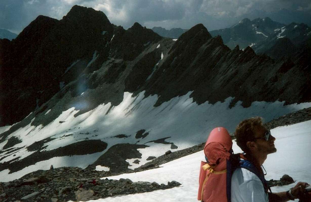
8/B) - Aiguille de Saulié and "L'Aiguillon de Saulié" (2.865m, 2.875 metres about) bypassing Saint Rhémy Hill(2560m).
Approach from State Road with Route through Saint Rhémy Hill East Slope: from SS.27 of the great Saint Bernard towards Pra di Farco Alp (2.221m) and following Saint Rhémy Hill (2.560m) with path n° 12 (E/F; 1h'30/1h'45). Continue with the same along the middle Thoula Vallon towards Saulié Pass (2.816m) from altitude 2.650 meters about in Southwest and crossing integrally on West Crest (E/F; 1h'00/1h'15 from St. Rhémy Hill; EEA/F+/PD-; 0h'40 to "Aiguillon"; 3h'20/3h'40 in total).
8/B) - Aiguille de Saulié e "L'Aiguillon de Saulié" (2.865 m, 2.875 metri circa) scavalcando il Colle di Saint Rhémy tramite il Versante Orientale (2.560 m).
Avvicinamento dalla SS. Gr. S. Bernardo tramite il Versante Est del Colle di St. Rhémy: dalla SS.27 verso l'Alpe Pra di Farco (2.221 m) ed il Colle di St. Rhémy (2.560 m) col sentiero n° 12 (E/F; 1h'30/1h'45). Continuare sul medesimo lungo il medio Vallone della Thoula in direzione del Col de Saulié (2.816 m) da quota 2.650 metri circa in Sudovest e successiva traversata integrale sulla Cresta Ovest (E/F; 1h'00/1h'15 dal Colle di St. Rhémy; EEA/F+/PD-; 0h'40 all'"'Aiguillon"; 3h'20/3h'40 in totale).
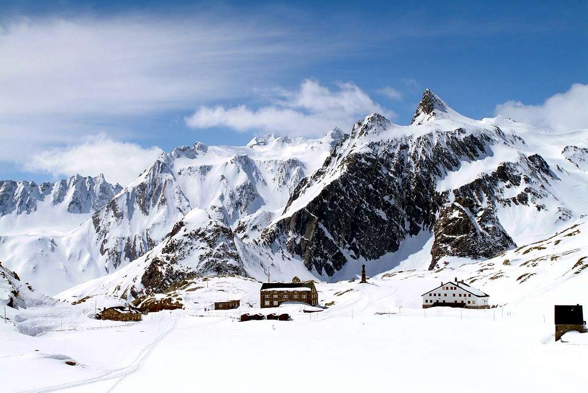
8/C) - Aiguille de Leisasses or Sasses also Leisache (3.015m).
Approach from State Road through Praz or Pra de Farcoz Alp: goes up from the hairpin bend (2.079m), just in West of Praz d'Arc Pasture (1.992m); briefly reached Alp Praz de Farcoz (2.223m), continue along the torrent on vallon floor and, after passing some ancient ruins, follow a secondary vallon ending with a debris channel leading to the Fourchon Pass (2.969m). After crossing the three elevations 2.833, 2.880, 2.908 meters on exposed but easy Northeast Ridge (I°+/II°-) you get the aerial and panoramic Vertex (EEA/F+/PD-; 3h'15/3h'45 by Praz d'Arc Pasture). This is more pleasant, scenic route, because it allows the easy stretches of climbing and searching via with some small bypass to the North in order to overcome short ribs (otherwise II°/II°+ with route on the edge of the ridge). Probably this route was for the first time in September 2000.
Variant or Normal Route: from the old alpages (2.357m) near various small torrents, leaving right (Northwest) the preceding route, continue West on moraines up to an steep narrowing, in general with hard snow; with traverse right/left (delicate) on the same reach an above plateau with residual snowfields. From these, through a smal track, towards the Southern Crest; climb on edge of the ridge (I°, but exposed in West) and enough easily to the Top (EE/F+; 2h'45/3h'15 from Praz de Farcoz). This route is surely more popular and used even in Ski-Mountaineering OSA (good Skiers-Mountaineers); caution when crossing the steep narrow passage, where train hard snow until the summer and often with ice. More caution should be observed in this step when the snow is high and not yet well transformed; better opt for the earlier, ie the Northeast Crest. 8/C) - Aiguille de Leisasses o Sasses oppure de Leisache (3015 m).
Avvicinamento dalla S.S. n° 27 presso l'Alpe Praz de Farcoz: dal tornante (2.079 m), subito ad Ovest dell'Alpe Praz d'Arc (1.992 m); raggiunta l'Alpe Praz de Farcoz (2.223 m), seguire il torrente sul fondovallone e, superate alcune vecchie alpi in completa rovina, indirizzarsi ad un valloncello secondario terminante con ripido canalino detritico conducente al Col Fourchon (2.969 m). Superate progressivamente le tre elevazioni 2.833, 2.880, 2.908 metri sull'esposta ma facile Cresta Nordest di frontiera (I°+/II°-) s'arriva all'aereo nonché panoramico Vertice (EEA/F+/PD-; 3h'15/3h'45 dall'Alpe Pra d'Arc). Quest'itinerario é più piacevole poiché permette dei tratti di facile arrampicata e la ricerca della via con qualche piccolo aggiramento verso Settentrione onde superare brevi risalti (altrimenti II°/II°+). Probabilmente percorso per la prima volta nel Settembre del 2000.
Variante o Via Normale: dai vecchi alpeggi (2.357 m) presso vari torrentelli, lasciando sulla destra (Nordovest) la precedente via, continuare invece sulla morena verso Occidente sino a raggiungere una ripida strettoia, generalmente con neve dura; con traversata da destra a sinistra (delicato) nella stessa s'arriva ad un soprastante plateau con residui di nevati. Da questi, tramite minuscola traccia, in direzione della Cresta Sud; salirne il filo (I°, ma esposto ad Ovest) ed abbastanza facilmente concludere alla Cima (EE/F+; 2h'45/3h'15 da Praz de Farcoz). La via risulta sicuramente come sicuramente la più frequentata ed é oggetto anche di pratica dello Sci-Alpinismo per OSA (Ottimi Sciatori-Alpinisti); richiede prudenza nell'attraversamento della piuttosto ripida strettoia, dove stazione neve dura fino all'estate e spesso con presenza di ghiaccio e "verglass". Ancor più cautela bisogna osservare in questo passaggio quando la neve risulti alta e non ancora ben trasformata; meglio optare per la precedente, cioè sulla Cresta Nordest.
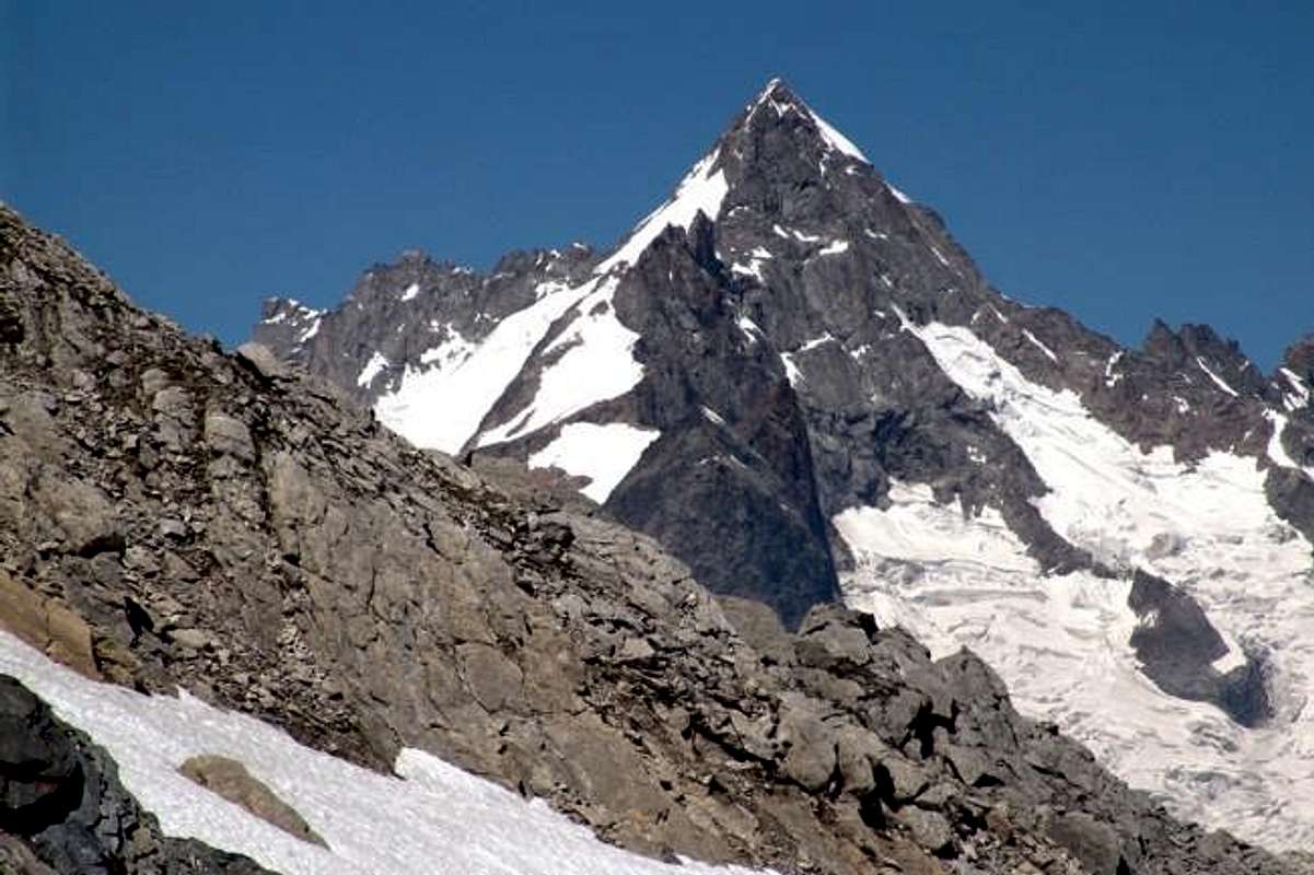
8/D)- Mont Fourchon/Pain de Sucre Traverse (2.902m, 2.900m).
Approach and Route from SS.27 (2.360 metres around): from Saint Bernard Pass (2.469m) also from just below Montagna Baus (2.373m) along the Fenêtre Vallon towards Mont Fourchon Eastern Slope with debris and easy rocks on very short Eastern crest in the final part in the middle of blocks of rock whitish (E/F; 1h'45/2h'00). Subsequent crossing to nearby Pain de Sucre, after bypassed the wide Saddle 2.800 meters about, through the West-northwest debris Slope with small and easy rocks composed by a series of great blocks in terminal part in the brief and easy edge of the West Ridge (one step of I°+, exposed in South; EE/F+; 0h'40 in total 2h'30/2h'45).
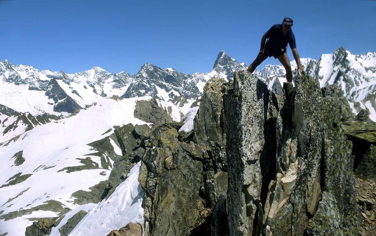
8/D)- Traversata Mont Fourchon/Pain de Sucre (2.902 m, 2.900 m).
Avvicinamento e Via dalla SS.27 (2.360 metri circa): dal Colle del Gran San Bernardo (2.469 m) oppure dall'appena sottostante Montagna Baus (2.373m) lungo il Vallone Fenêtre verso il Versante Orientale del Mont Fourchon per detriti e facili roccette e la più che breve Cresta Est nella parte finale in mezzo a blocchi di roccia biancastra (E/F; 1h'45/2h'00). Successiva traversata al Pain de Sucre, dopo aver scavalcato la larga Sella 2.800 metri circa tramite il detritico Versante Ovest-nordovest tramite un'esile traccia nel fine detrito e con alcune rocce a grandi blocchi nella parte finale sul filo della breve e facile Cresta Ovest (I°+; EE/F+; 0h'40 in totale 2h'30/2h'45).

8/E) - Petite e Grande Chenalette, Drône, Tête de Fonteinte towards Fenêtre de Ferret Crossing (2.665m, 2.889m, 2.949m, 2.775m, 2.698m 2.900m).
Approach through Great St. Bernard Hill: Gran San Bernardo Lake reach the Hospice and from this through easy Southeast Slope to Pt. Chenalette; continue with equipped path (check the stairs) to the Grande. After, always on watershed Italy/Switzerland, towards Drône, Fenêtre d'En Haut, Pointes de Fonteinte South and North with descent to Fenêtre de Ferret Hill and to the homonym vallon. Finally return, throuhg small paths just above the State Road to Great St. Bernard (EE/F+; 4h'30/5h'00 round trip).
8/E) - Traversata Petite e Grande Chenalette, Drône, Tête de Fonteinte sino alla Fenêtre de Ferret (2.665 m, 2.889 m, 2.949 m, 2.775 m, 2.698 m)
Avvicinamento dal Gran San Bernardo: dal Lago del Gran San Bernardo raggiungere l'Ospizio, donde per il facile Versante Sudest alla Petite Chenalette; continuare con sentiero attrezzato (verificare le scale) raggiungendo la Grande. Dopodiché, sempre sullo spartiacque Italia/Svizzera, verso il Drône, Fenêtre d'En Haut, Pointes de Fonteinte Sud e Nord con discesa alla Fenêtre de Ferret ed all'omonimo vallone. Da ultimo ritorno al Grande tramite sentierini subito sopra alla Statale (EE/F; 4h'30/5h'00 andata e ritorno).
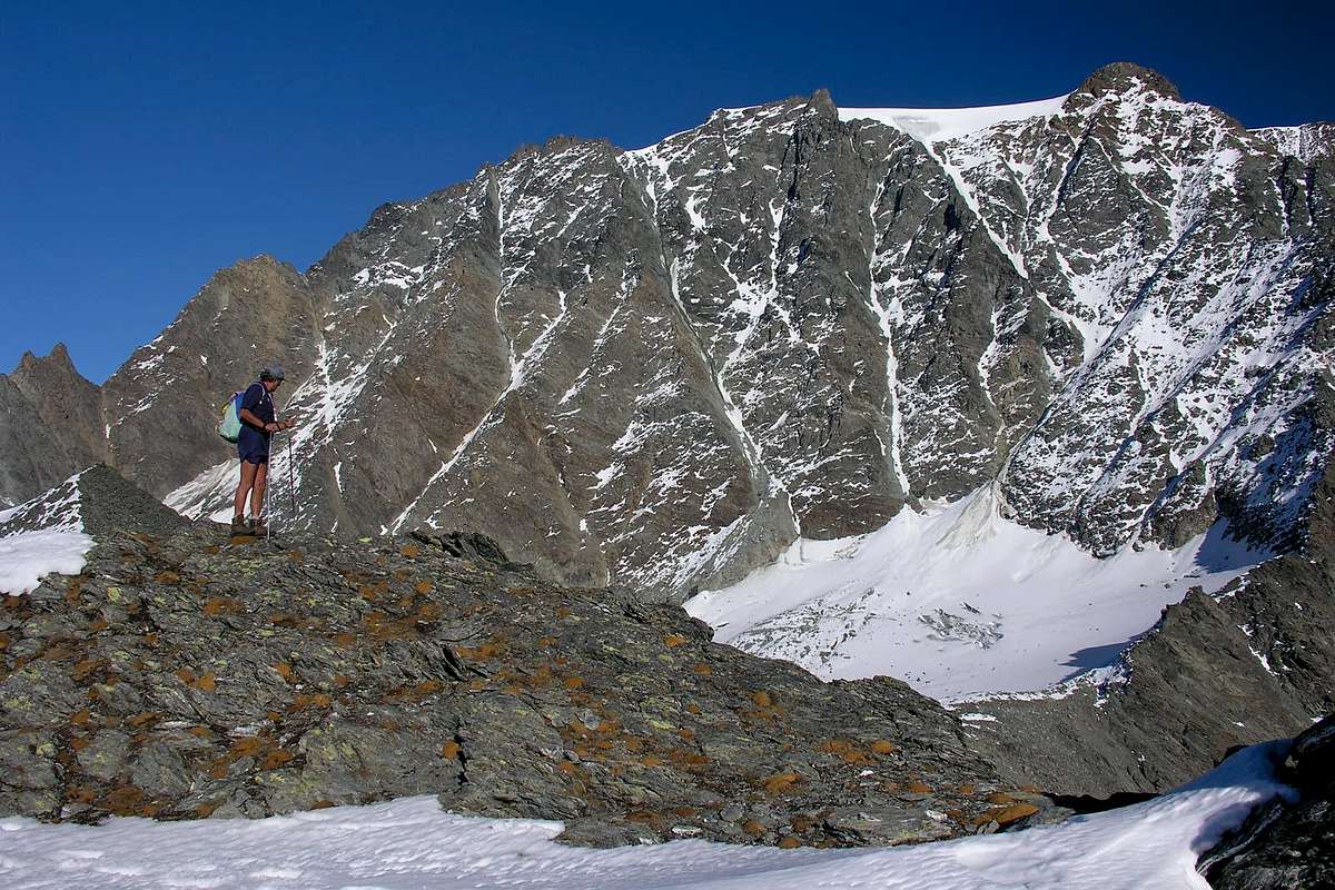
9/A) - Mont Velan by Western or "Hannibal Crest" (3.734m).
Approach by Etroubles through the private dirt road concomitant with the trail n° 21 towards Menouve/Molline Vallons and Hannibal Pass (2.992m): from the small Village of Prailles Dessous towards Menouve Vallon, Arvus Pasture (1.985m), Bivouac Molline (2.424m); after through a small not numbered path to the North up to the fork 2.519 meters and finally with traces on scree into a secondary small vallon to Hannibal Pass (2.992m) facing towards the end a steep section with the possibility of finding residual snowfields. Finally through the Western Ridge, known as "Crest of Hannibal" and formed at the beginning of rocks quite easy and very routes followed by some elevations circumvented preferably on the left (North); immediately after it passes over a shoulder dominated by a turret called Aiguille du Déjeuner (3.346m; A/F+/PD; 1h'15/1h'30). The last part does not present undue difficulty, and in about the same time it reaches the Altitude 3.678 meters, hence continuing to Southeast, between the Glacier du Mont Velan right (South) and the Dôme du Velan is reached easily to the Summit (A/F+/PD-; 3h'45/4h'15 from the hill; 7h'00/7h'30 by the start on dirt road).
![]()
Valle Orientale del Gran San Bernardo
9/A) - Mont Velan per la Cresta Ovest o d'"Annibale" (3.734 m).
![]()
9/B) - Mont Mort (2.867m).
9/B) - Mont Mort (2.867 m).
Avvicinamento dal per il Vallone dei Morti: da Aosta (583 m) salire lungo SS.27 del Gran San Bernardo, e dopo aver superato i paesi di Gignod (988 m), Etroubles (1.264 m), e St. Oyen (1.373 m), lasciare sulla sinistra la strada che porta al Tunnel del Gran San Bernardo. Salire verso il Comune di St. Rhemy-en-Bosses (1.632 m) continuando lungo il vallone che porta al valico del Gran San Bernardo (2.469 m; Mansio Romana, Plan de Jupiter, Albergo Italia, Lago e Hospice). Varcare la frontiera e scendere lungo la carrozzabile delle Combes des Morts sino allo sfiato del Tunnel, con piccolo parcheggio. Prendere la strada poderale che, oltrepassata La Drance ed il sentiero per l'Hospice, risale l'intera Comba di Barasson, fiancheggiando ad Ovest l'omonimo torrente; quando questa svolta bruscamente verso Nordovest, prendere il sentiero e seguirlo sino al Colle Occidentale di Barasson (2.635 m). Dal Colle continuare verso Ovest tramite l'abbastanza facile Cresta Sudorientale, per mezzo di facili roccette spesso ricoperte da detriti e blocchi rotti alternati a brevi tratti di roccia solida e divertente da arrampicarsi, raggiungendo la Vetta (EEA/F+; 1h'30/1h'50 dal Colle del Gran San Bernardo).
![]()
9/C) - Western Barasson Pass, Testa and Punta di Barasson, Arête de Tcholaire to Southern Menouve Hill (2.636m, 2.731m, 2.963m, 2.857m, 2.805m).
9/C) - Colle Occidentale di Barasson, Testa e Punta di Barasson, Arête de Tcholaire e Colle Meridionale di Menouve (2.636m, 2.731m, 2.963m, 2.857m, 2.805m).
Avvicinamento dal per il Vallone dei Morti ed il Colle Occidentale di Barasson: dal valico del Gran San Bernardo (2.469 m). Varcare la frontiera e scendere lungo la carrozzabile delle Combes des Morts sino allo sfiato del Tunnel di Le Tronchet, con piccolo parcheggio. Raggiungere la strada poderale che, oltrepassata La Drance ed il sentiero per l'Hospice, risale l'intera Comba di Barasson, fiancheggiando ad Ovest l'omonimo torrente; quando questa svolta bruscamente verso Nordovest, prendere il sentiero e seguirlo sino al Colle Occidentale di Barasson (2.635 m). Dal Colle continuare, abbastanza facilmente, lungo la cresta di confine raggiungendo la Testa di Barasson (2.731 m); superarla e scendere al Colle Orientale di Barasson (2.682 m). Risalire la facile Cresta O-SO tramite facili roccette. Dalla Cima, dopo essere discesi per mezzo della facile Cresta Settentrionale, percorrere verso Nordest la cresta di confine e, dopo avere attraversato tutta l'Arête de Tcholaire (Tête Verte 2.857 m o Babylone e Tête Rouge 2.805 m) raggiungere facilmente il Colle Sudovest di Menouve (EE/F+; 1h'30/2h'30 dal Grande; EE/F+; 3h'45/4h'15 compresa la traversata al Col Menouve Sudovest 2.758 m).
![]()
9/D) - Traverse Bec Noir, M. Menouve, Pointe de Crête Seche, Pointes de Molline, M. Tunnel, Tête Grise (2.801m, 3.051m, 2.953m, 3.020m, 3.033m, 3.060m).
9/D) - Traversata Bec Noir, M. Menouve, P. de Crête Seche, Pointes de Molline, M. Tunnel, Testa Grisa (2.801 m, 3.051 m, 2.953 m, 3.020 m, 3.033 m, 3.060 m).
Avvicinamento dal Comune di Etroubles per il Vallone di Menouve/Molline ed il Colle Sudovest di Menouve o Menovy (2.758 m): dai Comuni di Saint-Oyen (1.373 m) oppure da Etroubles (1.264 m) o dal Villaggio di Vachery (1.332 m) sulla SS.27 del Gran San Bernardo, tramite i sentieri n° 18/19A verso l'Agriturismo "La Grandze in Tsi Inconnu" e, per mezzo della strada poderale, al cartello di divieto a quota 1.608 metri circa, vicino all'Alpe Quaye; continuare con direzione Nord e sempre per mezzo della medesima, tra il Torrente ed il Ru di Menouve (antico ruscello costruito dalle popolazioni locali per l'irrigazione), raggiungere l'omonima alpe (1.913 m). Proseguire con direzione Nordovest e sentiero in ascesa diagonale a sinistra verso l'Alpeggio di Trecaoudette (2.133 m). Dallo stesso, sempre su poderale, indirizzarsi verso il Torrente Menouve, presso la Tsa de Menouve (2.243 m; in genere l'alpeggio più elevato, non in questo caso poiché sovrastato dalla più recente Tsa Nouva), ad Est e verso il termine del piccolo contrafforte divisorio le Valli di Menouve e di Molline. Dal tornante 2.315 metri, con direzione Nordovest, portarsi alla Tsa Nouva (2.426 m). Dall'alpe con la medesima strada verso il Colle Sudovest di Menouve (2.758 m) sino al bivio a quota 2.645 metri. Svoltare a destra (Nord-nordest) e, dapprima su tracce sparse tra i due torrentelli di Menouve all'interno del valloncello poi tramite detrito e pietraie, raggiungere facilmente ma faticosamente il Colle di Menouve Sudovest (2758 m (EE/F; 3h'00/3h'30 dall'inizio della poderale).
*** Variante Alternativa: tramite l'itinerario precedente risalire sino al sesto tornante della strada poderale dopo il cartello di divieto, presso l'Alpeggio di Quaye (1.550 metri circa). Con direzione Ovest-nordovest e col sentiero più elevato n° 21 pervenire in breve all'Alpe Combe Germa(i)n (1.863 m); dall'alpeggio, voltando a destra (Nord) dell'ultima baita, toccare la viciniora di Plan Bois (1.893 m). Con un lungo diagonale a Nord-nordovest, attraverso il bel bosco di larici, e lasciando dabbasso l'Alpe di Menouve arrivare a quella di Trecaoudette (2.133 m; T/E; 0h'45/1h'00). Dall'Alpe Tracaoudette, stessa direzione e stesso sentiero, lasciando in basso la strada poderale, attraversare un primo torrentello proveniente dalla Punta di Barasson (2.963 m) ed un secondo con laghetto; raggiungere una baita isolata e subito appresso l'Alpe Tsa Nouva (2.426 m), ove termina anche la poderale proveniente dalla Tsa de Menouve (2.243 m) con una serie di stretti tornanti (EE/F; 0h'45; complessivamente 1h'30/1h'45). Dal Colle Meridionale di Menouve seguire la cresta di frontiera verso Nordest raggiungendo vicino il Bec Noir (2.801 m) e subito dopo in discesa il Colle Nordest di Menouve (2.775 m; funivia dalla Svizzera). Oltrepassando le elevazioni entrambe 2.902 metri si risale la Cresta Sudovest del Mont de Menouve o Menovy chiamato anche Les Rayons de la Madeleine (3.051 m; EEA/PD-/F+1h'15/1h'30). Una breve ma esposta discesa lungo la Cresta Nord conduce al Col de Molline ed alle successiva Pointe de Crête Seche, sella, Pointes de Molline, Mont Tunnel, Tête Grise (2.915 m, 2.953 m, 2.907 m, 3.020 m, 3.033 m, 3.060 m,; EEA/F+; 2h'00/2h'30 per la intera traversata). Facilmente e rapidamente con la Cresta Est si scende al Colle d'Annibale, donde si rientra in Val Menouve, l'Alpeggio di Quaye ed il Villaggetto di Prailles Dessous con la precedente Via 9/A)-; (2h'15/2h'30 in discesa).
By Basin
![]()
10/A) - Mont de la Balme and Mont Gelé (3.347m, 3.518m) by Nino Regondi Bivouac (2.538).
Conca di By
10/A) - Mont de la Balme e Mont Gelé (3.347 m, 3.518 m) dal Bivacco Nino Regondi (2.538 m).
Avvicinamento dal Comune di Ollomont (Glacier): dal Villaggio di Glassier la Via Normale dal lato di Ollomont inizia dal Villaggio di Glassier od anche Glacier o, meglio, dal Bivacco Nino Regondi. Da Glassier (come nel cartello del villaggio) (1.549 m) con la mulattiera prima del ponte, che sale alla Conca di By, seguendola sino alla Casa Farinet, ove si prende il ramo di destra per la Fenêtre Durand. Portarsi sulla poderale e seguirla sino all'Alpe Balme de Bal (2.128 m); dall'alpeggio per la mulattiera n° 5, o per la strada poderale, dirigersi verso l'Alpe Lombardin (2.309 m) e risalire sulla destra o Nordest sino all'Alpe di Thoules (2.381 m), dove la strada poderale privata ha termine (E/F; 2h'00/2h'15). Da questa é possibile raggiungere il Bivacco Nino Regondi (2.599 m), dopo il Lago de la Batsèya o Bonseya (2.533 m), tramite un sentierino non numerato che si dirige verso Sudest attraversando il Vallone dell'Acqua Bianca, alle pendici dell'imponente Catena che tra Mont Morion e Mont Clapier e la dirimpettaia Punta Fiorio (EE/F; 3h'15/3h'30). Dal Bivacco Regondi raggiungere il Glacier du Mont Gelé intorno ai 2.750 metri circa, lasciando sulla destra l'"Hopital des Chamois" (2.783 m) e percorrendo la prima parte tramite detriti e banconate rocciose levigate di facile percorrenza. Passando al di sotto dell'intera Catena dei Morions raggiungere l'inizio del medesimo, molto variabile a seconda delle annate (0h'45/1h'00); continuare senza incontrare particolari zone con crepacci transitando sotto il Trident de Faudery,la Becca Crevaye e la Becca Faudery e raggiungendo, subito appresso a quest'ultima il Col du Mont Gelé (EEA/F; 1h'00/1h'15) e da questo collegarsi alla via che sale da Dzovenno-Ru in Valpelline. Con una breve digressione dal Ghiacciaio del Mont Gelé verso Est si può raggiungere facilmente anche il Col de la Balme e, appena "rientrando" con la breve Cresta Nord, il vicino Mont de la Balme (3.347 m); oppure dal ghiacciaio salire direttamente tramite la Cresta Sudest del medesimo, formata da blocchi e rocce facili ma alquanto rotte. Infine proseguire tramite il margine destro (Est) dello stesso ghiacciaio restando appena al di sotto della Cresta Sudest fino alla crepaccia terminale del Versante Sudovest che termina con un corto pendio di neve in genere dura frammisto a roccette (in totale 3h'15/3h'30 per il Gelé;EEA/F+; calcolare 0h'45 in più con il Mont de la Balme). Inoltre nel finale, in alternativa a destra salendo, si può percorrere abbastanza facilmente il filo con divertenti passaggi ma facendo attenzione alle spesso presenti cornici nevose, in genere rivolte a Settentrione.
![]()
10/B) - Tête Blanche de By (3.413m) from Chiarella-Amiante Refuge (2.979m).
10/B) - Tête Blanche de By (3.413m) dal Rifugio Chiarella-Amiante(2.979 m).
Avvicinamento dal Comune di Ollomont (Glassier): dalla SS.27 in direzione del del Gran San Bernardo; dopo circa un decina di chilometri svoltare sulla destra verso il Comune di Valpelline (964 m) sulla Strada Regionale per questa. Dopo averlo superato dirigersi sulla sinistra (Nord) e raggiungere quello di Ollomont (1.335 m); proseguire sino alla Frazione di Glacier o Glassier (1.549 m), dove inizia l'itinerario di salita. Da Glacier prendere il sentiero-mulattiera n° 3/4/5 prima del ponte risalente alla Conca di By, seguendola sino alla Casa Farinet, dove si prende il ramo di destra con sentiero n° 4 per il Rifugio Franco Chiarella-Amiante, attrezzato con delle catene nella parte terminale nell'ultima trentina di metri, proprio sotto il rifugio (2.979 m; E/F+; 3h'45/4h'15). Dal Rifugio risalire verso Est tramite sentierino non numerato tra detriti e sfasciumi fino a raggiungere i grandi blocchi della bancata rocciosa che scende da Settentrione, superare questi blocchi sulla destra sopra un risalto (3.130 metri circa), dominante il Colle di Gabelou (3.020 m). Continuare la salita facilmente su ampli tornanti detritici non molto evidenti e poco ripidi insino alla Cima (E/F; 1h'15/1h'30 dal rifugio).
![]()
10/C) - Mont Avril (3.347m) from Glacier through Fenêtre Durand (2.805m).
10/C) - Mont Avril (3.347 m) da Glacier tramite la Fenêtre Durand (2.805 m).
Avvicinamento dal Villaggio di Glacier: con l'itinerario precedente dalla "Casa Farinet" (2.010 metri circa) continuare verso Est tramite il sentiero n° 5 sin a che questo raggiunge la strada poderale dalla Commune de By inserendosi sulla medesima raggiungendo l'Alpe Balme de Bal (2.128 m). Da questa continua autonomamente come sentiero n° 5/TdC sino all'Alpe Lombardin (2.309 m), dove ritorna concomitante e, flettendo maggiormente a Nordest, arriva a quella di Thoules (2381 m; T/E; 2h'00/2h'20). Continuando più a Settentrione, dapprima lungo il Torrent Fenêtre poi guadando due volte il medesimo, dopo la quota 2.620 metri oltrepassa un torrentello secondario portandosi sul versante opposto (Ovest). Un lungo diagonale a Nord-nordest conduce appena sopra il Lac Fenêtre (2.711 m; piccole sorgenti un pò ovunque) con splendida vista sulla Parete Ovest del Mont Gelé e subito dopo alla Fenêtre de Durand (2.805 m; E/F; 3h'00/3h'30). Dall'ampio colle, che porta in Val des Bagnes con magnifica vista sulla Parete Nord sempre del Gelé, salire tramite la facile ed un pò noiosa Cresta Est-sudest per mezzo d'un sentierino non numerato che supera a destra un promontorio roccioso (3.064 metri; unico tratto dove si deve prestar attenzione), lasciando subito a destra (Nord) una bella "conchetta" atta a "salle à manger", in genere con nevai residui in altitudine di 3.000/10 metri circa. Diventato una traccia, continua in modo uniforme ed abbastanza ripido raggiungendo l'elevazione 3.192 metri e, passando in mezzo a facili rocce rossicce affioranti dai detriti nella parte finale, subito appresso, con grandiose vedute, la Vetta (E/F; 1h'20/1h'40 dalla Fenêtre; EE/F; 4h'30/4h'45 da Glacier).
![]()
10/D) - Traverse Mont Saron, Tête de la Praz, Crou de Bleintse, Col Champillon (2.681m, 2.751m, 2.824m, 2.708m).
10/D) - Traversata Mont Saron, Tête de la Praz, Crou de Bleintse, Col Champillon (2.681m, 2.751m, 2.824m, 2.708m).
Avvicinamento dal Comune di Allein: da Allein proseguire verso Settentrione raggiungendo con la Strada Municipale l'Alpe Pied du Plan (1.722 m) e poi, tramite strada poderale privata quelle superiori di Baravex de Meitin, Orgières e du Parc (2.014 m), dove questa ha fine. Da questo punto parte un sentierino a Nord-nordovest, dapprima sotto la Crestina Sudovest e poi in più aperto pendio, che raggiunge il Mont Saron o Mont Champ-Rion presso la Croce della sua Antecima Sud; raggiunta la vera Cima più a Nord si continua sul filo di cresta o subito sotto scavalcando le altre Sommità e scendendo al Colle Champillon (2.709 m; facile ma delicata la discesa dalla Crou de Bleintse) donde al Rifugio Letey ed all'Alpe Champillon al termine della strada in asfalto da Doues (EE/F+; 6h'00/6h'30 per il giro completo dall'Alpeggio di Pied du Plan al piazzale di Champillon).
![]()
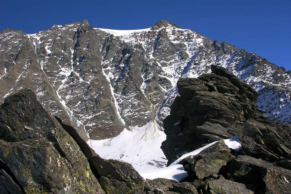
9/A) - Mont Velan per la Cresta Ovest o d'"Annibale" (3.734 m).
Avvicinamento dal Comune di Etroubles per i Valloni di Menouve e di Molline ed il Colle di Annibale (2.992 m): dal Villaggetto di Prailles Dessous con la poderale concomitante al sentiero n° 21 verso il Vallone di Menouve, l'Alpe Arvus (1.985 m), il nuovo Bivacco/Rifugio di Molline (2.424 m); poi con sentierino non numerato verso Settentrione fino al bivio 2.519 metri ed infine su tracce nella pietraia dentro un valloncello secondario al Colle d'Annibale (2.992 m) affrontando nella parte finale un tratto più ripido con possibilità di trovare nevati residui. Da questo tramite la Cresta Ovest, conosciuta come "Cresta di Annibale" e formata nella parte iniziale da rocce abbastanza facili e molto rotte seguite da alcune elevazioni aggirabili preferibilmente sulla sinistra (Nord); subito dopo si scavalca una spalla dominata da una torretta chiamata Aiguille du Déjeuner (3.346 m; A/F+/PD-; 1h'15/1h'30). L'ultimo tratto non presenta soverchie difficoltà ed in circa ugual tempo si raggiunge la Quota 3.678 metri, donde continuando a Sudest, tra il Glacier du Mont Velan a destra (Sud) ed il Dôme du Velan si perviene facilmente alla Cima (A/F+/PD-; 3h'45/4h'15; dal Colle d'Annibale; 7h'00/7h'30 dalla poderale).
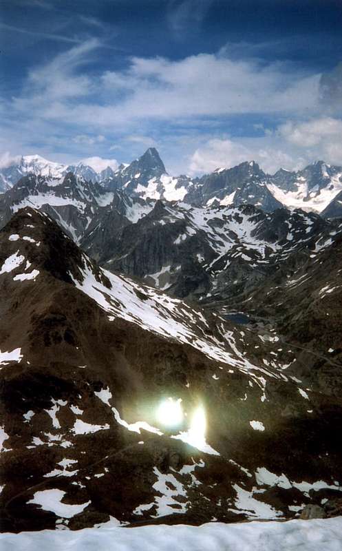
9/B) - Mont Mort (2.867m).
Approach through Vallon des Morts: from Aosta, along the SS.27 of Great St. Bernardo, crossing Gignod (988m), Etroubles (1.264m), and St. Oyen (1.373m), leave to the left the road to the tunnel and go up to Saint Rhemy-en-Bosses Common (1.632m) along the valley leading to the Pass of Gran San Bernardo (2.469m; Mansio Romana, Plan de Jupiter, Albergo Italia, Lago e Hospice). Pass the customs and descend along the road of Combes des Morts till a small car parking near the ventiduct of the Tunnel. Start walking along the dirt road, on the Western side of the torrent, ascending the Barasson combe and passing La drance and the path to the Hospice; when the road turns to Northwest start along a path and walk up to the Western Pass Barasson (2.635m). From the Pass to continue, easily enough, along the crest of border reaching to East the Testa di Barasson (2.731m); to overcome and to go down to the Oriental Hill of Barasson (2.682m). Climb West on the quite Southeastern Crest, through debris, easy rocks and enough rotten blocks alternating with short stretches of rock solid and fun to climb, reaching the Summit (EEA/F+; 1h'30/1h'50 from Great St. Bernard Hill).
9/B) - Mont Mort (2.867 m).
Avvicinamento dal per il Vallone dei Morti: da Aosta (583 m) salire lungo SS.27 del Gran San Bernardo, e dopo aver superato i paesi di Gignod (988 m), Etroubles (1.264 m), e St. Oyen (1.373 m), lasciare sulla sinistra la strada che porta al Tunnel del Gran San Bernardo. Salire verso il Comune di St. Rhemy-en-Bosses (1.632 m) continuando lungo il vallone che porta al valico del Gran San Bernardo (2.469 m; Mansio Romana, Plan de Jupiter, Albergo Italia, Lago e Hospice). Varcare la frontiera e scendere lungo la carrozzabile delle Combes des Morts sino allo sfiato del Tunnel, con piccolo parcheggio. Prendere la strada poderale che, oltrepassata La Drance ed il sentiero per l'Hospice, risale l'intera Comba di Barasson, fiancheggiando ad Ovest l'omonimo torrente; quando questa svolta bruscamente verso Nordovest, prendere il sentiero e seguirlo sino al Colle Occidentale di Barasson (2.635 m). Dal Colle continuare verso Ovest tramite l'abbastanza facile Cresta Sudorientale, per mezzo di facili roccette spesso ricoperte da detriti e blocchi rotti alternati a brevi tratti di roccia solida e divertente da arrampicarsi, raggiungendo la Vetta (EEA/F+; 1h'30/1h'50 dal Colle del Gran San Bernardo).
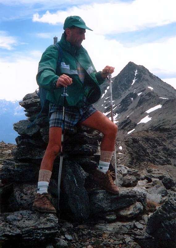
9/C) - Western Barasson Pass, Testa and Punta di Barasson, Arête de Tcholaire to Southern Menouve Hill (2.636m, 2.731m, 2.963m, 2.857m, 2.805m).
Approach through Vallon des Morts and Western Barasson Pass: from the Pass of Gran San Bernardo (2.469m). Pass the customs and descend along the road of Combes des Morts till a small car parking near the Le Tronchet ventiduct of the Tunnel. Start walking along the dirt road, on the Western side of the torrent, ascending the Barasson combe and passing La drance and the path to the Hospice; when the road turns to Northwest start along a path and walk up to the Western Pass Barasson (2.635m). From the Pass to continue, easily enough, along the crest of border reaching to East the Testa di Barasson (2.731m); to overcome and to go down to the Oriental Hill of Barasson (2.682m). Climb through the easy Crest West-Southwest for easy rocks to the Summit. From the Summit, after the descent on easy Northern Ridge, continue Northeast on border crest and, after the complete crossing on the entire Arête de Tcholaire (Tête Verte 2.857m or Babylone e Tête Rouge 2.805m), easily to reach Menouve Southwestern Pass (EE/F; 1h'30/2h'30 from Great St. Bernard Pass; EE/F+; 3h'45/4h'15 for the complete traverse up to the Menouve Southwestern Pass 2.758m).
9/C) - Colle Occidentale di Barasson, Testa e Punta di Barasson, Arête de Tcholaire e Colle Meridionale di Menouve (2.636m, 2.731m, 2.963m, 2.857m, 2.805m).
Avvicinamento dal per il Vallone dei Morti ed il Colle Occidentale di Barasson: dal valico del Gran San Bernardo (2.469 m). Varcare la frontiera e scendere lungo la carrozzabile delle Combes des Morts sino allo sfiato del Tunnel di Le Tronchet, con piccolo parcheggio. Raggiungere la strada poderale che, oltrepassata La Drance ed il sentiero per l'Hospice, risale l'intera Comba di Barasson, fiancheggiando ad Ovest l'omonimo torrente; quando questa svolta bruscamente verso Nordovest, prendere il sentiero e seguirlo sino al Colle Occidentale di Barasson (2.635 m). Dal Colle continuare, abbastanza facilmente, lungo la cresta di confine raggiungendo la Testa di Barasson (2.731 m); superarla e scendere al Colle Orientale di Barasson (2.682 m). Risalire la facile Cresta O-SO tramite facili roccette. Dalla Cima, dopo essere discesi per mezzo della facile Cresta Settentrionale, percorrere verso Nordest la cresta di confine e, dopo avere attraversato tutta l'Arête de Tcholaire (Tête Verte 2.857 m o Babylone e Tête Rouge 2.805 m) raggiungere facilmente il Colle Sudovest di Menouve (EE/F+; 1h'30/2h'30 dal Grande; EE/F+; 3h'45/4h'15 compresa la traversata al Col Menouve Sudovest 2.758 m).

9/D) - Traverse Bec Noir, M. Menouve, Pointe de Crête Seche, Pointes de Molline, M. Tunnel, Tête Grise (2.801m, 3.051m, 2.953m, 3.020m, 3.033m, 3.060m).
Approach through Vallons Menouve/Molline and Southwestern Menouve or Menovy Pass: from Saint Oyen Village (1.373m) to Farm Holidays or from Etroubles Village (1264m) in SR.27 of the Great Saint Bernard, also from Vachery Village (1.332m), by paths n° 18/19A to Agriturisme, and, through dirt road, to obstruction, in altitude 1.608 meters around, near Quaye Alpage; continue, by North direction, always by dirt private road, between Menouve Torrent/Menouve Ru (very old small brook for irrigation) to Menouve Alp (1.913m). By Northwest direction, path in left diagonal ascent, to Trecaoudette Alp (2.133m). From pasture, by the lower ground road to Menouve Torrent, near Menouve Tsa (2.243m; generally the most higher pasture, but no in this occasion for construction of the New Alp) in East, at the end of Mount Menouve/Great Moline Southern small Buttress. From hairpin bend 2.315 meters, by Northwest direction, to Tsa Nouva Pasture (2.426m). From alp go up, by same route towards Menouve South-western Pass (2.758m), and continue to the fork of paths in quota 2.645 meters; turn right (North-northeast) and, before through rare traces between two little torrent of Menouve Torrent into a small valley after by debris and rubbles, reach the Menouve Southastern Pass (2.758m; EE/F; 3h'00/3h'30 from the beginning of dirt road).
*** Alternative Route: by preceding route go up as far as the sixth hairpin bend of the dirt road after the signal of obstruction, near the Quaye Pasture (1.550 meters about). By North-northwest direction and through higher path n° 21 briefly to arrive to Combe Germa(i)n Alp (1.863m). From alp, leaving right (North) the last alpage, in short reach the nearby of Plan Bois Pasture (1.893m); by a long in North-northwest diagonal, through a larch nice forest and leaving down the Menouve Pasture, rejoin with Tracaoudette Alp (2.133m; T/E; 0h'45/1h'00). From this, same direction and same trail, leaving under the ground road, cross a little first torrent, descending from Punta Barasson (2.963m), and a second with tiny lake. To come at an isolated alp and immediately afterwards to the Tsa Nouva (New Upper Alp) Alp (2.426m), where ending even the dirt private road of Menouve Pasture (2.243m), through a narrow hairpin road series (EE/F; 0h'45; in all 1h'30/1h'45). From the Southern Pass of Menouve follow the crest of the border toward the Northeast reaching the nearby Bec Noir (2.801m) and immediately after in descent the Pass Northeast of Menouve (2.775m; cableway from the Switzerland). Going beyond the elevations both 2.902 meters go up the Southwest Ridge of Mont de Menouve or Menovy also called Les Rayons de la Madeleine (3.051m; EEA/PD-/F+; 1h'15/1h'30). A brief but exposed descent down the North Ridge leads to the next Col de Molline and following Pointe de Crête Seche, little saddle, Pointes de Molline, Mont Tunnel, Tête Grise (2.915m, 2.953m, 2.907m, 3.020m, 3.033m, 3.060m; EEA/F +; 2h'00/2h'30 for the whole crossing). Easily and quickly with the East Ridge descend to Hannibal Pass, whence he returns towards Menouve Vallon, Quaye Alp and the small Prailles Dessous Village with the previous Route 9/A)-; (2h'15/2h'30 in descent).9/D) - Traversata Bec Noir, M. Menouve, P. de Crête Seche, Pointes de Molline, M. Tunnel, Testa Grisa (2.801 m, 3.051 m, 2.953 m, 3.020 m, 3.033 m, 3.060 m).
Avvicinamento dal Comune di Etroubles per il Vallone di Menouve/Molline ed il Colle Sudovest di Menouve o Menovy (2.758 m): dai Comuni di Saint-Oyen (1.373 m) oppure da Etroubles (1.264 m) o dal Villaggio di Vachery (1.332 m) sulla SS.27 del Gran San Bernardo, tramite i sentieri n° 18/19A verso l'Agriturismo "La Grandze in Tsi Inconnu" e, per mezzo della strada poderale, al cartello di divieto a quota 1.608 metri circa, vicino all'Alpe Quaye; continuare con direzione Nord e sempre per mezzo della medesima, tra il Torrente ed il Ru di Menouve (antico ruscello costruito dalle popolazioni locali per l'irrigazione), raggiungere l'omonima alpe (1.913 m). Proseguire con direzione Nordovest e sentiero in ascesa diagonale a sinistra verso l'Alpeggio di Trecaoudette (2.133 m). Dallo stesso, sempre su poderale, indirizzarsi verso il Torrente Menouve, presso la Tsa de Menouve (2.243 m; in genere l'alpeggio più elevato, non in questo caso poiché sovrastato dalla più recente Tsa Nouva), ad Est e verso il termine del piccolo contrafforte divisorio le Valli di Menouve e di Molline. Dal tornante 2.315 metri, con direzione Nordovest, portarsi alla Tsa Nouva (2.426 m). Dall'alpe con la medesima strada verso il Colle Sudovest di Menouve (2.758 m) sino al bivio a quota 2.645 metri. Svoltare a destra (Nord-nordest) e, dapprima su tracce sparse tra i due torrentelli di Menouve all'interno del valloncello poi tramite detrito e pietraie, raggiungere facilmente ma faticosamente il Colle di Menouve Sudovest (2758 m (EE/F; 3h'00/3h'30 dall'inizio della poderale).
*** Variante Alternativa: tramite l'itinerario precedente risalire sino al sesto tornante della strada poderale dopo il cartello di divieto, presso l'Alpeggio di Quaye (1.550 metri circa). Con direzione Ovest-nordovest e col sentiero più elevato n° 21 pervenire in breve all'Alpe Combe Germa(i)n (1.863 m); dall'alpeggio, voltando a destra (Nord) dell'ultima baita, toccare la viciniora di Plan Bois (1.893 m). Con un lungo diagonale a Nord-nordovest, attraverso il bel bosco di larici, e lasciando dabbasso l'Alpe di Menouve arrivare a quella di Trecaoudette (2.133 m; T/E; 0h'45/1h'00). Dall'Alpe Tracaoudette, stessa direzione e stesso sentiero, lasciando in basso la strada poderale, attraversare un primo torrentello proveniente dalla Punta di Barasson (2.963 m) ed un secondo con laghetto; raggiungere una baita isolata e subito appresso l'Alpe Tsa Nouva (2.426 m), ove termina anche la poderale proveniente dalla Tsa de Menouve (2.243 m) con una serie di stretti tornanti (EE/F; 0h'45; complessivamente 1h'30/1h'45). Dal Colle Meridionale di Menouve seguire la cresta di frontiera verso Nordest raggiungendo vicino il Bec Noir (2.801 m) e subito dopo in discesa il Colle Nordest di Menouve (2.775 m; funivia dalla Svizzera). Oltrepassando le elevazioni entrambe 2.902 metri si risale la Cresta Sudovest del Mont de Menouve o Menovy chiamato anche Les Rayons de la Madeleine (3.051 m; EEA/PD-/F+1h'15/1h'30). Una breve ma esposta discesa lungo la Cresta Nord conduce al Col de Molline ed alle successiva Pointe de Crête Seche, sella, Pointes de Molline, Mont Tunnel, Tête Grise (2.915 m, 2.953 m, 2.907 m, 3.020 m, 3.033 m, 3.060 m,; EEA/F+; 2h'00/2h'30 per la intera traversata). Facilmente e rapidamente con la Cresta Est si scende al Colle d'Annibale, donde si rientra in Val Menouve, l'Alpeggio di Quaye ed il Villaggetto di Prailles Dessous con la precedente Via 9/A)-; (2h'15/2h'30 in discesa).

10/A) - Mont de la Balme and Mont Gelé (3.347m, 3.518m) by Nino Regondi Bivouac (2.538).
Approach through Ollomont Commune (Glassier): from Glacier the Standard Route from the side of Ollomont starts from the Hamlet of Glacier also Glassier or, rather, from the Nino Regondi Bivouac. From Glacier also Glassier (1.549m) take the mule-track to By Basin before the bridge and follow up to Farinet House, where you must turn right branch toward Fenêtre Durand. Follow the dirt road up to the Balme de Bal Pasture (2.128m); along the mule track n° 5, or along the dirt road, to the Alp Lombardin (2.309m) arriving there go to the Northeast up to the Alp Thoules (2.381m), where the private farm dirt road ends (E/F; 2h'00/2h'15). From this it is possible to reach the Bivouac Nino Regondi (2.599m), after Lake de la Batsèya or Bonseya (2.513m), through a small unnumbered path, that heads for Southeast through the Vallon of Acqua Bianca (White Water) (EE/F; 3h'15/3h'30). From Bivouac Regondi reach Glacier du Mont Gelé around 2.750 meters, leaving on the right the "Hopital des Chamois" (2.783m) and along the first part by debris and rocks smoothed easy to follow. Passing beneath the entire Chain of Morions reach the beginning of the same, very variable depending on the year (0h'45/1h'00); continue without encountering particular areas with crevasses passing under the Trident de Faudery, Becca Crevaye and Becca Faudery and reaching, immediately below this last the Col du Mont Gelé (EE/A/F; 1h'00/1h'15) and to connect this to the route that climbs from Dzovenno-Ru in Valpelline. A short digression from the glacier of Mont Gelé Eastward you can also easily reach the Col de la Balme and, with the short Ridge North, near the Mont de la Balme (3.347m). Or from the glacier up directly via the Southeast Ridge made of blocks and rocks easy but very broken. Finally go through the right margin (East) of the same remaining just below the Southeast Ridge until the final crevasse of the Southwest Face that ends with a short slope of generally hard snow mixed with small rocks (total 3h'15/3h'30 for the Mont Gelé; EEA/F+; calculate 0h'45 more with the Mont de la Balme). Also in the end you can climb quite easily the ridge paying attention to snow cornices, generally facing North.
10/A) - Mont de la Balme e Mont Gelé (3.347 m, 3.518 m) dal Bivacco Nino Regondi (2.538 m).
Avvicinamento dal Comune di Ollomont (Glacier): dal Villaggio di Glassier la Via Normale dal lato di Ollomont inizia dal Villaggio di Glassier od anche Glacier o, meglio, dal Bivacco Nino Regondi. Da Glassier (come nel cartello del villaggio) (1.549 m) con la mulattiera prima del ponte, che sale alla Conca di By, seguendola sino alla Casa Farinet, ove si prende il ramo di destra per la Fenêtre Durand. Portarsi sulla poderale e seguirla sino all'Alpe Balme de Bal (2.128 m); dall'alpeggio per la mulattiera n° 5, o per la strada poderale, dirigersi verso l'Alpe Lombardin (2.309 m) e risalire sulla destra o Nordest sino all'Alpe di Thoules (2.381 m), dove la strada poderale privata ha termine (E/F; 2h'00/2h'15). Da questa é possibile raggiungere il Bivacco Nino Regondi (2.599 m), dopo il Lago de la Batsèya o Bonseya (2.533 m), tramite un sentierino non numerato che si dirige verso Sudest attraversando il Vallone dell'Acqua Bianca, alle pendici dell'imponente Catena che tra Mont Morion e Mont Clapier e la dirimpettaia Punta Fiorio (EE/F; 3h'15/3h'30). Dal Bivacco Regondi raggiungere il Glacier du Mont Gelé intorno ai 2.750 metri circa, lasciando sulla destra l'"Hopital des Chamois" (2.783 m) e percorrendo la prima parte tramite detriti e banconate rocciose levigate di facile percorrenza. Passando al di sotto dell'intera Catena dei Morions raggiungere l'inizio del medesimo, molto variabile a seconda delle annate (0h'45/1h'00); continuare senza incontrare particolari zone con crepacci transitando sotto il Trident de Faudery,la Becca Crevaye e la Becca Faudery e raggiungendo, subito appresso a quest'ultima il Col du Mont Gelé (EEA/F; 1h'00/1h'15) e da questo collegarsi alla via che sale da Dzovenno-Ru in Valpelline. Con una breve digressione dal Ghiacciaio del Mont Gelé verso Est si può raggiungere facilmente anche il Col de la Balme e, appena "rientrando" con la breve Cresta Nord, il vicino Mont de la Balme (3.347 m); oppure dal ghiacciaio salire direttamente tramite la Cresta Sudest del medesimo, formata da blocchi e rocce facili ma alquanto rotte. Infine proseguire tramite il margine destro (Est) dello stesso ghiacciaio restando appena al di sotto della Cresta Sudest fino alla crepaccia terminale del Versante Sudovest che termina con un corto pendio di neve in genere dura frammisto a roccette (in totale 3h'15/3h'30 per il Gelé;EEA/F+; calcolare 0h'45 in più con il Mont de la Balme). Inoltre nel finale, in alternativa a destra salendo, si può percorrere abbastanza facilmente il filo con divertenti passaggi ma facendo attenzione alle spesso presenti cornici nevose, in genere rivolte a Settentrione.
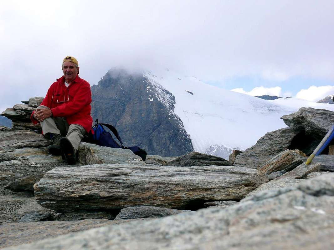
10/B) - Tête Blanche de By (3.413m) from Chiarella-Amiante Refuge (2.979m).
Approach from Ollomont Common (Glacier): from the R.27 to the Great St. Bernard turn to the right towards Valpelline (964m), cross it and turn to the left North) to get Ollomont Common (1.335m) and the small built area of Glacier or Glassier (1.549m), where you must start walking. Enter the path-muletrack n° 3/4/5 towards the By Basin before the bridge and follow up to Farinet House where you must take the rightt branch through the path n° 4, equipped in the short terminal part with iron chains of thirty metres about, immediately below the shelter, towards the Franco Chiarella-Amiante Refuge (2.979m; E/F+; 3h'45/4h'15). From the Refuge Franco Chiarella-Amiante, to go back Eastward with small not numbered trail between debris and until to reach the large blocks of the rocky band that comes down from North, to surpass these blocks on the right hand above an I stand out (3.130 meters about), dominating the Gabelou Pass (3.020m). To continue easily the ascent through a debris wide and little steep hairpin bends on not very obvious trail until the Summit, reached through a brief crossing to the left (West-northwest) in the final part (E/F; 1h'15/1h'30 shelter).
10/B) - Tête Blanche de By (3.413m) dal Rifugio Chiarella-Amiante(2.979 m).
Avvicinamento dal Comune di Ollomont (Glassier): dalla SS.27 in direzione del del Gran San Bernardo; dopo circa un decina di chilometri svoltare sulla destra verso il Comune di Valpelline (964 m) sulla Strada Regionale per questa. Dopo averlo superato dirigersi sulla sinistra (Nord) e raggiungere quello di Ollomont (1.335 m); proseguire sino alla Frazione di Glacier o Glassier (1.549 m), dove inizia l'itinerario di salita. Da Glacier prendere il sentiero-mulattiera n° 3/4/5 prima del ponte risalente alla Conca di By, seguendola sino alla Casa Farinet, dove si prende il ramo di destra con sentiero n° 4 per il Rifugio Franco Chiarella-Amiante, attrezzato con delle catene nella parte terminale nell'ultima trentina di metri, proprio sotto il rifugio (2.979 m; E/F+; 3h'45/4h'15). Dal Rifugio risalire verso Est tramite sentierino non numerato tra detriti e sfasciumi fino a raggiungere i grandi blocchi della bancata rocciosa che scende da Settentrione, superare questi blocchi sulla destra sopra un risalto (3.130 metri circa), dominante il Colle di Gabelou (3.020 m). Continuare la salita facilmente su ampli tornanti detritici non molto evidenti e poco ripidi insino alla Cima (E/F; 1h'15/1h'30 dal rifugio).
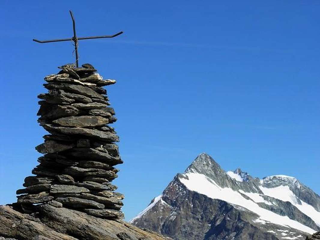
10/C) - Mont Avril (3.347m) from Glacier through Fenêtre Durand (2.805m).
Approach from Glacier Village: with the previous route from "Farinet House" (2.010m) continue Eastward through the trail n° 5 until it reaches the farm dirt private road from the Alpage Commune de By into the homonym Basin inserting the same reaching Balme de Bal Pasture (2.128m). From this continues independently as route n° 5/TdC to Alpage of Lombardin (2.309m), where returns and concomitant flexing most at Northeast, get to that Thoules, where it ends (2.381 m; T/E; 2h'00/2h'20). Continuing further North, initially along the Torrent Fenêtre wade twice the same after 2.620 meters altitude passes a secondary semi dry torrent lead to the opposite side (West). A long diagonal to the North-northeast leads just above the Lac Fenêtre (2.711m; small springs almost everywhere) with stunning views of the West Face of the Mont Gelé and immediately after the Fenêtre de Durand (2.805 m; E/F; 3h'00/3h'30). From the large hill, which leads to Val des Bagnes in Switzerland with magnificent view of the North Wall of increasingly Mont Gelé, climb through easy and a little boring East-southeast Ridge through a small path that exceeds unnumbered right a rocky promontory (3.064m; only stretch where you have to be careful), leaving an immediate right (North), a beautiful tiny basin designed to "salle à manger", usually with residual snowfields in altitude of 3.000/10 meters about. Became a track, continues evenly and fairly steep, reaching the unimportant elevation of 3.192 meters and, passing through the midst easy reddish rocks that emerge from the debris at the end, immediately following, with great views, the Summit (E/F; 1h'20/1h'40 by Fenêtre de Durand; EE/F; 4h'30/4h'45 Glacier).
10/C) - Mont Avril (3.347 m) da Glacier tramite la Fenêtre Durand (2.805 m).
Avvicinamento dal Villaggio di Glacier: con l'itinerario precedente dalla "Casa Farinet" (2.010 metri circa) continuare verso Est tramite il sentiero n° 5 sin a che questo raggiunge la strada poderale dalla Commune de By inserendosi sulla medesima raggiungendo l'Alpe Balme de Bal (2.128 m). Da questa continua autonomamente come sentiero n° 5/TdC sino all'Alpe Lombardin (2.309 m), dove ritorna concomitante e, flettendo maggiormente a Nordest, arriva a quella di Thoules (2381 m; T/E; 2h'00/2h'20). Continuando più a Settentrione, dapprima lungo il Torrent Fenêtre poi guadando due volte il medesimo, dopo la quota 2.620 metri oltrepassa un torrentello secondario portandosi sul versante opposto (Ovest). Un lungo diagonale a Nord-nordest conduce appena sopra il Lac Fenêtre (2.711 m; piccole sorgenti un pò ovunque) con splendida vista sulla Parete Ovest del Mont Gelé e subito dopo alla Fenêtre de Durand (2.805 m; E/F; 3h'00/3h'30). Dall'ampio colle, che porta in Val des Bagnes con magnifica vista sulla Parete Nord sempre del Gelé, salire tramite la facile ed un pò noiosa Cresta Est-sudest per mezzo d'un sentierino non numerato che supera a destra un promontorio roccioso (3.064 metri; unico tratto dove si deve prestar attenzione), lasciando subito a destra (Nord) una bella "conchetta" atta a "salle à manger", in genere con nevai residui in altitudine di 3.000/10 metri circa. Diventato una traccia, continua in modo uniforme ed abbastanza ripido raggiungendo l'elevazione 3.192 metri e, passando in mezzo a facili rocce rossicce affioranti dai detriti nella parte finale, subito appresso, con grandiose vedute, la Vetta (E/F; 1h'20/1h'40 dalla Fenêtre; EE/F; 4h'30/4h'45 da Glacier).
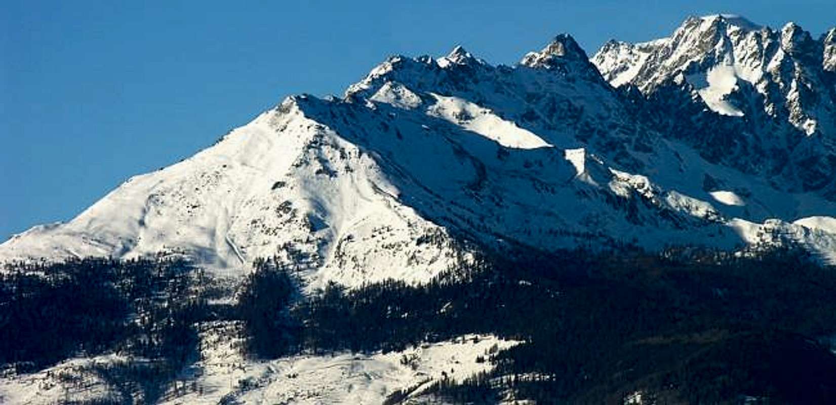
10/D) - Traverse Mont Saron, Tête de la Praz, Crou de Bleintse, Col Champillon (2.681m, 2.751m, 2.824m, 2.708m).
Approach through Allein Common: Allein continue to the North reaching through the Municipal Road Pied du Plan Pastures (1.722m) and after, on private farms road those upper of Baravex de Meitin, Orgières e du Parc (2.014m). This point goes up a path to the North-northwest, before under the Southwestern small Crest then in more open slope, that reach the Mont Saron or Mont Champ-Rion nearby the Cross of Southern Antetop; reached the true Summit, immediately to the North, continue on edge of the ridge or just below bypassing the other Summits and descend on Champillon Hill (2.709m; quite easy but delicate descent on North Ridge Crou de Bleintse) and finally towards Letey Shelter and Alp Champillon at the end of asphalt road by Doues Municipality (EE/F+; 6h'00/6h'30 round trip from Pied du Plan Alpage towards Champillon parking).
10/D) - Traversata Mont Saron, Tête de la Praz, Crou de Bleintse, Col Champillon (2.681m, 2.751m, 2.824m, 2.708m).
Avvicinamento dal Comune di Allein: da Allein proseguire verso Settentrione raggiungendo con la Strada Municipale l'Alpe Pied du Plan (1.722 m) e poi, tramite strada poderale privata quelle superiori di Baravex de Meitin, Orgières e du Parc (2.014 m), dove questa ha fine. Da questo punto parte un sentierino a Nord-nordovest, dapprima sotto la Crestina Sudovest e poi in più aperto pendio, che raggiunge il Mont Saron o Mont Champ-Rion presso la Croce della sua Antecima Sud; raggiunta la vera Cima più a Nord si continua sul filo di cresta o subito sotto scavalcando le altre Sommità e scendendo al Colle Champillon (2.709 m; facile ma delicata la discesa dalla Crou de Bleintse) donde al Rifugio Letey ed all'Alpe Champillon al termine della strada in asfalto da Doues (EE/F+; 6h'00/6h'30 per il giro completo dall'Alpeggio di Pied du Plan al piazzale di Champillon).
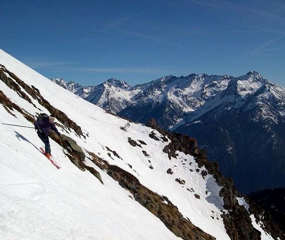
Campings
Remember that free camping is forbidden (except for emergency reasons, over 2.500m, from darkness until dawn).Mountain Condition
- Meteo: you can find all the needed informations at the official site of the Valle d'Aosta Region:
- Valle d'Aosta Meteo
Important Information
- REGIONE AUTONOMA VALLE D'AOSTA the official site.
- FONDAZIONE MONTAGNA SICURA Villa Cameron, località Villard de la Palud n° 1 Courmayeur (AO) Tel: 39 0165 897602 - Fax: 39 0165 897647.
- A.I.NE.VA. (Associazione Interregionale Neve e Valanghe).
Useful numbers
- Protezione Civile Valdostana località Aeroporto n° 7/A Saint Christophe (Ao) Tel. 0165-238222.
- Bollettino Meteo (weather info) Tel. 0165-44113.
- Unità Operativa di Soccorso Sanitario Tel. 118.