
|
|
Mountain/Rock |
|---|---|
|
|
36.68000°N / 81.678°W |
|
|
3840 ft / 1170 m |
|
|
Overview
 Grosses Mountain.
Iron Mountain is actually a huge ridge making up several mountain peaks just north and slightly west of the extremely high country that are Virginia's highest mountains, Rogers and Whitetop. As Appalachian peaks go, the Iron Mountains are respectable, but are generally dwarved by their state high-point neighbors.
 The old AT shelters were left in place after the reroute.
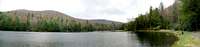
This ridge is the former site of the Appalachian Trail which was rerouted some years ago to take advantage of the finer scenery available in the Grayson Highlands area. The trail remains, and is now called The Iron Mountain Trail, and runs for about 40 miles along the higher peaks near Round Top (4,626 feet) to just north of the city limits of Damascus VA. While not quite as high as the taller peaks to the south, these ridges still afford beautiful scenery, nice forests of oaks, beech, hemlock, and pine; and contain lots of fine trout streams and rare high elevation bogs.
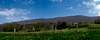
There is ample opportunity all along the Iron Mountains for any number of outdoor activities, including moutain biking, horseback riding, backpacking, day hiking, cross-country skiing, etc.
 |  |  |
Getting There
There are literally dozens of trailheads for access to the Iron Mountains. The easiest are via VA 58. From I-81, take 58 East through Damascus. Go about eight miles past Damascus and see Beartree Recreation Area on the left. Take VA 837 into Beartree. Connector trails to the Iron Mountain Trail can be found along any of the three campgrounds inside the Beartree Recreation Area.Total elevation gain from the Beartree area to the summit ridges are generally 600 to 700 feet.
I used the Lum Trail, which begins at the Chimpmunk Loop of the camground. The Lum Trail climbs from about 3,200 feet to 3,750 feet at a gap between Grosses Mountain and Straight Mountain. From there, travel west on Iron Mountain Trail for about three miles to the summit of Grosses Mountain for about 100 more feet of elevation gain.
 |  |  |
Red Tape
No permits for hiking, horeseback riding, or backpacking, unless you are using a fee area to gain access to the Iron Mountain Trail. If so, day use fees run $3 per vehicle.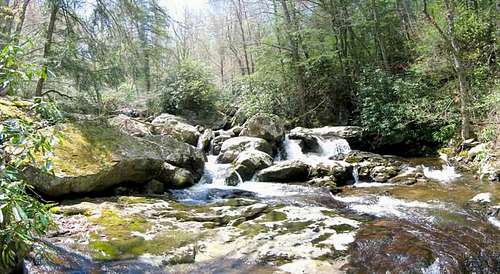 Waterfalls everywhere.
 | 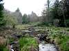 | 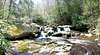 |
When To Climb
All year. |  |  |
Camping
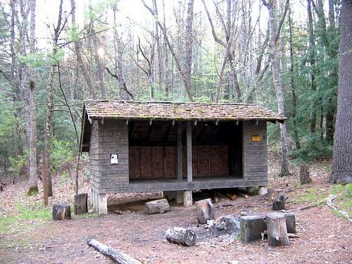 Straight Branch Shelter
 | 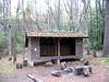 |  |
Mountain Conditions
Check the weather for Damascus, VA. Subtract five to ten degrees for the highest peaks. |  | 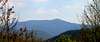 |
External Links
- Mount Rogers National Recreation Area.
Great official site concerning the Mount Rogers Recreation Area.
- Damascus Trail Days.
Great site with information about Trail Days in Damascus, VA; aka "the friendliest town on the AT".