Approach
Exit I-44 on Exit 45 (State Highway 49). Travel west on Highway 49 for approximately 11.5 miles. Turn right on OK-115. Drive for 1-2 miles until there is a parking area/enlarged shoulder. Park there.
Route Description
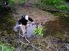
The initial portion of the route is a bushwhack through fairly dense forest that leads to a crossing of Cedar Creek or one of its tributaries. This portion is best undertaken in the winter, as the overgrowth will be much less dense. When I did the route the state was experiencing moderate drought conditions and it was still quite full. Have fun crossing this stream—we formed a “bridge” using branches (I won’t even call them logs) that we found that had fallen. You could just as easily wade it, although it was probably about a foot deep and will be deeper if it has rained within the past couple weeks before you climb this route. In my opinion coming out of the bushwhack/stream crossing is the crux of this climb. After crossing the stream continue to the northeast—a short period of ups and downs will bring you to a gully with direct Class One/easy Class 2 climbing to a band of trees. Force your way through the grabby undergrowth for a short period of time and emerge from the trees, not to return for the remainder of the climb. Ascend the path of least resistance to the ridge crest. From this point on the route consists of easy scrambling among the boulders that compose the ridge and the ascent and descent of one or two false summits. From the true summit the east summit is a short 15-20 minute hike, and can be well worth the effort. Descend the ascent route, but be careful to hit the stream at about the same point you crossed it at initially. Probably a 3.2-3.5 mile round trip with 850 feet of elevation gain round trip. Add .7-1.0 miles and 200 feet of elevation gain with east summit traverse.
Essential Gear
Long pants required, boots recommended. Bring lots of water, and be sure to err on the safe side, particularly in the summer, as temperatures can exceed 105 degrees, and exceed 100 degrees with some regularity. Late fall to early spring is the recommended time of ascent. I climbed it in late April and found things slightly more overgrown than I would have preferred, although the views from the top contained more green than the drab brown that will be dominant in January or February.

 3655 Hits
 0% Score
 0 Votes