Toggle navigation
Mountains
Routes
Images
Trip Reports
Forum
What's New
People
Areas & Ranges
Articles
Trailheads
Canyons
Huts & Campgrounds
Albums
Logistical Centers
Fact Sheets
Lists
Custom Objects
Gear
Plans & Partners
WELCOME TO SUMMITPOST
SIGN IN
REGISTER
Mount Tallac
Additional Parents
Image
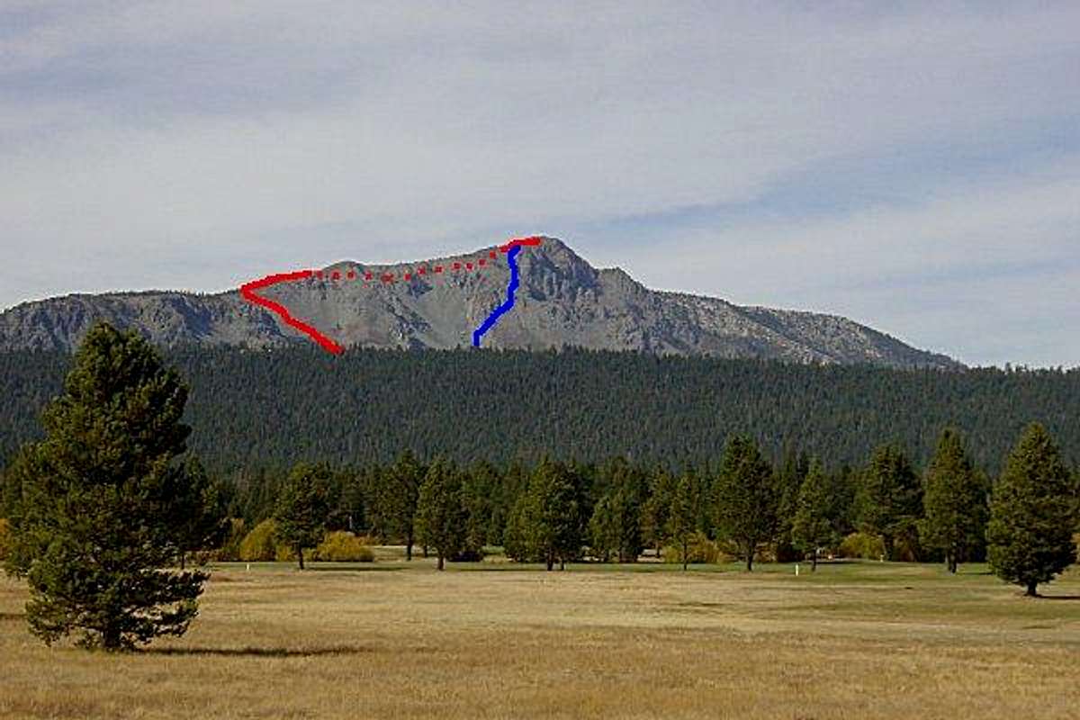
Mt. Tallac seen from Highway...
View High-Resolution Image
Mt. Tallac seen from Highway...
Mt. Tallac seen from Highway 89 near Meyers, CA. The red line indicates the normal route up the Mt. Tallac Trail. The blue line indicates the alternate route up the SE chutes.
« PREV
NEXT »
steeleman
on
Oct 30, 2001 9:07 am
Comments & voting
Other parents
Lat/Lon:
38.90610°N / 120.0978°W
Image ID:
2650
3770 Hits
70.83
% Score
1
Votes
Log in to vote
Comments
No comments posted yet.
to post!
Don't have an account?
Mount Tallac
(Mountain/Rock)
« PREV
Viewing
#147 of 187
GALLERY
NEXT »
steeleman's Image Gallery
« PREV
Viewing
#381 of 414
GALLERY
NEXT »
×
You need to login in order to vote!
User Name
Password
Remember me
Forgot your password?
Log me out when I close my browser.
Keep me logged in all the time.
sign in as a user
Don't have an account?
Register now for FREE
Rating available
Suggested routes for you
People who climb the same things as you
Comments Available
Create Albums
Register Here


