
-
 11479 Hits
-
 80.49% Score
-
 12 Votes
|
|
Mountain/Rock |
|---|---|
|
|
46.80690°N / 121.2739°W |
|
|
Summer, Fall |
|
|
7537 ft / 2297 m |
|
|
Overview
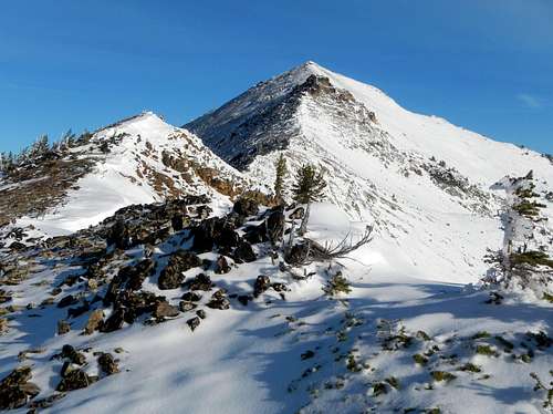 Nelson Ridge Seen From The Trail Junction
Nelson Ridge is a 10 mile long ridge located between Bumping Lake and the popular Mount Aix. The majority of the ridge-crest runs north by south, is above 7000 feet, and therefore is above treeline. This makes for some scenic hiking in the William O Douglas Wilderness. Although Nelson Ridge is often overlooked as a summit destination, it is well worth visiting along with Aix. Going to the highpoint of the ridge will only add a half mile to the overall round-trip distance of an Aix climb. The summit offers unique views of Mount Aix, Mount Rainier, Mount Adams, Bismark Peak and many other summits in the region. The summit can be reached by following the Nelson Ridge trail. The trail does not go all the way to the summit but it takes you within 100 yards and the remaining distance in off-trail travel is quite easy.
 A View Of Mount Rainier
The best way to approach Nelson Ridge is through the Mount Aix Trail #982. There are multiple high points and you may wish to visit more than one. The highest is a quarter mile north of the Mount Aix Trail while Point 7420 is located 100 yards east of the Mount Aix Trail and requires just 200 feet of steep off-trail hiking to attain. Point 7495 to the south requires the most work requiring you to drop into a saddle then rise again to attain the subpeak.
The Route
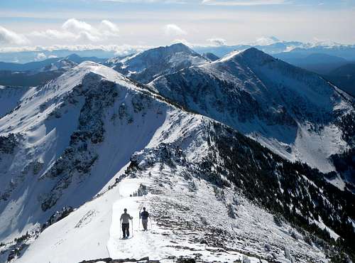 A View From The Summit
As Brian Jenkins states on his Mount Aix Trail route page:
"Trail is easy for about .2 miles and about 200 feet then launches upwards for probably 3 to 3.5 miles switchbacking up for about 3300 feet to the ridge. You'll reach a promontory about 6050 feet with great views of Rainier. About 6400 feet you will reach more open grassy slopes."
Near the crest of the ridge, the trail comes to a junction. Here the Aix trail continues to the right while the Nelson Ridge trail turns left (north). Follow the trail over a minor bump and then down a short distance to a saddle. From the saddle the trail continues to climb steadily staying to the left of a rocky promontory (see top photo) before passing near the summit of Nelson. Once near the summit, leave the trail in the place of your choosing and visit the top. Eastking has made a nice map.
 A Unique View Of Mount Aix From Nelson Ridge Summit
Getting There
FROM CHINOOK AND CAYUSE PASS: Take 410 to roughly 22 miles east of Cayuse Pass. Turn right at the sign for Bumping Lake Road and follow the road 11 miles to where it becomes a forest road #1800. Stay on it to 2 1/2 miles and at a junction you want to stay left on Road 1808 about two miles to the Mt. Aix Trailhead.FROM YAKIMA: Take 410 west until you see a sign on the left for Bumping Lake Road. Proceed using the above directions.
Red Tape
Northwest Forest Pass Required. A wilderness Permit is also required which is available at the trailhead.
Camping
There is plenty of camping near the trailhead which can make for a good early start for summit-bagging both Nelson Ridge and Mount Aix. There a couple of grassy spot just before timberline to set camp if you wish to head for higher ground.Weather Link

Many thanks to EastKing who was the original creator of this page.