Toggle navigation
Mountains
Routes
Images
Trip Reports
Forum
What's New
People
Areas & Ranges
Articles
Trailheads
Canyons
Huts & Campgrounds
Albums
Logistical Centers
Fact Sheets
Lists
Custom Objects
Gear
Plans & Partners
WELCOME TO SUMMITPOST
SIGN IN
REGISTER
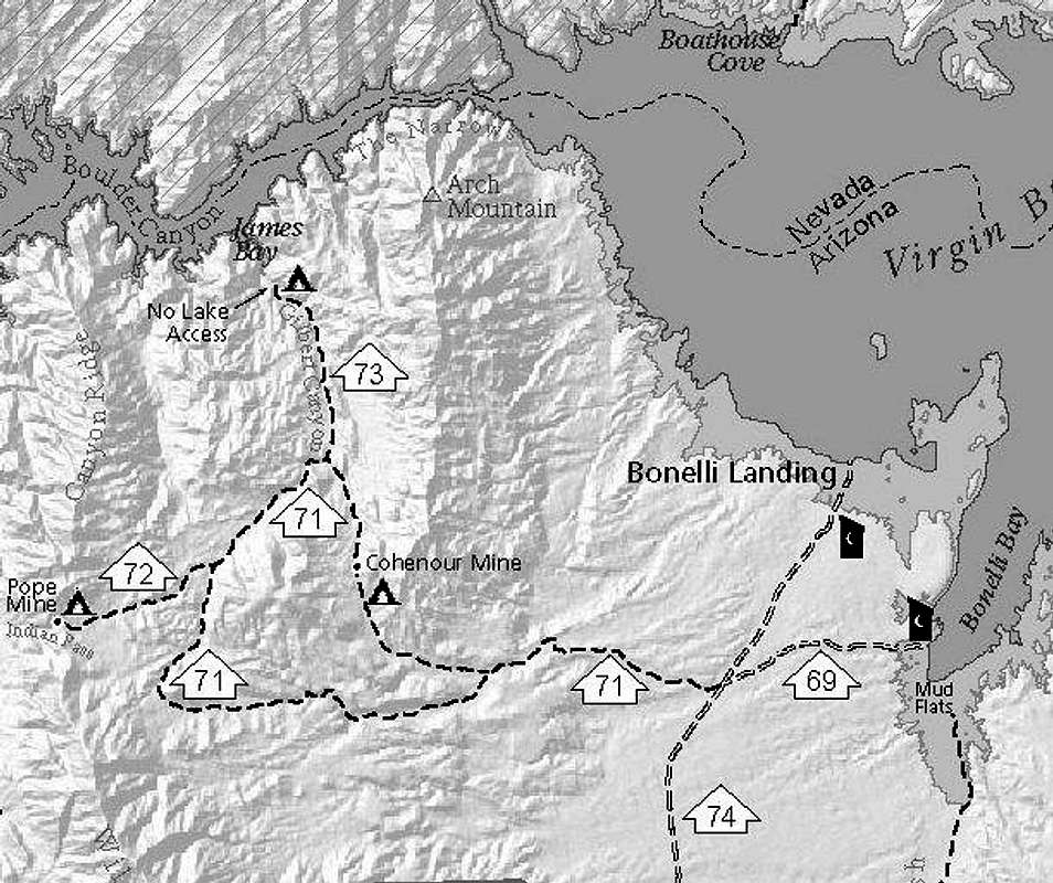
NPS Bonelli Area Roads
NPS Bonelli Area Roads
View High-Resolution Image
NPS Bonelli Area Roads
The NPS designates roads 71 and 73 for access to the Cohenour Mine and N. I'd surmise these are serious 4WD roads. There are designations for primitive campsites at Cohenour and N on 73; bear in mind these have NO WATER or toilets.
« PREV
NEXT »
MoapaPk
on
Feb 5, 2008 3:00 pm
Comments & voting
Other parents
Lat/Lon:
36.13525°N / 114.5589°W
Image Type(s):
Informational
Image ID:
378705
1590 Hits
73.06
% Score
3
Votes
Log in to vote
Comments
No comments posted yet.
to post!
Don't have an account?
MoapaPk's Image Gallery
« PREV
Viewing
#355 of 537
GALLERY
NEXT »
×
You need to login in order to vote!
User Name
Password
Remember me
Forgot your password?
Log me out when I close my browser.
Keep me logged in all the time.
sign in as a user
Don't have an account?
Register now for FREE
Rating available
Suggested routes for you
People who climb the same things as you
Comments Available
Create Albums
Register Here


